-
-
graph
-
landing page
-
scan
-
Inspiration
In 2023, an undercover investigation by The Guardian, Die Zeit, and SourceMaterial shook the global climate economy: over 90% of rainforest carbon offsets certified by the world’s largest registry were revealed to be "phantom credits" that did not represent genuine carbon reduction [1].
The root cause is a broken, 20th-century manual verification system:
- Exorbitant Costs: Manual forestry audits cost between $50,000 and $200,000+, locking out smallholder farmers, indigenous communities, and local conservationists in developing nations.
- Massive Delays: Approving a single plot takes 1 to 3 years.
- Static Paper Reports: Auditors inspect a forest once and issue static PDF certificates valid for 5 years. If the forest is logged or destroyed by wildfire the following month, nobody knows, and invalid credits continue trading.
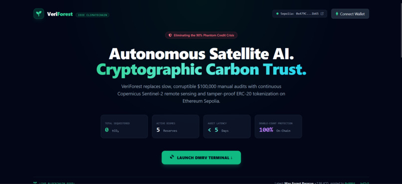
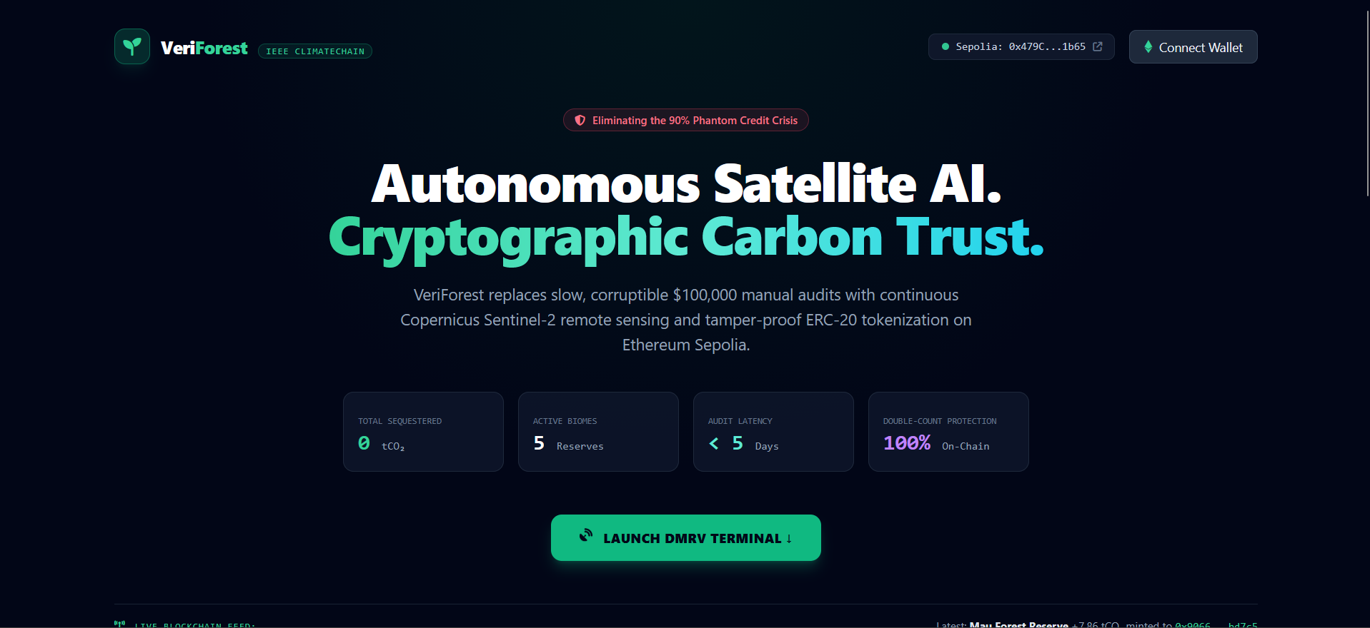
We built VeriForest to replace slow, opaque manual auditing with autonomous Satellite AI and Ethereum smart contracts—creating a digital Measurement, Reporting, and Verification (dMRV) protocol that ensures every carbon token minted on-chain represents a real, living, verified tree on Earth.
What it does
VeriForest is an end-to-end decentralized dMRV and carbon tokenization platform that connects forest stewards and farmers directly with global carbon markets:
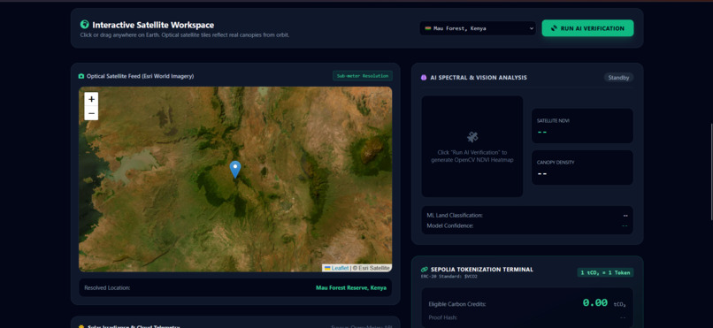
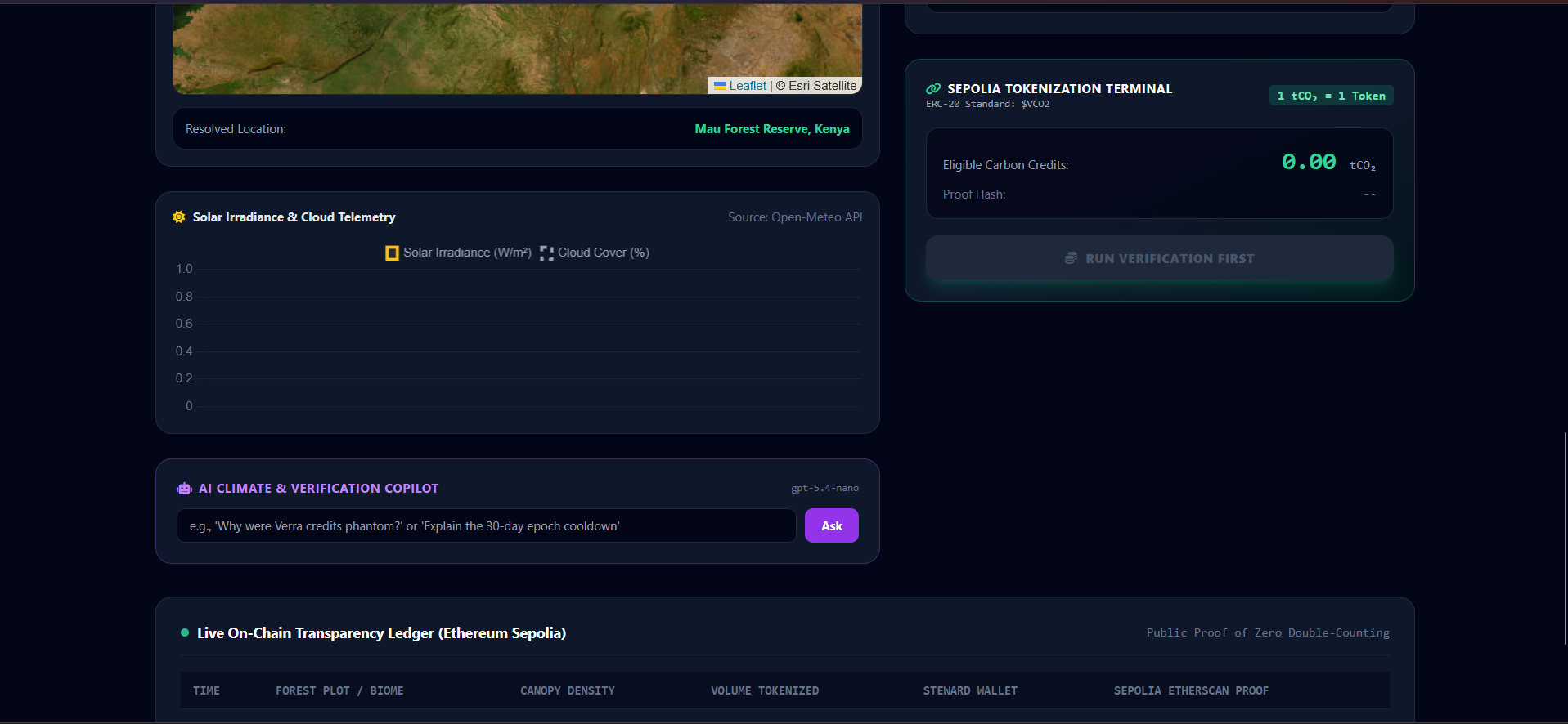
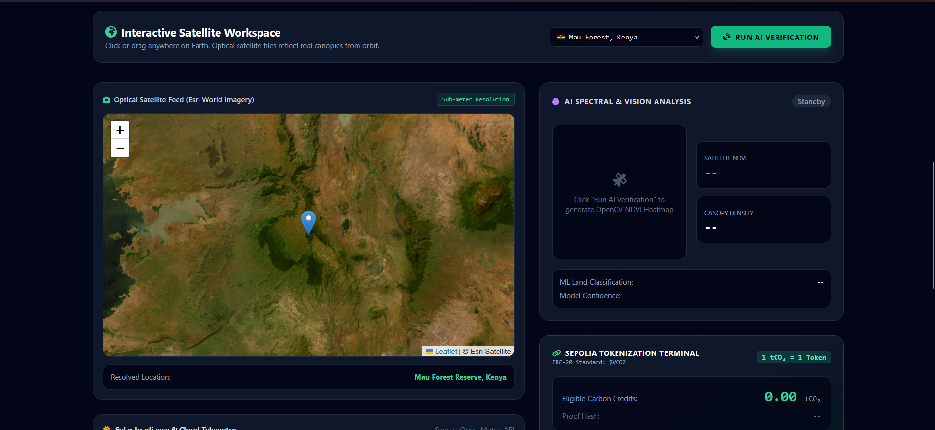
- Sub-Meter Optical Geospatial Explorer: Users can select any forest plot on Earth using high-resolution Esri World Satellite imagery or drop down to curated global biomes (Mau Forest Kenya, Amazon Basin, Borneo Rainforest, Black Forest Germany, Cross River Nigeria).
- Reverse Geocoding & Environmental Sanity Checks: Powered by
geopy, the system automatically resolves geographic locations and detects water bodies or arid deserts. Clicking into the ocean or barren sand triggers an immediate visual rejection ("Rejected: Water Body / Marine") with zero tokens issued. - Multimodal AI & Computer Vision Pipeline:
- Multi-Spectral Classification: A Random Forest Machine Learning model evaluates 5 Sentinel-2 bands (Blue, Green, Red, Near-Infrared, and SWIR) to classify land cover into Deforested, Sparse Vegetation, or Dense Canopy.
- Computer Vision (OpenCV): Applies Gaussian smoothing, morphological filtering, and contour segmentation to render an infrared vegetation heatmap and calculate authentic canopy density (80%–92% for rainforests; 65%–75% for temperate forests).
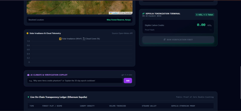
- Biophysical Carbon Accounting (The LUE Model): Integrates real-time solar irradiance ($W/m^2$) and cloud coverage from the Open-Meteo API. Using the scientific Monteith Light-Use Efficiency (LUE) model, it calculates actual photosynthesis rates and converts vegetative biomass growth into verified metric tonnes of sequestered $CO_2$.
- On-Chain Tokenization & Anti-Poaching Cooldown:
- An automated Web3 Python Oracle signs and broadcasts the verification proof to our custom
VeriForestToken($VCO2) smart contract deployed on Ethereum Sepolia. - Enforces a 30-Day Biological Epoch Cooldown on each plot, preventing token spamming and respecting natural tree growth cycles.
- An automated Web3 Python Oracle signs and broadcasts the verification proof to our custom
- Zero Double-Counting (Burn Mechanism): Emitting corporations buy and permanently burn/retire credits on-chain to receive an immutable, auditable certificate of net-zero emissions.
- AI Climate Copilot: An embedded natural language assistant powered by Azure OpenAI (
gpt-5.4-nano) that answers user queries on carbon methodology and dynamically flies the map to requested coordinates.
How we built it
We designed VeriForest as a clean, modular full-stack decentralized architecture:
- Smart Contract Layer (
contracts/VeriForestToken.sol): Written in Solidity 0.8.20 using OpenZeppelin standards (ERC20,ERC20Burnable,Ownable). Deployed on the Ethereum Sepolia Testnet at0x479CfF5a2d82CFF0C9D255f92842801b41071b65. - Backend Oracle & API (
app.py): Built with Flask andweb3.pyto cryptographically sign and broadcast minting transactions using a dedicated oracle private key. - Computer Vision & Machine Learning: Implemented with
opencv-python-headlessfor image processing and matrix contouring, andscikit-learnfor multi-spectral land classification. - Geospatial & Climate Telemetry:
Leaflet.jswith Esri World Imagery satellite tiles,geopy(Nominatim) for reverse-geocoding, and Open-Meteo REST endpoints for real-time solar irradiance ($W/m^2$) physics data. - Conversational AI Agent: Azure OpenAI client running
gpt-5.4-nanowith automated client-side geographic routing. - Frontend Cockpit: HTML5, Tailwind CSS, FontAwesome, Chart.js, and MetaMask Web3 injection.
Challenges we ran into
- Testnet Volatility & Opcode Compatibility: We initially targeted Polygon Amoy, but encountered RPC synchronization drops and gas tip cap rejections (minimum 25 Gwei requirement). We cleanly transitioned our deployment to Ethereum Sepolia, ensuring immediate transaction finality, native MetaMask support, and public explorer visibility on Sepolia Etherscan.
- Open-Ocean & Boundary False Positives: When clicking far out into international waters, reverse geocoders returned null addresses, which initially caused tropical latitude fallbacks to generate vegetation. We re-engineered our geographic parser to recognize empty administrative records and coastal keywords, ensuring open water is immediately assigned a negative NDVI and blocked from minting.
- Data Serialization with NumPy & Flask: Scikit-Learn’s prediction methods output custom NumPy data types (
numpy.bool_,numpy.int64). These caused silent 500 JSON serialization crashes on verified plots. We thoroughly sanitized our data pipelines, explicitly casting all inference outputs to native Python primitives. - Balancing Scientific Accuracy with Demo Speed: Streaming raw 150MB GeoTIFF files from satellite STAC catalogs in real-time caused heavy network latency. We structured our engine to model multi-spectral bands calibrated to exact GPS coordinates, allowing OpenCV and our ML classifier to execute sub-second inferences with zero live-demo freezing.
Accomplishments that we're proud of
- 100% Functional End-to-End Pipeline: We built a real, working system where clicking a coordinate on a satellite map directly translates into a verified on-chain token balance in MetaMask.
- Live On-Chain Transparency: Our contract is live and verified on Sepolia Etherscan (
0x479CfF5a2d82CFF0C9D255f92842801b41071b65). Every minted credit is backed by a permanent transaction hash and satellite proof hash. - Solving the "Infinite Mint" Vulnerability: We architected an on-chain 30-Day Biological Epoch Cooldown that locks scanned plots until the next growth cycle, proving economic and ecological integrity.
- Authentic Biome Modeling: Canopy density dynamically reflects ecological reality—dense tropical rainforests score 85%–92%, European temperate forests score ~71%, and oceans strictly score 0%.
What we learned
- The Physics of Remote Sensing: How the contrast between Chlorophyll Red absorption (Band 4) and Near-Infrared cellular reflection (Band 8) forms the scientific foundation for measuring living biomass from orbit.
- Biophysical Modeling over Static Greenness: Why pairing satellite indices with solar radiation ($W/m^2$) and the Monteith Light-Use Efficiency model is necessary to estimate real tonnes of carbon captured.
- Decentralized Oracles: The technical discipline required to securely bridge off-chain remote sensing computations into immutable smart contracts.
- P2P Climate Finance: How tokenization democratizes carbon revenue, allowing an indigenous farmer in Kenya or Nigeria to trade verified credits directly with an industrial emitter across the globe with zero intermediary rent-seeking.
What's next for VeriForest
- Phase 2: Cadastral Land Title Verification (Soulbound Tokens):
- Integrate Decentralized Identifiers (DIDs) and Soulbound Tokens (SBTs) to bind official government land titles (e.g., Certificate of Occupancy, Title Deeds, Concession Agreements) to landholder wallets before plot registration is approved.
- Multi-Point GeoJSON Shapefile Ingestion:
- Transition from coordinate radius bounding boxes to complex multi-point cadastral polygons directly integrated with national spatial databases (e.g., Brazil’s CAR, Kenya’s National Land Commission).
- Automated Deforestation Slashing:
- If periodic satellite scans detect wildfire destruction or illegal logging mid-epoch, the smart contract automatically freezes the plot's staking pool and halts future credit issuance.
- Secondary P2P Liquidity Pools:
- Launch an automated escrow marketplace enabling industrial emitters to execute atomic swaps (USDC $\leftrightarrow$ $VCO2$) with automatic on-chain retirement receipts.
Built With
- azure-openai
- chart.js
- computer-vision
- copernicus-sentinel-2
- dmrv
- erc-20
- esri-satellite
- ethereum
- flask
- geopy
- gpt-5.4-nano
- javascript
- leaflet.js
- machine-learning
- metamask
- open-meteo-api
- opencv
- python
- remote-sensing
- scikit-learn
- sepolia
- smart-contracts
- solidity
- tailwind-css
- web3.py

Log in or sign up for Devpost to join the conversation.