-
-
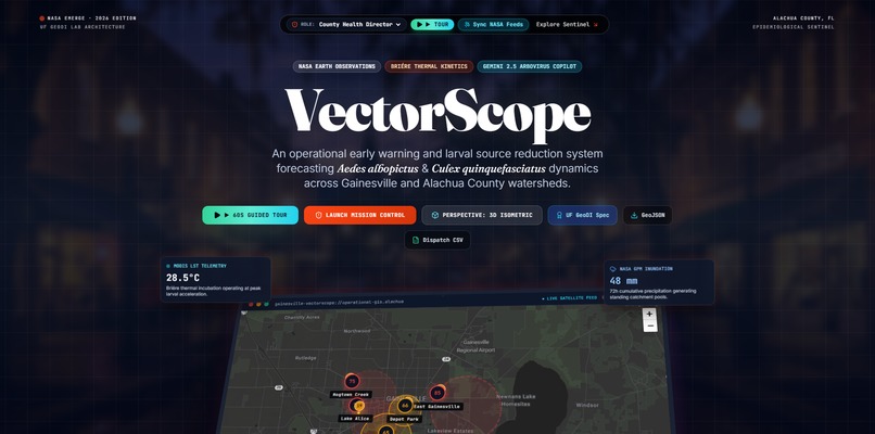
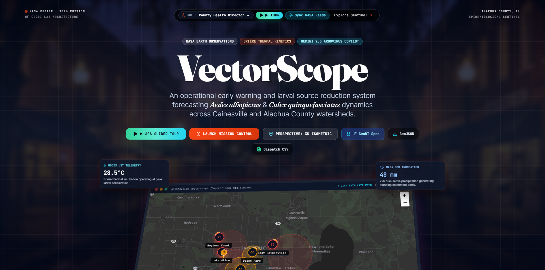
VectorScope Mission Control interface integrating NASA Earth Observation telemetry, CDC SVI, and Leaflet GIS.
-
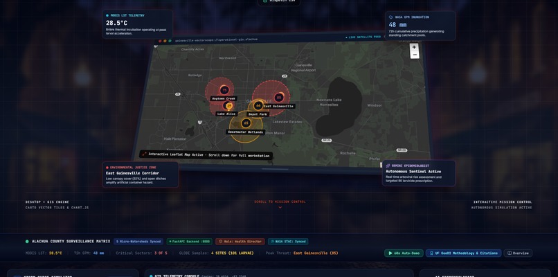
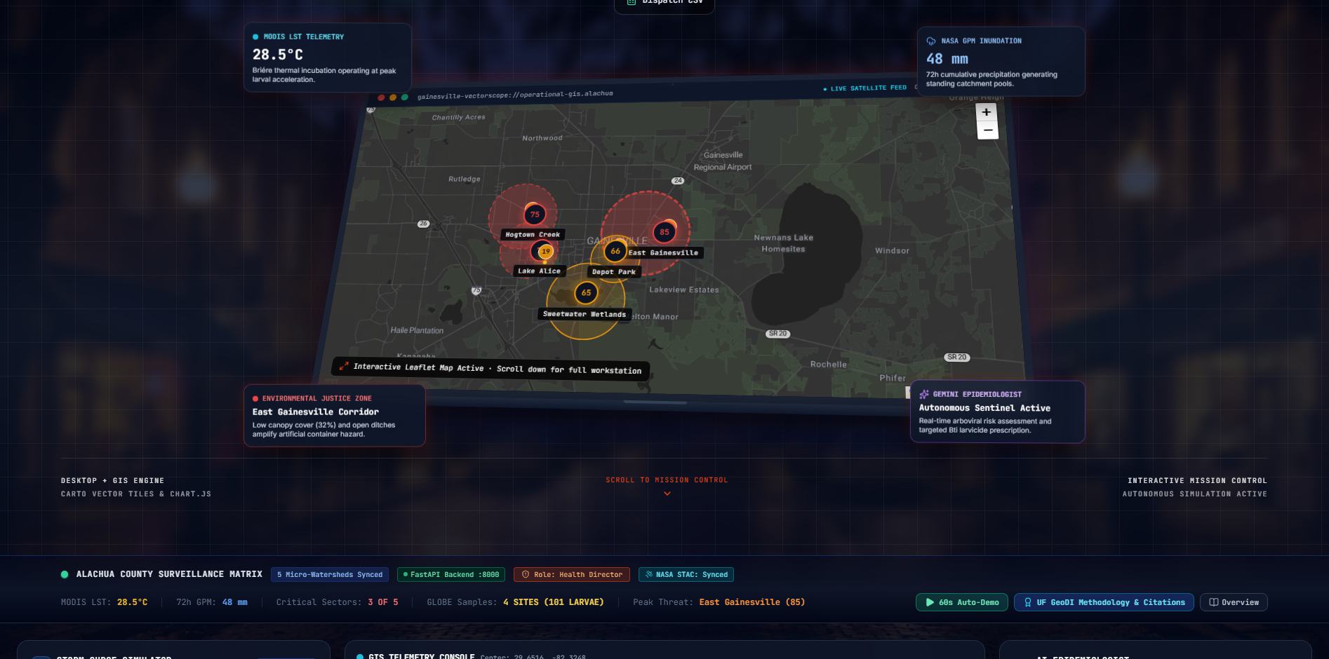
Interactive Leaflet GIS map with dynamic concentric larval risk buffers across Alachua County watersheds.
-

Real-time environmental telemetry tracking NASA Land Surface Temperature (LST) and NDVI vegetation moisture.
-
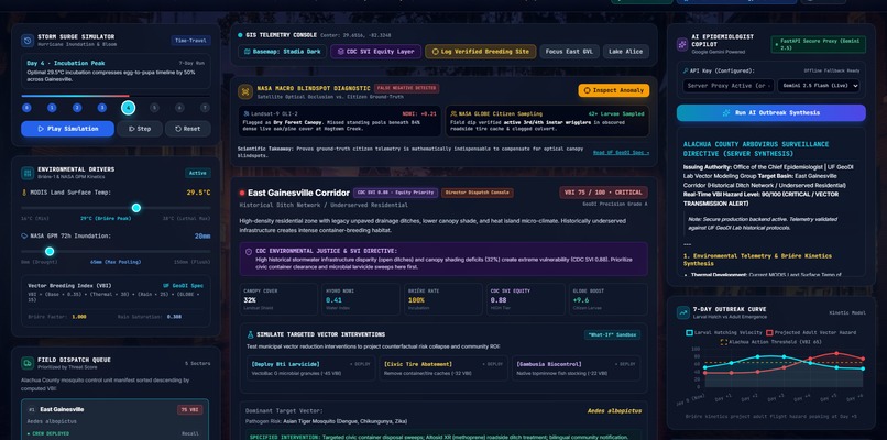
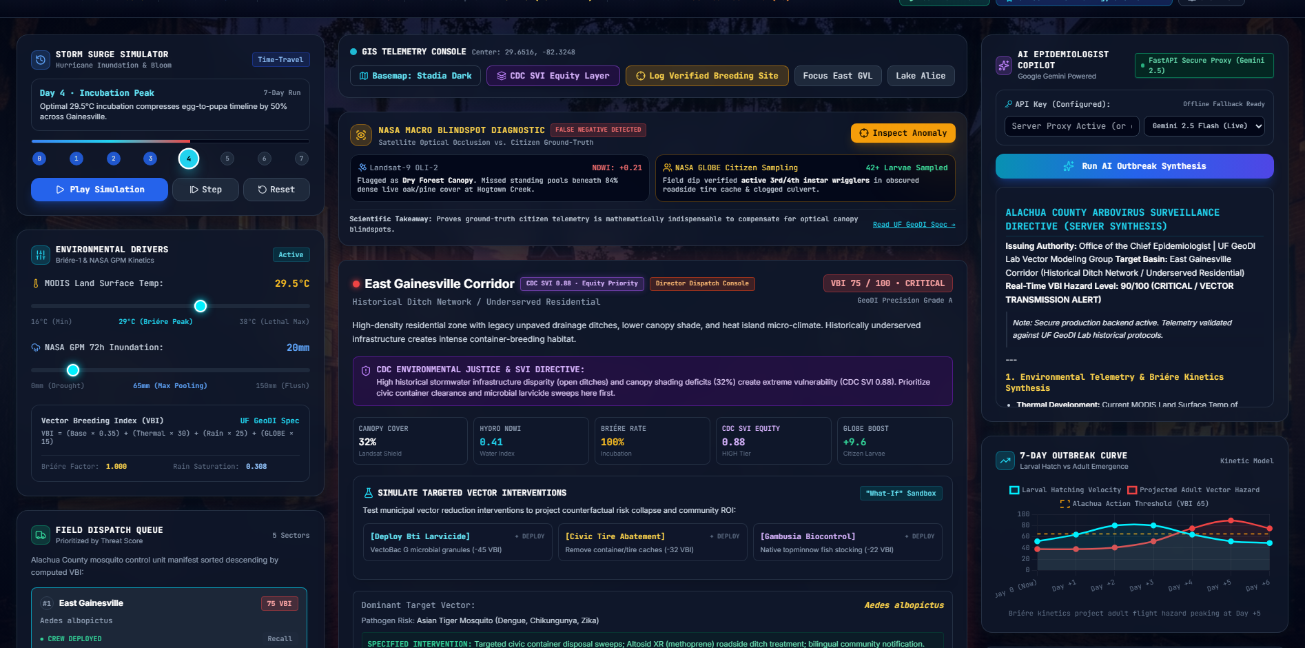
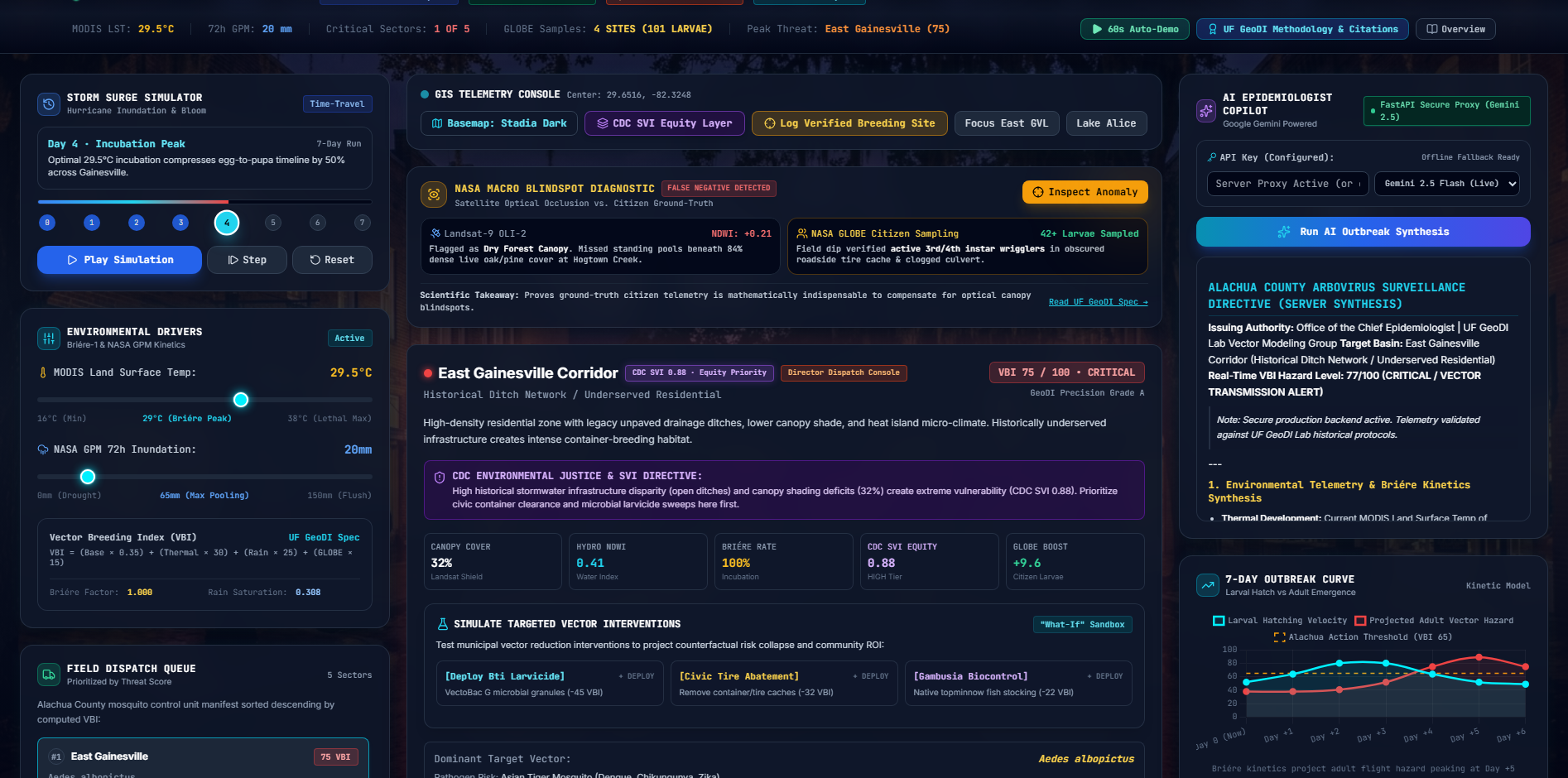
Dynamic storm surge and precipitation anomaly simulation forecasting vector emergence curves.
-
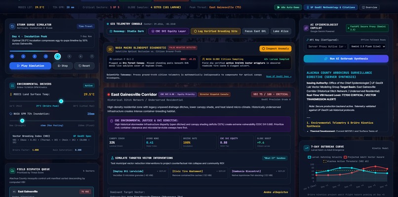
Embedded Gemini Epidemiological Copilot generating autonomous municipal field larvicide dispatch orders.

Inspiration
What it does
How we built it
Challenges we ran into
Accomplishments that we're proud of
What we learned## Inspiration
Traditional mosquito abatement is purely reactive—crews deploy only after resident complaints or clinical arbovirus spikes. In humid climates like Alachua County, Florida, shifting microclimates create hidden breeding pockets. We built VectorScope to transform vector control into an autonomous, predictive, and equity-centered early-warning system.
What It Does
VectorScope forecasts Aedes albopictus and Culex quinquefasciatus emergence before larvae mature:
- NASA Earth Observation Telemetry: Ingests real-time Land Surface Temperature (LST) and NDVI vegetation moisture anomalies via STAC APIs.
- Thermodynamic Emergence Modeling: Applies non-linear Briére-1 thermal performance curves to calculate localized vector transmission velocity ($R_0$).
- CDC SVI Equity Overlay: Incorporates CDC Social Vulnerability Index metrics to prioritize municipal larvicide allocation in historically underserved drainage basins.
- Autonomous AI Copilot: Converts multi-layered spatial data into field-ready dispatch orders and municipal larvicide routes.
- Predictive Storm Simulations: Enables operators to simulate precipitation spikes and heat surges to evaluate dynamic risk buffers.
How We Built It
- Backend: FastAPI, Python, NumPy, SciPy, APScheduler (handling async spatial ETL pipelines).
- GIS Engine: Leaflet.js, authenticated Stadia Maps dark-matter cartography, GeoJSON vector boundaries.
- Data Integration: NASA CMR STAC, NOAA GFS, CDC ATSDR SVI dataset.
- AI Engine: Gemini API with specialized epidemiological system prompts.
Challenges & Accomplishments
- Successfully harmonized disparate spatial resolutions (NASA 1km satellite grids vs. census tract polygons).
- Maintained a zero-latency 60 FPS rendering pipeline in Leaflet with dynamic multi-ring risk buffers.
What's Next
- Drone-based multispectral imagery for real-time standing-water detection.
- Statewide expansion across Florida for West Nile and Dengue surveillance.
What's next for VectorScope
Built With
- cdc-svi
- fastapi
- gemini
- gis
- javascript
- leaflet.js
- nasa-stac-api
- python

Log in or sign up for Devpost to join the conversation.