Inspiration
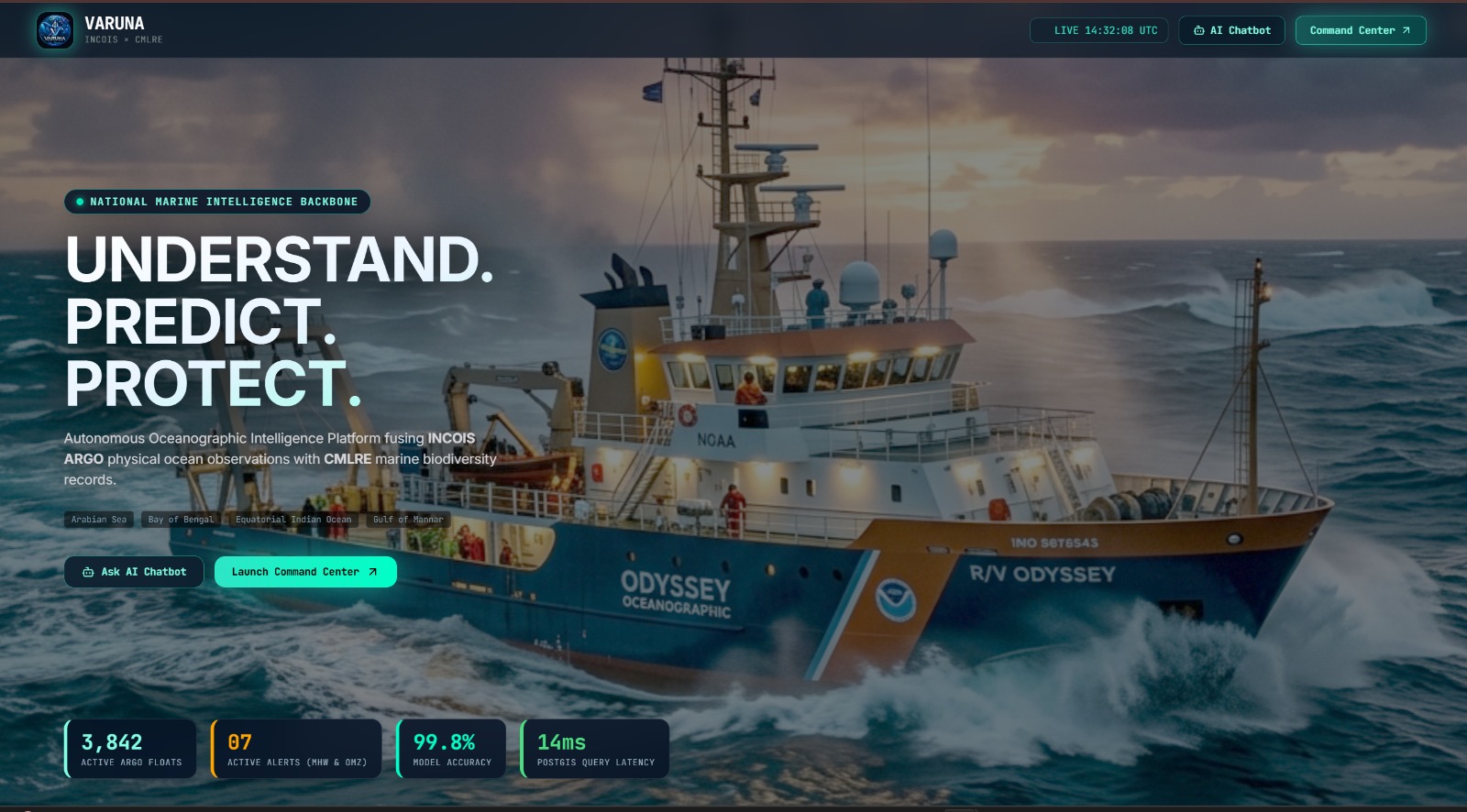
India has a massive amount of ocean data, but much of it is difficult to access, connect, and interpret. We were inspired by the idea of turning this complex data into something that scientists, researchers, and decision-makers can actually interact with and understand. VARUNA brings together INCOIS ARGO oceanographic data and CMLRE biodiversity data to create a unified view of the Indian Ocean.
What it does
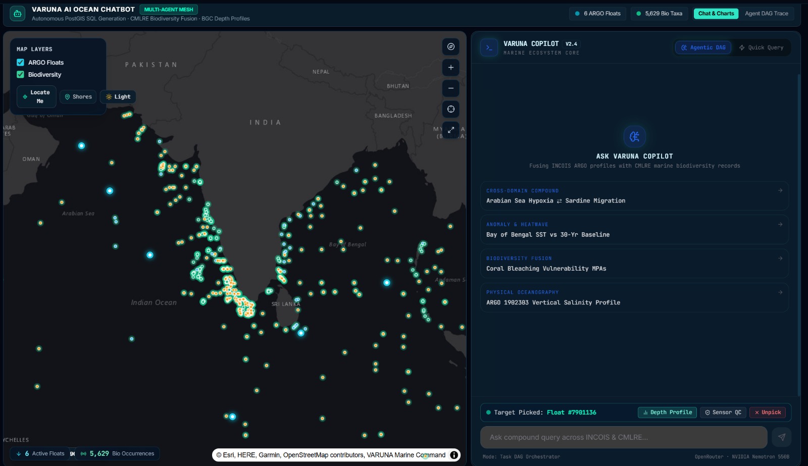
VARUNA is an AI-powered ocean intelligence platform that lets users ask complex marine questions in natural language.
It can:
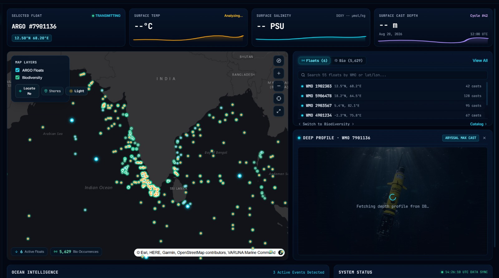
- Explore ARGO ocean observations through an interactive geospatial map.
- Analyze temperature, salinity, oxygen, and chlorophyll data.
- Connect physical ocean conditions with marine biodiversity.
- Detect and monitor marine heatwaves and hypoxia.
- Use AI agents to break complex questions into smaller tasks.
- Generate data-backed answers with provenance instead of making up values.
- Present results through interactive oceanographic charts and visualizations.
How we built it
We built VARUNA using a combination of AI, geospatial technologies, data engineering, and machine learning.
- Frontend: Next.js, WebGL/Deck.gl, Plotly
- Backend: FastAPI
- Database: PostgreSQL + PostGIS
- Vector Search: Qdrant + BM25
- AI: Gemini API and NVIDIA Nemotron through OpenRouter
- Data: INCOIS ARGO + CMLRE biodiversity records
- ML: Marine heatwave forecasting, anomaly detection, and ARGO quality-control models
Our architecture uses a Multi-Agent Task DAG where specialized agents handle SQL generation, retrieval, biodiversity analysis, and final synthesis.
Challenges we ran into
The biggest challenge was working with large, complex scientific datasets rather than clean, ready-to-use data.
We also had to solve:
- Efficient processing of large NetCDF datasets.
- Spatially joining ocean observations with biodiversity records.
- Preventing LLMs from generating unsupported scientific values.
- Making complex AI processing understandable through the frontend.
- Streaming pipeline activity in real time.
- Visualizing large amounts of geospatial data without making the interface overwhelming.
Accomplishments that we're proud of
We're proud that VARUNA isn't just a chatbot or a visualization dashboard.
We created a system where ocean conditions, biodiversity, AI reasoning, spatial analysis, and predictive intelligence work together.
We're especially proud of our zero-hallucination approach, interactive geospatial interface, multi-agent architecture, and the ability to connect physical ocean observations with marine ecosystem information.
What we learned
We learned that building an AI system for scientific data is very different from building a normal chatbot.
The AI needs to be grounded in reliable data, spatial relationships need to be handled by actual databases, and the interface needs to make complex processing understandable without overwhelming the user.
Most importantly, we learned that good ocean intelligence isn't just about collecting more data — it's about connecting the right data at the right time.
What's next for VARUNA
We want to take VARUNA from an intelligence platform into a more proactive national marine decision-support system.
Our next steps include:
- Expanding real-time ocean data integration.
- Improving marine heatwave and ecosystem forecasting.
- Expanding biodiversity coverage.
- Adding more predictive models.
- Making the platform useful for fisheries, researchers, coastal authorities, and disaster-response teams.
- Building stronger real-time alerting and decision-support capabilities.
Our long-term vision: Monitor. Analyze. Protect.
Built With
- agents
- ai
- api
- computer
- convlstm
- data
- deck.gl
- fastapi
- gemini
- generative
- nemotron
- next.js
- nvidia
- openrouter
- plotly
- postgis
- postgresql
- python
- qdrant
- react
- typescript
- vision
- webgl

Log in or sign up for Devpost to join the conversation.