Inspiration
It is important for farmers and managers to have a comprehensive overview of the fruit growth in USA based on different counties. Helping people to get this overview was the major inspiration for developing this application.
What it does
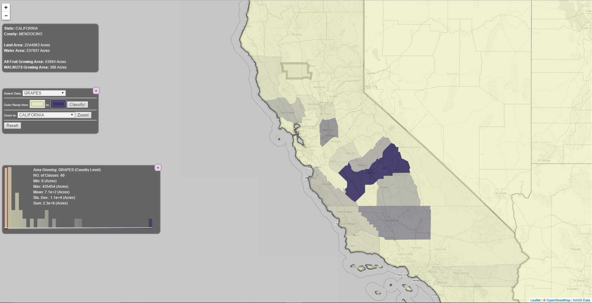
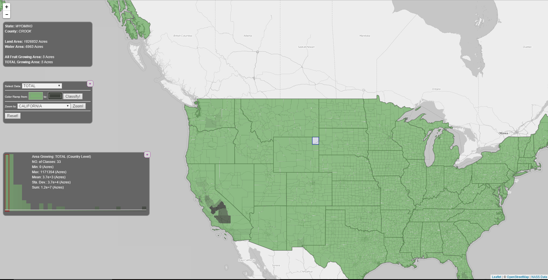
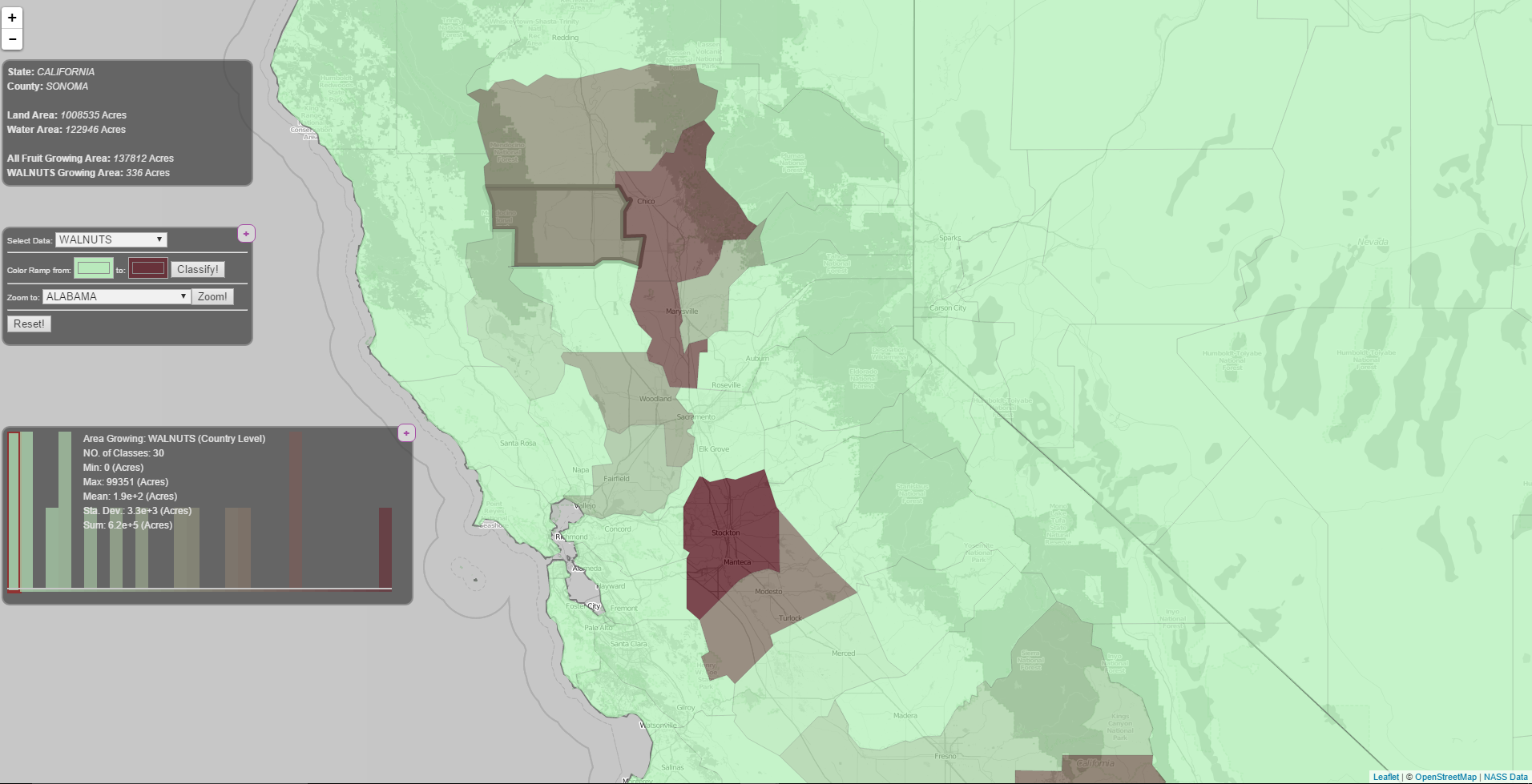
It generates interactive choropleth map of USA showing areas under fruit growth for each county.
How I built it
I cleaned the data provided by NASS. Combined PHP, Leaflet Web Mapping library, jQuery and JavaScript to develop this application.
Challenges I ran into
Choropleth maps are useful tools to provide visual maps based on some specific themes. The more complete the data, the more visually beautiful maps. Cleaning the data for this purpose was the major challenge I had.
Accomplishments that I'm proud of
Designing everything from base and combining all libraries and functions to develop this awesome application is what I am proud of.
What I learned
I learned lots of things about USA fruit growing industry while developing this application. Getting involved in this project also challenged my knowledge of GIS and Web Map programming.
What's next for USDA: sustainable US food system
If I get the useful data, I can extend this application for those data. Some of the ideas include: Human Geographic Data, Landuse Data, Soil Type, Weather, Precipitation, Education and so on.


Log in or sign up for Devpost to join the conversation.