-
-
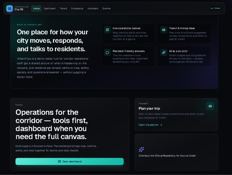
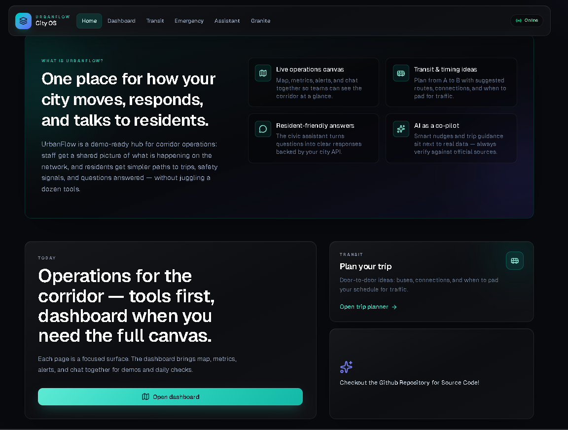
Home Page
-
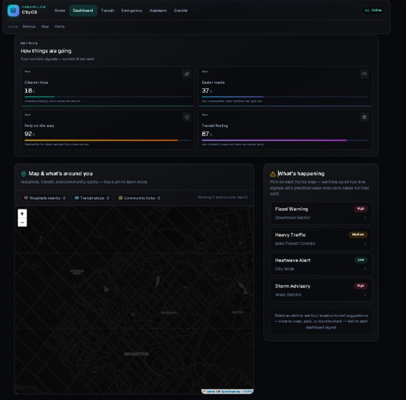
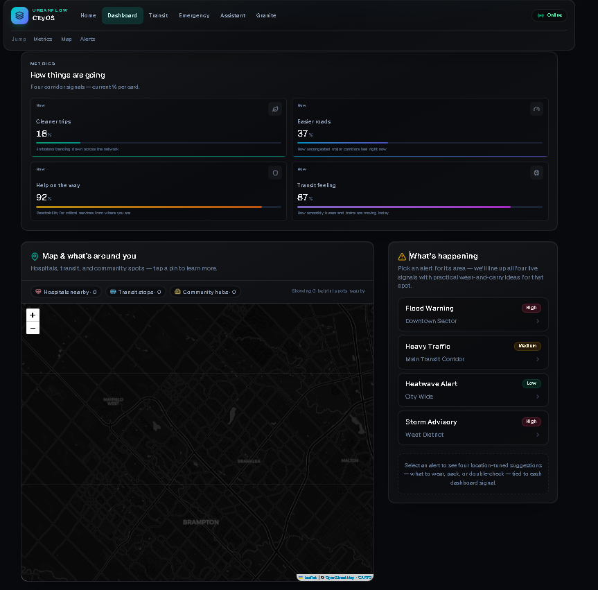
Dashboard
-
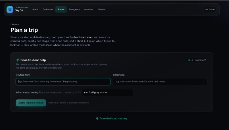
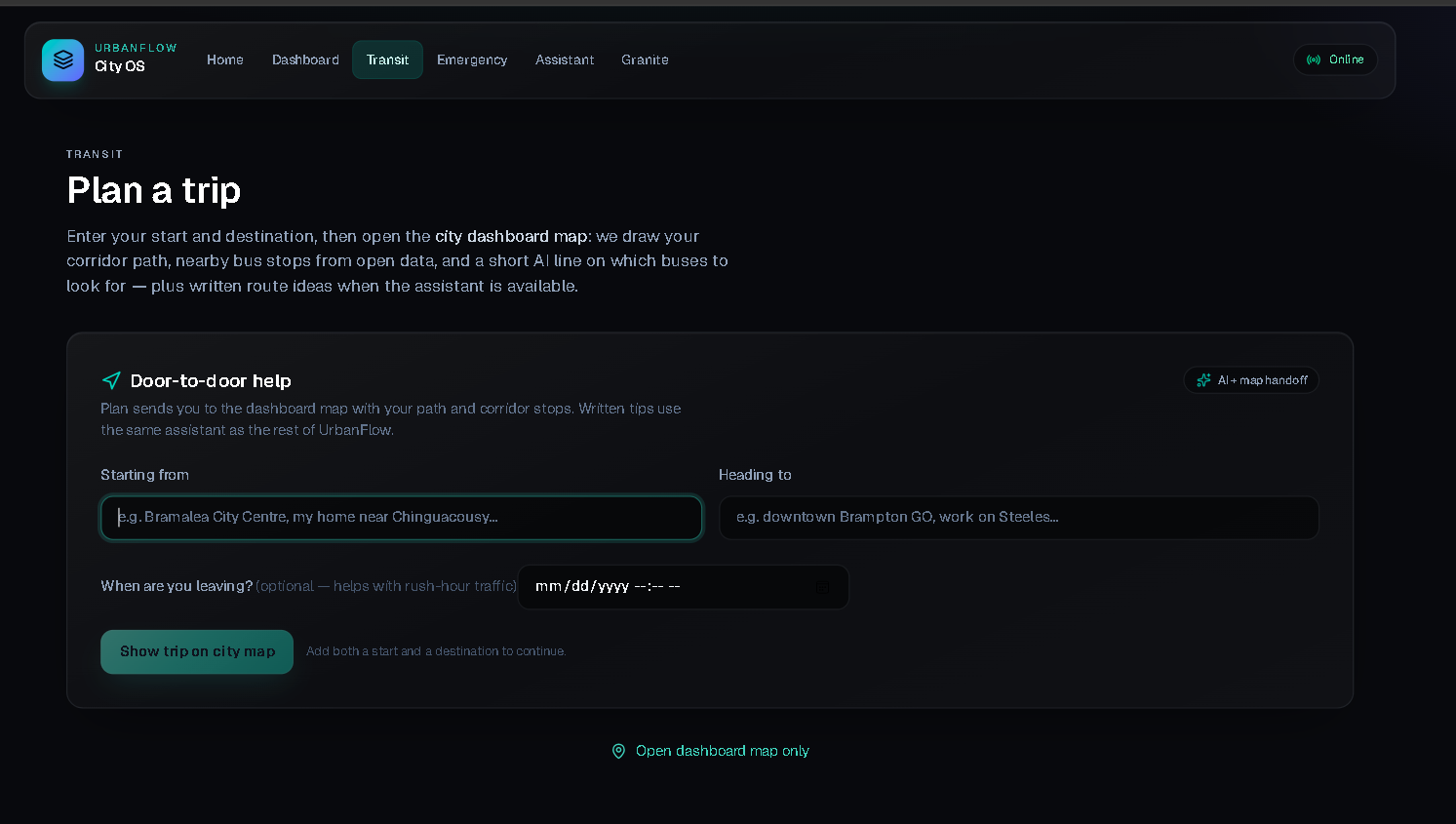
Transit Planner
-
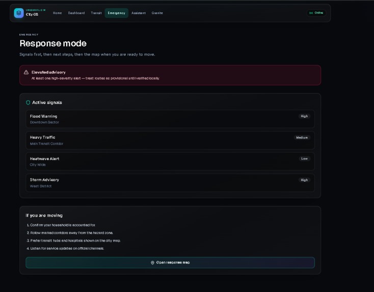
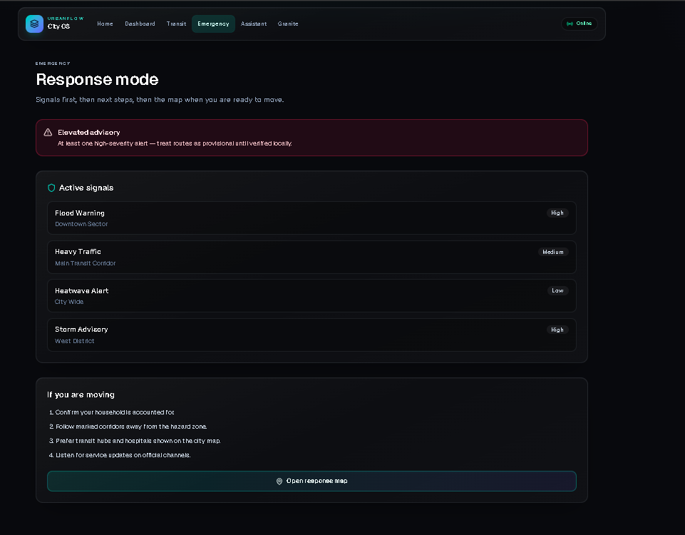
Emergency Alerts
-
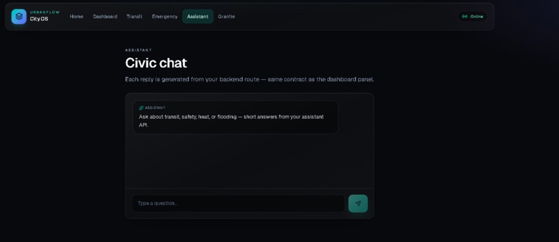
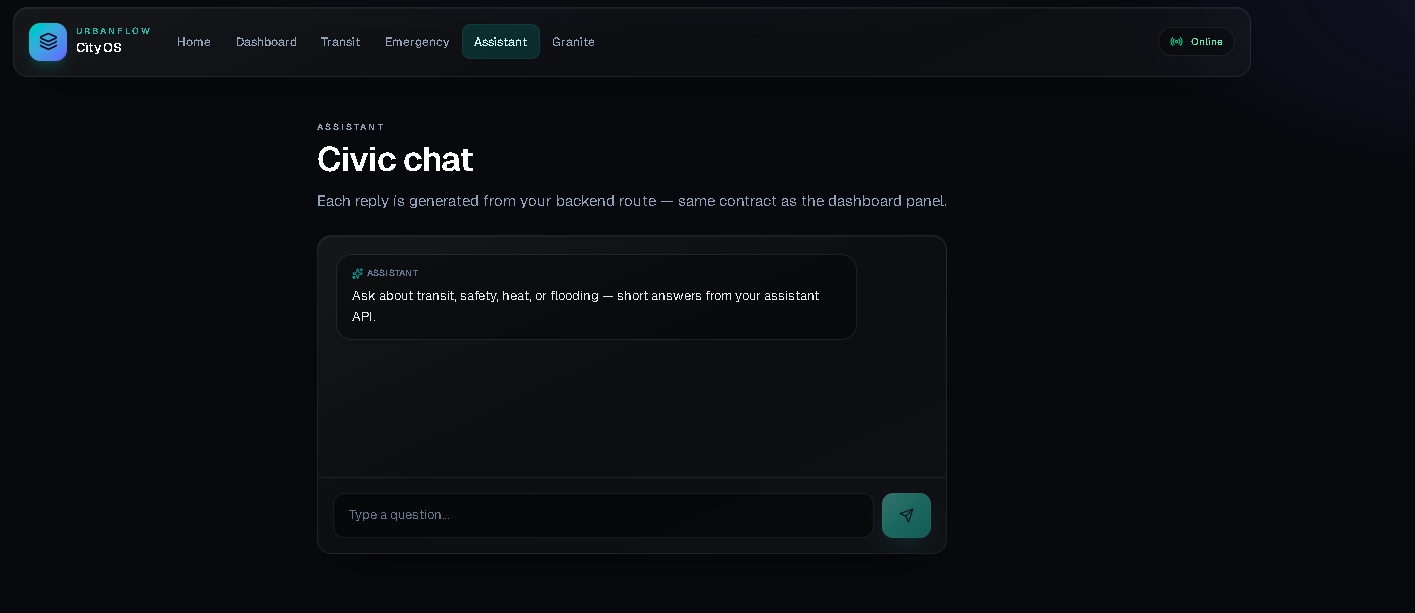
AI Assistant
-
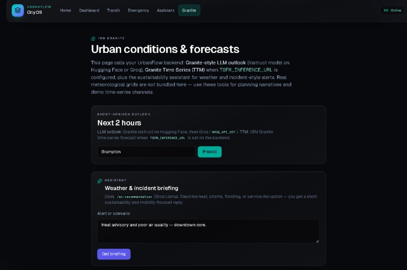
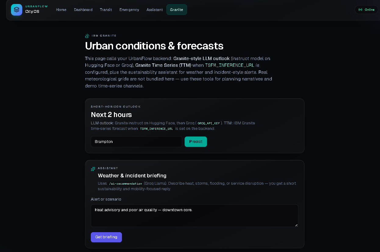
IBM Granite Prediction Analytics
🌆 About UrbanFlow
Inspiration
Our inspiration for UrbanFlow came from a simple observation: cities are becoming more crowded, transportation systems are harder to manage, and emergency response often depends on disconnected systems.
As a two-person team that previously worked together in Hackville and later participated in BramHacks 2025, we became increasingly interested in how technology could improve everyday urban experiences. During those experiences, we realized that many city systems still react to problems after they happen instead of helping predict them earlier.
That made us ask:
What if cities could become proactive instead of reactive?
UrbanFlow started from this idea — creating a platform that combines real-time city intelligence, smarter transit planning, emergency awareness, and predictive analytics into one experience.
We also wanted to focus on sustainability. Traffic congestion, inefficient transit systems, and delayed emergency access affect both people and the environment. We believed AI could help cities become smarter, safer, and more sustainable.
What it does
UrbanFlow is an AI-powered smart city intelligence platform that helps cities monitor, optimize, and predict urban activity.
UrbanFlow includes:
- 📊 A real-time smart city dashboard with live metrics and city insights
- 🗺️ Transit route optimization using Google Maps for smarter mobility
- 🚨 Emergency intelligence for better awareness and response planning
- 🤖 AI-powered recommendations for urban decision-making
- 📍 Nearby infrastructure mapping such as hospitals, transit hubs, and community centers
- 📈 Predictive analytics powered by IBM Granite Time Series to forecast city disruptions and urban trends
Instead of only showing what is happening right now, UrbanFlow also helps users understand what could happen next.
How we built it
We built UrbanFlow using a modern full-stack architecture.
Frontend
We used Next.js, React, Tailwind CSS, Framer Motion, and React Leaflet to create a modern and interactive smart-city experience.
Backend
We used FastAPI with Python to manage APIs, route optimization, city intelligence, and predictive endpoints.
APIs & Services
To make UrbanFlow practical and real-time, we integrated:
- Google Maps API for transit planning, routing, and directions
- Geoapify API for nearby infrastructure and city places
- Open-Meteo API for weather intelligence
- Groq AI for smart recommendations and insights
- IBM Granite Time Series for predictive city analytics and forecasting
We deployed UrbanFlow using Vercel for a production-ready experience.
Challenges we ran into
One of our biggest challenges was integrating multiple systems into one seamless experience.
We faced challenges with:
- Connecting real-time APIs together
- Route optimization and transit mapping
- Frontend-backend deployment and API communication
- Making predictive insights feel meaningful for a smart-city context
We also spent a lot of time debugging deployment, environment variables, and making sure everything worked smoothly in production.
What we learned
UrbanFlow taught us how to move beyond building isolated features and instead create a complete production-ready system.
We learned:
- Full-stack deployment and production workflows
- API integrations at scale
- Real-world routing and mobility systems
- The value of predictive analytics in urban planning
- How IBM technologies like Granite Time Series can support proactive decision-making
Most importantly, we learned that technology for smart cities should not just be innovative — it should solve real problems people experience every day.
🌍 Sustainable Development Goals (SDGs)
UrbanFlow aligns with several United Nations Sustainable Development Goals (SDGs):
SDG 3 — Good Health & Well-being
By improving emergency routing and access to hospitals and critical infrastructure.
SDG 9 — Industry, Innovation & Infrastructure
Through AI-powered smart-city innovation and predictive infrastructure intelligence.
SDG 11 — Sustainable Cities & Communities
By supporting smarter transit systems, reduced congestion, and safer urban environments.
SDG 13 — Climate Action
Through optimized transit planning and reduced unnecessary congestion to support sustainability.
SDG 17 — Partnerships for the Goals
By combining technologies such as IBM Granite Time Series, Google Maps, Geoapify, and AI systems to build collaborative urban intelligence.
What's next for UrbanFlow
We plan to continue improving UrbanFlow by exploring:
- Real-time traffic forecasting
- Better emergency response optimization
- Public transit disruption prediction
- Multi-city intelligence systems
- IoT sensor integrations
- Deeper IBM Granite-powered predictive urban intelligence
Our long-term goal is to help cities become smarter, safer, and more sustainable through predictive urban intelligence.
Built With
- fastapi
- google-maps
- granite
- groq
- ibm
- nextjs
- postgresql
- tailwindcss
- typerscript


Log in or sign up for Devpost to join the conversation.