-
-
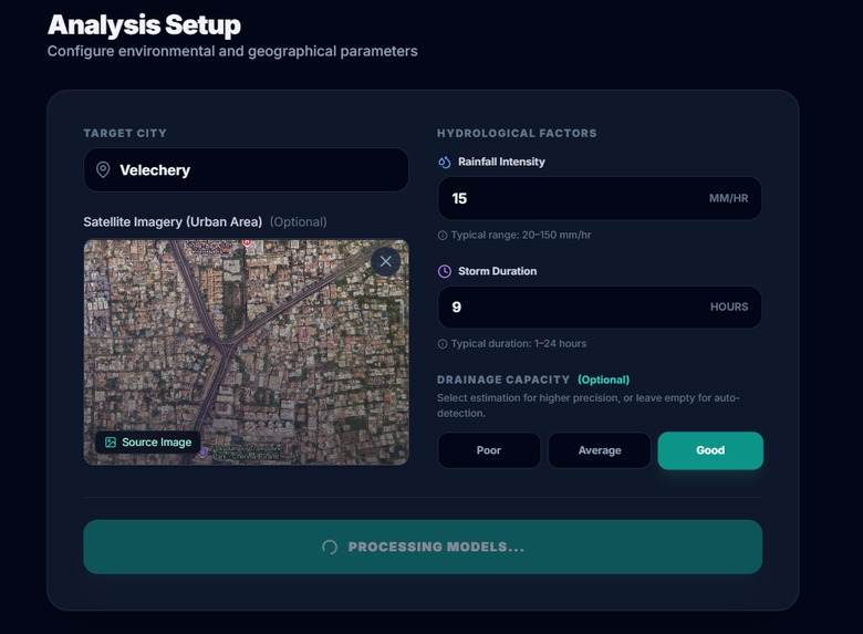
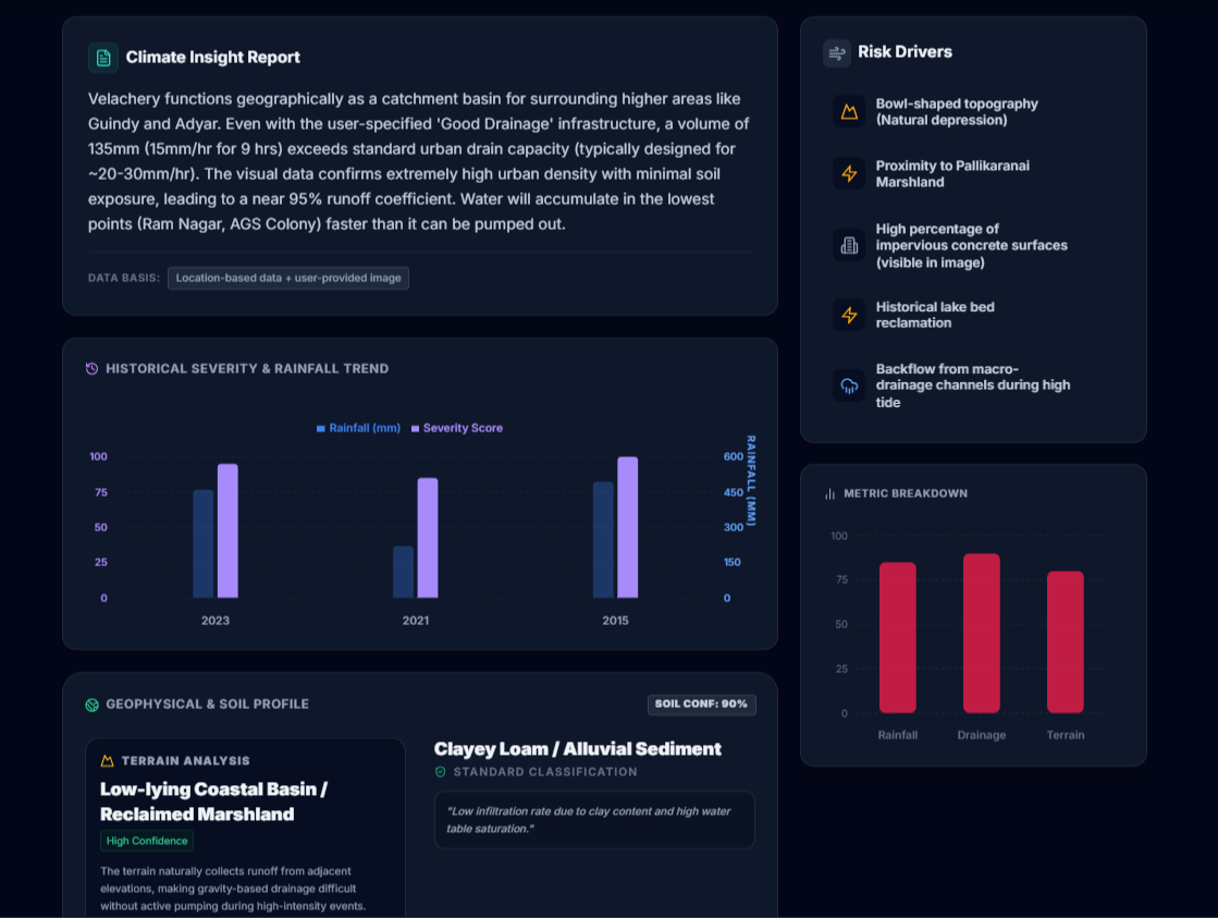
Analysis page
-
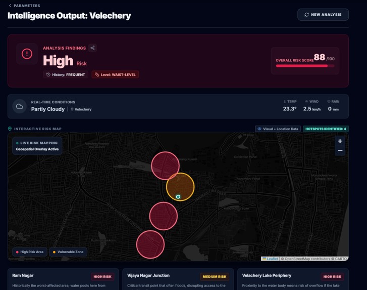
Risk Map with potential hotspots
-
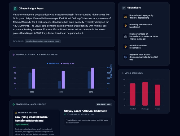
AI insights of the inputs

Inspiration
UrbanFlood AI is an intelligent climate-resilience platform developed for SDG 13: Climate Action. It provides a sophisticated bridge between raw environmental data and community safety, transforming complex satellite imagery into actionable risk assessments. The core mission is to shift disaster management from a reactive stance to a proactive, AI-driven survival strategy. Tech Stack
- Frontend: React and Vite for a high-performance, responsive user interface.
- Development Environment: Antigravity IDE.
- Version Control: Managed and synchronized via GitHub.
- Intelligence: Integrated with the Gemini 3 API for multimodal and high-reasoning tasks. Gemini 3 Implementation Gemini 3 serves as the "analytical brain" of the system, utilized through several advanced features:
- Multimodal Spatial Reasoning: The model processes high-resolution satellite imagery using the media_resolution="high" parameter to detect subtle infrastructure vulnerabilities and encroachment in residential zones.
- Deep Hydrological Simulation: We utilize the Thinking Levels feature (thinking_level="high") to allow the model to reason through complex topographical data and project potential flood paths based on rainfall intensity.
- Long Context Intelligence: The 1M+ token context window enables the platform to cross reference real-time imagery with extensive historical flood archives for high-fidelity predictive scoring.
- Agentic Report Generation: Gemini 3 automatically synthesizes these technical findings into clear, shareable risk reports for the Data Sharing Protocol, allowing users to broadcast lifesaving information to stakeholders. Impact UrbanFlood AI moves beyond simple detection by offering collaborative intelligence, ensuring that verified, AI-vetted flood data is instantly accessible and shareable for coordinated emergency response.
Built With
- gemini-api
- google-ai-studio
- html


Log in or sign up for Devpost to join the conversation.