-
-
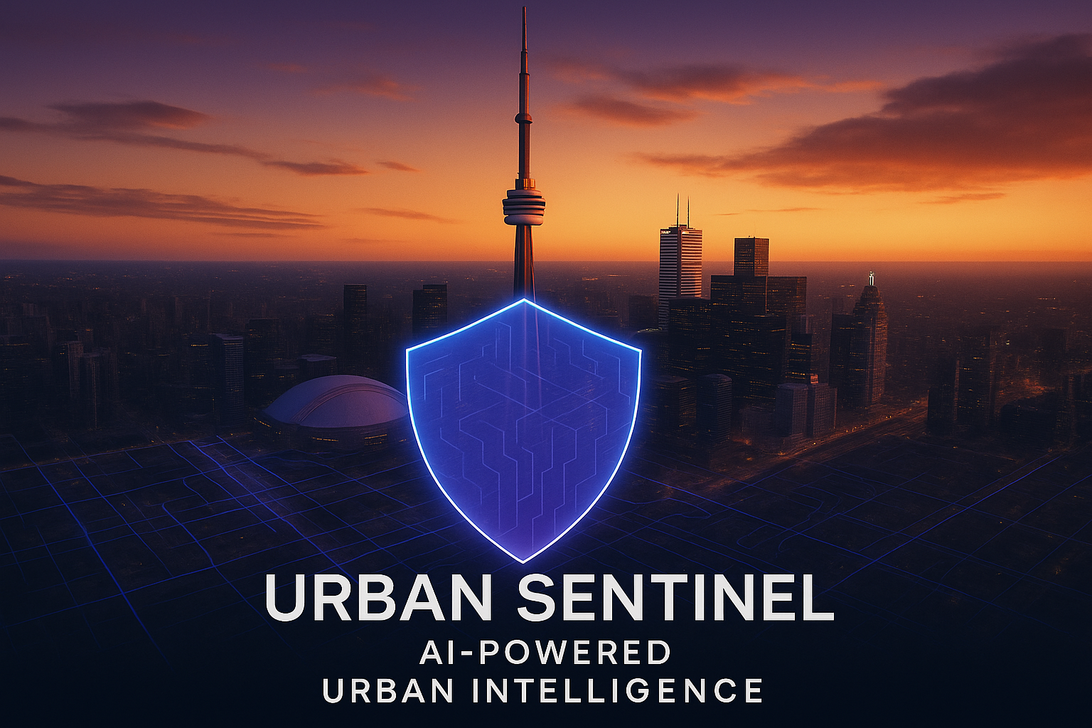
Cover Photo
-
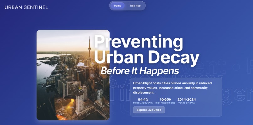
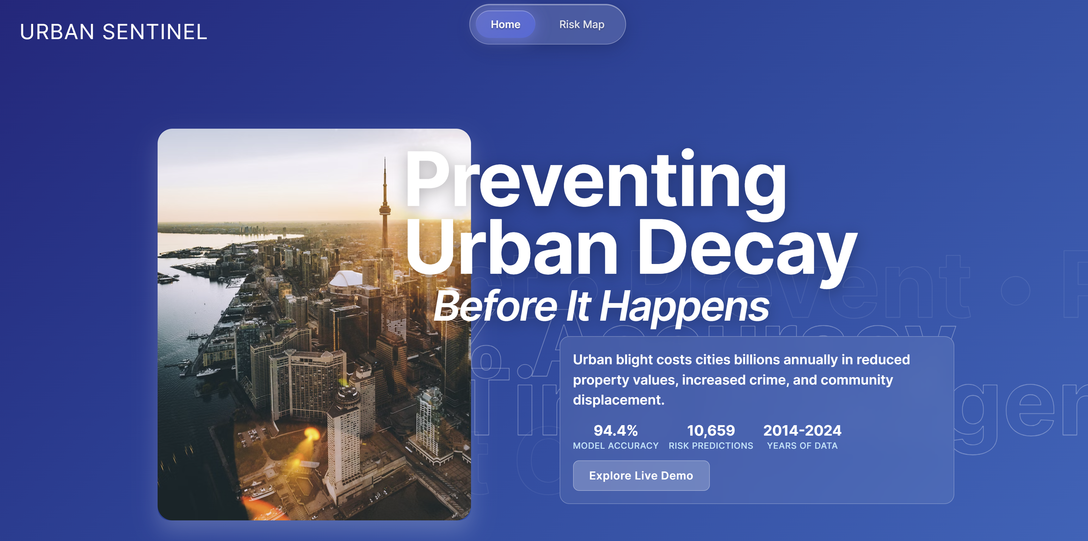
Front Page
-
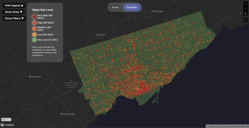
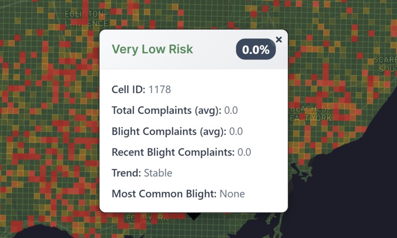
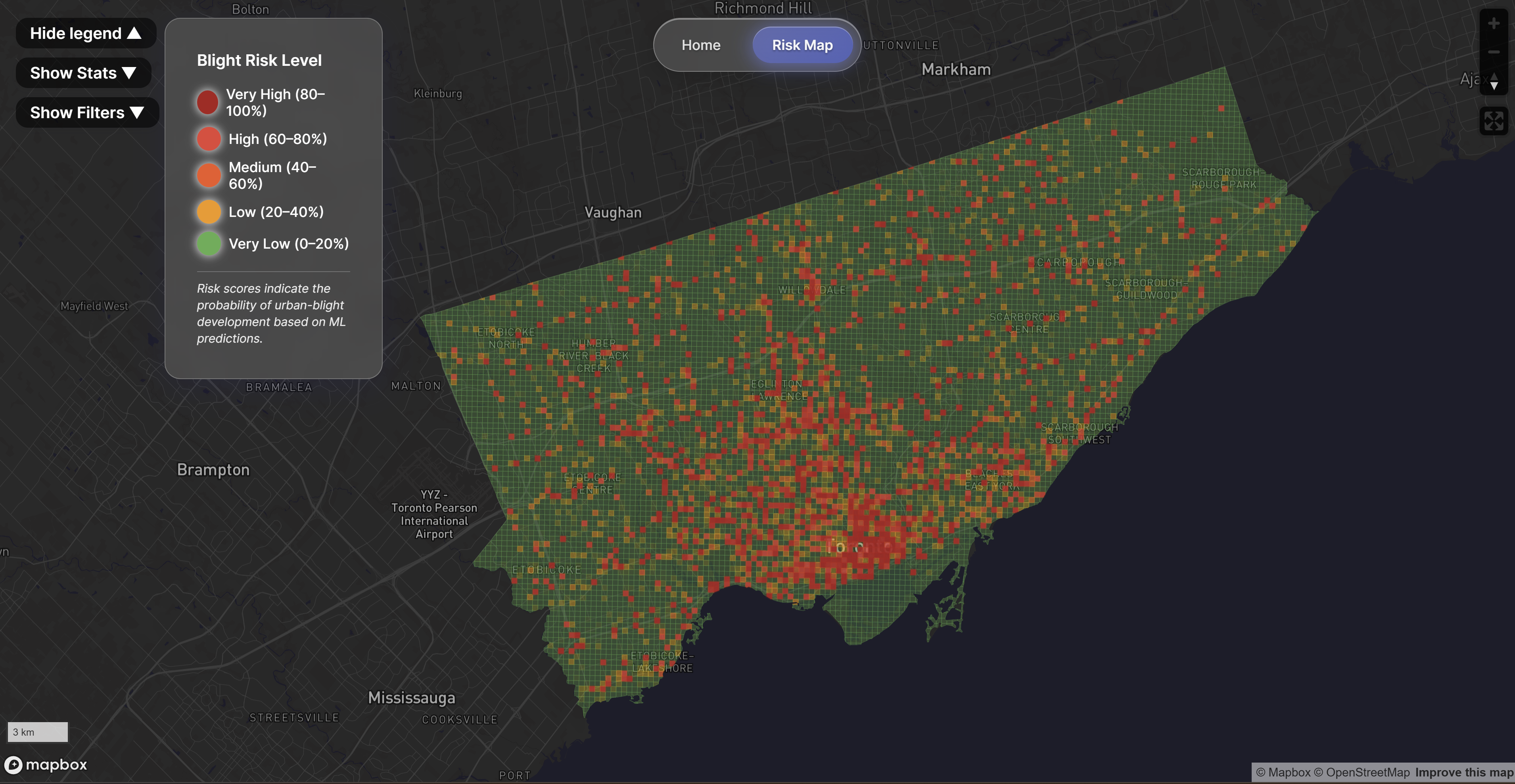
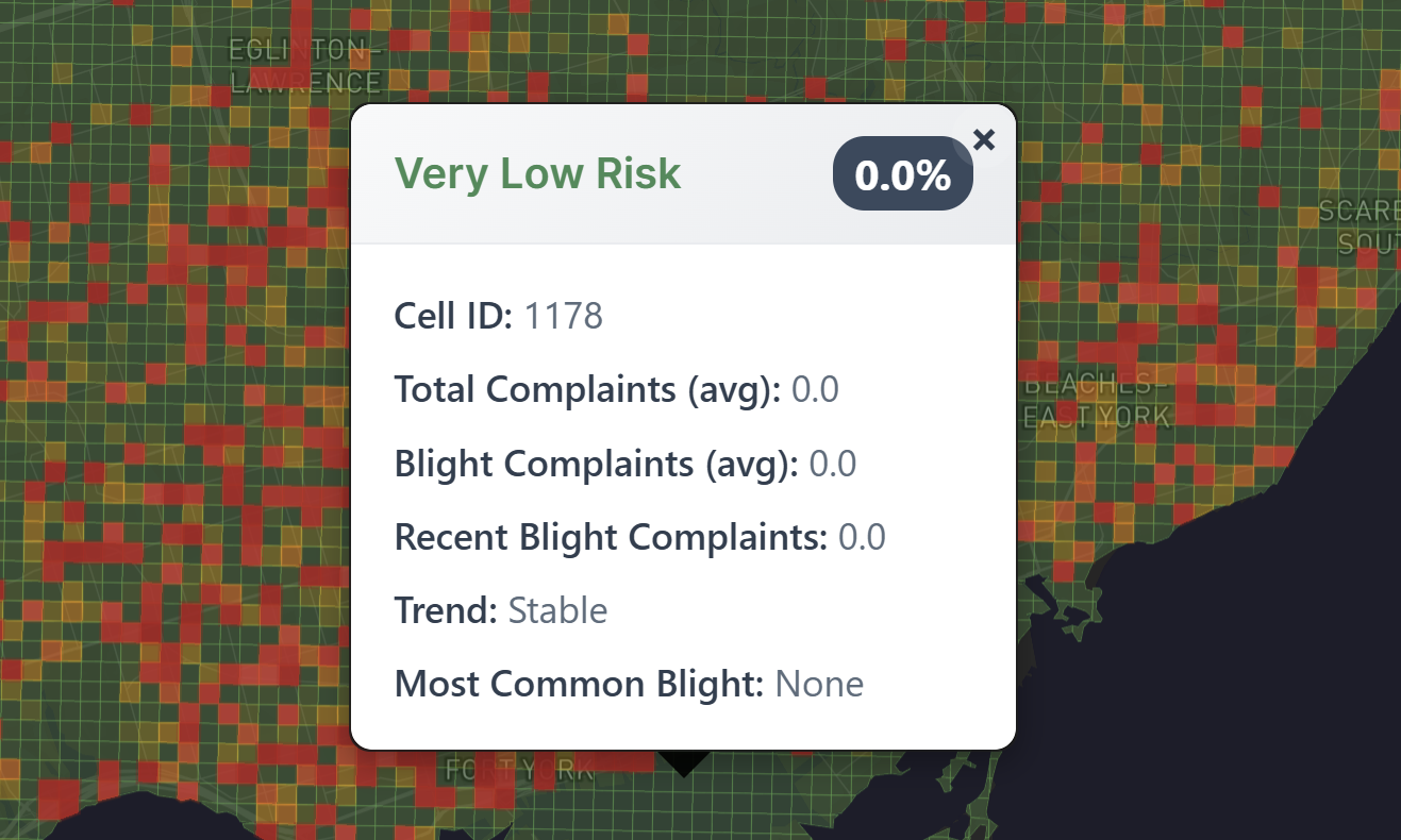
Map Page
-
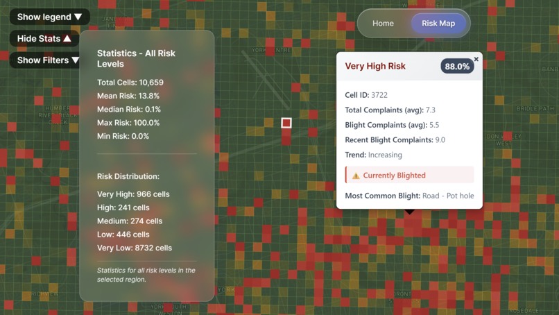
High Statistic
-
Low Statistic

🏙️ Urban-Sentinel
Your City's Crystal Ball for Urban Health
Inspiration
Toronto is awesome, but let’s be honest, every city has its questionable neighbourhoods. We kept seeing headlines about urban decay, abandoned buildings, and potholes falling through the cracks. We thought:
“Why are we always playing catch-up with city issues? Why not get ahead and forecast the problem?”
Also, we really wanted an excuse to use the phrase “urban-sentinel” in a sentence.
What it does
Urban Sentinel is a predictive analytics platform for city planners—minus the fog and creepy old lady. Our tool scans Toronto’s neighborhoods and pinpoints the areas at risk of urban decay, up to two years in advance.
We don't just give you a spreadsheet. You get:
- An Interactive Map: A beautiful, real-time visualization of neighborhood health. Think SimCity, but for real-world impact.
- Real-Time Stats: Dive deep into the data driving our predictions.
- Proactive Insights: The power to spot trouble before it starts, allowing for smarter, more timely resource allocation.
- A Pure ML Core: Built with a classical LightGBM algorithm. No GPT wrappers here :P
How we built it
- Frontend: React, TypeScript, and Mapbox GL JS for a snappy, glass-morphic UI that’s a joy to use.
- Backend: FastAPI and Python serving up our powerful LightGBM model.
- Data Wrangling: A whole lot of GeoPandas, Pandas, and moments of, “Why doesn't this CSV have coordinates?!”
- DevOps: Dockerized for simple, one-command deployment.
Challenges we ran into
- The Data Wilderness: Toronto’s 311 data is a wild ride. We wrangled typos, missing values, and a disturbing amount of awful formatting.
- The Accuracy Battle: Getting the model to predict blight accurately (and not just say “everything’s fine!”) took a marathon of feature engineering.
- Performance Tuning: Making the map look cool without making our laptops sound like jet engines.
- The Classic Nemesis: Docker on Windows. Enough said. (Probably should've ran WSL lol).
Accomplishments we're proud of
- 94.4% Model Accuracy!
- A fluid, interactive map that runs at a smooth 30-60fps, even on older hardware.
- We are genuinely predicting signs of urban decay before they become major issues.
What we learned
- Urban data is messy, but with enough patience (and GeoPandas), you can turn chaos into clarity.
- Predictive AI can be a powerful force for good in our cities.
- Great UX matters. If it’s not intuitive and fun to use, it won't be used.
- Hackathons are a masterclass in learning, laughing, and questioning your design choices at 2 AM.
What's next for Urban Sentinel
- Multi-City Expansion: Chicago, Detroit, and New York have fantastic open datasets just waiting to be explored.
- Adding a New Layer: Integrating satellite imagery to analyze changes in green space and infrastructure from above. Because why not add space tech to the mix?
- API Integrations: Allowing other smart city tools to plug into the Urban Sentinel ecosystem.
- Deeper Metrics: Incorporating new data metrics for our algorithm to utilize in the future! This being our most important wanted development that we didn't have enough time to complete. We would love to incorporate Building Code Violations, Crime Statistics, & a tracking of Business Licenses to further enhance our models predictive power in regards to Urban Decay/Blight.


Log in or sign up for Devpost to join the conversation.