-
-
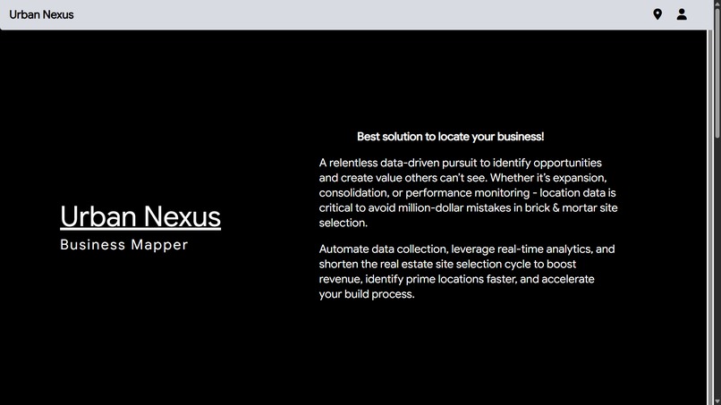
Homepage1
-

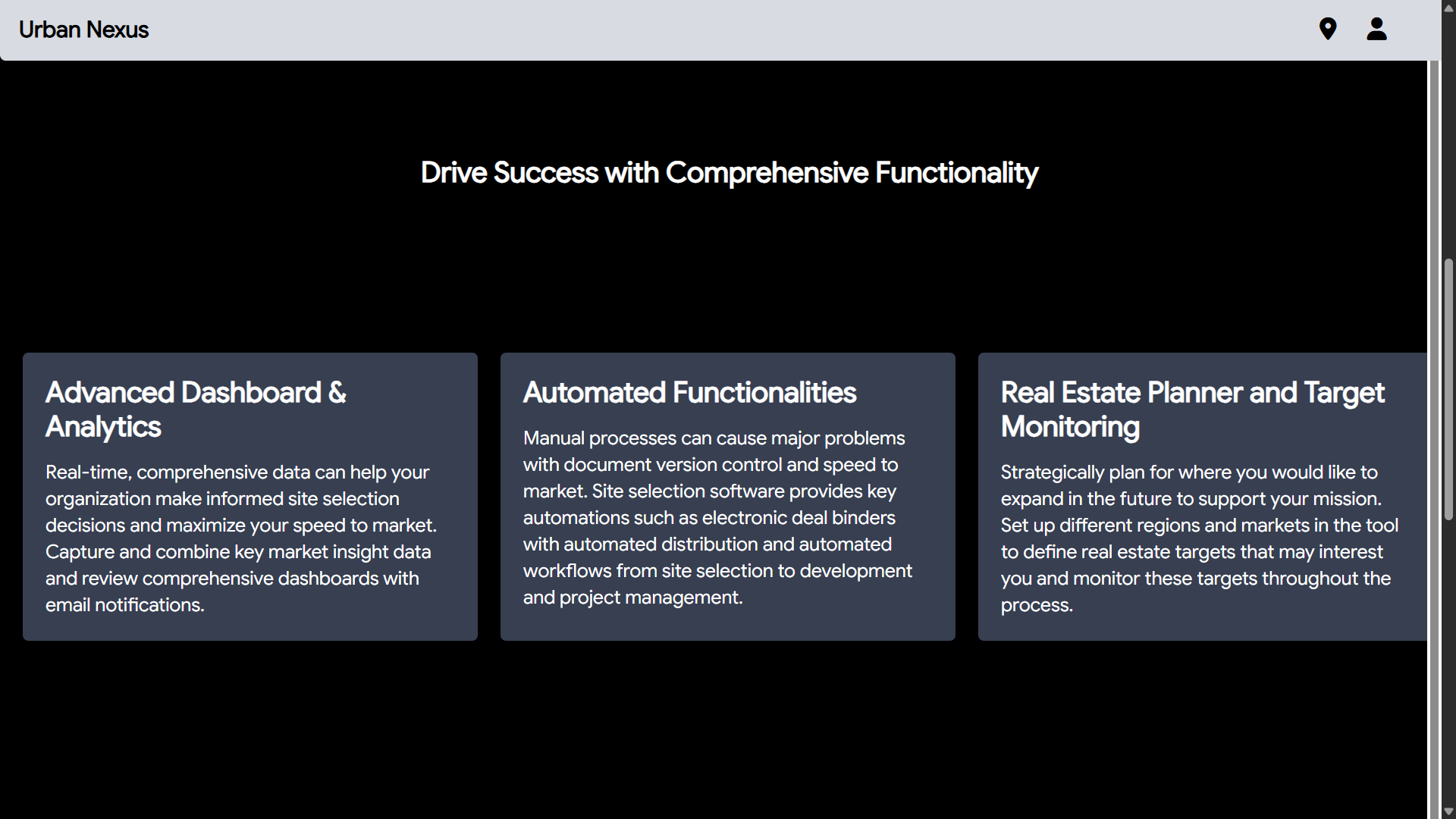
Homepage3
-
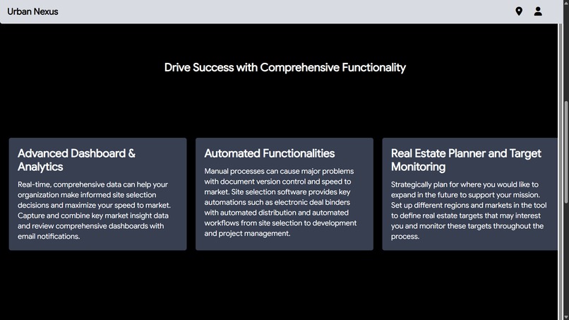
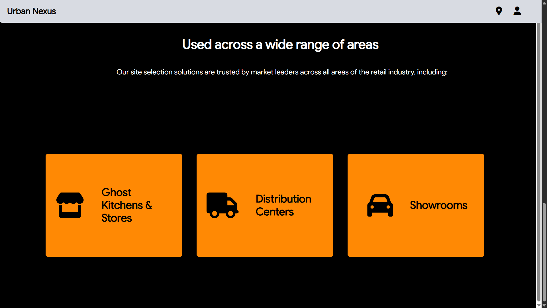
Homepage2
-

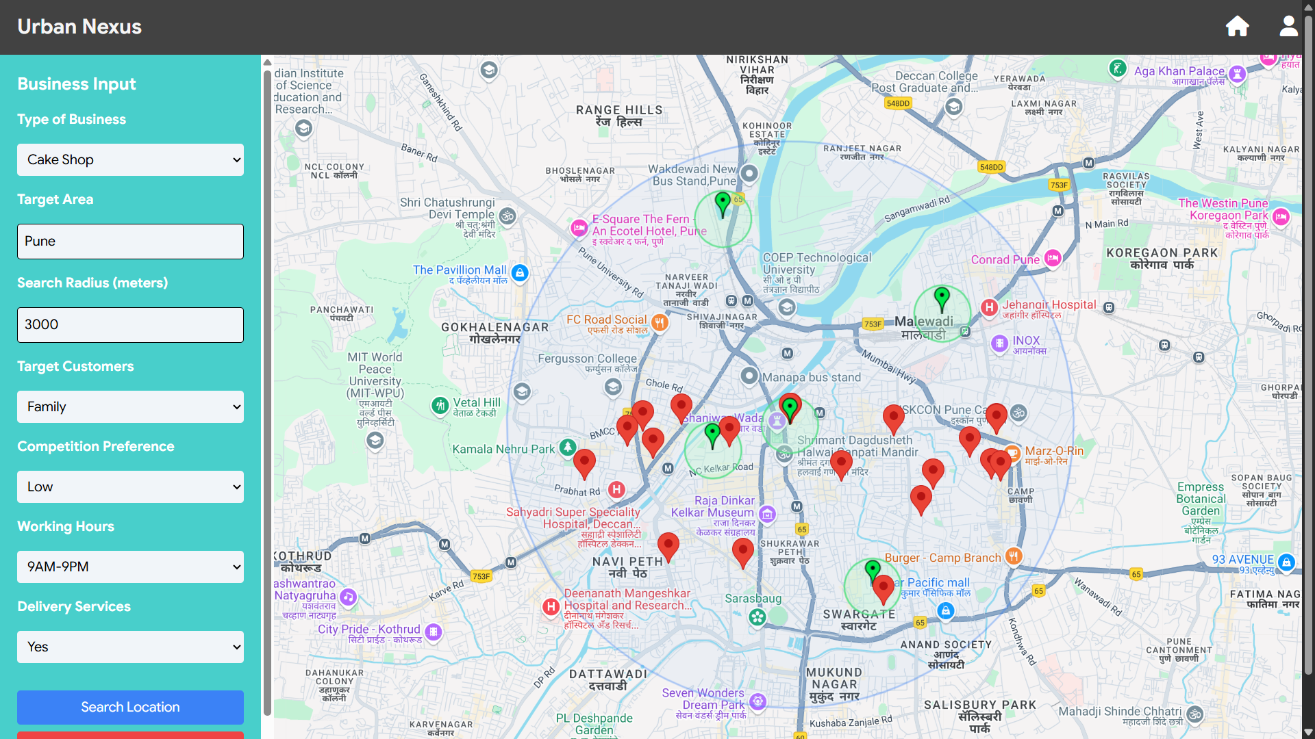
Dashboard
-

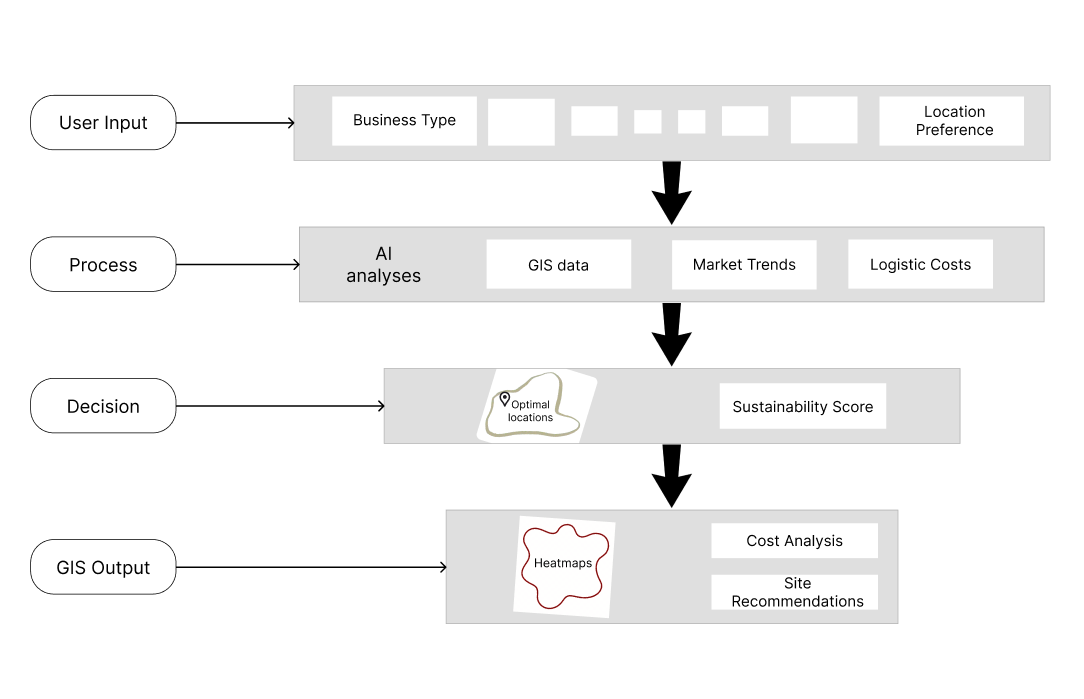
Process Flow Diagram
-

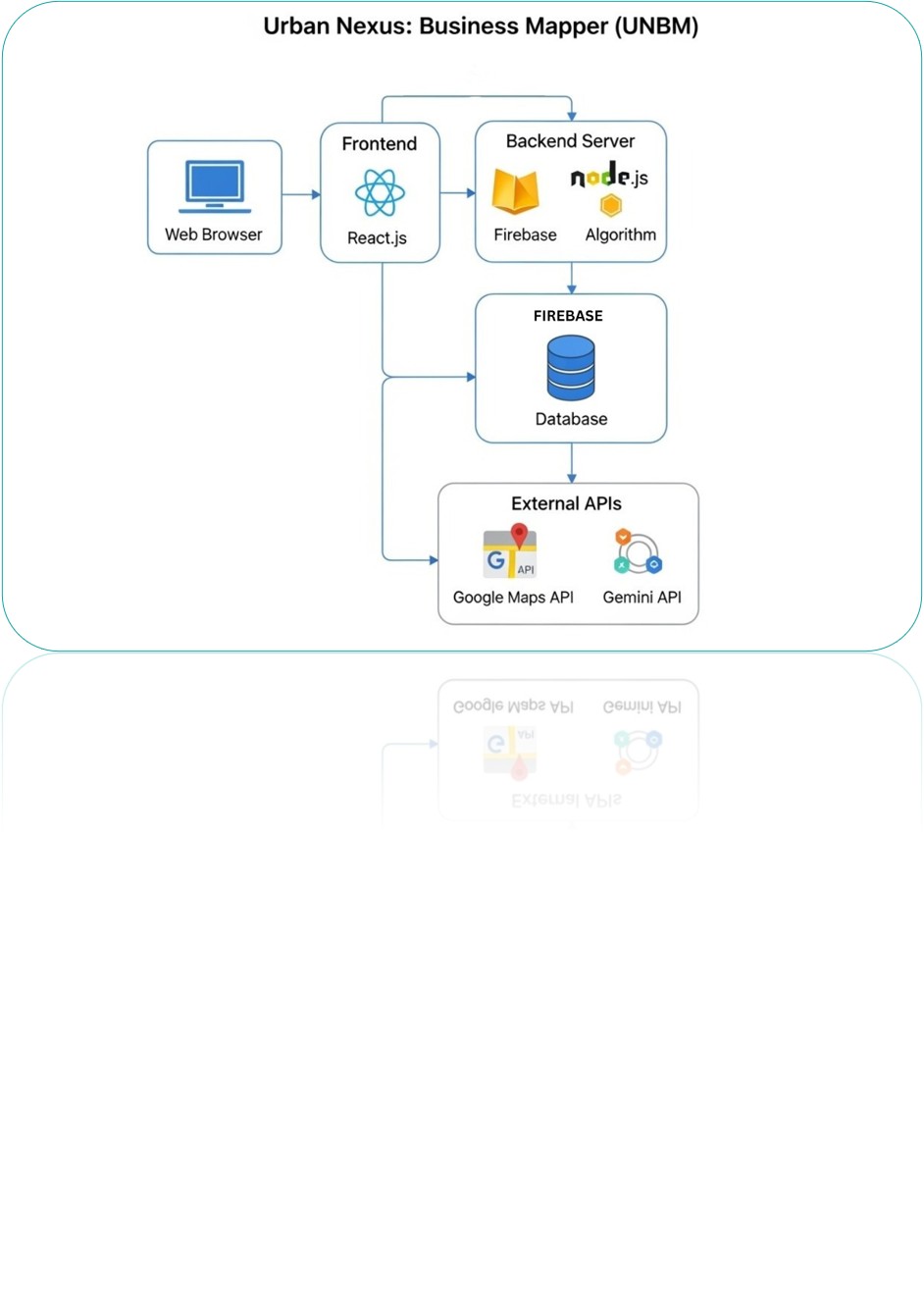
Architecture Diagram
-
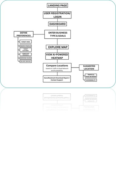
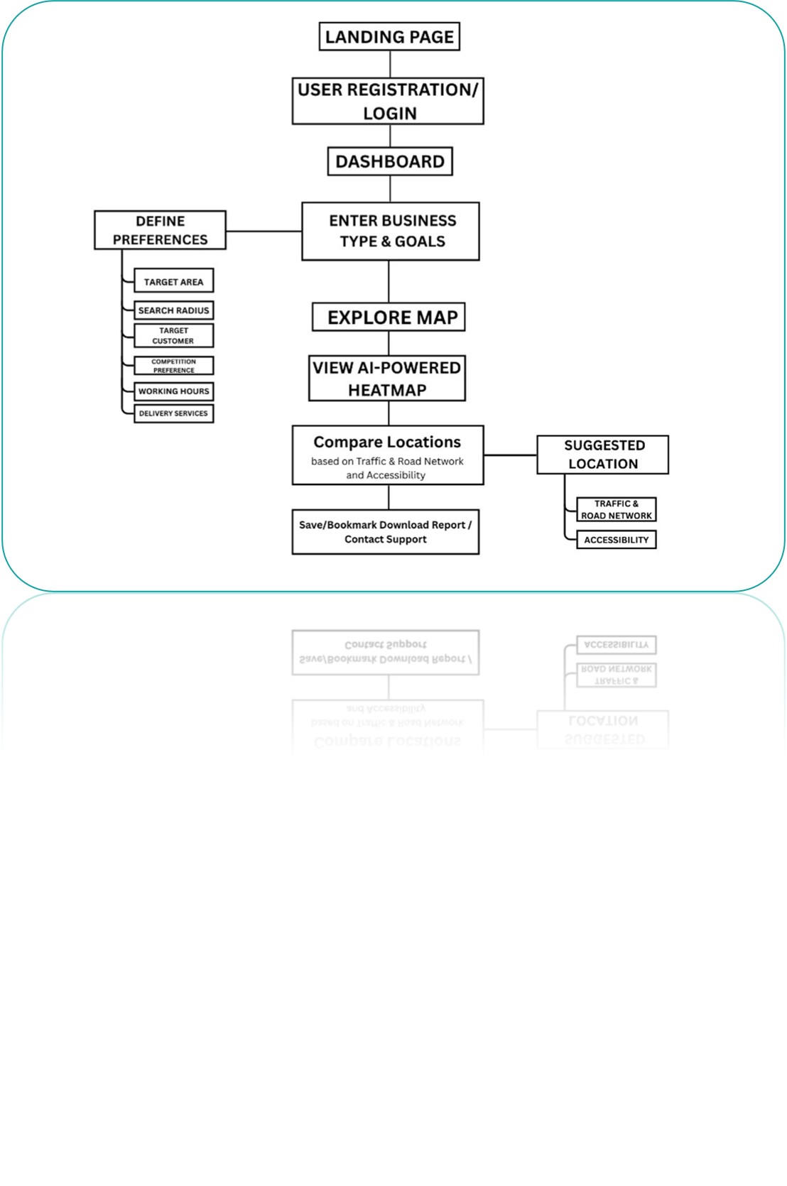
User Flow Diagram
Inspiration
Finding the “right spot” is often the make-or-break moment for cafés, pharmacies, and other SMBs. While researching Indian startup failure rates, we discovered that up to 70% of closures trace back to poor location choice. As students in Computer Engineering and BS Data Science, we saw an opportunity to apply geospatial data, machine-learning, and sustainability metrics to a real-world pain point. Urban Nexus Business Mapper (UNBM) was born from the desire to give every entrepreneur “big-consultancy” insight—without the big-consultancy price.
What it does
UNBM is a web-based SaaS platform that:
- Ingests Google Maps, census, traffic, and open-GIS layers.
- Runs an AI scoring model that weights foot-traffic, competition density, logistics cost, and even carbon impact.
- Presents a ranked shortlist of top-3 optimal locations, complete with heatmaps, cost estimates, and sustainability scores.
- Generates a shareable PDF so founders can pitch landlords or investors with data-backed confidence.
How we built it
- Frontend: React.js + Tailwind on Vercel for rapid UI iterations.
- Backend: Node.js micro-services on Firebase Functions; REST & WebSocket endpoints.
- Data stack: Google Maps API for POIs and routing; OpenStreetMap tiles; Gemini LLM for narrative insight; Pandas & GeoPandas for on-the-fly feature engineering.
- Model: Gradient-boosted trees that output a composite score
[ Score = 0.35\,T_{\text{foot}} + 0.25\,C_{\text{demand}} + 0.2\,L_{\text{logistics}} + 0.2\,S_{\text{carbon}} ] - DevOps: GitHub Actions → Firebase Hosting → Cloudflare CDN for painless CI/CD.
Challenges we ran into
- Data sparsity: Detailed retail foot-traffic datasets for Pune were scarce. We improvised by proxying Google Popular Times and weekday GPS pings.
- API cost ceilings: Free-tier call limits forced us to batch requests, cache results, and implement a spline-based traffic estimator to avoid overages.
- Balancing accuracy vs. speed: Early models took 3min per location. Pruning irrelevant features and moving heavy GIS joins to PostGIS cut this to 11s.
- Explaining AI to non-tech users: We added tooltip explanations and a “Why this score?” accordion to build trust.
Accomplishments that we're proud of
- Deployed a working MVP in eight weeks that demoed live at Innothon and landed in the top-5 finalists among 120 teams.
- Integrated a sustainability module that estimates (\Delta \text{CO}_2) emissions if logistics routes shift—turning mere site selection into green site selection.
- Achieved 92% agreement with human experts on a validation set of 40 existing retail outlets.
What we learned
- Real-world datasets are messy; strong ETL pipelines matter as much as fancy algorithms.
- UI/UX trumps raw tech: early testers valued clear explanations over marginal gains in model precision.
- Cross-disciplinary thinking—combining urban planning, GIS, and machine learning—creates solutions that single-domain approaches miss.
What's next for Urban Nexus
- Mobile Companion App: On-site AR overlay to visualize score heatmaps through a phone camera.
- City Roll-out: Add Mumbai and Bengaluru using scalable ETL templates.
- Dynamic Rent Index: Partner with listing platforms for real-time rental feeds, refitting our cost component.
- API Monetization: Expose a
/scoreendpoint for prop-tech and food-delivery startups. - Research Collaboration: Work with municipal bodies to incorporate UNBM's carbon-aware routing into urban planning dashboards. Urban Nexus is our step toward data-democratized city building—where every entrepreneur can make location decisions that are both profitable **and* sustainable.*
Built With
- css3
- figma
- firebase
- gemini-api
- google-maps
- html5
- javascript
- node.js
- react.js
- vercel


Log in or sign up for Devpost to join the conversation.