-
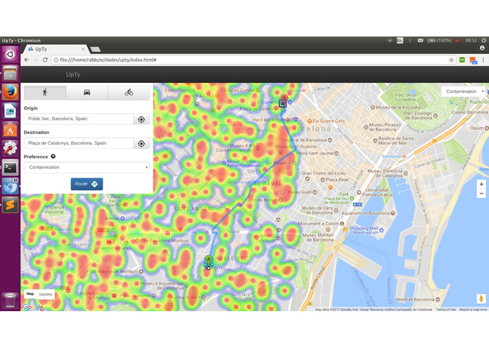
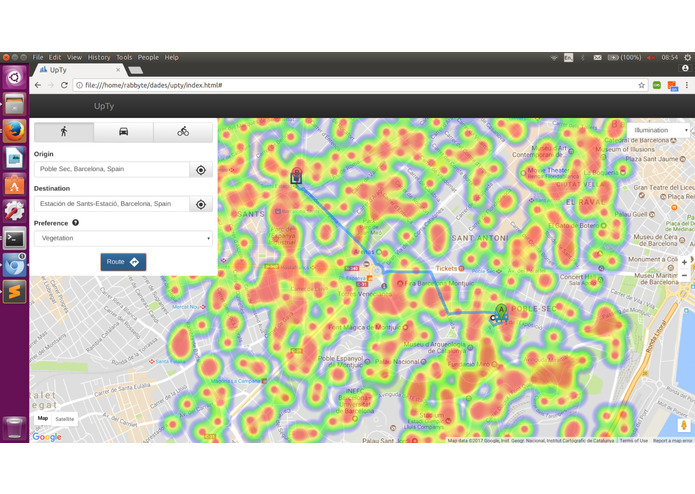
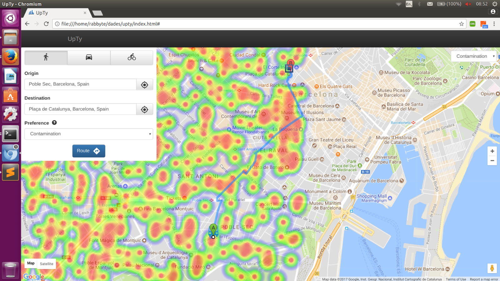
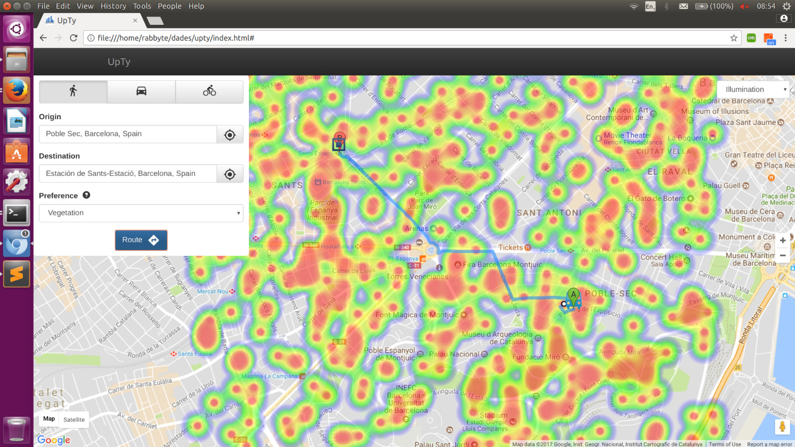
WebApp in action
-
Inspiration
Hackathons are really wonderful experiences. Hundreds of people meet, united by their passion to code and see technology advance. However, one question sometimes lingers amongst participants: Is there a way to be part of a major breakthrough in our field? Surely there will be some during our lifetime, but only a select bunch will be able to work on them. Also, what could that major breakthrough be? Almost everything seems to be invented, and the few things that aren't are being investigated by groups of scientists with far more resources and experience than us... However, we don't want to be simple spectators of progress. We want to be a driving force pushing it. Therefore, after giving it a lot of thought, we have crafted a project which could actually change how people relate with their cities.
What it does
UpTy is a platform built to raise the life standards of citizens living in a specific city. It uses a large amount and variety of sensors to collect information, process it and deliver it to it's users, allowing them to take control of many aspects which usually go unnoticed but have a large impact on one's well-being. The features we will provide are only a small portion of a wide toolbox of services which could be provided using basic information collected in the city. The webapp in our GitHub helps people plan their trips through a city, offering different criteria. You might want a route with a lot of vegetation that will help you relax or a walk through a quite zone. You may be scared of something happening to you while going back home after having dinner with some friends. Or you could simply want to bike through a zone that isn't too polluted. For all of these ocasions (and more), UpTy's got options to find the directions that most suit your needs. It also has a strong social and environmental component, since it's mechanisms allow prevention of hazardous pollution situations created by an abundance of cars and help minorities and people in danger avoid possible issues. For example, it shows most transited areas so you don't have to walk back home in empty alleys, and warns drivers when they are going to drive through extremely poluted areas.
How we built it
Using Opentrends's API, we access and store different sensor values. Then, through a Google Maps API and some algorithms, the best routes are decided to fit the user's needs, while also detecting possible dangers. Since we are building a webapp, most of the coding is in JavaScript or HTML. However, the first steps and testing datasets are built with C++ and bash.
Challenges we ran into
None of us has any proficiency building web content, so the JavaScript and HTML part was kind of a hussle. We spent a lot of time on code academy learning the basics. We were a little too greedy at first, trying to do much more without taking time into account. Later we had to sit down, reconsider our idea and eliminate some capabilities we really wanted to include (and which we will include in the future!).
Accomplishments that we're proud of
We believe that our idea could really change the way people relate to their environment, much like how Google Maps changed it after it became widespread. Our code is only a tiny portion of the picture we have imagined, but we are going to fight to make that image a reality. So we take pride in our vision, and we hope many people will share it. You can be the first!
What we learned
We learned a lot about chaining APIs together and pipelining different programing languages. We also worked really hard to make our UI user-friendly and elegant (we don't have much of a taste for this things). However, since our vision carries further after the Hack, we want a "brand image", which we tried to create using details like favicons and logos. Now we have learned that this little things can really change the overall feel of a project.
What's next for UpTy
Expanding all the options, including more reliable algorithms to calculate the data we want. Once we have a big enough pool of data, both in amount of sensors and in timelapse of data recorded, we plan on using ML techniques to not only monitor pollution and hazard levels in real time, but also predict them, avoiding possible incidents before they happen. Finally, personalization is really important. We want users to feel like UpTy knows their preference. Therefore, we'd like to extend the ML capabilities to learn from our user and perfect the options offered, considering both the empirical data collected by sensors and the unique characteristics of the person using our platform.


Log in or sign up for Devpost to join the conversation.