Inspiration
Cities keep expanding, but not always sustainably. Urban sprawl often means more traffic, less green space, and inefficient infrastructure. We realized that urban planners don’t always have easy tools to analyze all these factors together. That’s why we built UrbanPlannerAI (UPlanning) — an AI-powered tool that helps visualize how cities grow and gives smart, data-backed suggestions for building greener, more efficient communities.
What it does
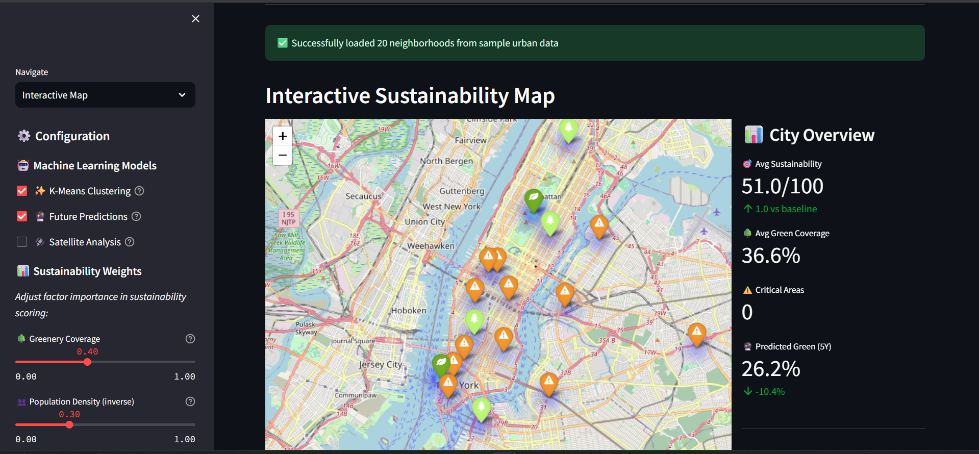
UPlanning analyzes population density, greenery, and infrastructure data to calculate a sustainability score for each area. It shows an interactive map with color-coded zones, highlighting places that could use more green space or better layouts. The tool then suggests ways to improve, like adding parks, optimizing roads, or focusing on vertical development instead of horizontal sprawl.
How we built it
We pulled data from open sources like WorldPop, OpenStreetMap, and Sentinel-2 satellite imagery, then processed it using pandas, geopandas, and rasterio. We built the dashboard with Streamlit, using Folium for interactive maps and Plotly for charts. We also experimented with simple AI models to cluster neighborhoods and predict sustainability trends.
Challenges we ran into
Handling and merging large datasets from different formats was tricky, especially balancing performance with visual interactivity. Making everything run smoothly in real time while keeping the interface simple was another challenge we worked hard to solve.
Accomplishments that we're proud of
We created an interactive map that actually helps people see how sustainable their city is. We’re proud of how we combined complex data into one clear, easy-to-use dashboard — and how our AI suggestions make the tool both informative and actionable
What we learned
We learned a ton about geospatial data, AI for sustainability, and how visualization can make technical insights understandable to everyone. More importantly, we saw how AI can help make cities greener and smarter, not just bigger.
What's next for UPlanning
Next, we want to add real-time data like air quality and traffic, and let users test different scenarios — for example, “What if we added a park here?” We’re also exploring generative AI layouts and working toward collaborating with real urban planners to apply UPlanning in real cities.

Log in or sign up for Devpost to join the conversation.