


Inspiration
When joining the University, sometimes we found it hard to find our way around. We noted that there is a lack of indoor map facilities available and happened to come across HERE API when we were looking through the list of sponsors. While HERE works to help on a larger scale, we wanted to first, develop something that would be of use on a smaller scale, starting with our very own university.
What it does
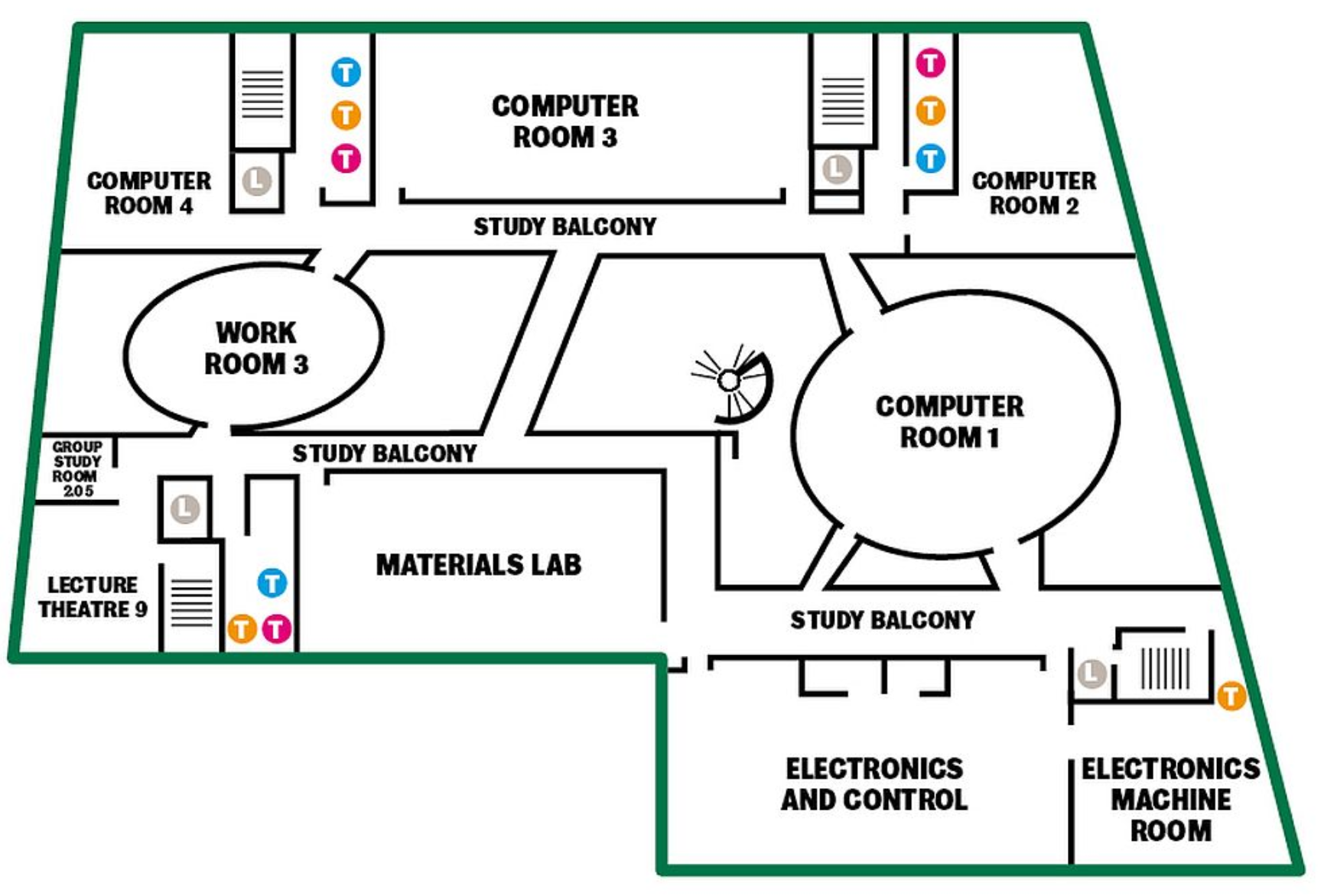
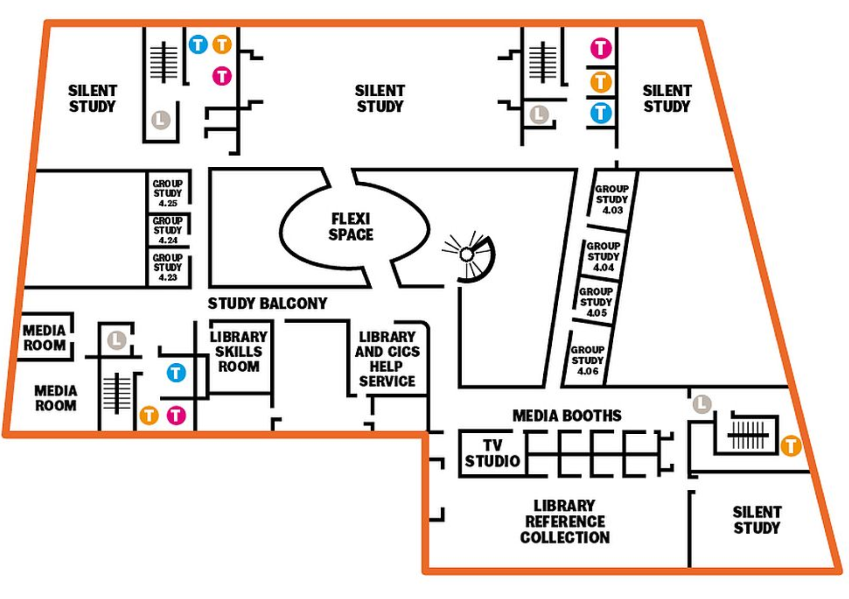
At the moment, we have multiple webpages. The main webpage consists of a map with zoom functionality and a marker set to the Diamond. Unfortunately, as we were unfamiliar with APIs we were unable to make the progress we would have liked to have therefore were unable to reach a point where we could fully incorporate indoor mapping, hence we have put links in its place with floor plans for the time being. In future, creating a 3D model would be useful to depict the map in a more accessible way.
How we built it
We used JavaScript, HTML, CSS and HERE APIs. We initially had planned to use Android Studio to create an application instead but wanted to attempt using the HERE APIs.
Challenges we ran into
Using unfamiliar software. Our initial idea to develop an app for mobile devices proved difficult hence we moved to HTML where we would be able to attempt the project with use of HERE's APIs.
Accomplishments that we're proud of
Every functionality that we were able to add, we were proud of as we were unfamiliar with the software. We also think the logo is very snazzy.
What we learned
With enough motivation, you can figure it out.. eventually.. with much hardship. :D
What's next for UniMaps
Finish developing so that we can incorporate indoor GPS tracking in addition to a 3D map model Develop it on mobile as an app, for usability purposes


Log in or sign up for Devpost to join the conversation.