-
-
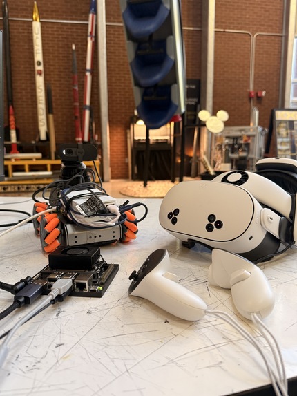
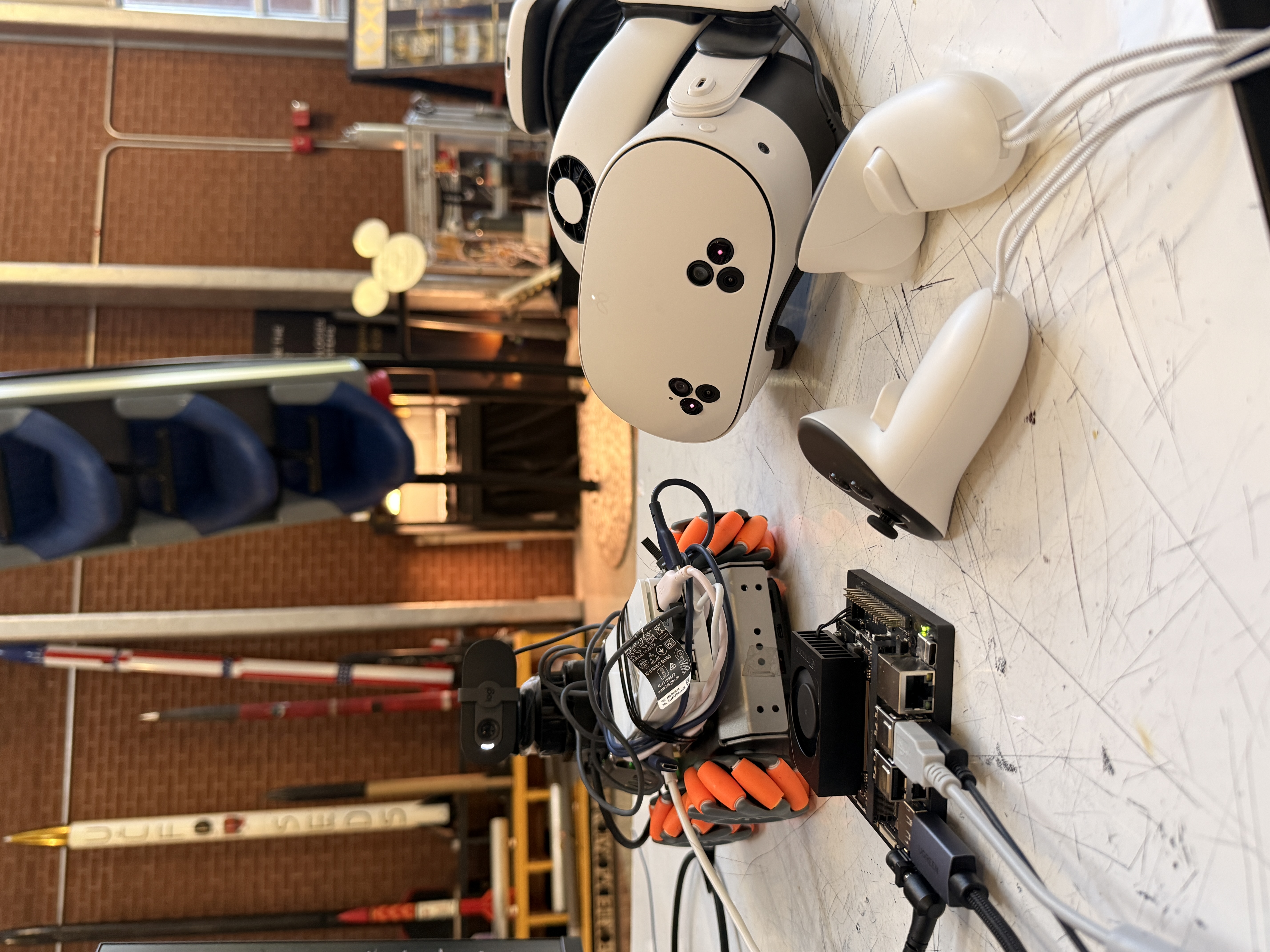
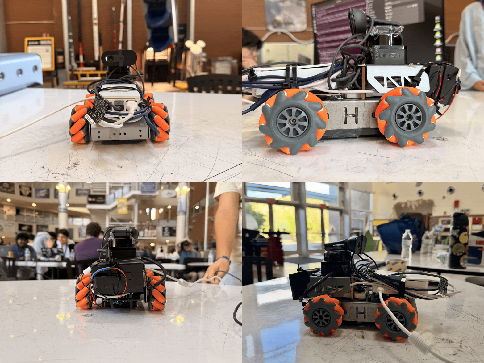
Look at our set up
-
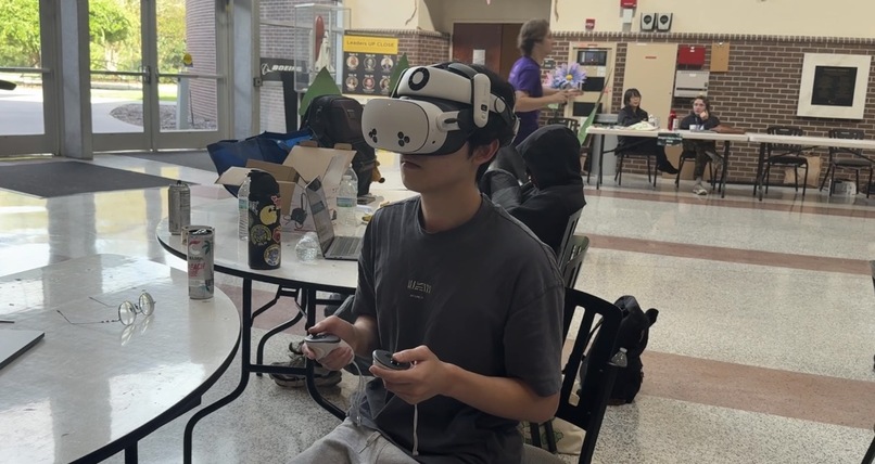
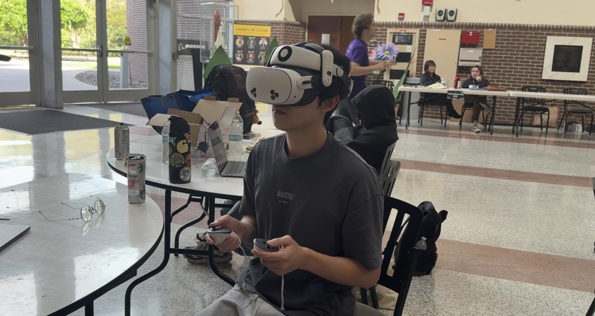
Utilize the Meta Quest to control the robot
-
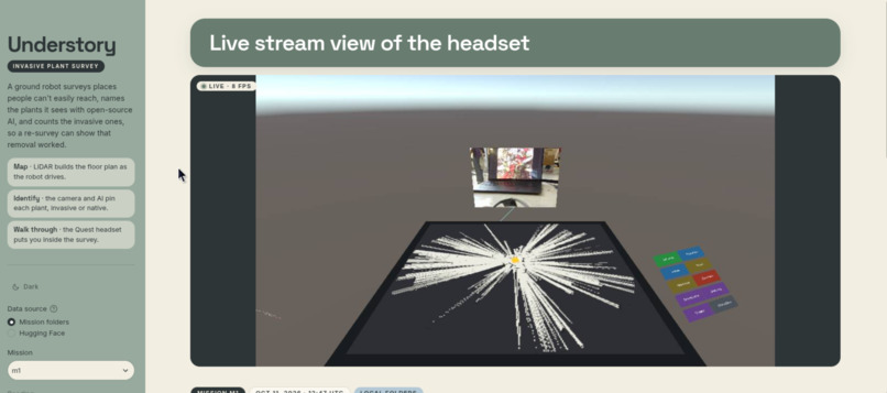
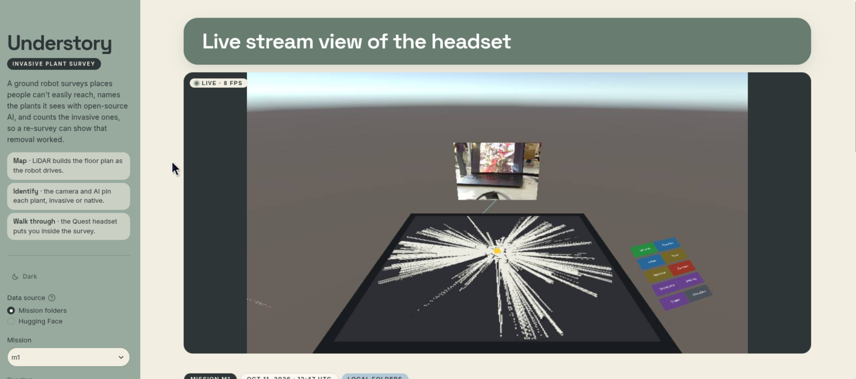
Dashboard and look from the Meta Quest
-
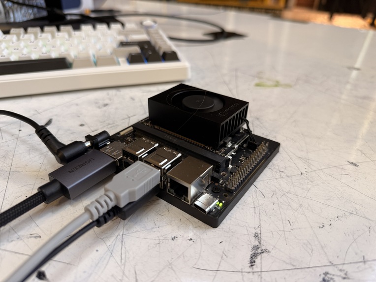
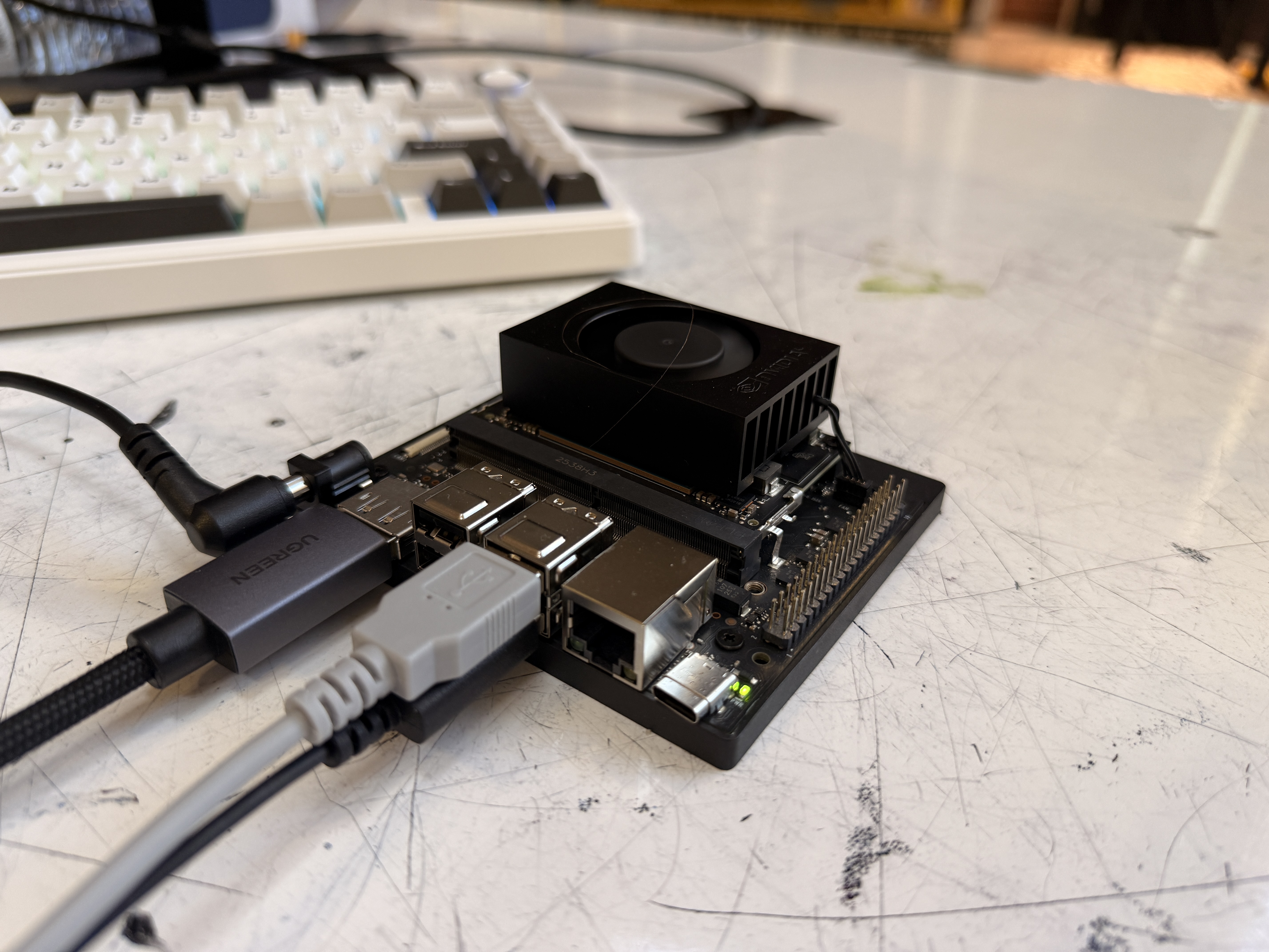
Powered by the Jetson-Nano
Inspiration
- Central Florida's conservation land is being overrun by invasive plants such as Brazilian pepper, air potato, and cogongrass.
- Crews remove them by hand, but checking whether a removal worked means scouting the land through thick brush, heat, and mud, so most of it is never re-surveyed.
- Our goal: a robot that drives through a habitat, maps it, identifies the plants with on-device AI, and turns the survey into a place you can walk through in VR.
- Understory is named after the layer of a forest below the canopy, where these plants spread and where people rarely look.
What it does
- Maps as it drives: a 2D lidar builds a floor plan live with SLAM, and the robot plans its own survey points on that map.
- Captures 360° "bubbles": at each survey point the robot spins in place, stopping every 30° to take 12 photos, each tagged with its heading.
- Finds and names plants: an open-vocabulary detector finds plant-like objects, and a biology model names the species and flags it as invasive or native.
- Pins each plant on the map: the plant's position in the image plus the lidar range in that direction places it on the floor plan, with a cropped photo saved for each pin.
- VR walkthrough: a Meta Quest app shows a tabletop miniature of the map with the robot, bubbles, and pins. Pick a bubble and you are standing inside it, with the plants marked around you.
- Before and after: survey once, remove the invasives, survey again, and the app shows which plants are gone and which remain ("7 invasive → 1 remaining").
- Voice commands: hold a button on the Quest controller and say "start survey", "take a picture", or "come back home". Speech is transcribed on the robot's own network.
- Manual driving: the Quest thumbsticks drive and strafe the robot, and one button is an emergency stop that overrides everything else.
- Web dashboard: a live lidar view of the robot and the saved map with its pins, open to any laptop on the robot's network.
- Mission logging: every mission is saved to a folder (bubbles, pins, photos, map) that the dashboard and cloud steps read.
- Works offline: every model in the live demo runs on our own hardware.
How we built it
- Compute: Raspberry Pi 5 on the robot (lidar, camera, mapping, navigation); NVIDIA Jetson Orin Nano at the table (AI and dashboard); ESP32 for motor control
- Sensing: Slamtec RPLIDAR C1 and a Logitech Brio 101 camera
- Motion: mecanum chassis powered by 6× AA cells (7.2 V)
- Perception: OWL-ViT for detection, BioCLIP for species ID, Whisper for speech, and OpenCV for panorama stitching, all through PyTorch and Hugging Face Transformers
- Acceleration: NanoOWL-style TensorRT engine on the Jetson for detection
- Robotics: ROS 2 Jazzy in Docker with
slam_toolbox, Nav2,twist_mux, and our own mission manager and survey planner - VR: Unity 6 with the Meta XR SDK and OpenXR on a Meta Quest, talking to ROS through ROS-TCP-Connector
- Dashboard: Streamlit, with a WebSocket relay for the live lidar and headset view
- Data: mission folders handed off through a private Hugging Face dataset
- 3D reconstruction: MASt3R and gsplat on an AMD Radeon PRO W7900, with Depth Anything V2 as a fallback
- Tooling: Foxglove for debugging; pytest for the geometry, voice, and mission logic
Technical details
- Two-stage plant ID
- OWL-ViT only answers "is this a plant?" using general prompts like "a plant" or "a leaf".
- Each box is cropped from the exact frame it came from and passed to BioCLIP, which picks from a fixed list of five species by scientific name.
- The list also contains non-plants (a wall, a hand, a laptop). If one of those wins, the crop is dropped instead of being forced into a species.
- Rejecting things that are not our plants
- The list also holds 20 other living things by scientific name (people, pets, house plants). If one of those wins, the crop is dropped.
- TensorRT on the Jetson
- The detector runs as a TensorRT engine: 19 ms per frame vs. 62 ms in PyTorch, enough to keep up with the camera at 15 frames per second.
- Putting a plant on the map
- The box's horizontal position becomes an angle using the camera's field of view; added to the robot's heading, that gives a direction in the map.
- The lidar range in that direction gives the distance.
- Sightings of the same species within 0.5 m merge into one pin, and a pin is only published after 3 sightings.
- 360° bubbles
- The mission manager rotates the robot in 30° steps using the SLAM heading, waits for it to settle, and asks for a frame.
- The 12 frames are sent to the headset as a ring of curved panels at their recorded headings, so the bubble works even when stitching fails.
- A stitched panorama follows as an extra when OpenCV can build one.
- Who controls the wheels
- Three sources can send drive commands, and
twist_muxpicks one by priority: e-stop, then Quest thumbsticks, then autonomy. - The ESP32 stops the motors if it hears nothing for 300 ms.
- Three sources can send drive commands, and
- Built against fake data first
- We agreed on topic names and JSON shapes on Friday night and wrote them down in one file.
- Every part was built against a fake mission generator and a mock ROS endpoint, so the Quest app, navigation, and perception could each be tested without the robot.
Challenges we ran into
- Heat: running both models on the Pi 5 pushed it to 83 °C in five minutes and throttled the CPU, so the AI moved to the Jetson.
- Speed: OWL-ViT takes about 3 seconds per frame on the Pi's CPU, so the detector drops frames and the species step matches each box to its original frame by timestamp.
- Lookalike plants: in photos, cogongrass looks like grass and wild coffee looks like leaves. Both scored so low that we dropped the detector threshold to 0.05 and relied on BioCLIP to reject the junk.
- False positives: a ceiling decoration was confidently named cogongrass until we added the "not a plant" list.
- Faces and decorations: the first live pins were a face named Brazilian pepper and an artificial flower garland named air potato. Adding other species by scientific name fixed it.
- Pi power and clock: the Pi rebooted several times and has no clock battery; it once came back almost six hours slow, which breaks ROS transforms between machines.
- USB power: on a power bank the Pi 5 limits its USB ports, so the lidar kept dropping out with over-current errors until we raised the limit in the bootloader.
- Hotspot: on 2.4 GHz the phone hotspot could not carry the camera stream. Moving to 5 GHz took ping from over a second to 5 ms.
- Two of everything: more than once both computers started mapping at the same time, with two mission managers driving the same wheels, until we added a check to the start scripts.
- Motor shield: loose I2C wiring made the wheels keep turning after a stop, so the firmware now re-sends stop while idle and recovers the bus.
- Humble vs. Jazzy: our navigation code was written for ROS 2 Humble. On Jazzy,
slam_toolboxneeds lifecycle activation,twist_muxexpects a different message type, and Nav2 plugin names changed. - Panoramas with no start angle: OpenCV's stitcher crops its output, so the headset couldn't place pins on it. We switched to always sending the 12 raw frames with their headings.
- Boxes off the frame: our detector scaled box heights by the image width, so boxes ran off the bottom of the picture.
- Quest build: the first headset build took 13 minutes, and a shader that worked in the editor failed on Android.
Accomplishments that we're proud of
- A full chain from camera frame to named, mapped plant, built only from open-source models and running offline
- Detection at camera speed (15 frames per second) on an 8 GB Jetson, alongside the species model
- A VR view where you can stand inside a spot the robot photographed and see what it found there
- A before/after comparison that turns two surveys into one number
- Two computers, a headset, and a microcontroller sharing one map over a phone hotspot
- Four people building in parallel against a shared contract, with a fallback for every fragile part
What we learned
- How to split a robot's work across a Pi, a Jetson, and a microcontroller with ROS 2
- Chaining a general detector with a specialist classifier, and why a "none of the above" option matters
- How much sensor fusion depends on timestamps, clocks, and measured offsets
- Building a Unity app against a robot that doesn't exist yet
- Thermal and power limits decide where code runs as much as software does
What's next for Understory
- An outdoor chassis that can handle real understory terrain
- A real before-and-after survey of a habitat, to replace our staged data
- A larger species list, including animals
- Soil moisture, light, and air quality readings shown as heat maps on the map
- Before/after reports and similar-plant search in the dashboard for land managers
- Full 3D Gaussian splat reconstructions of each survey site
- GPS so surveys line up across weeks and seasons



Log in or sign up for Devpost to join the conversation.