-
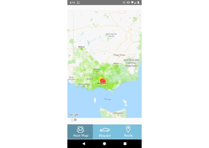
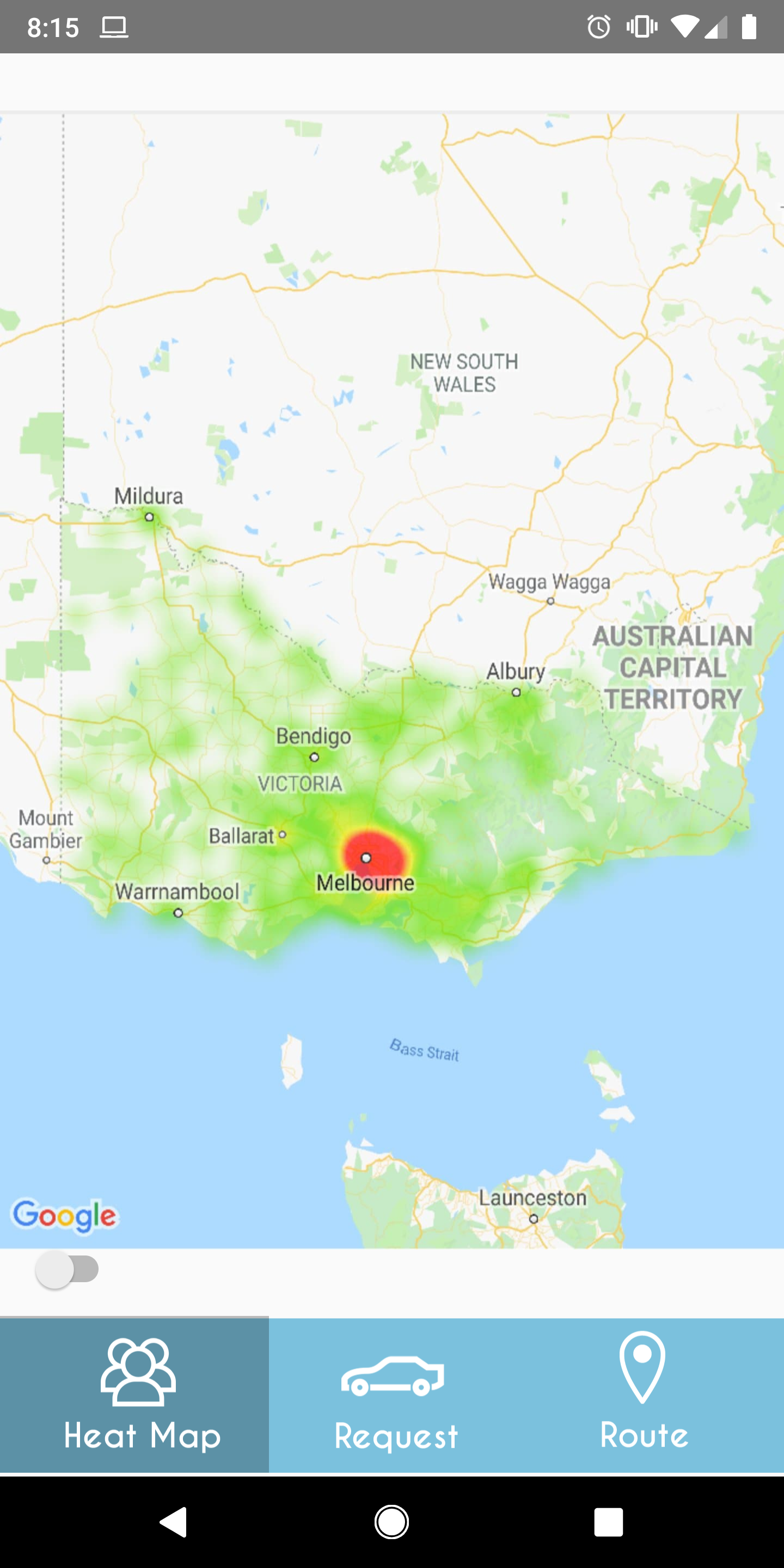
Heat Map Mode
-
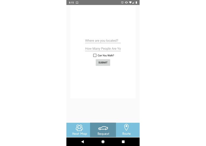
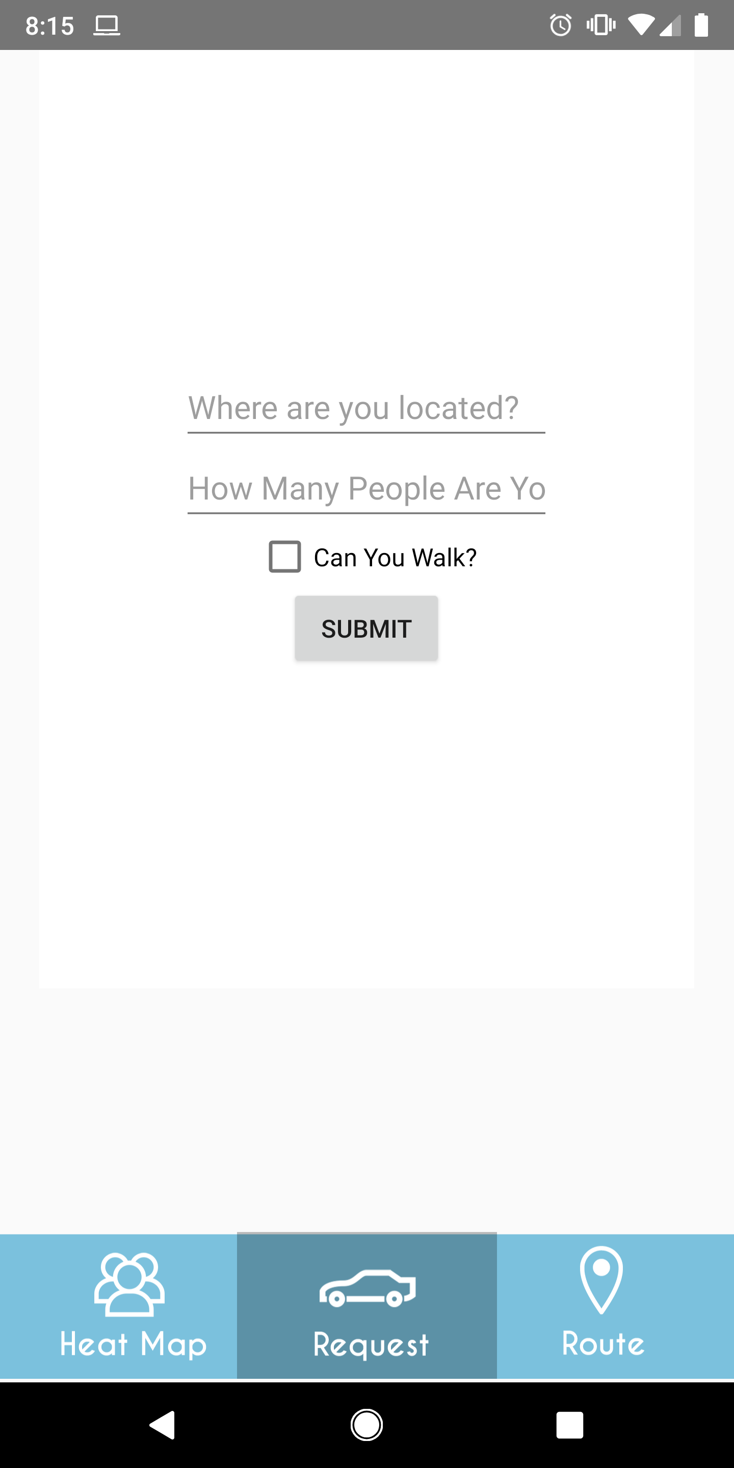
Request a Ride (Emergency Feature)
-
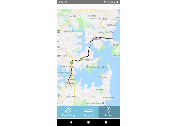
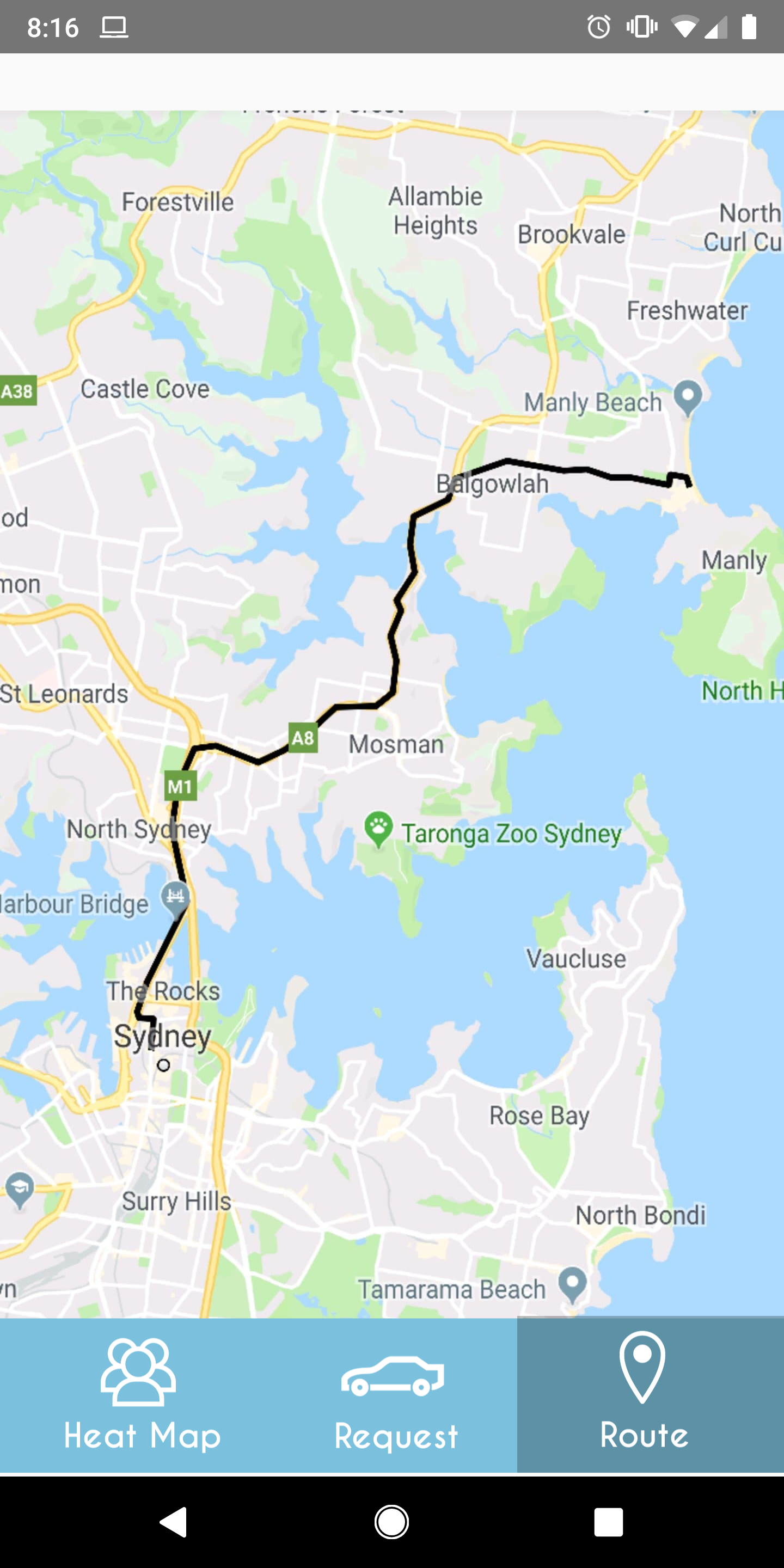
Predictive Route Finding
-
Logo
Inspiration
The team behind First Mile started out of NYU Tandon School of Engineering after learning about the challenge statement. After meeting with many other hackers at Galvanize, we matched with two freelancers who we thought would be enjoyable to work with and balance our skills. The problem of evacuating people during a disaster situation was particularly relevant to us: we were were there in NY during Hurricane Sandy and volunteered with FEMA after 9/11. Our team came together so we could use our collective skills to help people make the best evacuation decision possible by leveraging psychology, data science, and traffic engineering.
What it does
First Mile is a multi-purpose app that provides every day navigation capabilities, but has an "emergency" mode which introduces new functionalities during a crisis. In an emergency, First Mile makes the decision on how to evacuate easier by presenting data visualization of the flow of pedestrians and traffic.
First Mile uses predictive analytics to distribute evacuees evenly, so that the governments are able to distribute supplies effectively and evacuation zones are not overwhelmed. First Mile also gives the opportunity for those who are need in transportation to pair with a driver who has seats available. Finally, First Mile offers information about those who mark themselves as injured to volunteer rescue teams.
How we built it
We built the basic framework for First Mile by using Android Studio and Java to create a basic framework. The Data visualization part was done with Python and Google API. Different sets of data such as 2018 yellow taxi data and open map data were used to create this visualization. Location of all the pick up and drop off points are analyzed to predict the optimal evacuation zone during crises.
Challenges we ran into
The first challenge we encountered was narrowing the scope so that we could identify a problem statement with a demonstrable _ need _. While working on this project, we realized that we didn’t have as much insight into evacuation procedures as we would have liked, but each conversation with a mentor helped imbue us with their field expertise. Then we had a conversation with one of the judges and we were told that if we didn't find a business model that allowed us to immediately monetize our solution and encourage users to build trust by incorporation our solution into their life.
Accomplishments that we're proud of
Julia: I liked that we were able to pull pretty much all of our skills together to come up with something. We didn't just come up with a tech solution--we came up with a well-rounded solution.
Connie: We were able to define a specific problem and create a solution to it.
Kedar: We were able to come up with an idea that utilizes the infrastructure of existing platforms.
Sarah: I'm proud of finding a team that has great and complementary skill-sets, and helping to imagine a solution that has the potential to become real.
Jason: We finally came up with a problem statement.
Will: I’m happy that the team was receptive to each other’s feedback as well as the mentor’s feedback. Our project is now completely different from our original idea.
What we learned
Julia: Solutions that rely exclusively on sexy technology aren't everything.
Connie: I learned a lot from the mentors about the efforts that go into disaster relief / emergency responses.
Kedar: Defining a problem scope is more challenging than expected.
Sarah: I learned more about evacuation and the specifics of it like how we can get people to evacuate without technology.
Jason: The process of coming up with an idea and turning it into a viable product.
Will: I learned that we have to rely on inter-disciplinary collaboration to have the ideal variety of perspectives.
What's next for First Mile
A $15K reward would allow us to start forming the predictive analytics portion. We would be able to broaden its capabilities and conduct/acquire the appropriate psychological, environmental, and data research. We would also like to have the opportunity to collaborate with existing car sharing platforms. Data we gather could also be used to help the Humanitarian app on OpenMapSource to help with rescue efforts post strategy.
How we utilized judges' feedback
Data collection
- [Network available] During non-emergency times, data would be collected through location-tracking.
- [Network available] Updated traffic data
- [Network unavailable] During emergency situations, data would begin to depend on GPS to continue providing direction services based on models stored locally.
Differentiation from Existing Services
- Aim to emphasize predictive capabilities on top of real-time capabilities and simple averages.
- Greater accuracy of data provided vs inability to incorporate standstill data
- We want to move away from static traffic models

Log in or sign up for Devpost to join the conversation.