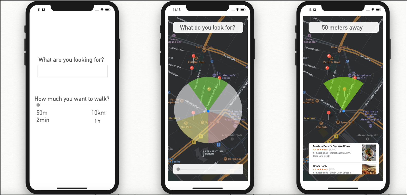
We were inspired by a very big problem of cluttered map UIs when trying to find a particular venue/place of interest when using mobile app maps on the go. We wanted to come up with a better solution to help orient the user around their given location, and help them navigate the area via the app by seeing on the map the concentration of places of interest arranged by category, for e.g. category of restaurant, historic places, independent clothes shops, game shops, and so on. We use a transparent color-coded UI that is overlaying the map view which is shaped in a circle, or in a relevant number of arcs/segments of a circle.
So when you are in a given location such as on a street in an area of a city you are not familiar with, our app shows you the concentration of businesses and places of interests within a distance/range you specify.
We used Xcode, TomTom Map API and SwiftUI and Sketch.
Time was the biggest challenge. We had a different idea based around planning an itinerary at first, but then pivoted to this as it solved a bigger problem.
We are proud to have come up with a solution to solve a real problem we and others encounter all the time when using map apps. Future: Sometimes the simpler a solution is for the user the more time that is needed in concept development and app development. We hope you like the idea.


Log in or sign up for Devpost to join the conversation.