-
-
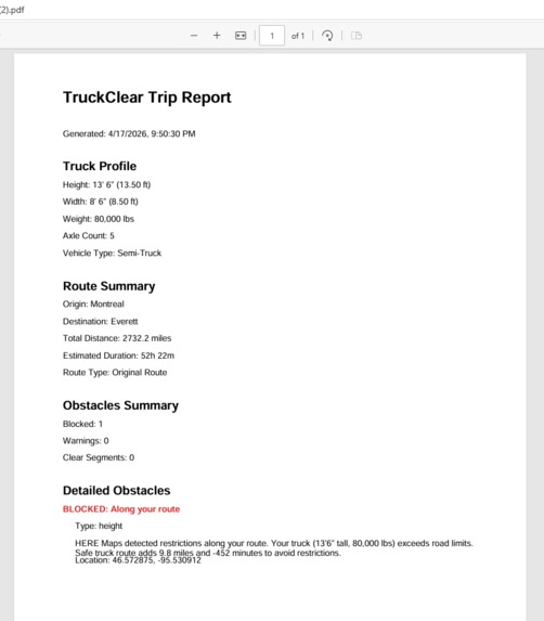
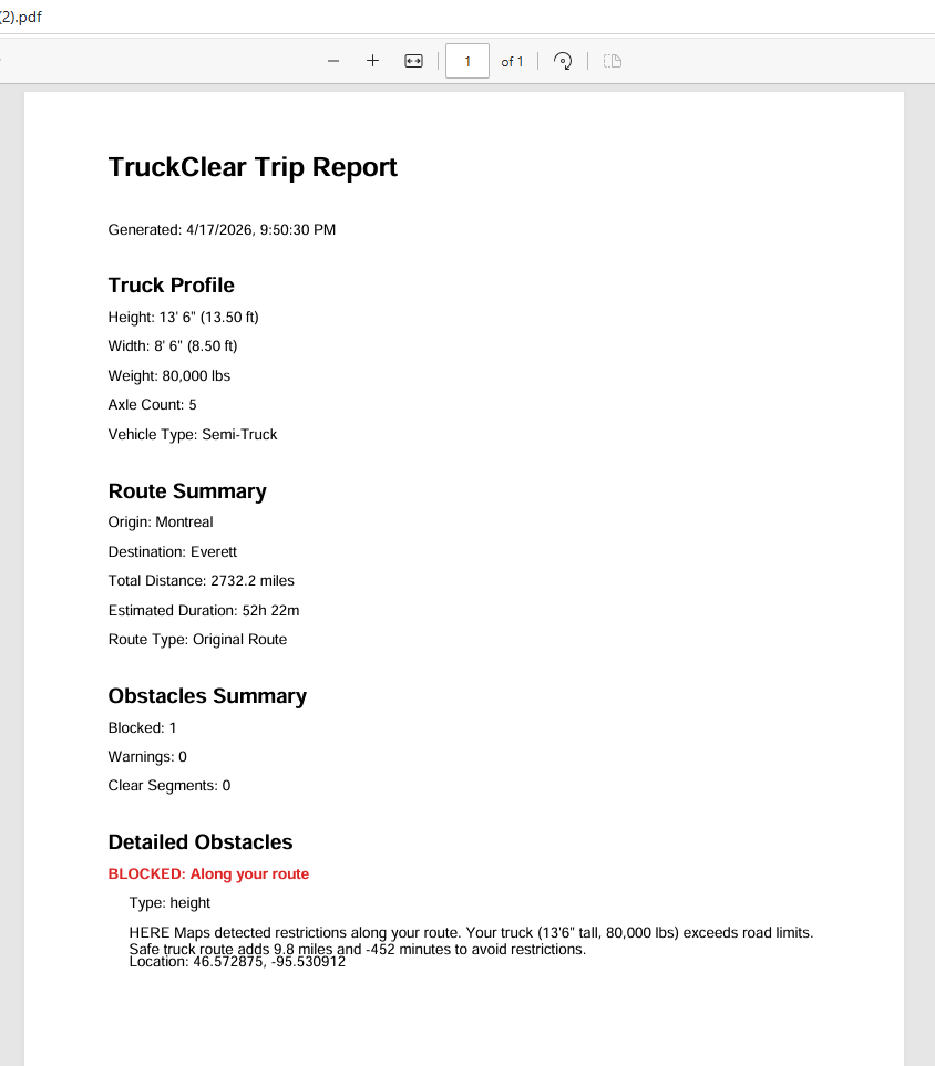
pdf report before choosing alternate route on map
-
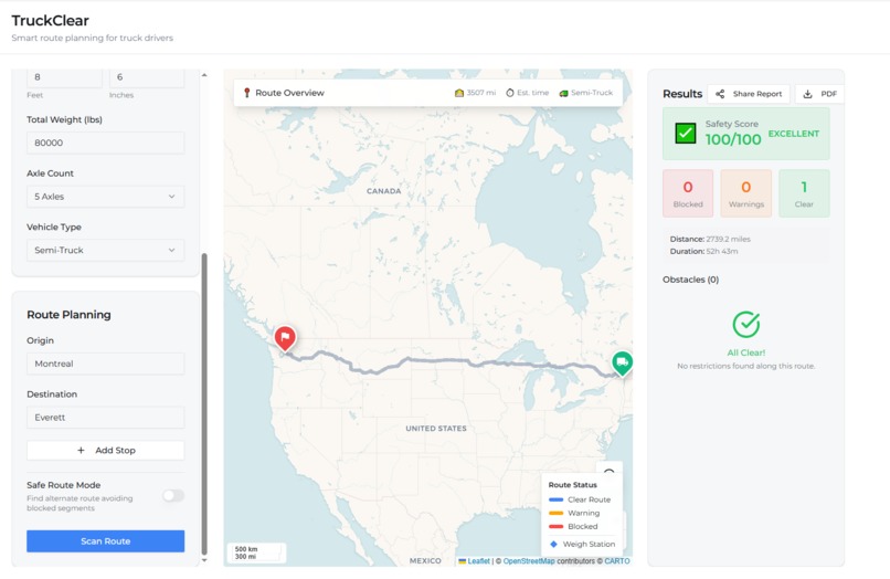
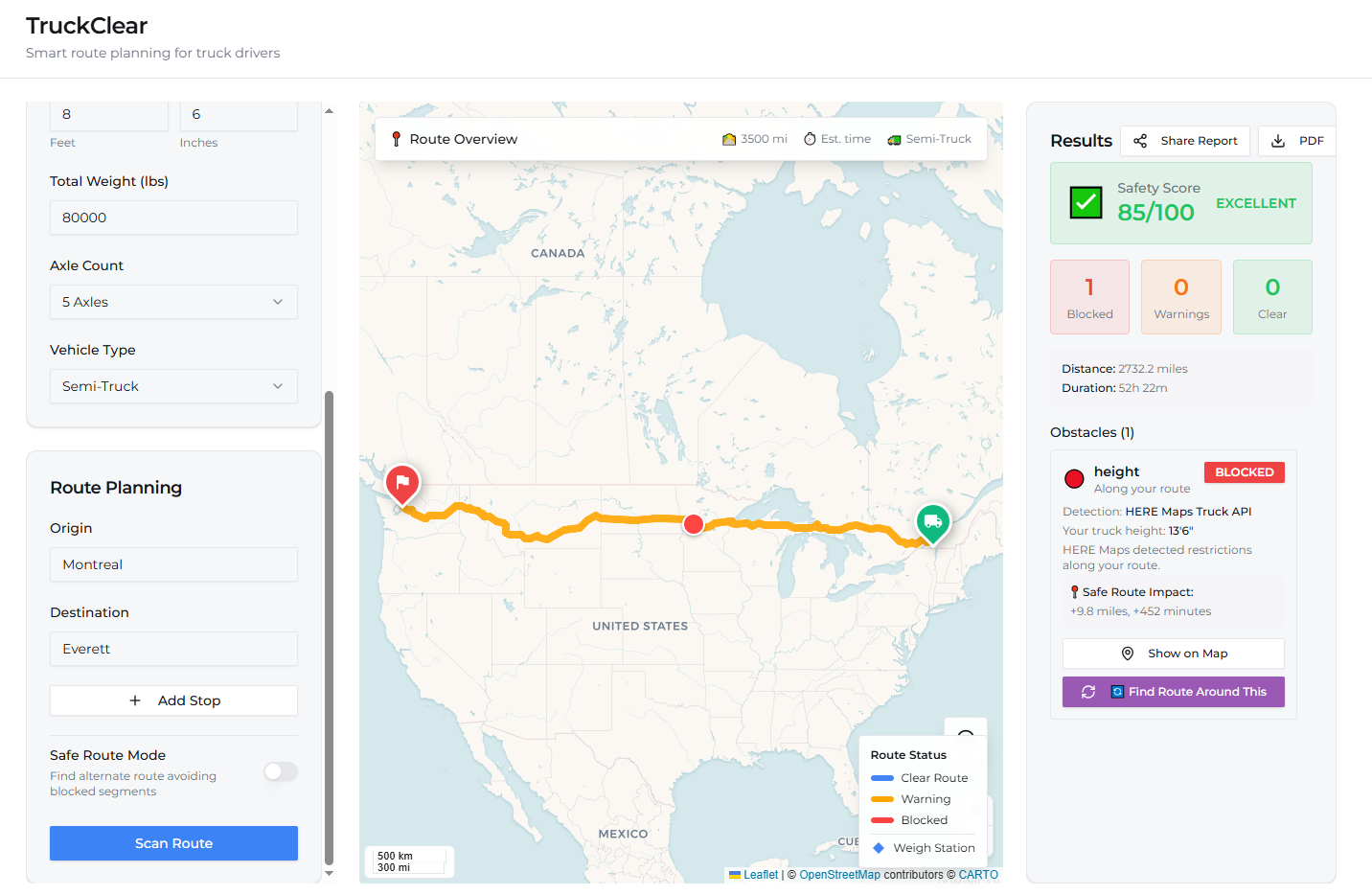
Results panel showing Safety Score + obstacle details
-
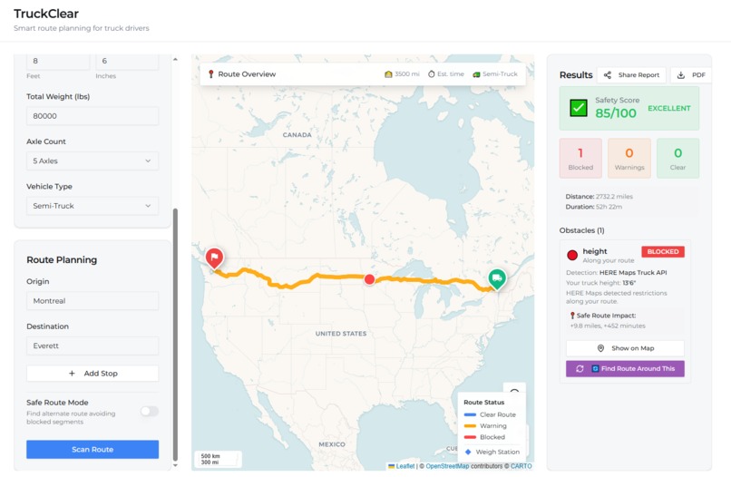
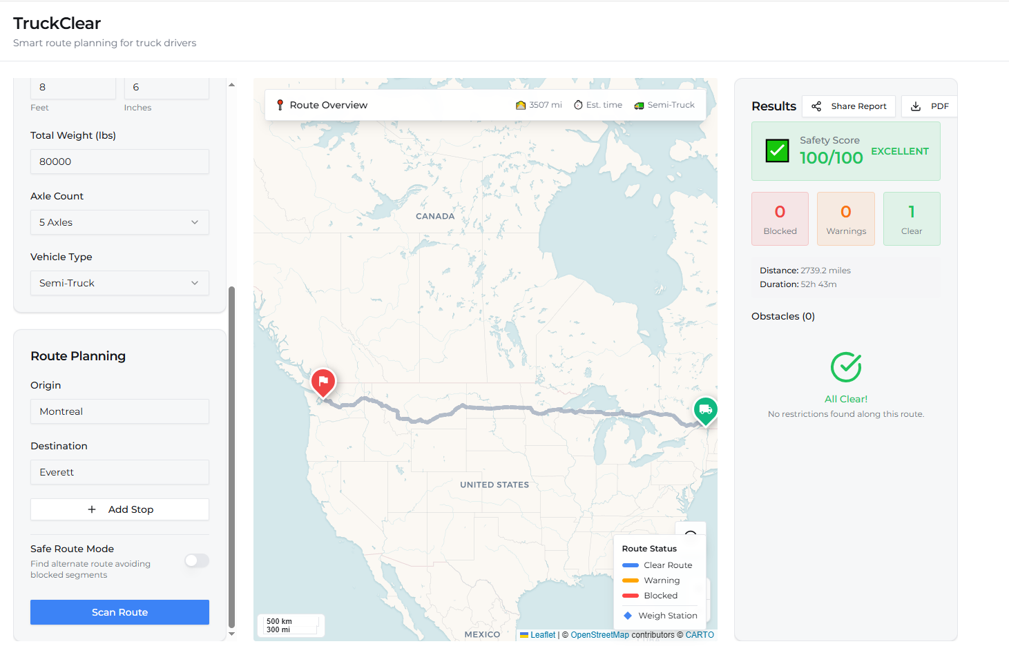
Main map with a route scanned showing blocked obstacle marker
-
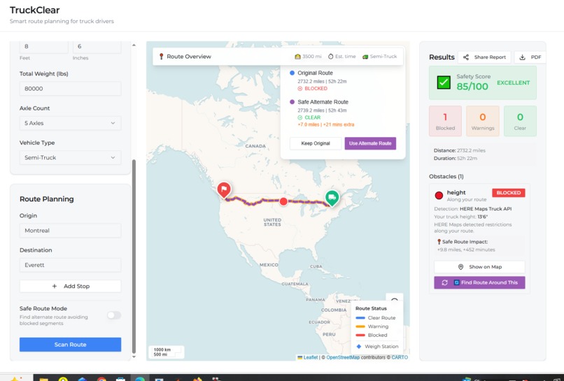
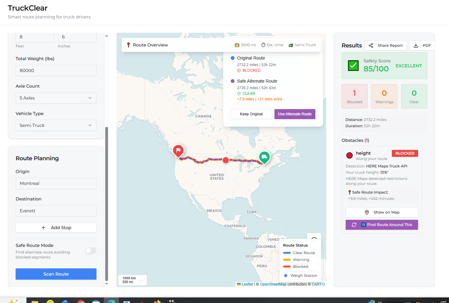
Route Comparison card showing original vs alternate route on map
Inspiration
Every day, trucks get stuck under low bridges or stopped at weight-restricted roads that their GPS never warned them about. A single wrong turn costs trucking companies thousands in delays, fines, and damage. I wanted to build a tool that solves this before the truck leaves the dock — not after it is already stuck under a bridge.
What it does
TruckClear is a pre-trip safety scanner for truck drivers. Enter your truck dimensions (height, width, weight, axle count) and your route — TruckClear checks every bridge, tunnel, weight limit and road restriction along the way using HERE Maps Truck Routing API. When restrictions are detected, it automatically calculates a safe alternate route and shows a side-by-side comparison so drivers can make smart decisions before they hit the road.
How we built it
Built entirely using MeDo as the AI development platform. The frontend uses React with TypeScript and Leaflet.js for interactive mapping. The routing uses a hybrid approach — OSRM API draws the route on the map while HERE Maps Truck Routing API v8 checks all truck-specific restrictions simultaneously including height, weight, width, axle limits and tunnel categories. Geocoding uses Nominatim from OpenStreetMap. PDF reports are generated client-side with jsPDF.
Challenges we ran into
The biggest challenge was that HERE Maps Truck API silently reroutes around restrictions without reporting them explicitly. We solved this by comparing the direct car route duration against the HERE truck route duration — when HERE takes longer it means restrictions were found and the truck was rerouted. Another challenge was HERE FlexPolyline encoding which we bypassed entirely by using OSRM for all map drawing and HERE only for comparison data.
Accomplishments that we're proud of
- Built a working truck route safety scanner in days using MeDo AI platform
- Solved the real-world problem of hidden road restrictions that cost trucking companies millions
- Successfully integrated HERE Maps Truck API for worldwide restriction detection covering height, weight, width and tunnel restrictions
- Implemented smart alternate route calculation that tries both sides of a blocked road and picks the shorter detour automatically
- Created a professional PDF safety report that drivers can print and keep in the cab
- App works for any route worldwide not just the USA
What we learned
Building a real logistics tool means understanding how commercial trucking actually works. Professional truck GPS software costs $500-2000 per truck per year. TruckClear shows that a free accessible alternative is achievable with modern APIs and AI-assisted development. We also learned that HERE Maps Truck API is extremely powerful but requires creative solutions to extract restriction data.
What's next for TruckClear
- Real-time traffic and construction zone alerts
- Mobile app optimized for in-cab tablet use
- Fleet management dashboard for dispatchers
- State permit routing for oversize loads
- Driver account system to save frequent routes
- Integration with ELD systems for hours of service
Built With
- here-maps-truck-routing-api-v8
- jspdf
- leaflet.js
- medo-ai-platform
- nominatim-openstreetmap
- osrm
- react
- supabase
- tailwind-css
- typescript

Log in or sign up for Devpost to join the conversation.