Inspiration
We are both experienced hikers who have struggled dealing with hiking apps in the past. We have ran into many situations in which we were caught in a place we did not want to be in due to lack of knowledge. The hiking apps that we used failed to inform us on important events going on in the area that we should watch out for such as severe weather, hazards, or even the sun setting faster than we expected. All of these could have been avoided if the apps only gave us warning beforehand.
What it does
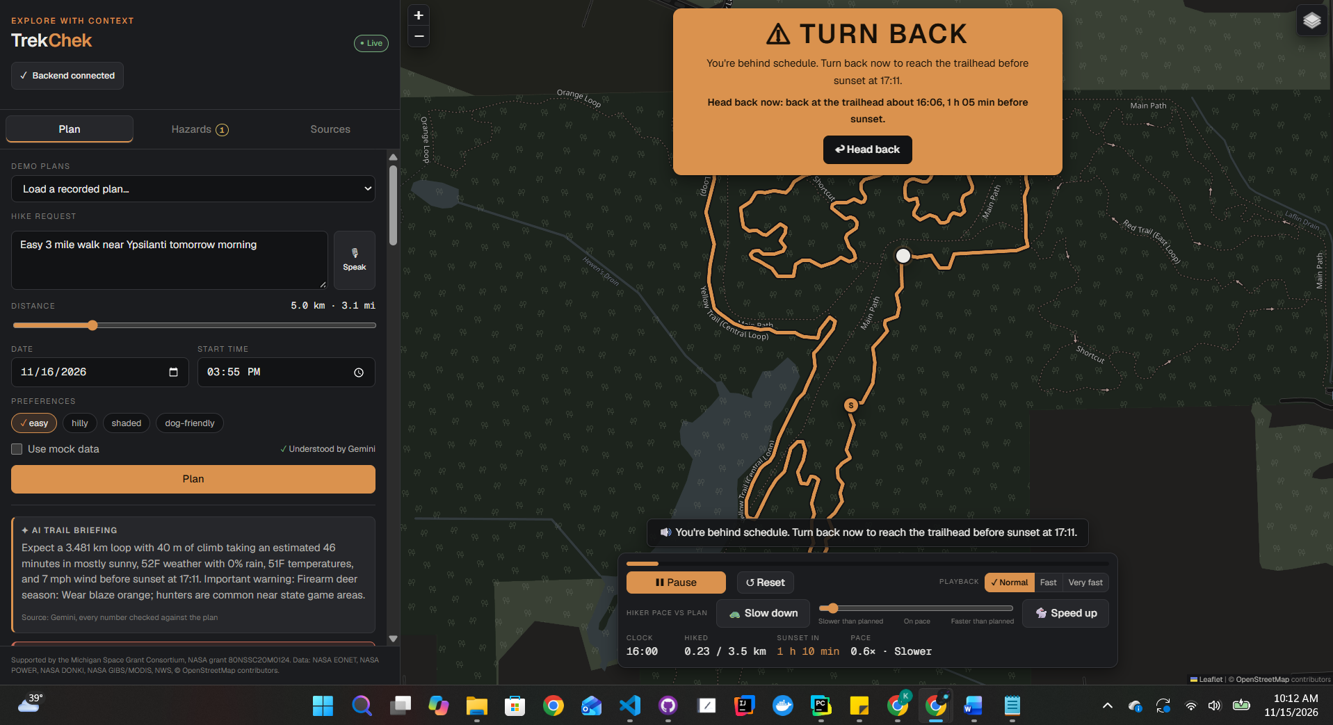
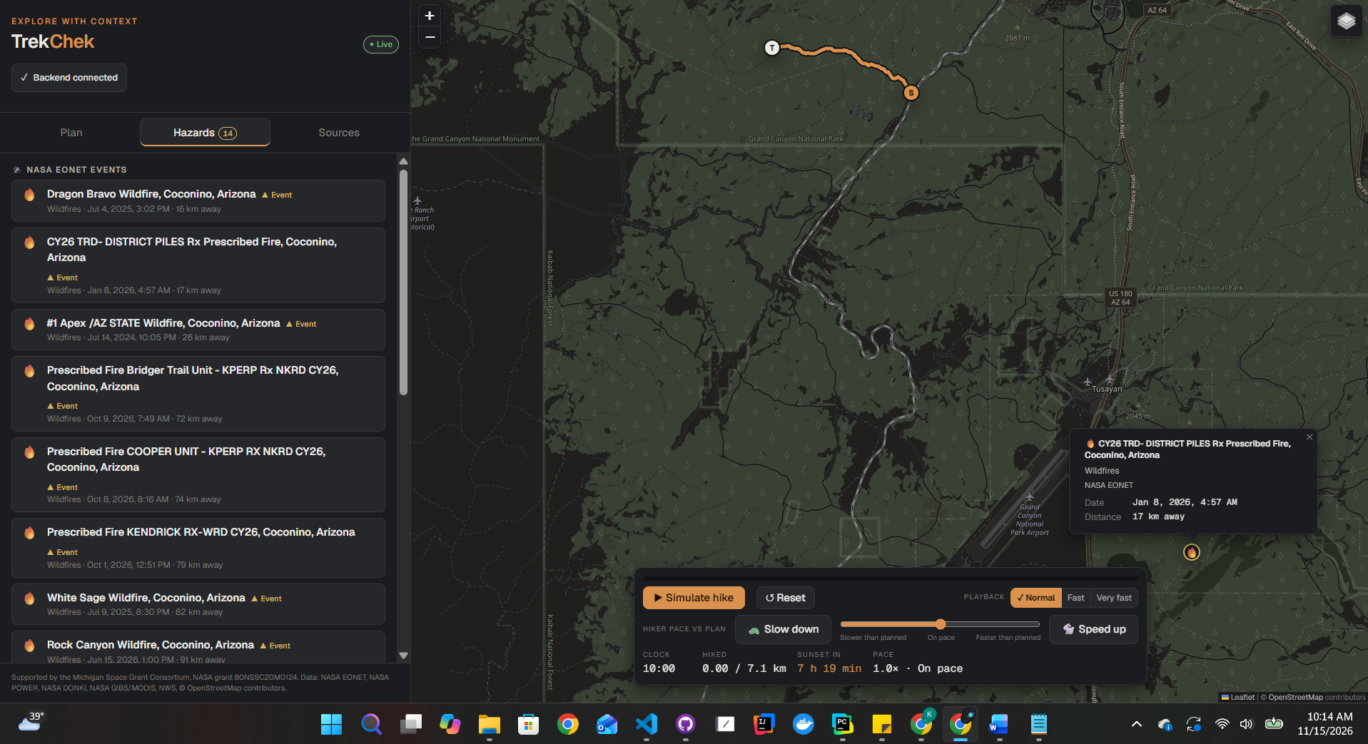
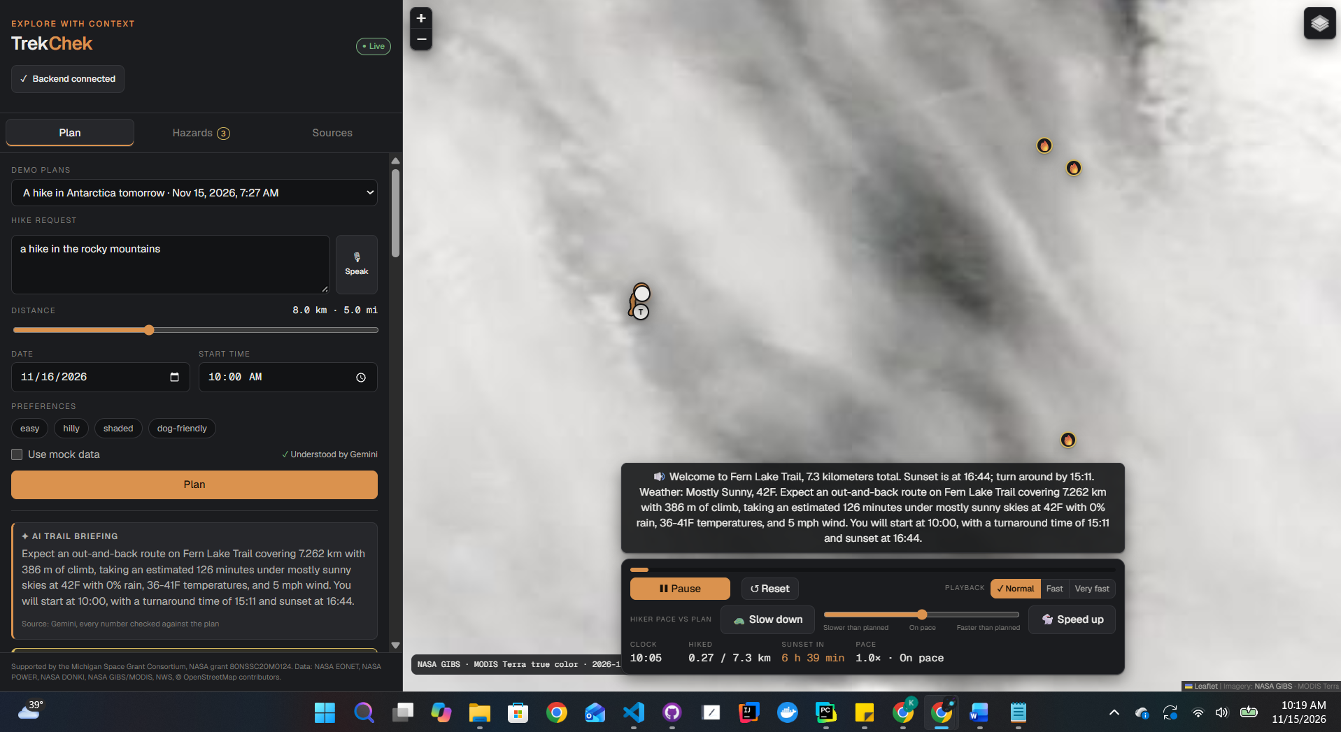
TrekChek turns a spoken or typed request, like “4 miles with hills near Ypsilanti starting at 3:30 PM” or “Hike Bright Angel at the Grand Canyon tomorrow at 1 PM,” into a real hike plan drawn on the map. A planner agent finds real trails from OpenStreetMap and ranks them by distance, loop or out-and-back, and terrain. Then a safety-checker agent reviews the plan against live data: NASA EONET wildfires and storms, NWS forecasts and weather alerts for your exact hike window, NASA SRTM elevation, hunting seasons, and NASA POWER’s 20-year climate normals (so it can tell you when a day is unusually cold). If the plan is unsafe, the checker sends it back. For example, it moves a 1 PM Bright Angel start to 8:36 AM, because the 25 km out-and-back climbs about 1,900 m and you wouldn’t make it out before sunset. You can watch every step in the “How I planned this” trace. On the trail, an ElevenLabs voice guide narrates the hike. If you fall behind pace, TrekChek says “Turn back now” and shows when you’d reach the trailhead if you head back immediately. Speed back up, and it tells you you’re back on schedule. MongoDB Atlas stores complete hike-plan snapshots, including the route, forecast, safety warnings, and timestamp. Users can reopen saved plans after refreshing, and we clearly label historical forecasts so they aren’t mistaken for current conditions.
How we built it
Backend: Python + FastAPI. Each data source is a small tool with a timeout, a source label, and a safe “unavailable” result when it fails. Agents: Gemini (function calling) is the planner and a second safety checker. Gemini only chooses and explains; every number comes from a tool. Hard Python checks enforce sunset, hazard and weather rules, and a rule-based planner takes over if Gemini is slow or rate-limited. Data: OpenStreetMap trails (Overpass) with cached snapshots, Nominatim geocoding, NWS forecasts, hourly forecasts and alerts, NASA EONET, POWER, DONKI and GIBS imagery, NASA SRTM elevation, local time zones and sunset times, and Naismith’s rule for hiking time. Frontend: HTML, JavaScript and Leaflet, with a hike simulation, pace and playback controls, and a replay of the agent trace. Voice: ElevenLabs text-to-speech with cached audio. Reliability: a demo mode that replays recorded real plans with their audio, plus 180+ offline tests and golden prompt tests. Database: MongoDB Atlas stores complete hike-plan snapshots, including the route, forecast, safety warnings, and timestamp. Users can reopen saved plans after refreshing, and we clearly label historical forecasts so they aren’t mistaken for current conditions.
Challenges we ran into
The public OpenStreetMap trail servers were overloaded all weekend, so we saved real trail snapshots and fall back to them. Gemini timeouts and rate limits: we added strict time limits and a rule-based fallback so a plan never takes more than about 20 seconds. Elevation APIs rate-limited the whole event Wi-Fi, so we switched to NASA SRTM with a permanent cache. A bug where a Grand Canyon request quietly fell back to a Michigan trail. We fixed it so a named place is never replaced, and added tests that fail if that ever happens again. Getting time zones and sunsets right in Arizona and Alberta.
Accomplishments that we're proud of
The safety checker catches real, famous mistakes, like a 1 PM Bright Angel descent, and fixes them with numbers you can verify. Every number on screen shows its source and when it was checked, and the app says “unavailable” instead of guessing. A full voice-guided hike demo that works even with bad Wi-Fi.
What we learned
Build a working end-to-end version first, agree on a data contract early, never let the AI invent numbers, and design every external API to fail safely. We also learned how much hiking safety depends on combining data sources, not any single one.
What’s next for TrekChek
Weather and official alerts outside the US (trails already work anywhere OpenStreetMap has them). National Park Service closure alerts. Live GPS mode on your phone. Shortcut routing back to the trailhead when you’re running late. Confidence levels on each prediction. NASA Prithvi flood and burn-scar layers. Community trail reviews and condition reports. In the future, we will expand to other places around the world other than the US and Canada. We will also add to the variety of sources we use to locate and predict these conditions to avoid and add a confidence interval on each condition. We could also add reviews to each produced trail where people could review themselves.


