-
-
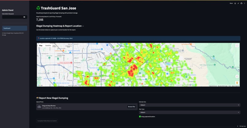
TrashGuard Dashboard
-
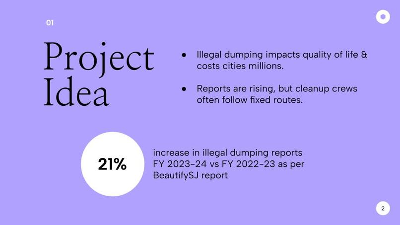
Project Idea
TrashGuard
Spot the dump, snap the pic, help keep San José clean.
Selected track: Clean up your city
💡 Inspiration
As an international student new to San José, I experienced the city with fresh eyes. Near campus I kept seeing overflowing bins and illegally dumped mattresses and furniture.
I soon learned about San José’s 311 system, a channel for non-emergency service requests—a civic tool I’d never used back home.
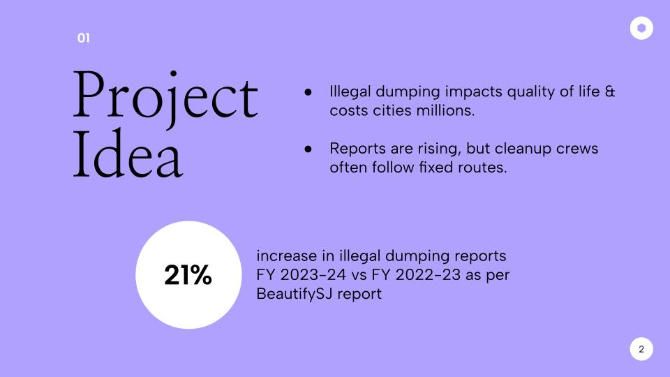
Yet public data show illegal-dumping reports are rising, while anecdotes suggest cleanup crews still follow fixed routes that may miss brand-new piles.
So I asked:
Can we augment 311 with a focused app that turns resident snapshots into a live hotspot map—helping the City direct crews faster?
🌍 What TrashGuard Does
| Feature | Details |
|---|---|
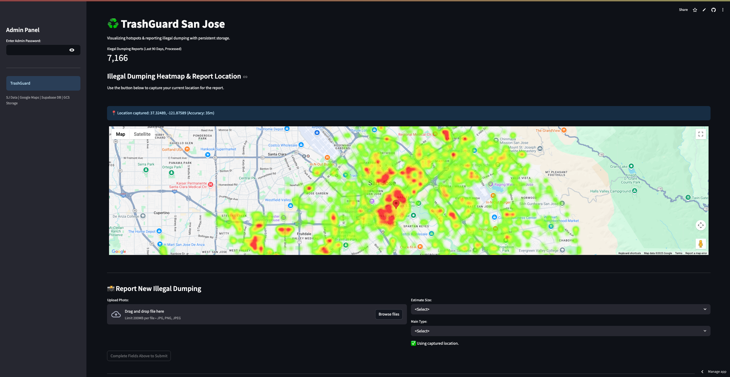
| Maps Current Intensity | Google-Maps heat-map of every “Illegal Dumping” 311 ticket from the last 90 days (via Open-Data CKAN). |
| Highlights Persistent Areas | Aggregates tickets into 200 m grid tiles—recurring hotspots glow brighter. |
| Focused Citizen Reporting | Users: • Upload a photo • Choose size (Small/Med/Large) & type (Furniture, Bags…) • Capture GPS with one tap. |
| Persistent Cloud Storage | • Metadata → Supabase (Postgres) • Images → Google Cloud Storage |
| Admin Workflow | Password-protected sidebar lets staff view reports, change status (“New / Reviewed / Cleaned”), or delete errors. |
❓ Why another uploader when 311 already accepts photos?
| Extra value from TrashGuard | Why 311 alone isn’t always enough | Status |
|---|---|---|
| Visual context on a live map | 311 form shows no heat-map; TrashGuard gives instant context & confirmation. | ✅ |
| GPS precision | Mistyped 311 addresses default to city centroid; we use device GPS. | ✅ |
| Structured severity data | 311 text is generic; we collect Size/Type plus photo. | ✅ |
| Single-purpose UX | 311 covers dozens of services; TrashGuard is dumping-only, super-fast. | ✅ |
| Enriched analytics fields | Adds structured size/type/location/status & direct image link. | ✅ |
| Foundation for duplicate detection | Precise GPS + timestamp + photo enable auto-merge later. | Enabled |
| Gamified lifecycle | Watch your marker change status live—future enhancement. | Future |
Think of TrashGuard as a specialised overlay that enriches 311 data and visualises urgency.
🛠️ How I Built It
| Layer | Tech | Key Steps |
|---|---|---|
| Data Retrieval | Python + CKAN SQL API | Query “Service Type = 'Illegal Dumping'”. |
| Processing | Pandas / NumPy | Parse “Date Created”, filter 90 days, clean lat/lon, bin to 200 m tiles. |
| Caching | @st.cache_data |
Speed up reloads, cut API calls. |
| Map UI | Streamlit + HTML component | Embed Google Maps HeatmapLayer; tune radius & maxIntensity. |
| Geo-Location | streamlit-js-eval |
Grab navigator.geolocation coords. |
| Metadata DB | Supabase (Postgres) | CRUD for reports + status updates. |
| Photo Storage | Google Cloud Storage | Upload via service account, retrieve public URL. |
| Admin Panel | Streamlit sidebar | List reports, show image, status dropdown, delete button. |
| Modularity | Python packages | data_handler, db_handler, storage_handler, utils. |
| Deploy | Streamlit Cloud | Secrets for Maps, CKAN, Supabase, GCS in .streamlit/secrets.toml. |
📚 What I Learned
- Cloud integration: Streamlit can talk to Supabase + GCS with service keys.
- GCS IAM nuances: Uniform vs fine-grained ACLs, public read vs backend write.
- Supabase Python client: Great for CRUD but needs careful error handling.
streamlit-js-evalbridges browser APIs (GPS) back to Python.- Modular design keeps the codebase sane and testable.
st.session_stateis vital for sticky messages acrossst.rerun().
🚧 Challenges
- Swapped storage stack twice (temp → SQLite → Supabase + GCS).
- Debugged GCS permissions (needed Storage Object Creator role).
- Managed multiline JSON service keys in Streamlit secrets.
- JS ↔️ Python messaging for geolocation took trial & error.
- Ensured state persistence around
st.rerun()calls.
🏆 Accomplishments
- Solo-built a full-stack, cloud-persisted app in under a day.
- Integrated CKAN, Google Maps, Supabase, GCS within Streamlit.
- Delivered a live hotspot map + structured photo reports + admin workflow.
- Modularised code for future contributors.
🚀 What’s Next
- Richer admin UI – filtering, search, sortable columns.
- Notifications – email/SMS on new reports & status changes.
- Duplicate detection – auto-merge reports at same GPS/timestamp.
- ML triage – classify image volume/type for priority scoring.
- Clickable map reporting – pick location first, then photo.
- User accounts – Supabase Auth for report history & gamified feedback.
- City pilot – package docs & pitch to BeautifySJ.
TrashGuard shows how open data, cloud tools, and a focused UX can extend 311 and put cleaner streets within reach. 🌱
Built With
- ckan
- github
- google-cloud
- google-maps
- javascript
- numpy
- pandas
- python
- streamlit
- supabase


Log in or sign up for Devpost to join the conversation.