
Inspiration
We were inspired by how counterintuitive traffic behavior—like Braess’ Paradox—can cause well-intentioned infrastructure changes to actually make congestion worse. With many cities spending billions on road expansions, we wanted to build a tool that helps people understand why more roads aren't always the answer.
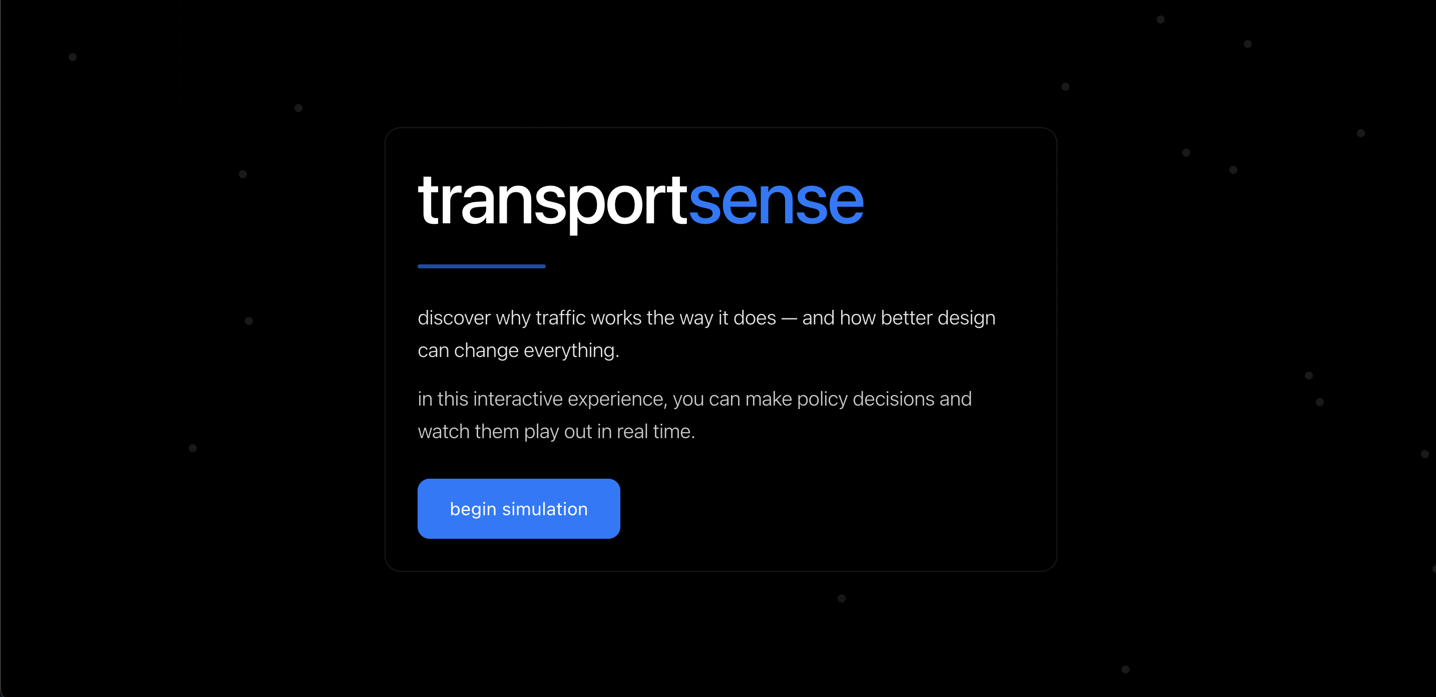
What it does
TransportSense is an interactive AI-powered, data-driven traffic simulation designed to educate users—particularly those unfamiliar with the complex realities of urban traffic—about the unintended consequences of road expansions and infrastructure decisions. By enabling users to add or remove roads and observe real-time changes in travel time, fuel consumption, and congestion costs, the simulator sheds light on counterintuitive phenomena like Braess’ Paradox.
How we built it
Google Cloud:
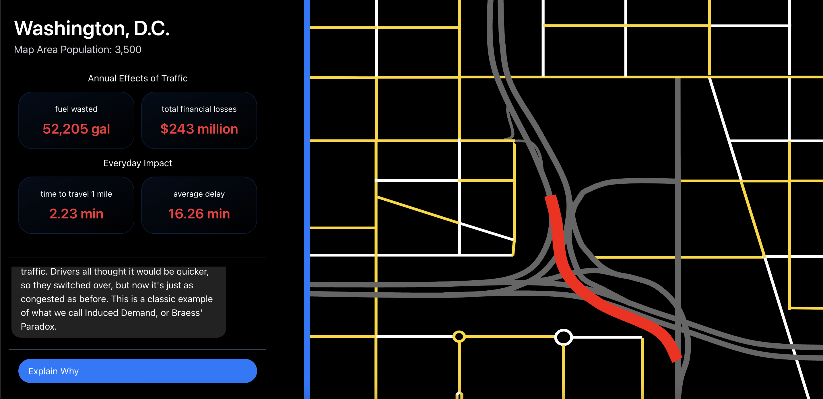
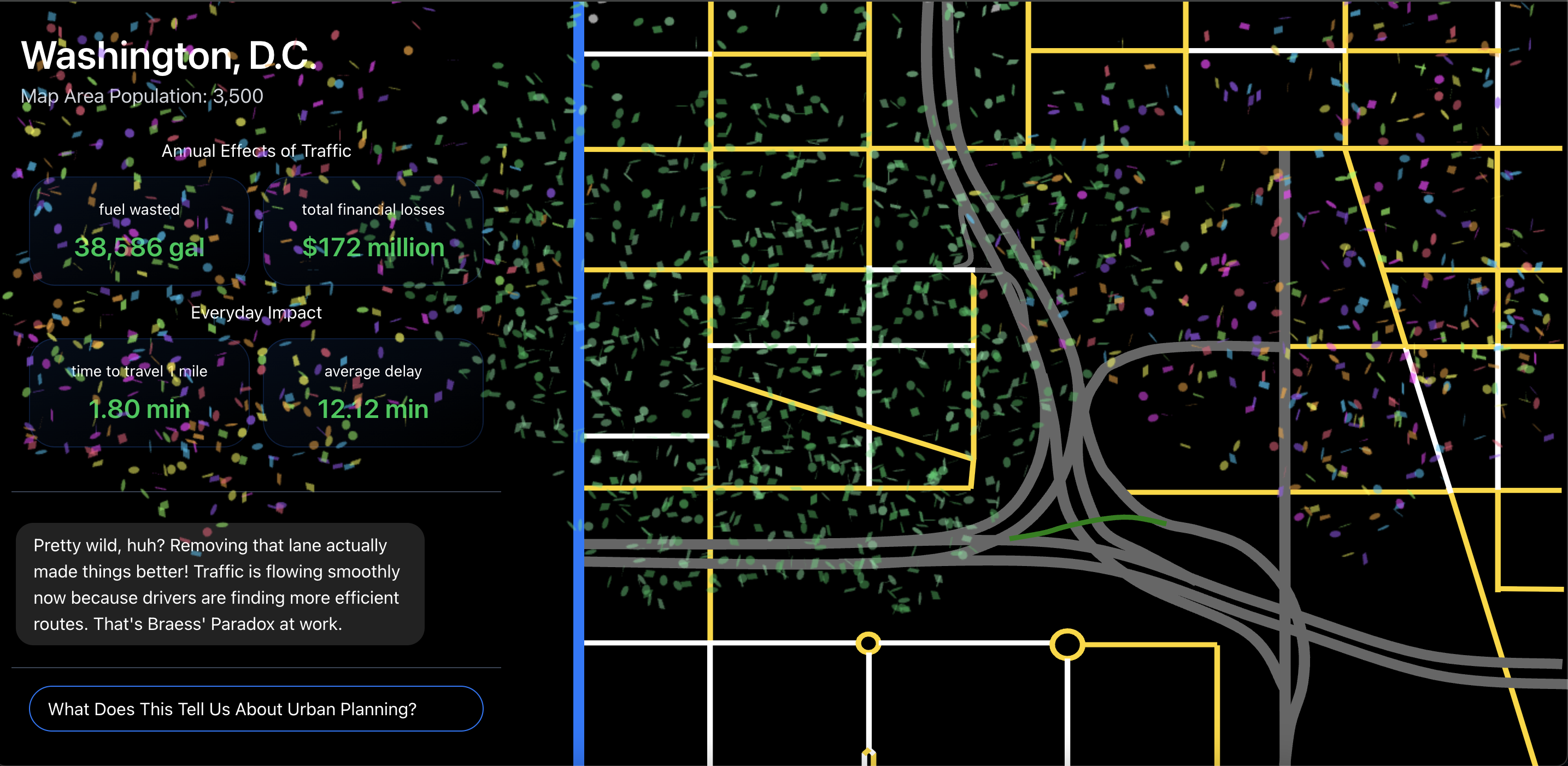
- Vertex AI + Gemini 2.0 Flash – Guides the user step-by-step to help them fix a highly congested portion of Washington, D.C, generating natural-language explanations of traffic changes, and teaching users about real-world traffic dynamics like Braess' Paradox and induced demand.
- Cloud Run – hosts our NextJS app as a scalable containerized web app
MongoDB Atlas:
- Stores real-world transportation data sourced from the following public dataset and report:
- We use the data for Washington, D.C. from both data sources to calculate and persist updated traffic metrics based on the user actions (adding/removing roads) and our dynamic traffic simulation. These are the main metrics we track:
- Average delay per mile
- Average travel time per mile
- Annual excess fuel wasted
- Annual congestion cost
- We created embeddings and used MongoDB Atlas' Vector Search to help us find and compare similar traffic patterns.
Challenges we ran into
- Modeling realistic traffic behavior in our similation was difficult due to limited public data
- Balancing simplicity, interactivity, and educational value to make sure we built the best possible solution
Accomplishments that we're proud of
- Building a fully interactive and AI-driven solution that breaks down the complex concept of Braess' paradox in an easily understandable and effective way.
- Translating real-world traffic data and metrics into dynamic and educational visualizations
- Using Google's Cloud Platform, Vertex AI Platform, and MongoDBs vector database to create a scalable, high-performance app.
- Creating an impactful and enjoyable user experience that allows users to learn in a hands-on way.
What we learned
- The importance of balancing data accuracy with visual simplicity in simulations
- How urban planning decisions ripple into metrics like fuel waste and environmental cost
- How harmful poor road/urban planning can be to communities and cities
What's next for TransportSense
- Integrate real-time traffic APIs (e.g., Google Maps, OpenTraffic) to reflect live conditions
- Expand to multiple cities and allow users to simulate their own neighborhoods
- Add policy recommendations using AI to guide sustainable infrastructure decisions
- Open TransportSense as a public educational tool for schools, civic orgs, and local governments

Log in or sign up for Devpost to join the conversation.