-
-
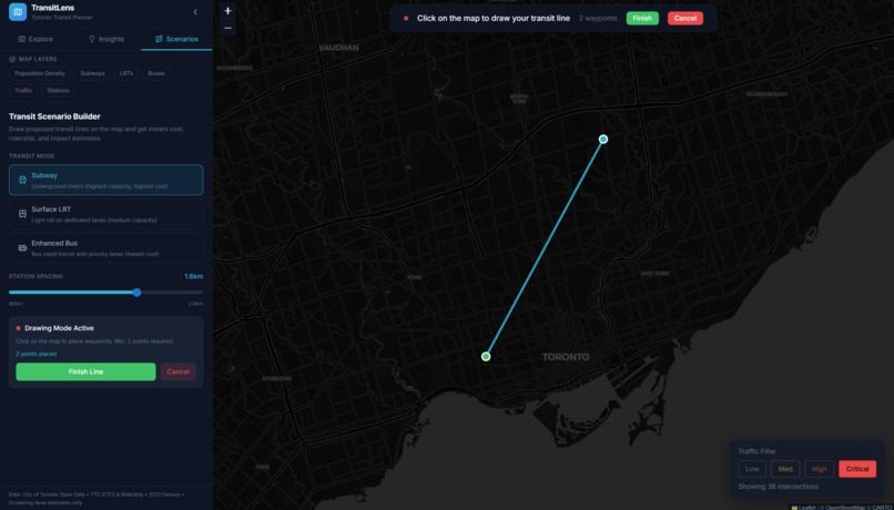
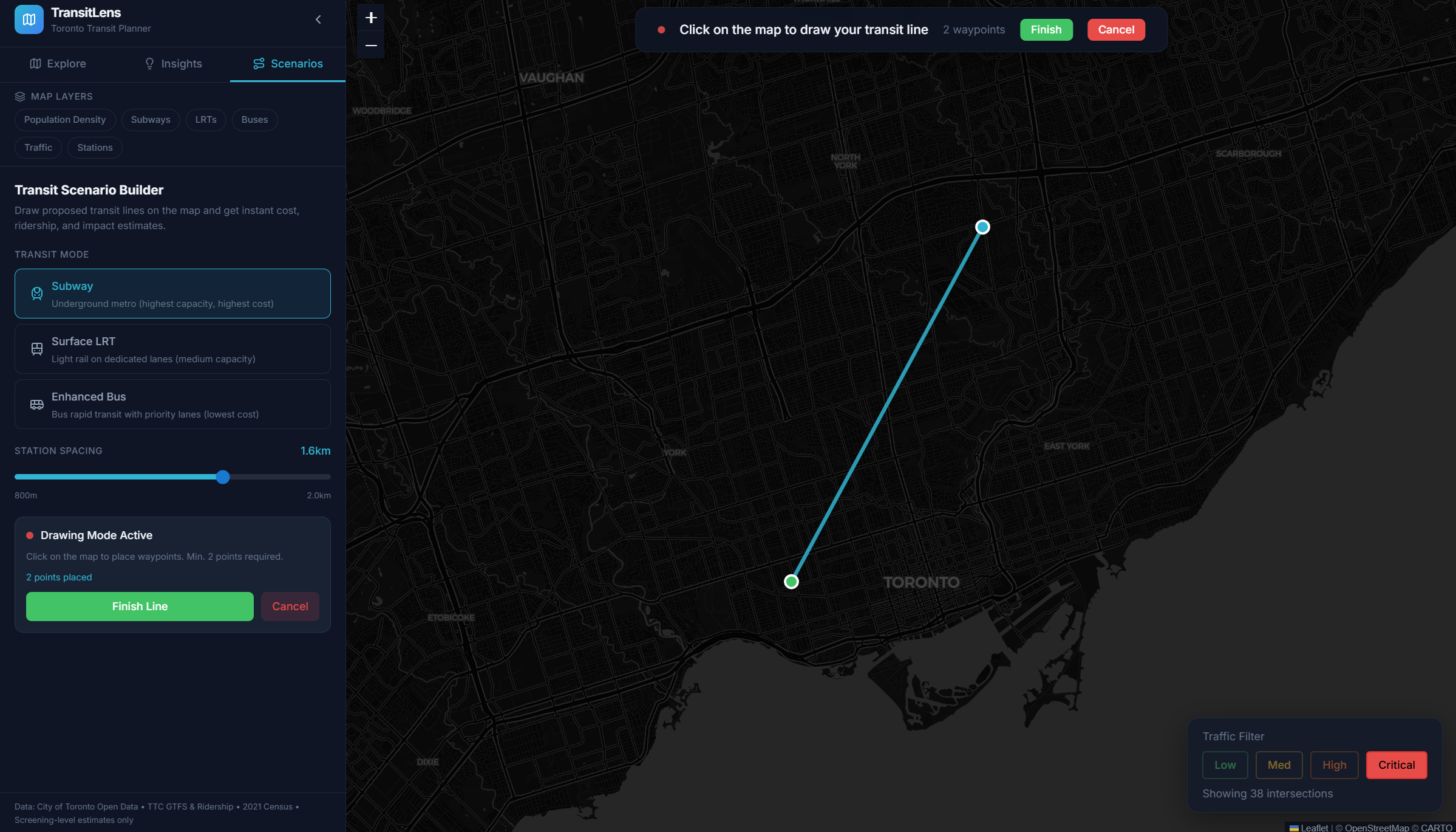
Place two or more lines on a map to begin simulating a new transit line
-
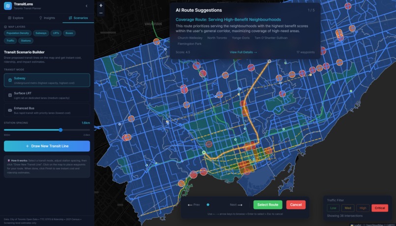
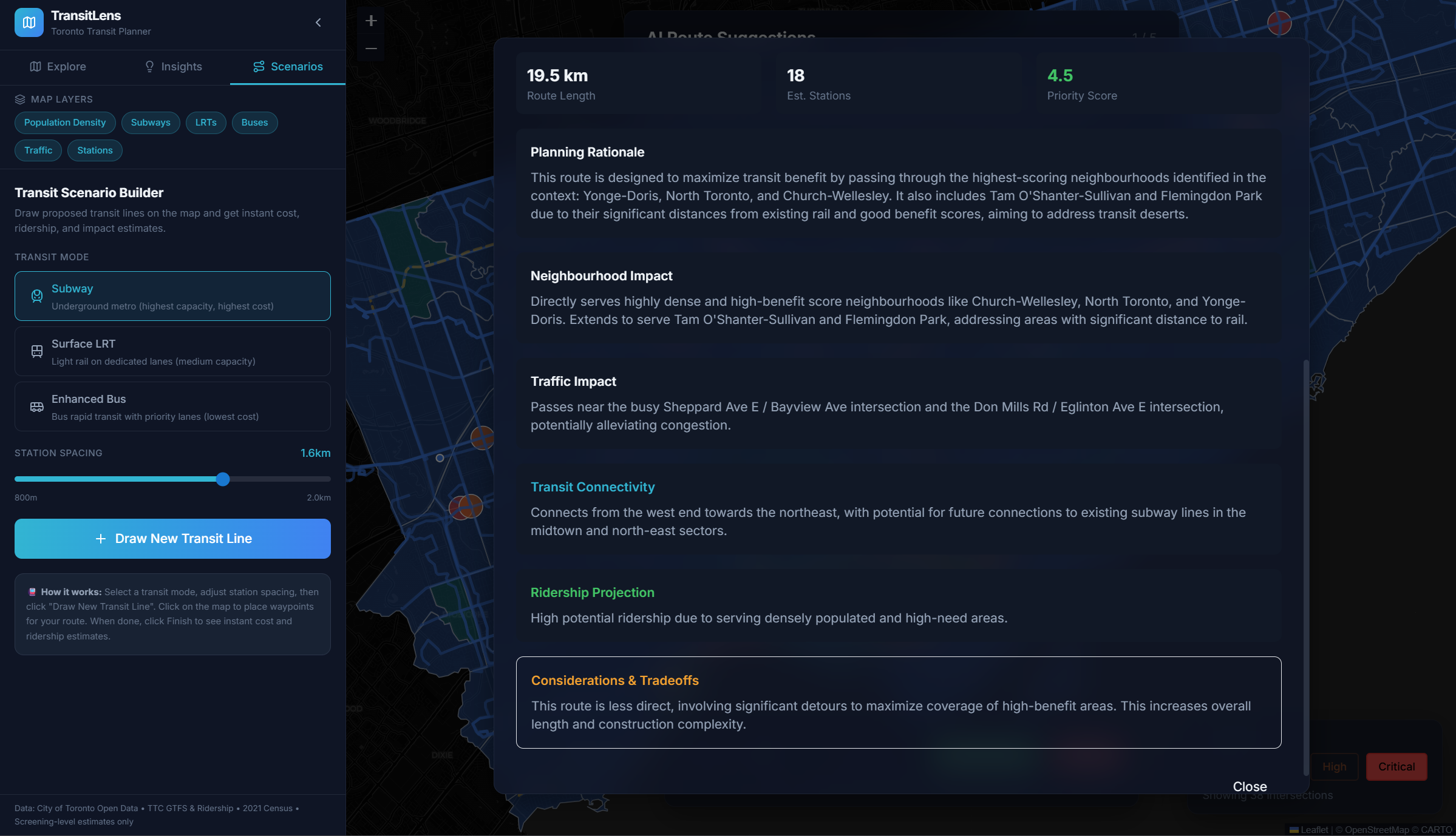
Multiple transit line suggestions considered by the AI, all presented to the user.
-
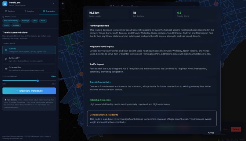
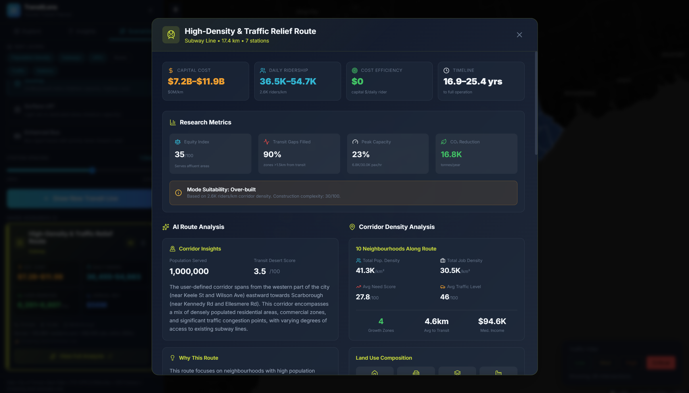
Get a breakdown on analytics for each generated best route by the AI
-
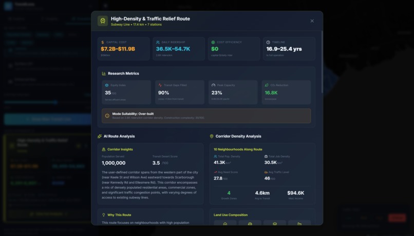
...More analytics
-
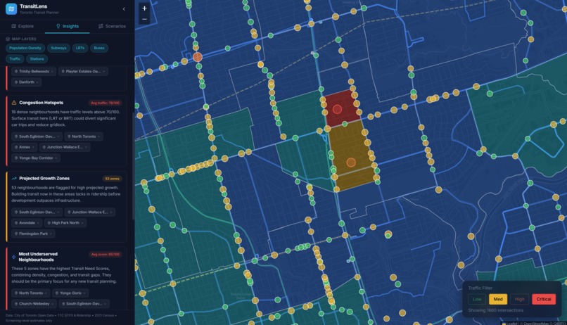
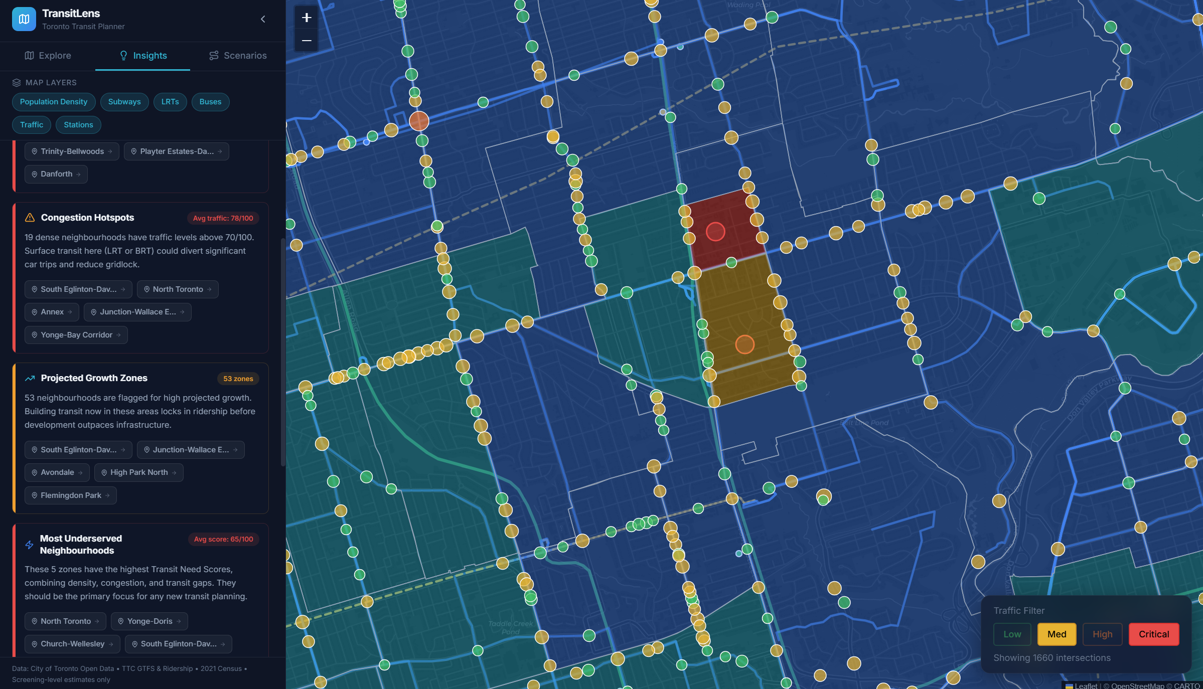
Get pointed to areas around the city that need the most attention based on need for public transit
-

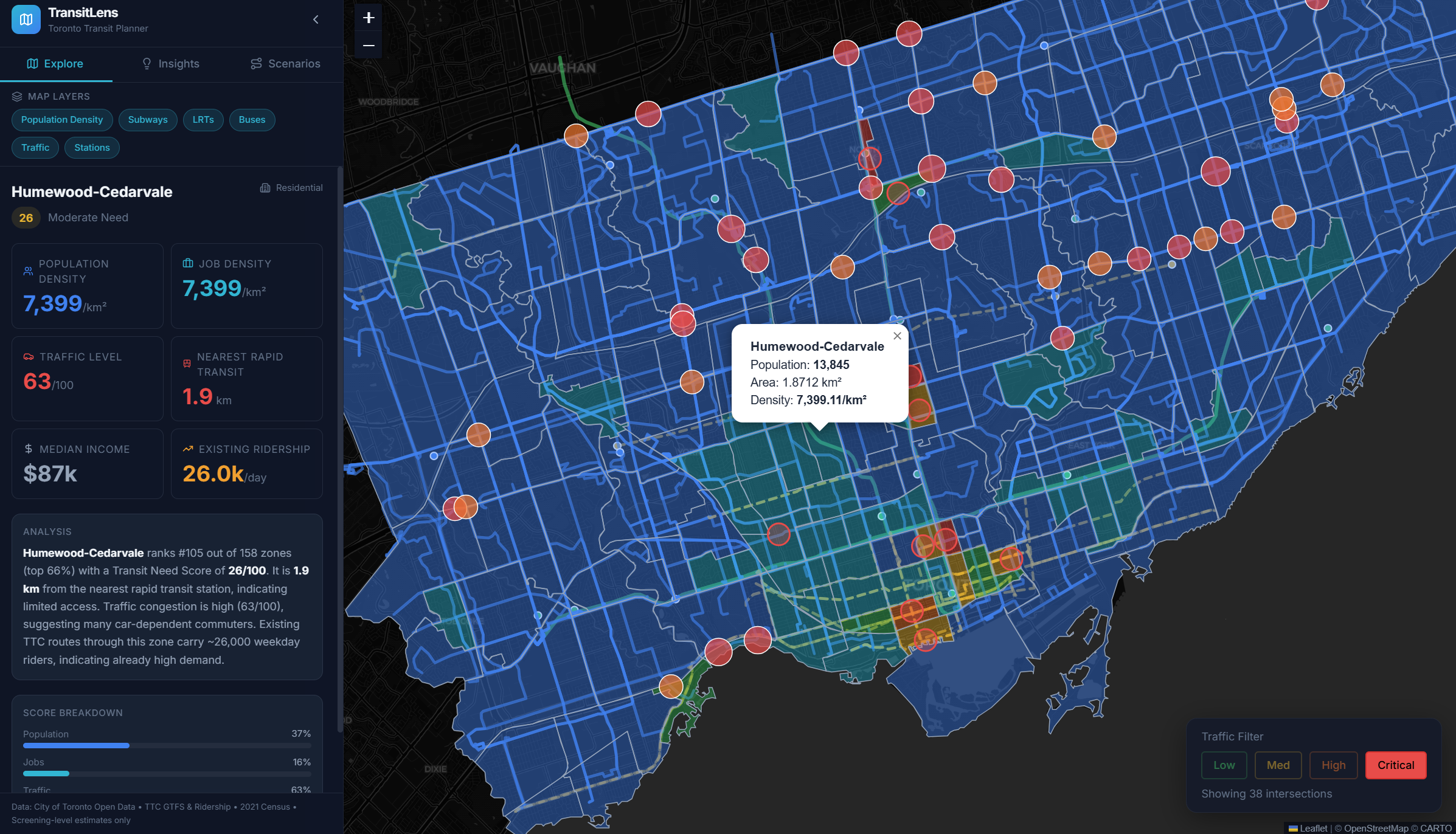
Instantly see busy intersections, population density, and existing transit to help plan your next subway project.

Inspiration
Recent LRT openings like the Eglinton Crosstown has long been a topic of discussion on how not to plan a transit project. Years of delays, ballooning costs. We wanted to build a tool that gives planners an instant, data driven view of where Toronto actually needs rapid transit so future projects hit the mark instead of missing it.
What it does
TransitLens delivers an instant city wide view of population density, traffic congestions, and transit gaps. Planners get a heatmap of priority zones plus an interactive transit line builder. Draw potential routes and see immediate projections for ridership, construction costs, and traffic relief, turning weeks of analysis into seconds of actionable insight.
How we built it
- Fullstack NextJS app with integrated FastAPI backend
- Collected real data from Statistics Canada Census, CIty of Toronto Open Data traffic counts, and TTC GTFS feeds.
- Scraped and processed government datasets into spatial grtids with a computed "transit needed score"
- Used Google Gemini API to analyze drawn transit lines to optimize routes, estimate ridership from nearby density/traffic patterns, and generating scenario breakdowns.
- Applied cost benchmarks from actual Toronto projects for realistic construction estimates.
Challenges we ran into
Firstly, we had challenges trying to find relevant data for our project. There were so many different datasets, and some seemed like good choices, but after cleaning and processing, we realized some weren't right fits. We also had difficulty with our transit line simulations. Some issues included our lines being too reliant on traffic zones, or were overlapping.
Accomplishments that we're proud of
We had a basic idea in our heads and were able to flesh out our plan into a roadmap that we thought might have been too out of scope, but throughout our development we were hitting all the marks.
What we learned
Gemini really helped us out in determining best paths and reasoning with the data we gave it. We fed in our density grids, traffic patterns, and existing rail lines to help us generate our ideal routes and predict metrics.
What's next for TransitLens
At the beginning of the hackathon, our vision was to create a genuinely useful research tool for urban planners. We believe that access to more data can help us make even better decisions for transit line simulations, and provide even more insights. We believe that we can bring TransitLens further than Toronto, to other transit agencies around the world. We would love to also develop personalized AI/ML models tailored to each agency/country.
Built With
- gemini
- nextjs
- python
- tailwind
- typescript

Log in or sign up for Devpost to join the conversation.