-
-

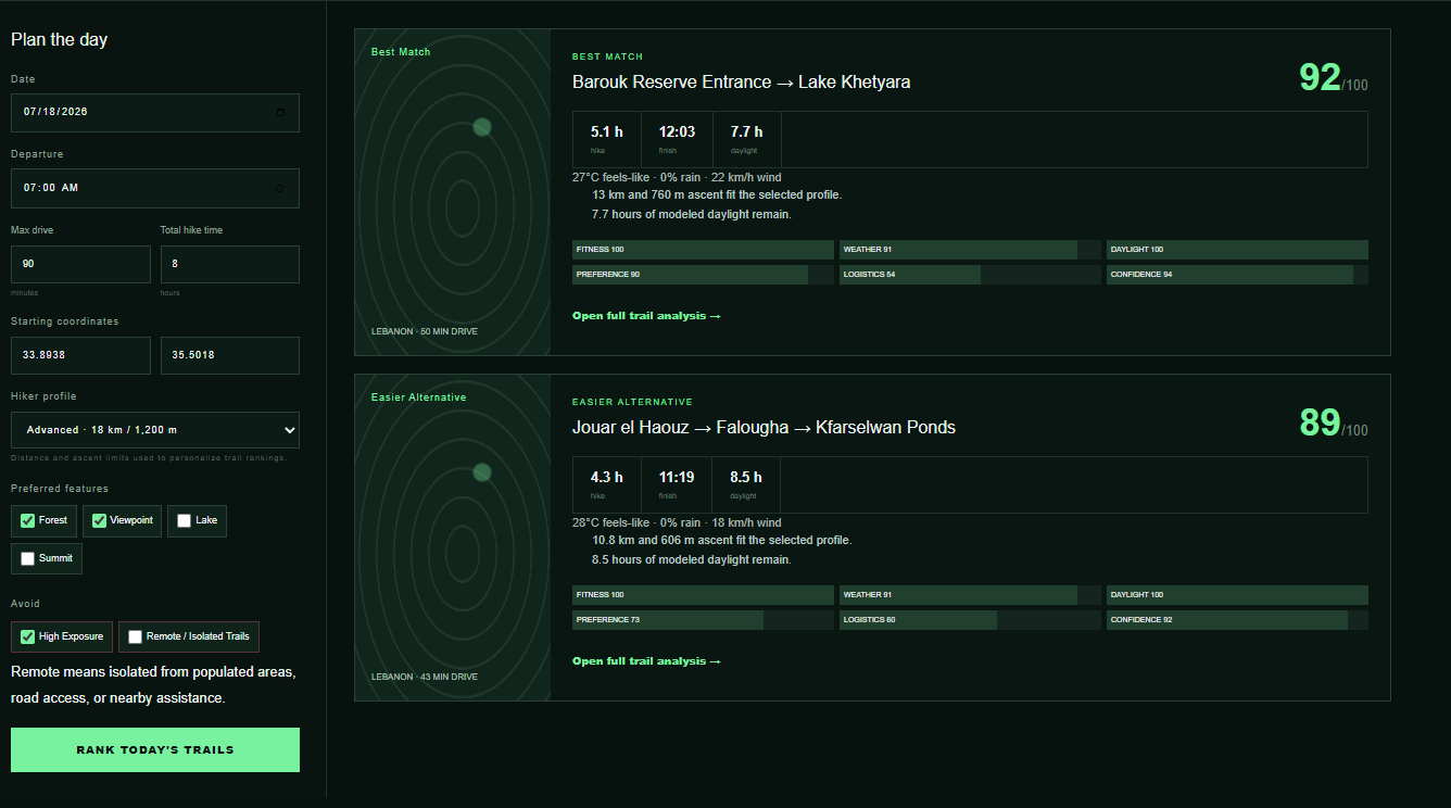
Where should I hike?
-
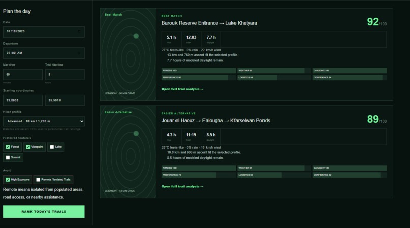
Where should I hike? results
-
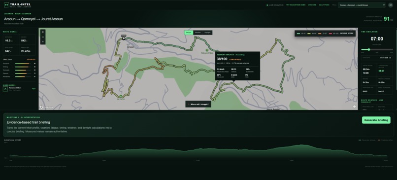
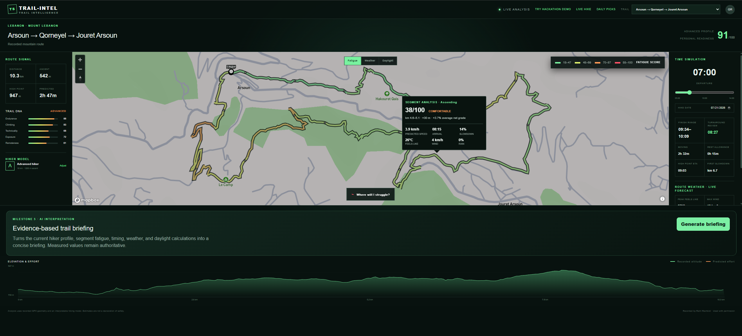
Full Trail Analysis
-
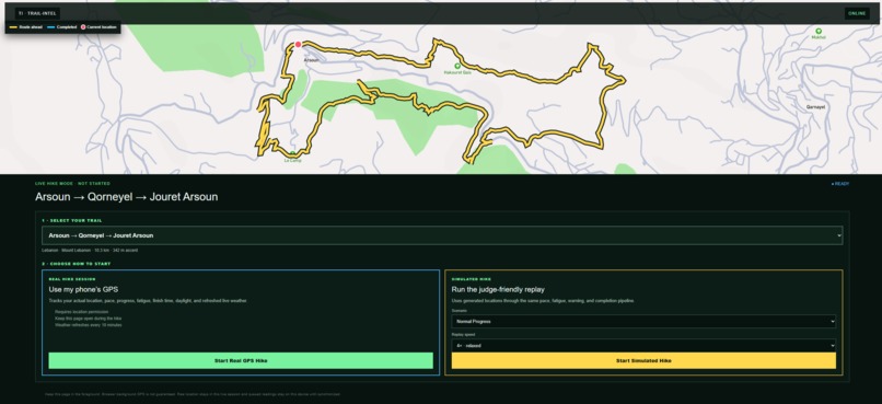
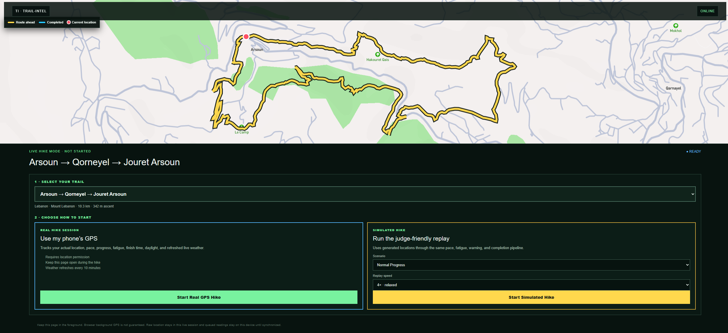
Live Hike & Simulated Hike

Inspiration
I have become an avid hiker when I visited Switzerland for a 9 days hike retreat. Once back to my country, I spent every sunday exploring the existing trails using hiking apps and GPX trails. While these tools are excellent for navigation, I often found myself asking questions they couldn't answer:
- Is this the best trail for today given weather conditions and start time?
- Will I finish before sunset at my pace?
- How will today's weather affect different parts of the hike?
- Am I slowing down enough that I should reconsider my plan?
Most hiking platforms tell you where a trail goes and where you are. I wanted to build something that helps hikers understand how a hike is likely to unfold and adapts that prediction as conditions change.
What it does
Trail-Intel is an adaptive hiking intelligence platform that helps hikers make better decisions before and during a hike.
1) Before a hike, it:
- analyzes GPX trails
- recommends the best hike for a specific day
- considers weather, daylight, terrain, and user preferences
- predicts hiking duration and fatigue
- explains why one trail is a better choice than another
2) During a hike, Trail-Intel continuously compares predicted progress with actual progress and updates:
- estimated finish time
- pace
- fatigue
- daylight margin
- weather exposure
- route insights Instead of simply tracking a hike, it continuously updates its understanding of how the remainder of the hike is expected to unfold. With the credits I have, I was able to prepare a hike simulator showing these abilities.
How we built it
The frontend was built with Next.js, React, TypeScript, Tailwind CSS, and interactive maps. The backend was built with Drizzle ORM and Node.js, SQLite schema, OpenAI JavaScript SDK using geospatial libraries for trail analysis and APIs for weather and mapping.
I've downloaded GPX trails from Wikiloc, 15 trails from Lebanon and 2 trails from the USA.
Trail_Intel combines deterministic geospatial analytics with AI-generated explanations. It includes:
- GPX parsing and route processing
- deterministic trail analytics
- trail segmentation
- fatigue and daylight prediction
- weather and daylight recommendations
- a personalized Daily Hike Recommendation engine
- an interactive demo/simulation built around curated Lebanon hiking trails
Challenges we ran into
I'm a data scientist. First challenge was working with new tools, going into an area I'm not familiar with. I relied on gpt 5.6 to recommend best tools for this project. I knew about this challenge on July 17th. Fortunately, the project idea came quickly and I knew I wanted to work on Trails. I ran out of credits. Would have liked to add more features and refine the existing ones.
Accomplishments that we're proud of
Being in this challenge and the experience I gained working on it!
What we learned
I learnt how to structure my prompt to Codex. I learnt how to integrate geospatial analysis, weather forecasting, recommendation systems, and web tools into a single product.
What's next for Trail-Intel
This hackathon version demonstrates the core concept, but there's plenty more I'd like to build, like:
- real-time GPS-powered Live Hike mode
- offline navigation
- community-contributed trails
- improved personalization based on hiking history
- international trail support
- collaborative group hiking features
Trail_Intel is an intelligent hiking companion that helps outdoor enthusiasts like me make more informed decisions before, during, and after every adventure, and to make the best of it!
Built With
- cloudflare
- drizzle
- mapbox
- next
- node.js
- open-meteo
- openai-javascript-sdk
- react
- tailwind
- typescript

Log in or sign up for Devpost to join the conversation.