Inspiration
We were inspired by the idea of creating a more streamlined process in understanding what happens to trash/litter. We thought that the ability to track trash leads to a cleaner community and more responsible residents. In addition, this data tracking and routing can be used for community clean-up efforts, municipality reports, and management of local waterways.
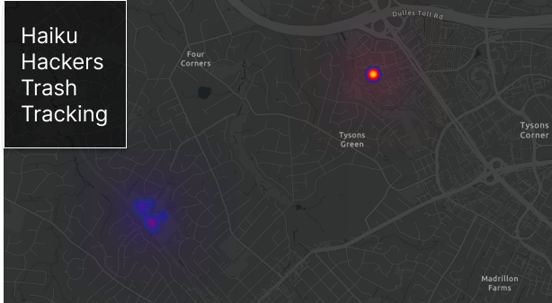
What it does
Track Your Trash is an app created in ArcGIS Experience Builder that allows the user to visualize the trash located in their community and how track the movement. The user can input different trash items found in their community and this will be logged and updated on the map embedded in ArcGIS Experience Builder.
How we built it
In creating our Track Your Trash, we used ArcGIS Experience Builder to display the data collected. We implemented QuickCapture so that a user can also take a picture of what you’re reporting. We used this function to run image recognition, to be able to automatically tell if the litter you are reporting is recyclable or not. Using webhooks, QuickCapture is connected to an independent server run using Python’s fast API, and a PyTorch CNN to classify incoming images from the app with a type of trash and its recyclability.
Challenges we ran into
The process of transferring data and allowing proper sharing abilities for all features and users. In addition, connecting QuickCapture points to automate the route connection ability to track the movement of trash. We also ran into issues connecting to automating the process between these different tools (ex. QuickCapture and Python). Lastly, we ran into permission issues in implementing a Notebook server which lead to complications on the backend of the project.
Accomplishments that we're proud of
The ability to configure Webhooks and the process of connecting QuickCapture output to an independent server running Python API.
What we learned
We learned how to use a variety of ESRI products such as ArcGIS Experience Builder, ArcGIS Pro, ArcGIS QuickCapture, ArcGIS Survey123, and different compatibility features using Python.
What's next for Track Your Trash
Track Your Trash would look into further integrating satellite imaging in order to recognize trash. This can be used to expand past the community level and further automate processes of tracking trash.
Built With
- arcgisonline
- arcgispro
- experiencebuilder
- python
- quickcapture


Log in or sign up for Devpost to join the conversation.