Inspiration
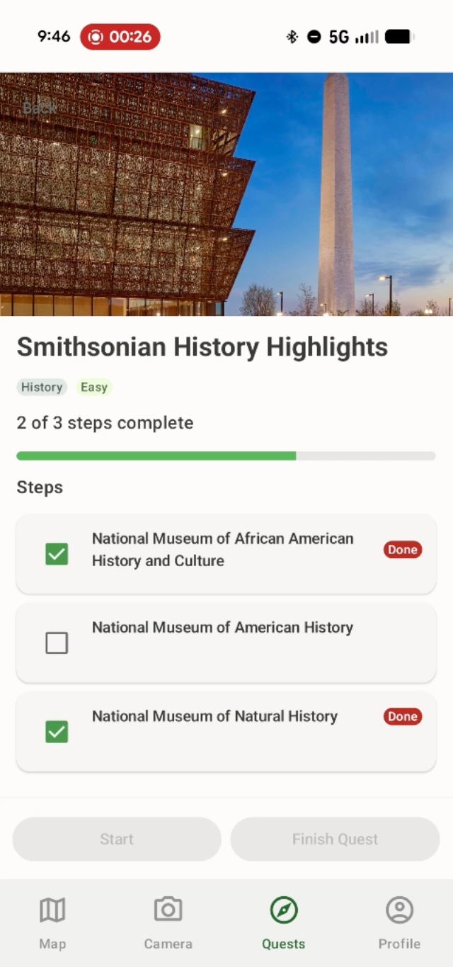
Travelers are surrounded by remarkable places, such as landmarks, monuments, historic buildings, museums, and hidden local gems. The information exists online, but reaching it means stopping, searching, and wading through long articles that rarely match what you actually care about. So we asked a simple question: What if you could point your camera at something and instantly understand why it matters? LandmarkLens combines ESRI's ArcGIS technology with geospatial context and AI to identify what a traveler is looking at and deliver a personalized response tuned to their interests, such as history, architecture, culture, food, or family-friendly stories. It turns any landmark into a meaningful moment instead of just a name on a map. We focused on Washington, D.C. as our launch city, using its dense concentration of iconic memorials, museums, and cultural destinations as the proving ground.
What it does
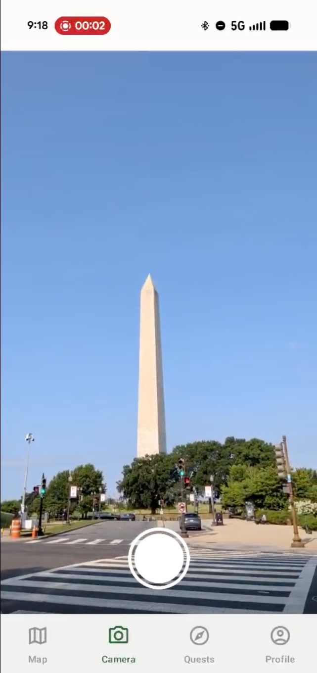
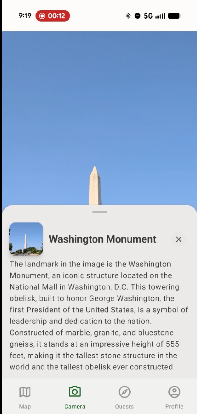
LandmarkLens is an Android app that helps travelers understand the world right in front of them. From a single photo, combined with the device's location, the app identifies landmarks, buildings, monuments, restaurants, and other points of interest. Once a place is recognized, LandmarkLens delivers:
- Its official name and a brief description
- Interesting facts
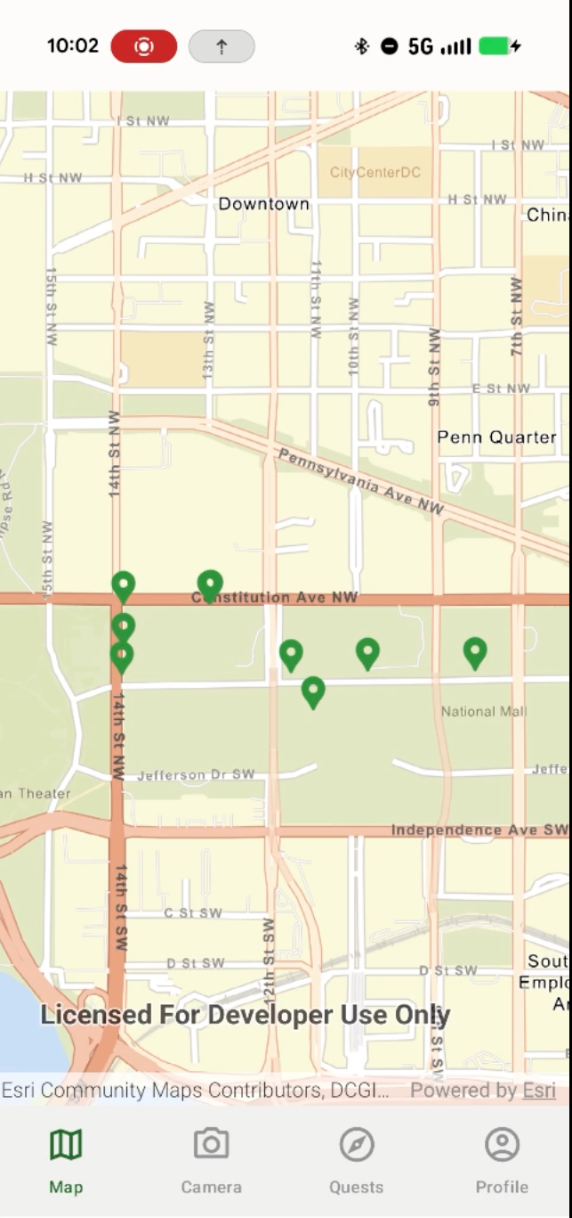
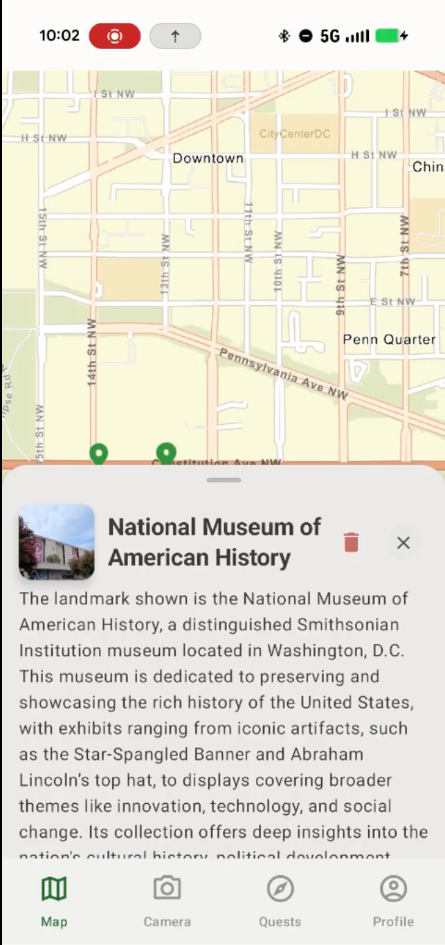
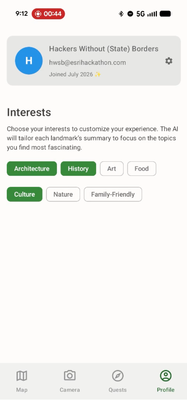
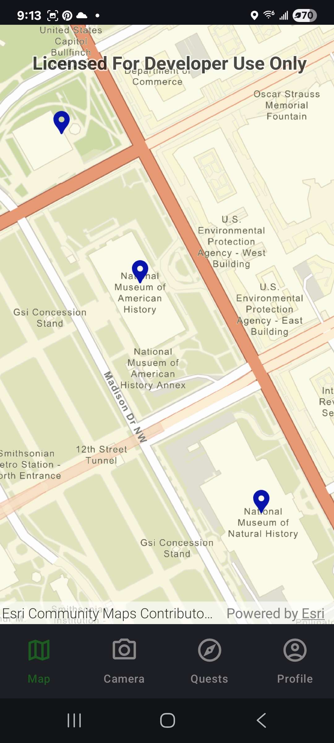
- Content personalized to the user's interests Travelers choose what matters to them from: History, Architecture, Food, Culture, or Family-Friendly; because the same landmark can tell a completely different story depending on who's looking. For example, an architecture enthusiast hears about design influences and construction materials; a family with kids gets a simpler explanation with a fun fact they'll remember. Every photo is saved, so travelers build a personal record of their journey on a living map of where they've been and what they discovered.
How we built it
LandmarkLens pairs AI-assisted landmark recognition with Esri's location intelligence. The whole workflow is built around geospatial context. When a user takes a photo, the app uses their device location and city name from ArcGIS to narrow the field of possible matches. This ensures landmark accuracy based on geospatial positioning of the user. The application generates a summary for the target landmark shaped by the user's interests, rather than repeating encyclopedia style text.
Under the hood:
- ArcGIS Maps SDK - mapping and the mobile experience
- ArcGIS Reverse Geocode- determining the city the user is currently in
- ArcGIS Location Services and ArcGIS Online - location and data access
- AI-powered content generation - personalized, spoken-style summaries
- Kotlin - native Android development The heart of our geospatial workflow is making landmark and points of interest data accessible and meaningful to the user, turning raw location data into something a traveler can actually use in the moment.
Challenges we ran into
We were the only remote team in the hackathon spread across 5 offices and 2 time zones.
- With no dedicated graphic designer, we made product design a team sport. Developers, entrepreneurs, and geographers all took ownership of user experience, branding, interface design, content, and storytelling while carrying the technical build and project planning at the same time. Our other big challenge was teaching the AI how to talk. Getting responses that were concise, engaging, accurately tailored to the travelers' interests, took significant prompt refinement. This led to deep, philosophical conversation about how we ask questions and think.
Accomplishments that we're proud of
We're proud that LandmarkLens turns a single photo into a personalized learning experience. Specifically, we:
- Built a working, end-to-end landmark-discovery workflow
- Delivered AI summaries that adapt closely to user interests
- Fused geospatial context with AI to go beyond a generic search result
- Designed and branded the entire product without a dedicated graphic designer, and as a bicoastal, fully remote team
- Created one interface that serves tourists, architecture buffs, families, and foodies alike Most importantly, we built something that feels memorable, useful, and immediately impactful to the uses. It's a product that people get the moment they see it.
What we learned
This hackathon reinforced the power of communication, adaptability, and user-focused design. Our biggest lesson: AI alone isn't enough geospatial context is everything. By combining location, nearby-places data, and user interests, we produced responses far more valuable than any generic search result. We also learned how tightly technical decisions and user experience are linked. Some of our most impactful discussions weren't about code at all but rather about how travelers naturally ask questions, and how AI should answer.
What's next for LandmarkLens
LandmarkLens starts as a way to identify landmarks, but recognition is just the beginning. What's ahead:
- Expanded quest coverage across U.S. and international cities
- Multi-language summaries for global travelers
- Audio-guided experiences
- Personalized, auto-generated travel itineraries
- Group trip sharing and collaborative travel journals
- Automated StoryMap generation from visited locations
- Customizable basemap with different color pins Our vision stays true to the question we started with helping travelers understand not just what they're looking at, but why it matters to them.
Built With
- ai
- arcgis-maps-sdk-for-kotlin
- arcgis-reverse-geocode
- education
- jetpack-compose
- kotlin
- landmark-recognition
- tourism
- travel


Log in or sign up for Devpost to join the conversation.