-
-
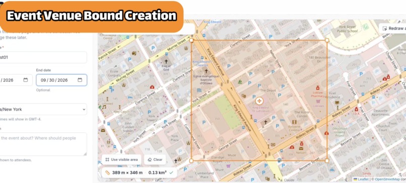
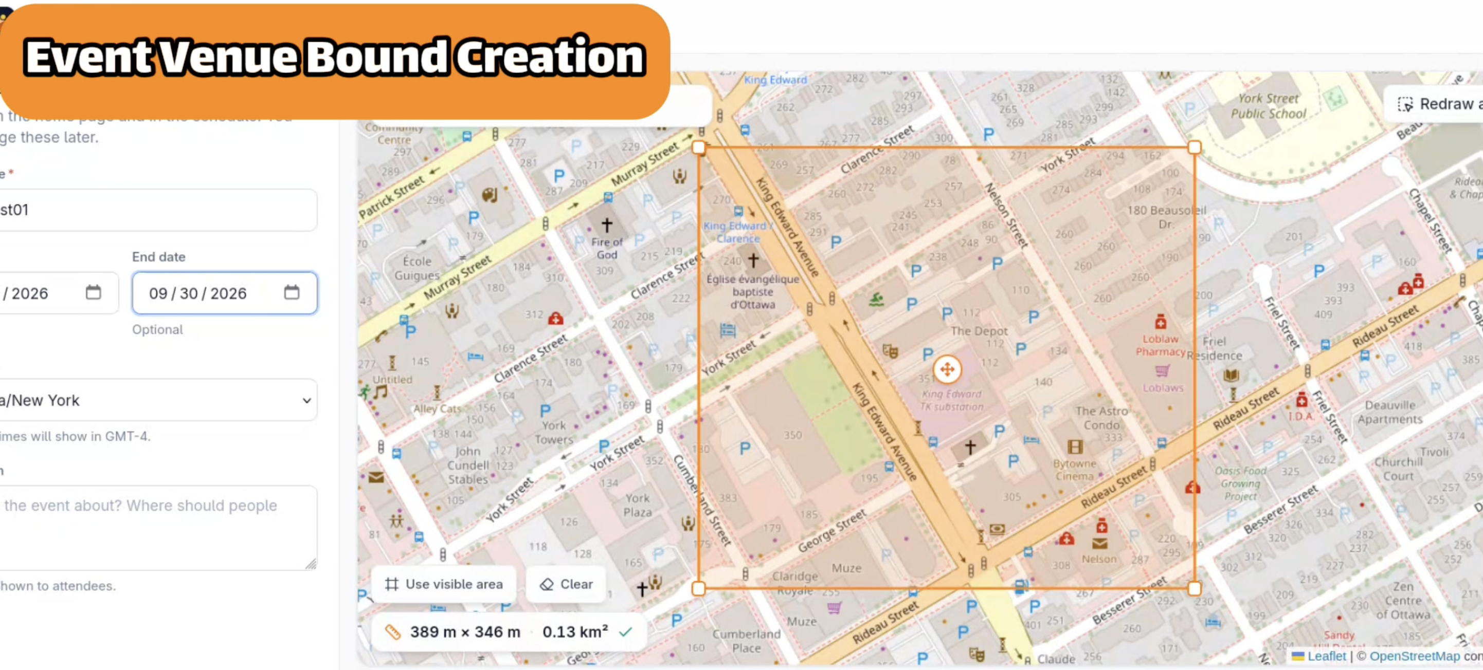
Event Bound Creation
-
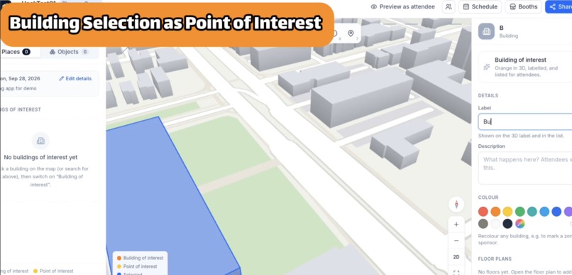
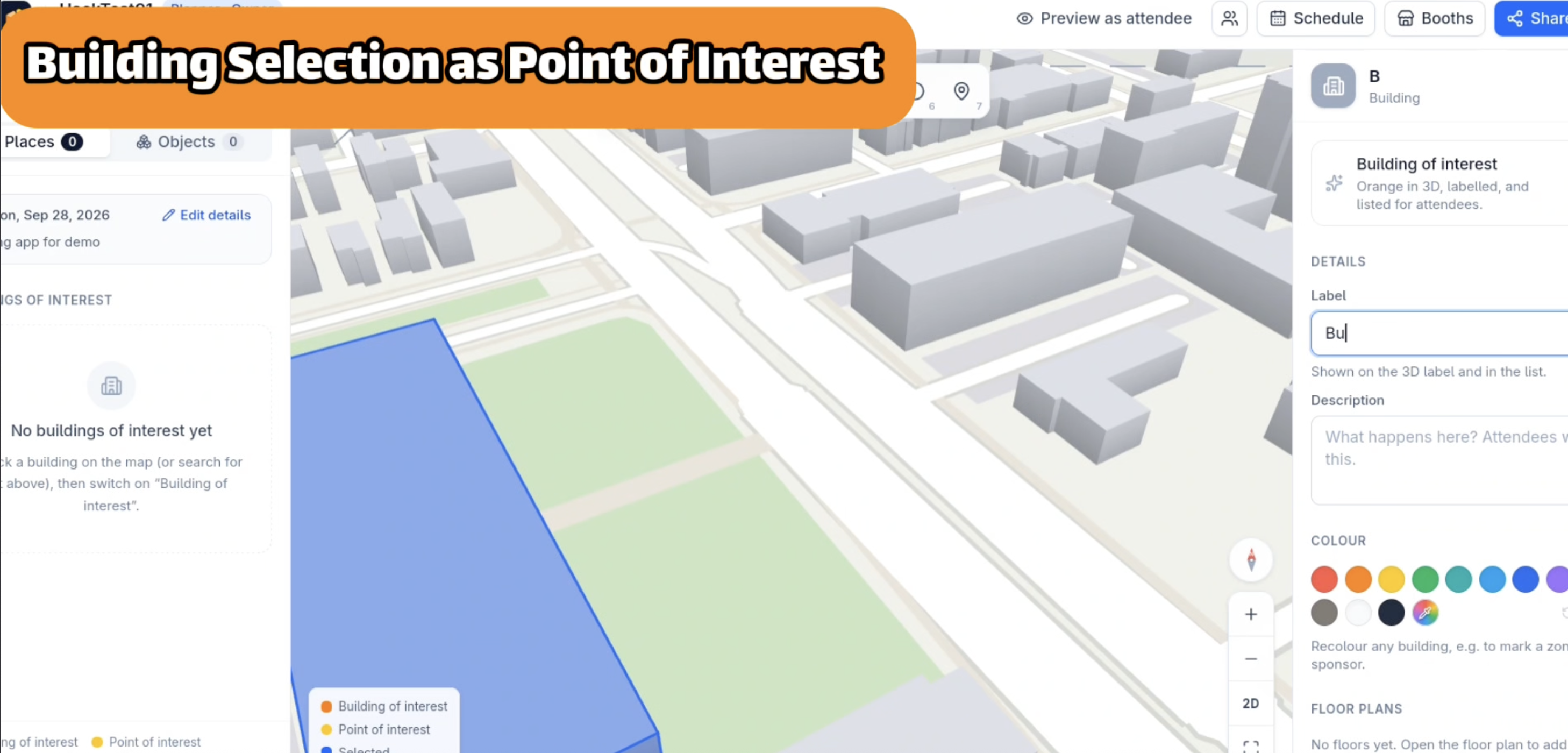
Building Selection as POI
-
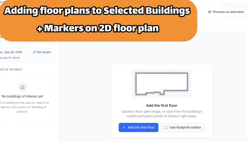
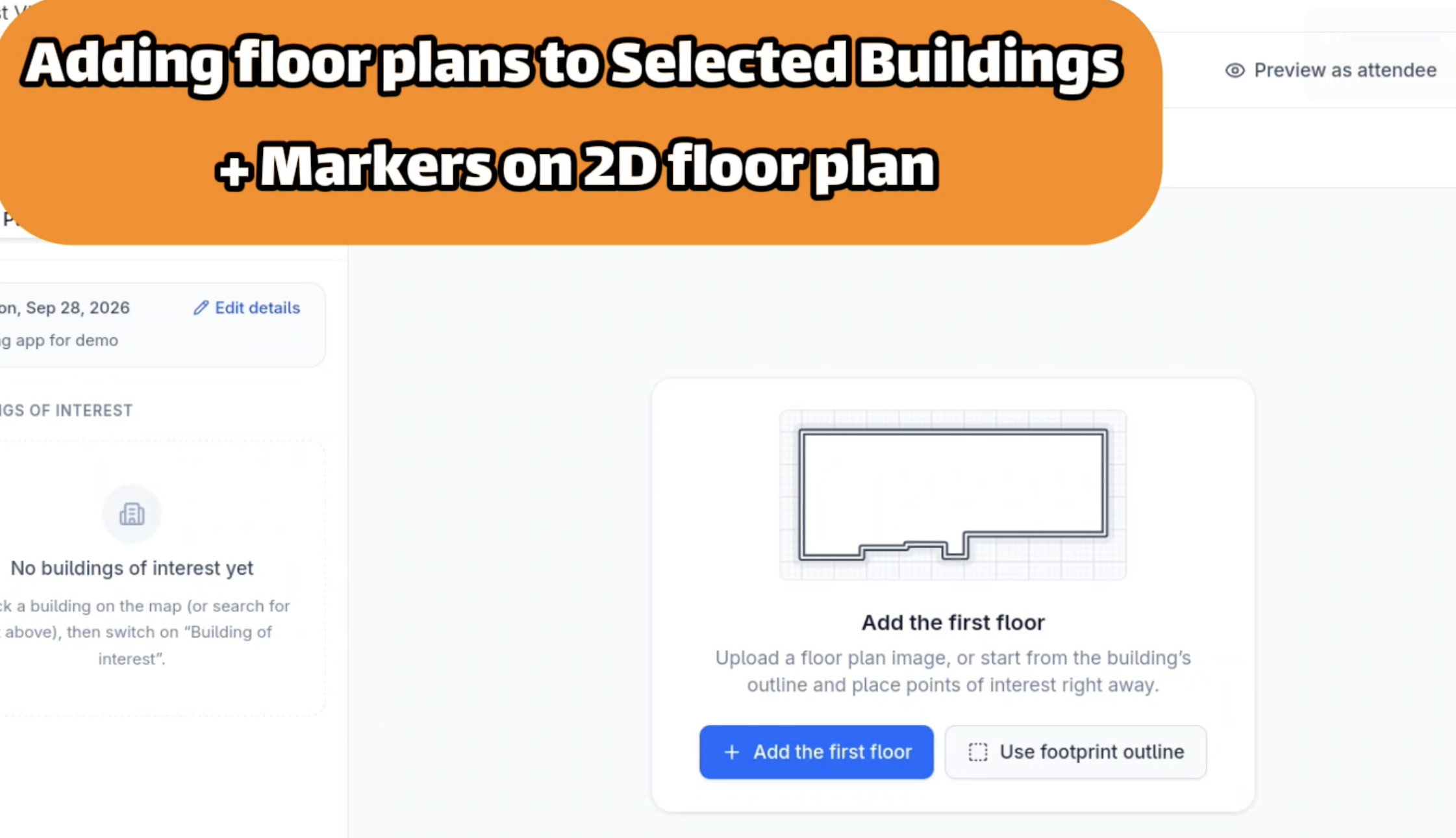
2D Floor Plan Support
-
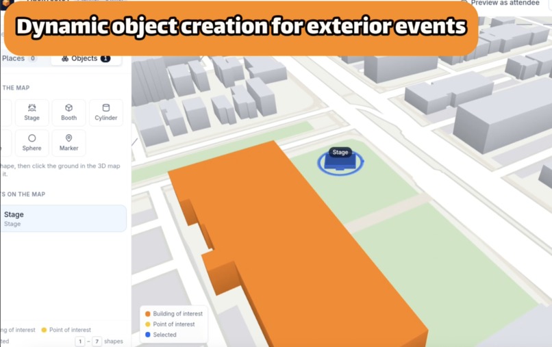
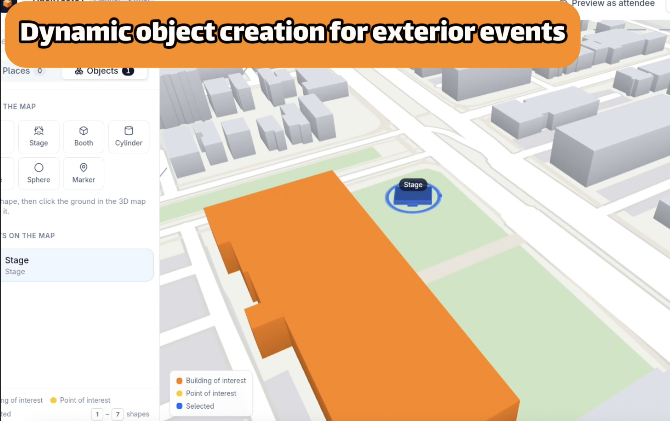
Dynamic Object Creation
-
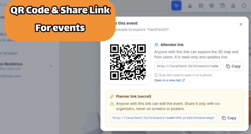
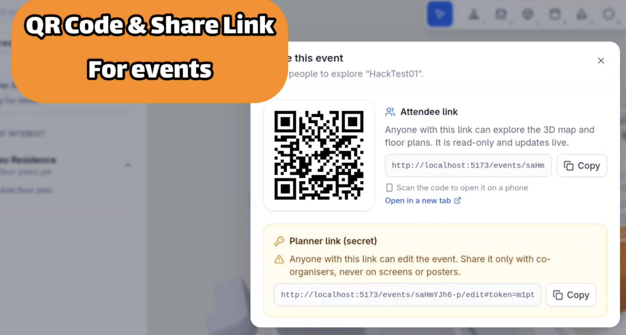
QR Code & Share Link
Inspiration
The idea came from our own experience attending events in unfamiliar places. We often found ourselves trying to locate buildings, rooms, and event spaces using static maps or directions from other attendees. After struggling through navigation at one event, we started discussing how much easier it would be if participants could explore the venue through an interactive map before and during the event.
What We Built
We built a web application that combines a 3D map of an event's surrounding area with indoor floor plans for participating buildings. Users can navigate the venue as a connected experience, moving from an outdoor campus view directly into building layouts to better understand where they need to go.
Challenges
One of our biggest challenges was finding the right tools and technologies to support interactive 3D mapping. We also wanted to build the 3D map experience without relying on external mapping APIs, which meant handling map rendering and interaction ourselves. Another challenge was making the map dynamic by supporting object creation and placement within the environment.
What We Learned
Through this project, we learned more about 3D geospatial visualization, map rendering, and integrating multiple sources of spatial data into a single user experience. We also gained experience designing interfaces that help users orient themselves in unfamiliar environments.
Built With
- docker
- express.js
- leaflet.js
- node.js
- playwright
- react
- three.js
- typescript
- zod
- zustand


Log in or sign up for Devpost to join the conversation.