-

Home/signin page
-

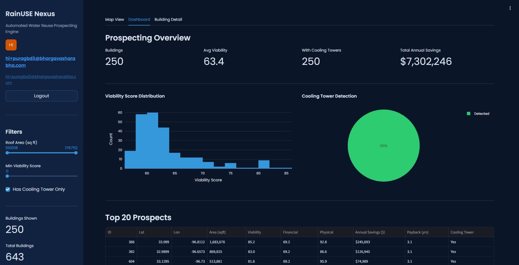
Dashboard page
-
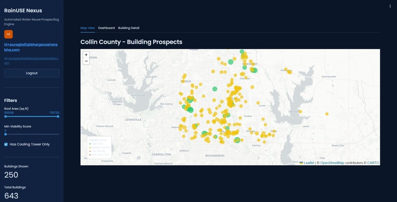
Interactive color indicated Map view
-
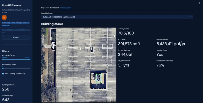
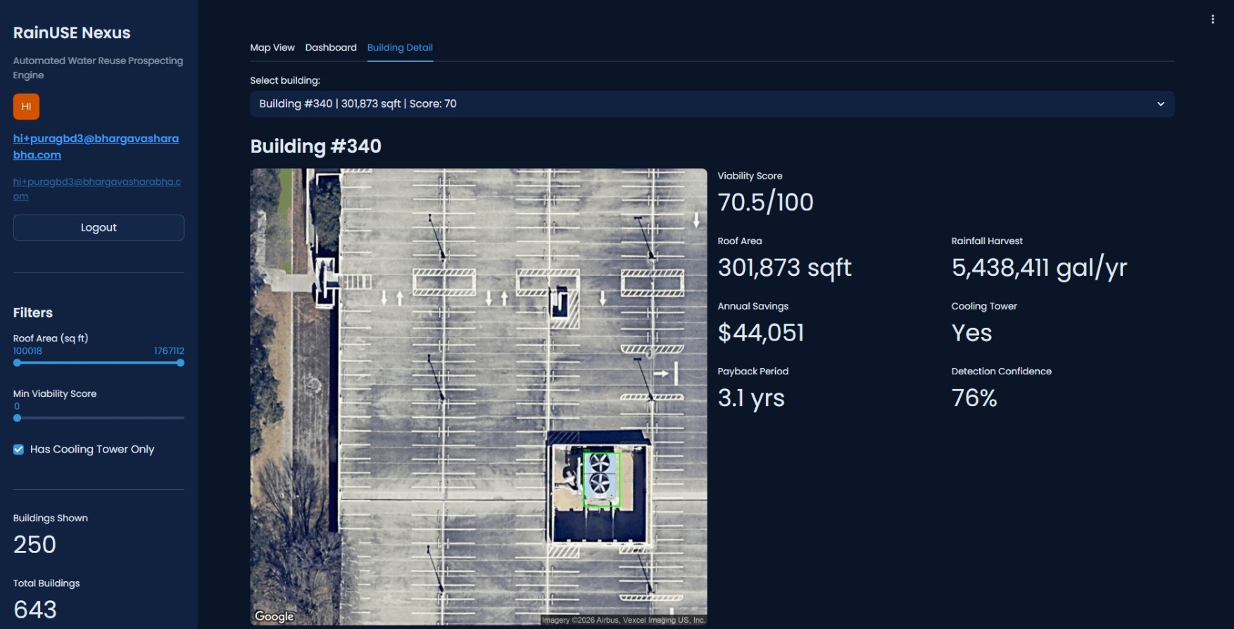
Specific building details page


Inspiration
We took the Grundfos challenge head-on. Water scarcity in commercial buildings is a real problem and we wondered: what if we could automatically find the buildings with the highest rainwater harvesting potential? That question lead me to RainUSE Nexus.
What it does
RainUSE Nexus is an ML-powered platform that identifies commercial buildings with the highest potential for rainwater harvesting and water reuse systems. It uses satellite imagery + YOLOv8 to detect cooling towers, scores buildings on physical, financial, and ESG factors, and shows everything on an interactive map with detailed analytics focused on USA (Collin County, Texas for now).
How we built it
Built the full stack in under 24 hours. Streamlit frontend with Folium maps and Plotly charts, a YOLOv8 cooling tower detector trained on a custom dataset, Google Maps Static API for satellite imagery, SQLite for fast lookups, deployed on DigitalOcean with Docker. The scoring engine combines roof area, rainfall data, water/sewage costs, and tax incentives to generate payback period and ROI estimates for every building.
Challenges we ran into
Training a reliable cooling tower detection model was the hardest part. Public datasets for cooling towers on satellite imagery basically don't exist. We scraped Google Maps, annotated images by hand, and iterated through multiple training runs until we had something that actually works.
Accomplishments that we're proud of
Getting the full pipeline: satellite image → detection → scoring → live map — working end-to-end. And deploying it live at rainusenexus.com.
What we learned
From satellite imagery and GIS coordinate handling... to YOLOv8 model training, fine-tuning, and deployment... to OAuth2 authentication with Auth0... to building interactive map UIs with Folium and Streamlit. End-to-end ML + web development in one sprint.
Built With
- auth0
- digitalocean
- grundfos
- ml
- openbuilding
- opencv
- python
- streamlit


Log in or sign up for Devpost to join the conversation.