-
-
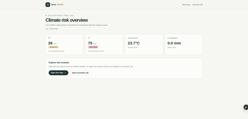
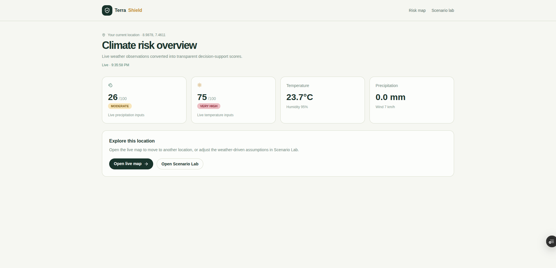
dashboard
-
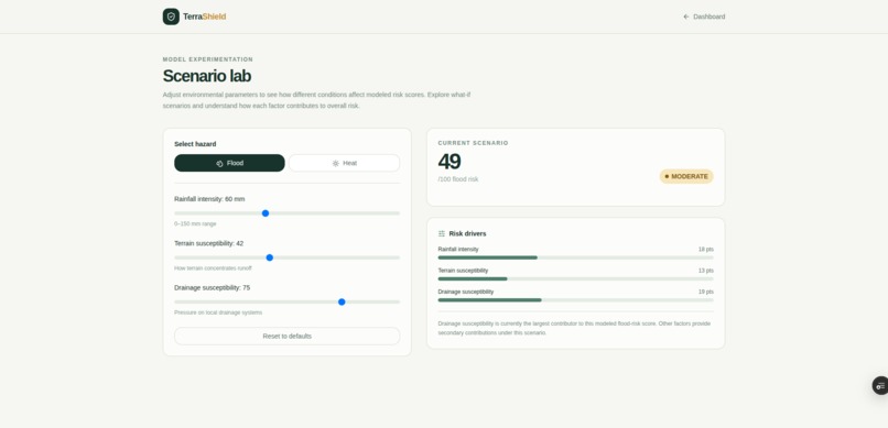
scenerio lab
-
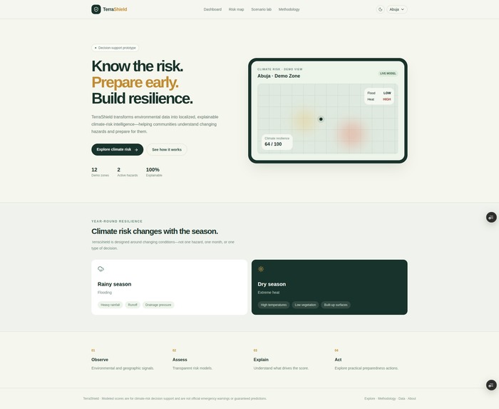
landing
Inspiration
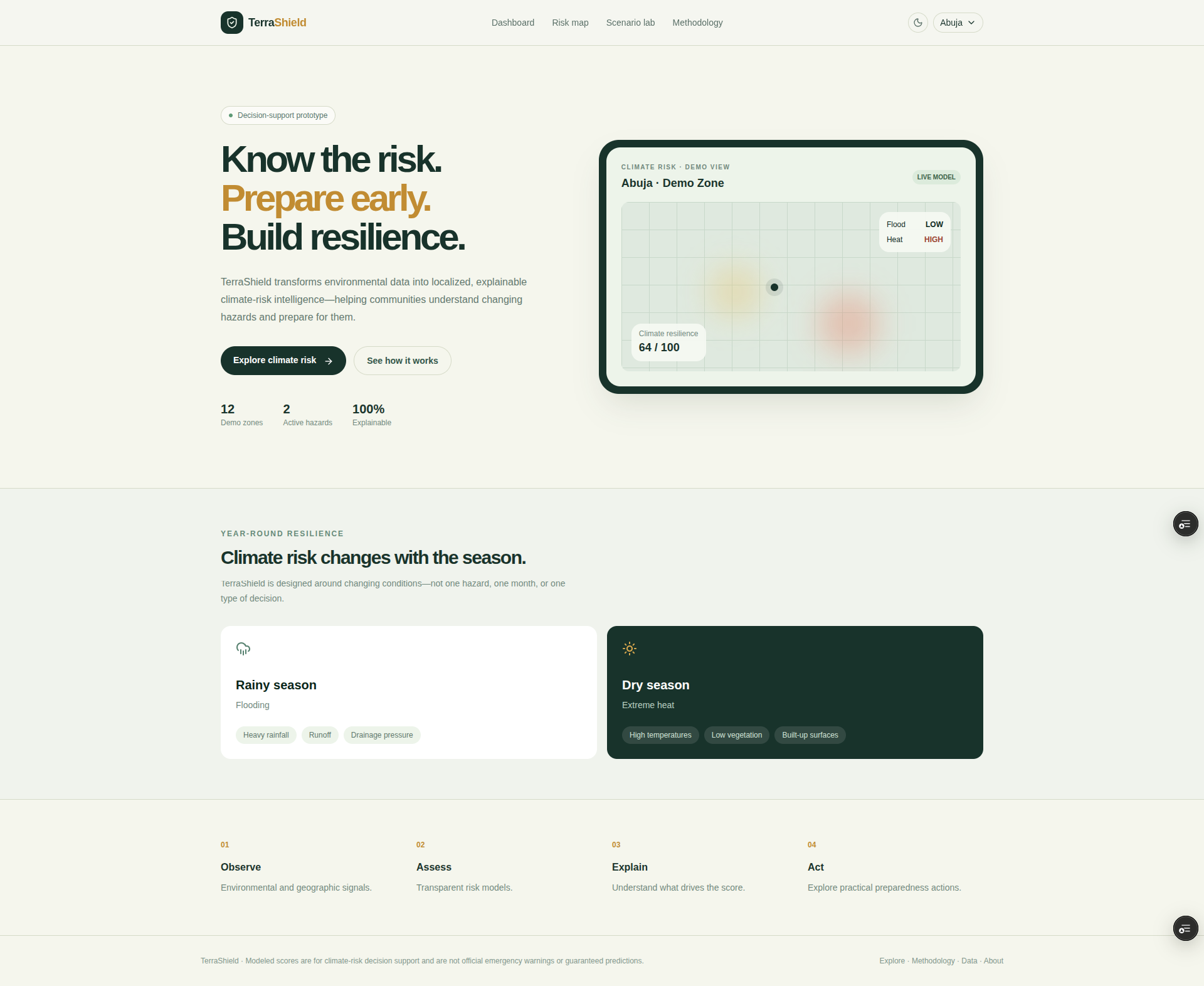
Climate risk doesn't only show up when there is a disaster. It changes with the seasons. During the rainy season, communities may face increased flooding, while during hotter and drier periods, extreme heat can become the bigger concern.
We noticed that most weather and climate tools provide data without enough context: What does this mean for my area? Why is the risk increasing? And what can I actually do about it?
That inspired us to build TerraShield — a climate-risk intelligence platform designed to make environmental risk easier to understand, explain, and act on.
What it does
TerraShield transforms environmental signals into localized, explainable climate-risk insights.
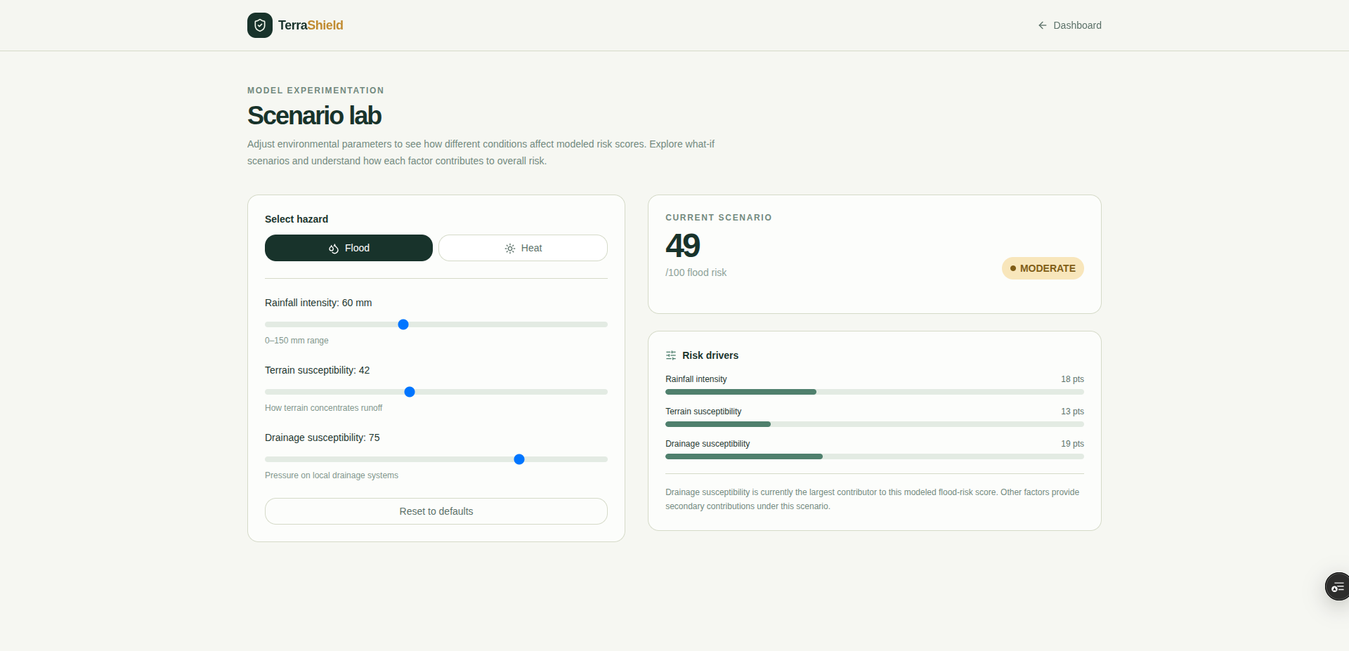
Users can explore an area, view modeled flood and heat risks, understand the factors contributing to those risks, and test different environmental scenarios.
For example, a user can increase rainfall intensity in the Flood Scenario Lab and immediately see how the modeled risk changes, which factors contribute most to the score, and what preparedness actions may be appropriate.
TerraShield is designed to remain useful throughout the year: flooding is one use case during wetter periods, while extreme heat becomes another during hotter and drier periods.
The core experience is:
Observe → Assess → Explain → Act.
How we built it
TerraShield was built as a modular web application using Next.js, TypeScript, React, Tailwind CSS, shadcn/ui, MapLibre GL JS, Recharts, and Zod.
The risk engine is deterministic and explainable rather than relying on a black-box AI model. Flood and heat risk scores are calculated from environmental factors such as rainfall intensity, terrain susceptibility, drainage susceptibility, temperature, vegetation coverage, and built-up exposure.
We also built a data-provider abstraction, allowing the application to start with clearly labeled synthetic demo data while remaining architecturally ready for real weather, satellite, historical, and government datasets in the future.
The platform includes interactive maps, scenario simulation, risk-factor breakdowns, recommendations, methodology and data-provenance pages, responsive layouts, accessibility considerations, API validation, and automated tests for the core risk calculations.
Challenges we ran into
One of the biggest challenges was balancing scientific responsibility with hackathon constraints.
We wanted TerraShield to demonstrate meaningful climate-risk analysis without pretending that a prototype using synthetic data could accurately predict whether a specific neighborhood would flood or experience dangerous heat.
We addressed this by making the model transparent, clearly labeling synthetic data, separating the risk engine from the UI, documenting the assumptions behind the calculations, and explicitly communicating the limitations of the prototype.
Another challenge was designing the product to be useful beyond a single climate event. Instead of building only a flood dashboard, we designed the architecture around multiple hazards so that the same platform can evolve as different environmental risks emerge.
Accomplishments that we're proud of
We're proud that TerraShield is more than a static climate dashboard.
The platform allows users to interact with environmental scenarios and see the consequences immediately. Changing rainfall, temperature, vegetation, or built-up exposure changes the modeled risk, its contributing factors, and the resulting recommendations.
We're also proud of the explainability built into the experience. Rather than simply displaying a number like "78% risk," TerraShield explains what contributed to that score and why the modeled risk changed.
Most importantly, we built the foundation with real-world extensibility in mind: the demo data can be replaced with real environmental data without rebuilding the entire application.
What we learned
We learned that building a climate-focused product is not just about displaying more environmental data. Context and explainability matter just as much as the data itself.
We also learned the importance of communicating uncertainty. A climate-risk tool should distinguish between observed information, modeled estimates, forecasts, and synthetic demonstration data.
From a technical perspective, we learned that separating the risk engine, data providers, API layer, and presentation layer makes it much easier to experiment with new hazards and eventually integrate real-world datasets.
What's next for TerraShield
The next step is replacing the synthetic demonstration data with real environmental datasets and validated local models.
From there, we want to expand TerraShield beyond flood and heat risk to include water stress, drought, wildfire, air quality, and other climate-related hazards.
We also see opportunities to incorporate historical observations, satellite-derived vegetation data, community reporting, and integrations with official emergency and climate-information systems.
Our long-term goal is to turn TerraShield into a platform that helps communities move from simply knowing that climate conditions are changing to understanding where the risk is, why it is changing, and how they can prepare for it.
Built With
- maplibre-gl-js
- next.js
- react
- recharts
- shadcn/ui
- tailwind-css
- typescript
- vercel
- zod


Log in or sign up for Devpost to join the conversation.