Inspiration
Kenyan farmers make high-risk decisions every season: what to plant, when to plant, whether rainfall will be enough, and how to prepare for drought, heat, or flooding.
The problem is not that environmental data does not exist. It is that useful information is scattered across weather services, satellite platforms, soil databases, terrain models, climate records, and ground sensors.
TerraPlan started with one question:
What if all of this environmental data could be translated into one clear decision for a specific farm?
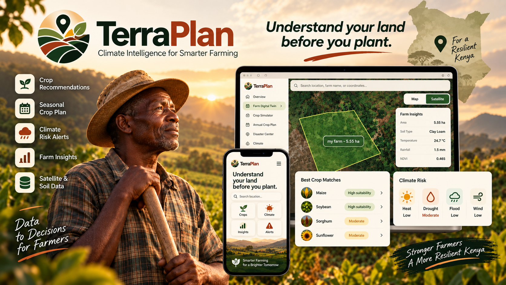
That idea became TerraPlan — a platform designed to turn climate and environmental data into practical agricultural intelligence for Kenyan farmers.
What it does
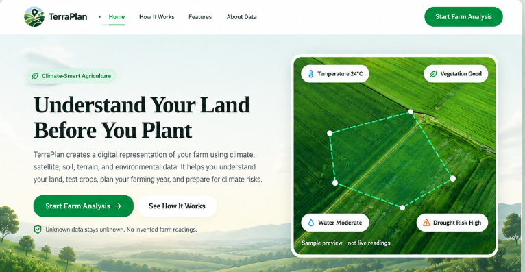
TerraPlan is a climate-smart agricultural decision-support platform.
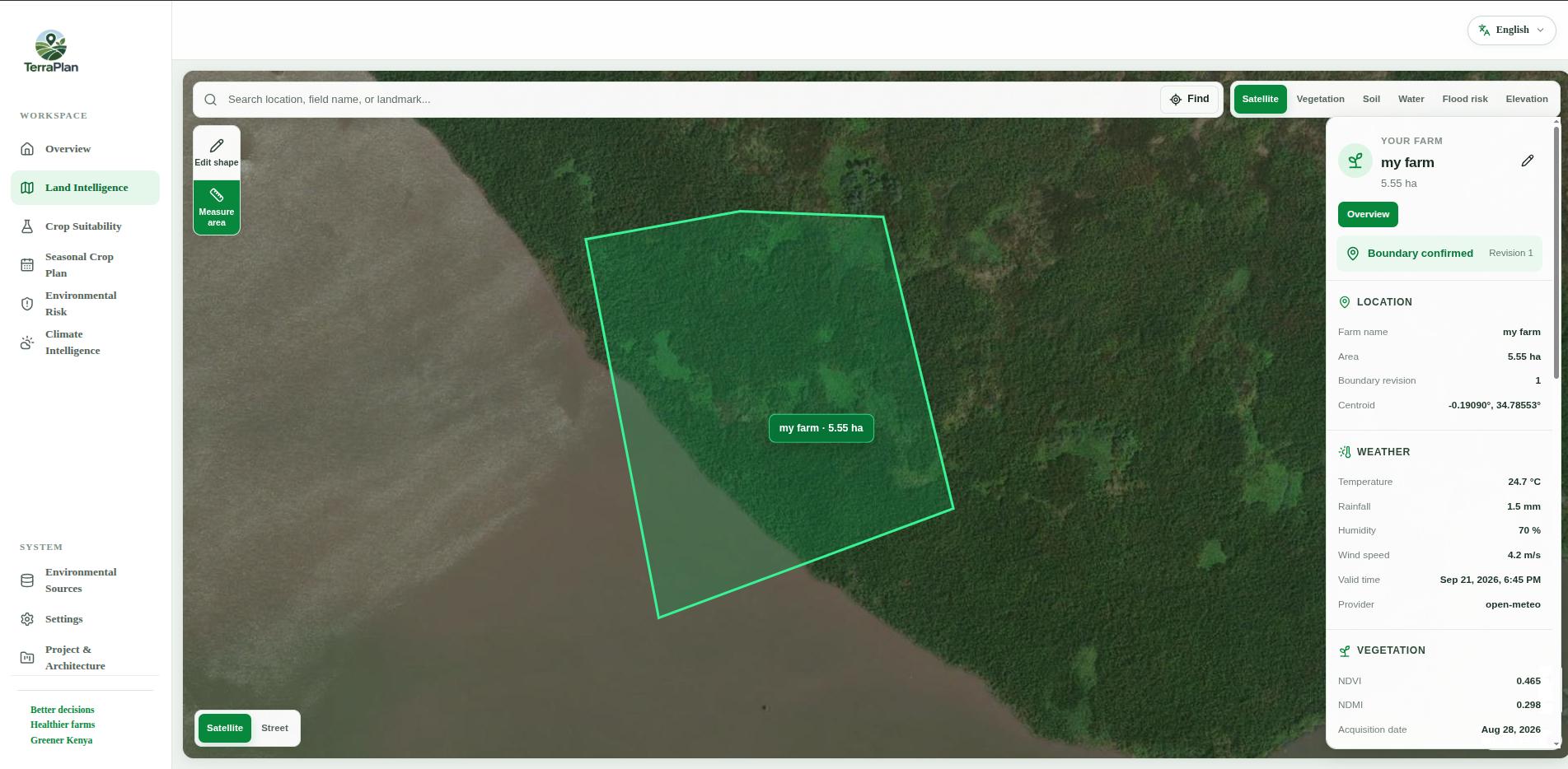
A farmer selects or draws their land on a map, and TerraPlan creates a Farm Digital Twin using weather, satellite, soil, terrain, historical climate, and available ground observations.
It then helps answer practical questions such as:
- What crops are suitable for this farm?
- Is rainfall likely to be enough?
- Is drought, heat, heavy rainfall, or flood exposure becoming a risk?
- What environmental factor is limiting this crop?
- What should be planted during different seasons?
TerraPlan also includes a “What if I grow this?” Crop Simulator, climate-risk analysis, seasonal crop planning, and climate scenario simulation.
The goal is to move from:
Data → Insight → Decision → Action
How we used JKUAT Conduit data
JKUAT Conduit is an important part of TerraPlan because it provides ground-level environmental observations that can complement regional weather and satellite data.
TerraPlan processes Conduit observations through a pipeline that:
- Parses and validates incoming observations
- Normalizes sensor fields
- Applies quality checks
- Combines multiple temperature readings into a temperature consensus
- Removes duplicate observations
- Creates hourly and daily aggregates
- Checks whether a station is geographically relevant to a farm
- Calculates environmental indicators such as Vapor Pressure Deficit (VPD)
The processed Conduit data is then added to the Farm Digital Twin and used by TerraPlan's crop and climate-risk engines.
For example:
Temperature + Humidity → VPD → Moisture Stress → Drought Safety → Farmer Recommendation
This allows TerraPlan to translate a technical value such as:
VPD = 2.9 kPa
into something more useful:
“High evaporative stress is present. Consider conserving soil moisture or using supplemental irrigation.”
For the hackathon prototype, TerraPlan uses 191 real historical Conduit observations from June 2025 through a historical replay pipeline.
How we built it
The frontend was built using React, TypeScript, Tailwind CSS, MapLibre GL JS, and Turf.js.
The backend uses FastAPI, Python, PostgreSQL/PostGIS, Redis, and Docker.
TerraPlan combines six environmental sources:
- JKUAT Conduit — ground weather observations
- Open-Meteo — weather and forecasts
- Sentinel-2 — NDVI, NDMI, and vegetation condition
- SoilGrids — soil properties
- Copernicus DEM — elevation and slope
- ERA5-Land — historical climate baselines
These signals are converted into a versioned environmental snapshot and processed by deterministic crop-suitability, climate-risk, and seasonal-planning engines.
AI may help explain calculated results in simpler language, but it does not generate or override TerraPlan's numerical scores.
Challenges we ran into
One of the hardest parts was combining environmental datasets with very different formats, timestamps, spatial resolutions, and levels of availability.
Satellite imagery can be affected by clouds. Soil datasets are modeled estimates. Weather forecasts change constantly. Ground sensors can contain missing or inconsistent readings.
Another major challenge was making sure TerraPlan did not silently produce confident recommendations when important evidence was unavailable.
To address this, TerraPlan tracks information such as the source, data mode, retrieval time, availability, and quality of environmental evidence.
The biggest engineering challenge was not collecting more data — it was converting that data into recommendations a farmer could actually understand and use.
Accomplishments that we're proud of
We are proud that TerraPlan goes beyond being another weather dashboard.
We created a complete data-to-decision pipeline that combines multiple environmental sources into a farm-specific digital profile.
TerraPlan includes:
- Interactive farm-boundary selection
- Farm Digital Twins
- A deterministic crop-suitability engine
- 12 Kenya-relevant crops
- Drought, heat, heavy-rainfall, flood-exposure, and wind analysis
- Seasonal crop planning
- Climate what-if simulation
- English ↔ Kiswahili localization
- Explainable crop and risk recommendations
- Environmental data provenance and quality tracking
- More than 420 automated backend tests
Most importantly, the system tries to explain why it produced a recommendation instead of only displaying a score.
What we learned
We learned that climate intelligence is not only about collecting environmental measurements.
The real challenge is turning those measurements into information that helps someone make a better decision.
Working on TerraPlan taught us how difficult it is to combine weather, satellite, soil, terrain, climate, and ground-sensor data reliably.
We also learned about geospatial systems, environmental uncertainty, data quality, deterministic scoring engines, API integration, climate-risk modelling, and designing technology around the needs of real users.
What's next for TerraPlan
The next step is to develop TerraPlan from a hackathon prototype into a more locally validated agricultural decision-support platform for Kenya.
We plan to expand it with:
- Live Conduit and additional ground weather-station integrations
- Validation with agronomists and Kenyan farmers
- More Kenya-specific crops
- County-level agricultural intelligence
- Explicit Long Rains and Short Rains seasonal planning
- Stronger drought, flood, heat, and rainfall early-warning systems
- Improved irrigation and water-planning tools
- SMS and low-connectivity alerts
- Dashboards for cooperatives and agricultural extension officers
We also plan to build a mobile version of TerraPlan, giving farmers a simpler way to check their farm, receive climate alerts, compare crops, and view recommendations directly from a phone.
In the future, the same platform could expand from individual Kenyan farms to farming cooperatives, communities, and eventually other climate-sensitive agricultural regions across East Africa.
The long-term vision is simple:
Give farmers one place where environmental data becomes a clear agricultural decision.

Log in or sign up for Devpost to join the conversation.