Inspiration
Satellite imagery contains valuable information about our planet, but turning that information into timely, actionable insights can be difficult. Natural disasters such as floods and wildfires can affect thousands of people, while deforestation and other environmental changes threaten ecosystems.
We were inspired by the potential of artificial intelligence to make Earth-observation data more accessible and useful. We wanted to explore how AI could help people understand environmental changes, identify potentially affected regions, and make better-informed decisions.
This led to TerraLens AI, a project focused on transforming complex satellite imagery into meaningful environmental intelligence.
What it does
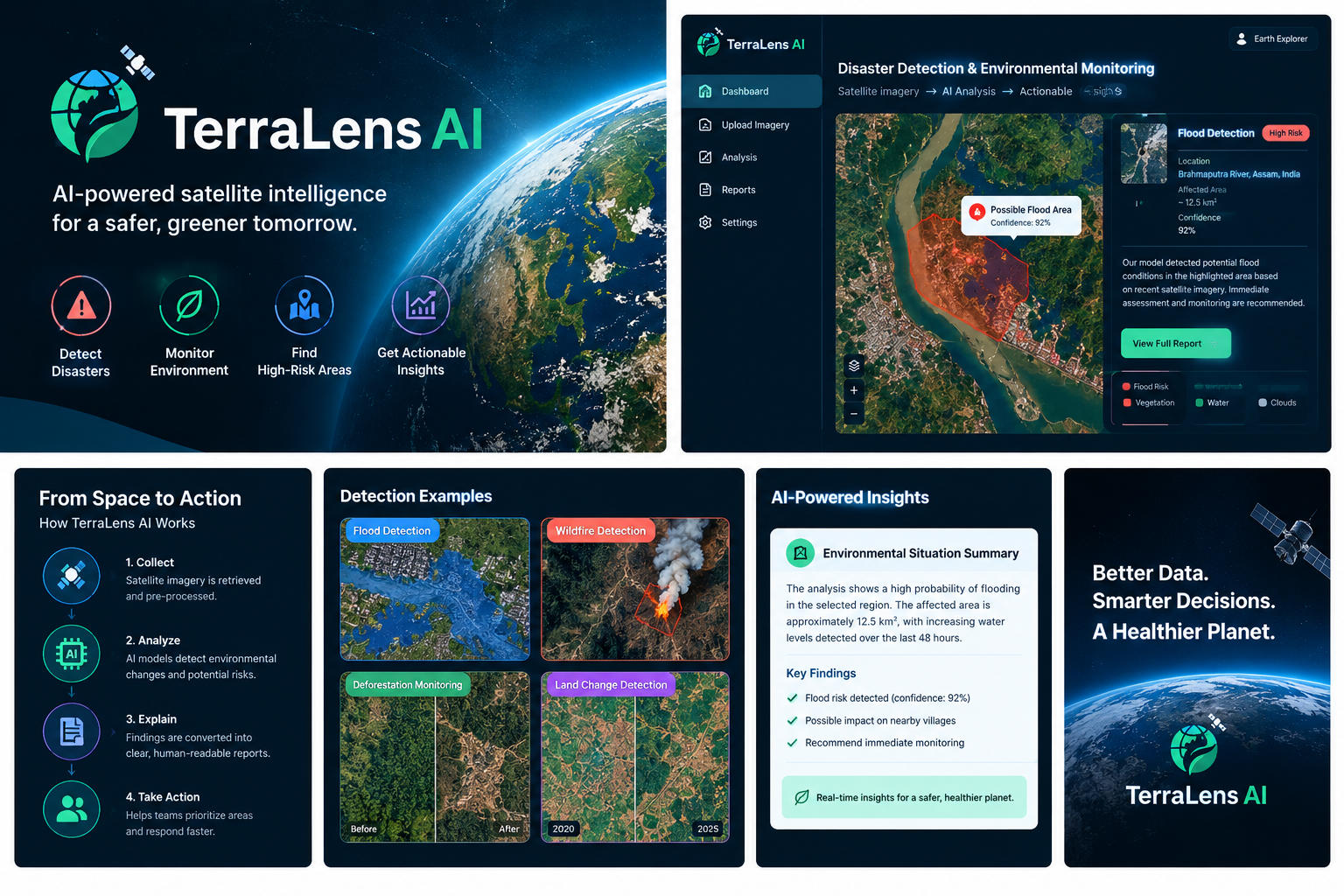
TerraLens AI is an AI-powered Earth-observation platform designed to analyze satellite imagery and support environmental monitoring and disaster assessment.
Its planned capabilities include:
- Disaster monitoring: Identify potential flood- and wildfire-affected areas from suitable satellite imagery.
- Environmental change detection: Help identify changes in land cover, vegetation, and other environmental features.
- Visual insights: Present image-analysis results through an intuitive dashboard.
- AI-generated explanations: Translate technical findings into clear summaries that users can understand.
- Risk prioritization: Help users identify areas that may require further investigation or emergency response.
TerraLens AI is intended to support human decision-making, not replace official disaster assessments or emergency services.
How we built it
Our approach combines geospatial data processing, computer vision, and generative AI to create a practical Earth-observation workflow.
The planned technology stack includes Python and PyTorch for image-processing and machine-learning tasks, a suitable computer-vision model for satellite-image analysis, and a web-based dashboard for displaying results. An AI language model can help turn verified analysis results into concise, understandable reports.
Nebius infrastructure provides a potential deployment environment for scalable AI inference, while NVIDIA open-source models and tools can support the AI components of the application.
The workflow is designed to take satellite imagery as input, process the relevant data, identify environmental features or changes, and present the resulting insights in a user-friendly format.
Challenges we ran into
One major challenge is the complexity of satellite imagery. Images can vary significantly because of weather conditions, cloud cover, resolution, lighting, and differences between data sources.
Another challenge is that environmental disasters may be relatively rare compared with normal conditions in training datasets. This class imbalance can cause machine-learning models to overlook important events, making careful evaluation and appropriate sampling strategies essential.
We also considered how to communicate model predictions responsibly. AI-generated explanations must remain grounded in actual analysis results, and uncertain predictions should not be presented as confirmed disasters.
Finally, building an end-to-end system requires integrating data processing, AI inference, visualization, and deployment into a reliable workflow.
Accomplishments that we're proud of
We developed the concept for TerraLens AI around a practical global challenge: making Earth-observation information easier to interpret and act upon.
We are particularly proud of the project's potential to connect computer vision with accessible explanations, helping bridge the gap between complex geospatial data and real-world decision-making.
The project also provides a foundation for experimenting with scalable AI infrastructure, environmental monitoring workflows, and responsible AI-assisted analysis.
What we learned
Working on TerraLens AI highlighted the importance of selecting appropriate data, evaluating AI models carefully, and designing applications around real user needs.
We learned that a useful AI solution involves more than model accuracy. Data quality, inference speed, transparency, visualization, and clear communication all contribute to the overall experience.
We also recognized the importance of evaluating models on imbalanced datasets and measuring their ability to detect important events rather than relying on accuracy alone. Metrics such as precision, recall, and F1-score can provide a more informative assessment.
What's next for TerraLens AI
Our next goal is to develop TerraLens AI into a more complete and reliable environmental intelligence platform.
Future improvements could include integrating publicly available satellite datasets, implementing before-and-after image comparisons, improving detection of rare environmental events, and introducing interactive maps with affected-area overlays.
We also aim to evaluate suitable NVIDIA models and deploy the application using Nebius infrastructure, with a focus on performance, scalability, and cost efficiency.
Ultimately, our vision is to make satellite-powered environmental insights more accessible to researchers, environmental organizations, and disaster-response teams, helping them better understand changes on our planet and make more informed decisions.
Built With
- artificial-intelligence
- computer-vision
- data-science
- deep-learning
- disaster-management
- earth-observation
- fastapi
- image-processing
- machine-learning
- natural-language-processing
- nebius
- nvidia
- predictive
- python
- pytorch
- react
- satellite-imagery

Log in or sign up for Devpost to join the conversation.