Inspiration
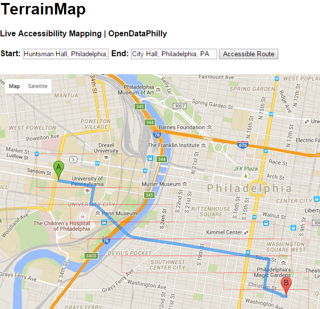
Route mapping is instrumental for navigating urban spaces. Wheelchair users face large hurdles in using existing route mapping due to lack of information on curbs and sidewalk terrain.
What it does
Senses bumps and extended rough terrain and posts to the cloud when WiFi is accessible, or connected to a phone app via Bluetooth.
How I built it
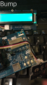
Intel Edison + Grove Plus Kit and Shield Arduino Compiler/Programmer Grove 3-axis Accelerometer Grove RBG-LCD
Edison is WiFi enabled and was successfully connected. The next step was to push data using system("curl .. POST ..") to the cloud or to a mobile device.
Challenges I ran into
C++ Request queue when querying large data sets
Accomplishments that I'm proud of
Working on an idea that I hope will improve mobility and quality of life for wheelchair users in urban environments
What I learned
Solutions to make sensor data cloud-accessible
What's next for TerrainMap
Getting cloud-integrated!

Log in or sign up for Devpost to join the conversation.