-
-
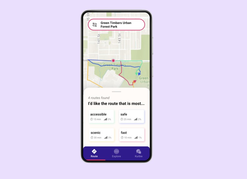
Curb Cut allows users to reach their destination by routing them around reported accessibility barriers
-
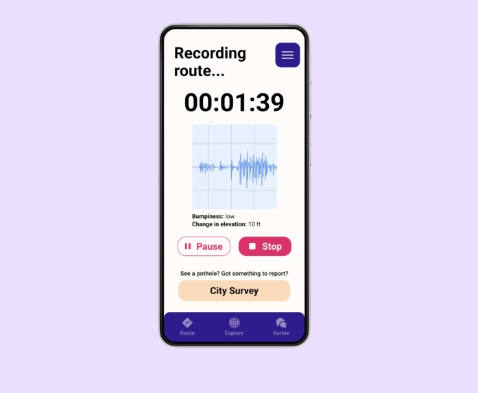
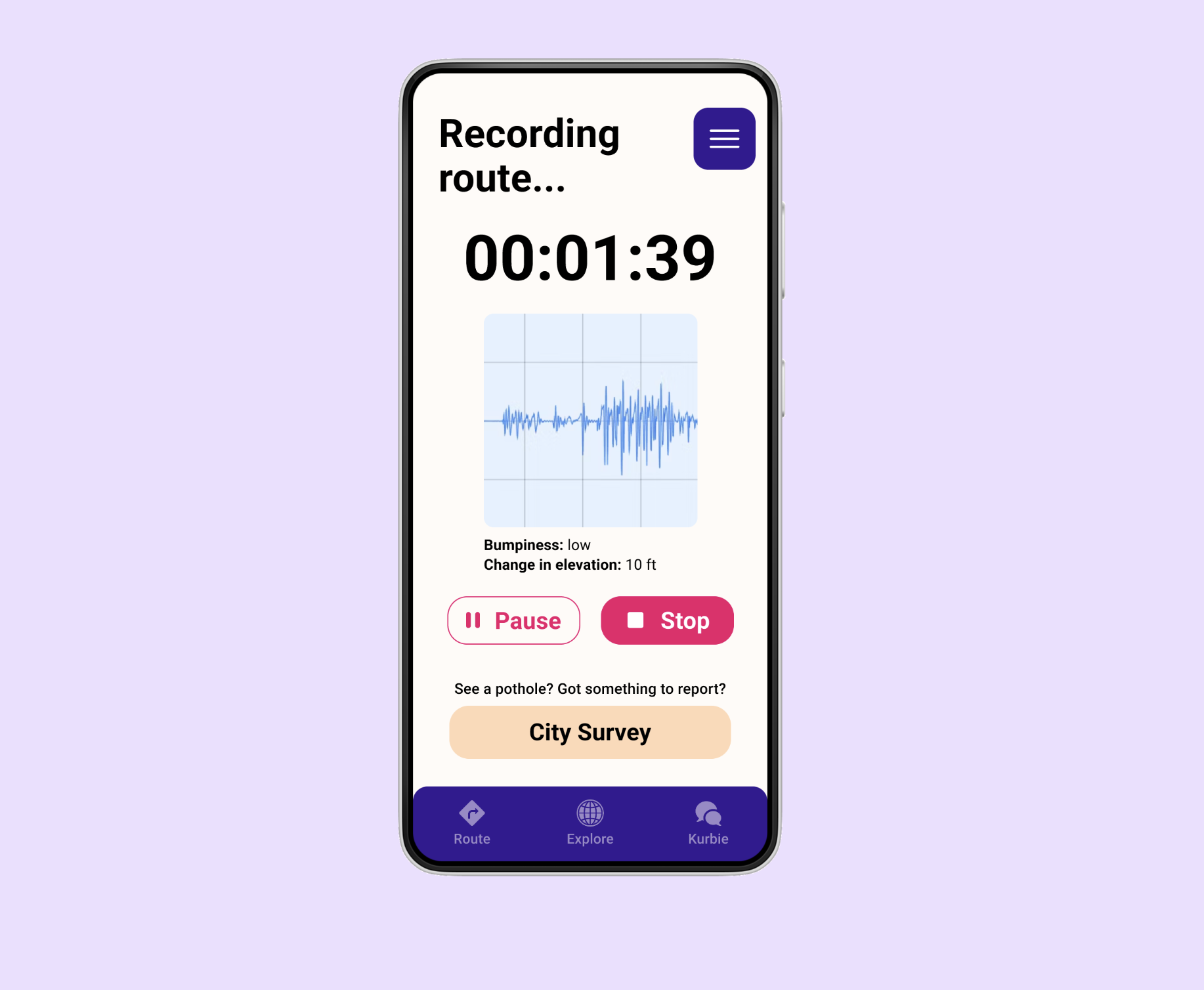
Our app crowdsources accessibility data by allowing users to report accessibility info with tools like Survey 123 and seismometers.
-
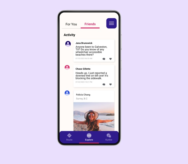
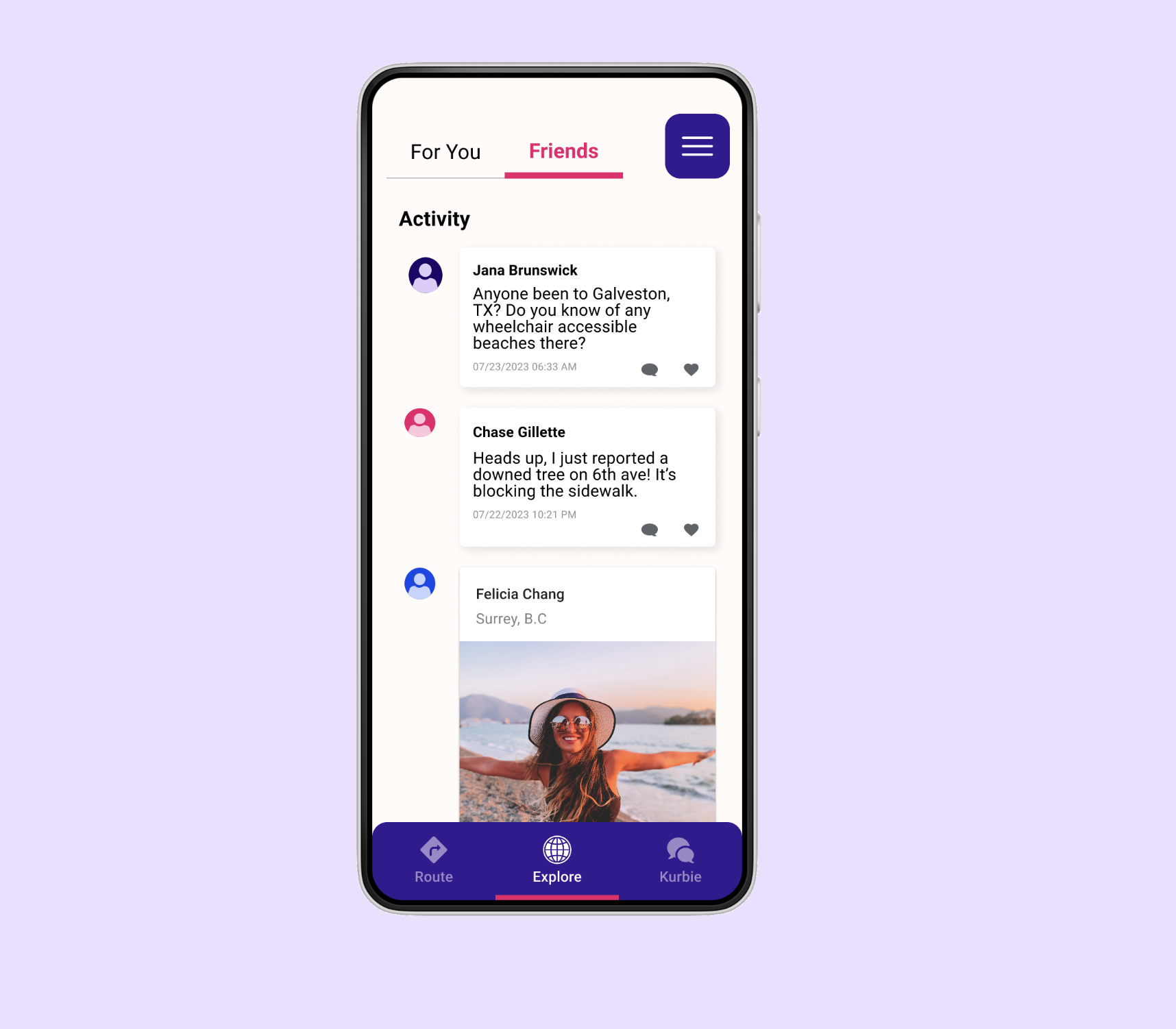
Users can explore recommended places and keep up with friends in Curb Cut's Explore tab.
Inspiration
We believe that everyone should be able to explore the world around them without barriers. We wanted to create a space for exploration, community, and accessibility that can be enjoyed by people all around the world!
What it does
Users can find ideal routes for traveling that avoid accessibility barriers such as potholes, blocked sidewalks, and steep grades. Our map also displays accessible parking for users with data on curb ramps, number of spaces, dimensions of spaces, signage for accessibility, safe pathways, and overall review from crowdsourcing. Within the app users will be able to connect and chat with other users in the area! Users can report on the route experience. At the end of their route, they are able to answer Survey123 questions about barriers, enjoyability, whether they recommend it to other users, and accessibility barriers that are new or have been overlooked.
This App is connected to a backend server that retrieves reddit data but can be further improved to store user profile, chatbot, and social feed with more time. This server also contains a ChatGPT chatbot that has been fine-tuned on Reddit threads related to wheelchairs. However we have not integrated this with the UI yet.
How we built it
We build this using maps SDK for Kotlin, Android studio, figma, ArcGIS online, living atlas, 123 Survey, storymaps, & dashboards, Python Flask Server, PRAW (reddit API),
Implemented but not integrated: LangChain, OpenAI
Challenges we ran into
We ran into some coding challenges with implementing navigation with a lack of data which ended up pushing us in a different direction. Also had challenges learning Kotlin and developing on the Android Studio platform. On top of that, we had some trouble navigating through the Kotlin Documentation of ArcGIS to generate Walking Route instead of Automobiles. We also faced issues correctly rendering maps from AGOL with ArcGIS SDK for Kotlin.
Accomplishments that we're proud of
We are really proud of using applications like Figma for the first time and trying to navigate ArcGIS online with no geographer .
Technical Achievement
- Implementation of a working python server to retrieve reddit data.
- Functioning Android Kotlin App with ArcGIS SDK navigation
- User input geographic barrier avoidance in ArcGIS navigation
What we learned
We learned how to adapt to changes when things did not go the way we wanted, rolling with the punches and finding new ways to attain our goal.
What's next for curb cut
We want to improve routing capabilities by taking feature layers and converting their data into barrier points, to use alongside our crowdsourced info.
Technical Future Development
- Integrate OpenAI chat bot into UI and connect to backend
Built With
- 123survey
- android-studio
- dashboard
- esri
- figma
- sdk
- storymaps


Log in or sign up for Devpost to join the conversation.