-
-

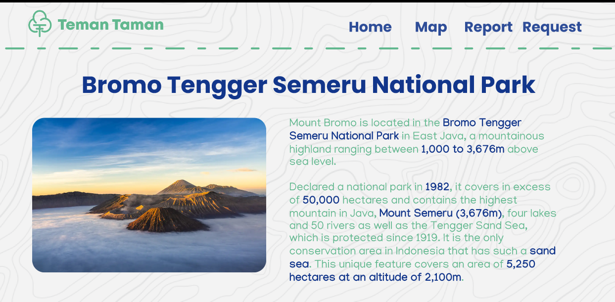
National Park Description page
-
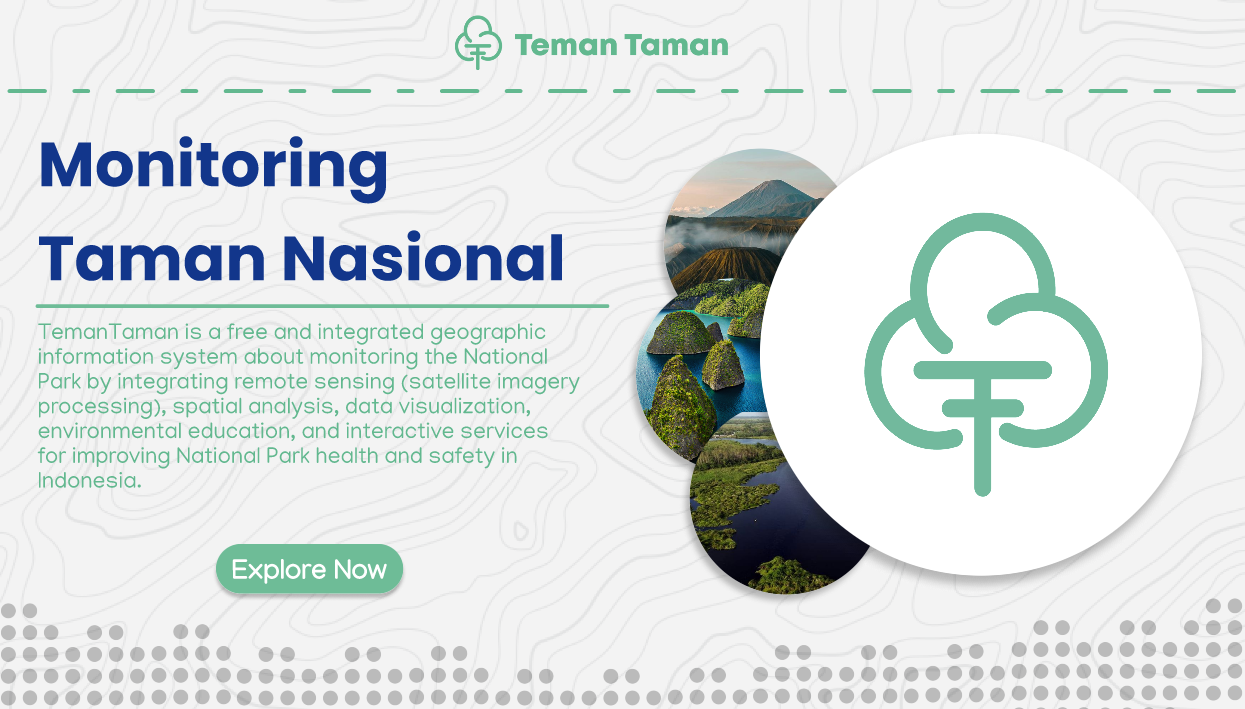
Home Page
-

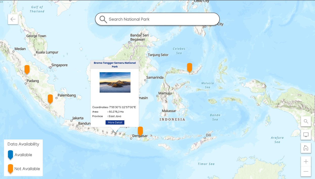
Map Page
-
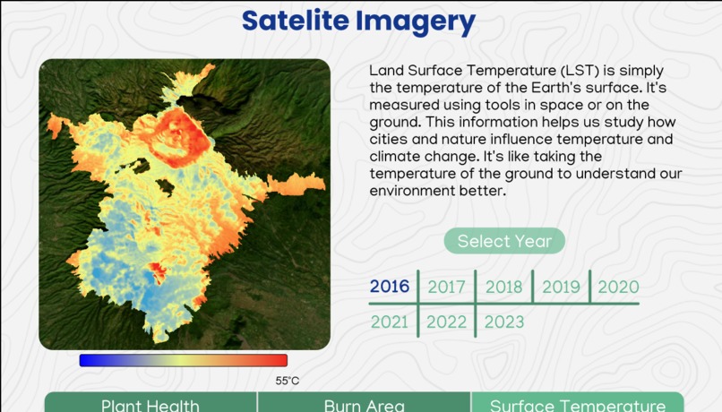
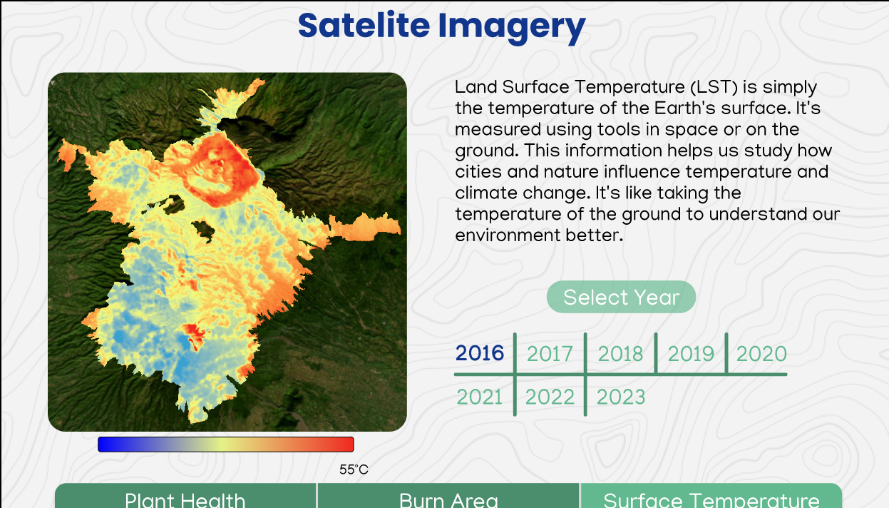
Satellite Imagery Page
-
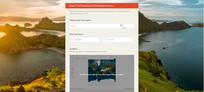
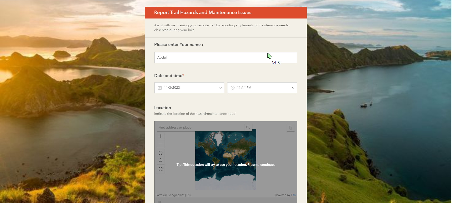
Report Page
-

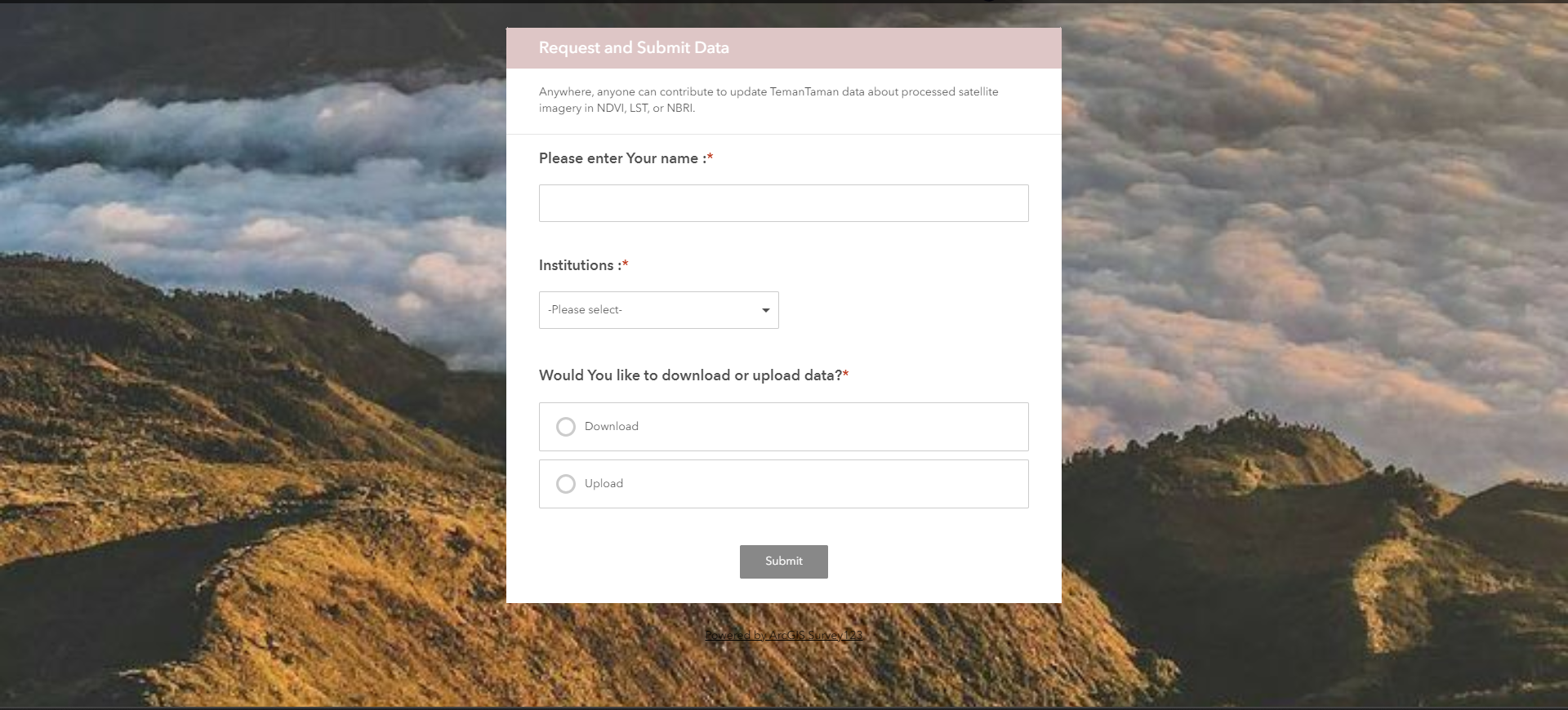
Request Page
Inspiration
To protect the biodiversity and ecosystems of Indonesia, which is one of the most biologically diverse countries in the world, with more than 17,000 islands, 10% of the world’s flowering plants, 12% of the world’s mammals, 16% of the world’s reptiles and amphibians, and 17% of the world’s bird species .
What it does
TemanTaman is a free and integrated geographic information system about monitoring the National Park by integrating remote sensing (satellite imagery processing), spatial analysis, data visualization, environmental education, and interactive services for improving National Park health and safety in Indonesia.
How we built it
TemanTaman must be supported by ESRI Product, because it provide the most suitable tools and environment. Here we used ArcGIS Pro for processing satellite imagery in several band ombination such as NDVI and LST. ArcGIS Survey 123 for creating spatial data form to report national park inconvenienceand destruction that had been noticed by society and institutions. For visualizing the data and distribution about reporting cases, we plan to choose ArcGIS Dashboard.
Challenges we ran into
We ran into some challenges, for example because we are using remote sensing that are using satellite imagery Some of the imagery have a cloud cover over the national park that we want to process, so we have to filter and select imagery that have a little to nothing cloud cover.
Accomplishments that we're proud of
We are so proud because we have made a prototype for the app using one case of national park in Indonesia which is Bromo Tengger Semeru National Park, and we have shown the effect of Bromo national park’s forest fire through 3 parameters of NDVI,LST, and NBRI.
What we learned
After analyzing 3 parameters of multitempotal data of NDVI,LST, and NBRI from Bromo Tengger Semeru National Park. We learned that those 3 parameters can be used for monitoring the health and condition of National Park. because in Bromo Tengger Semeru National park those 3 parameters are used for identifying burn area from forest fire, detect the area that are burning through Land Surface Temperature (LST), and mitigates the effect with analyzing the severity of the burning using NBRI (Normalized Burning Ratio Index). Also with NDVI (Normalized Difference Vegetation Index) we know the density of vegetation that are in the national park.
What's next for TemanTaman : Monitoring System for Indonesia's National Park
We want to applies our system and app to all of the national parks in Indonesia, to make a free and integrated app that can provide data for every people to see and monitor the health and condition of every national park in Indonesia. We want to collaborates with the government to help monitoring the health and condition of every National parks, and suppress the number of forest fire that are happening in Indonesia.


Log in or sign up for Devpost to join the conversation.