-
-
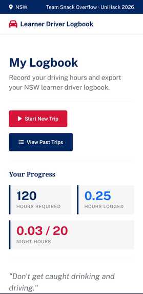
Landing Page: Displays Progress
-
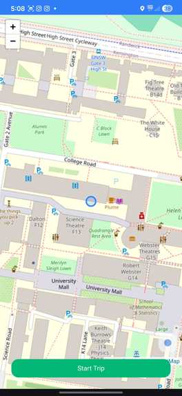
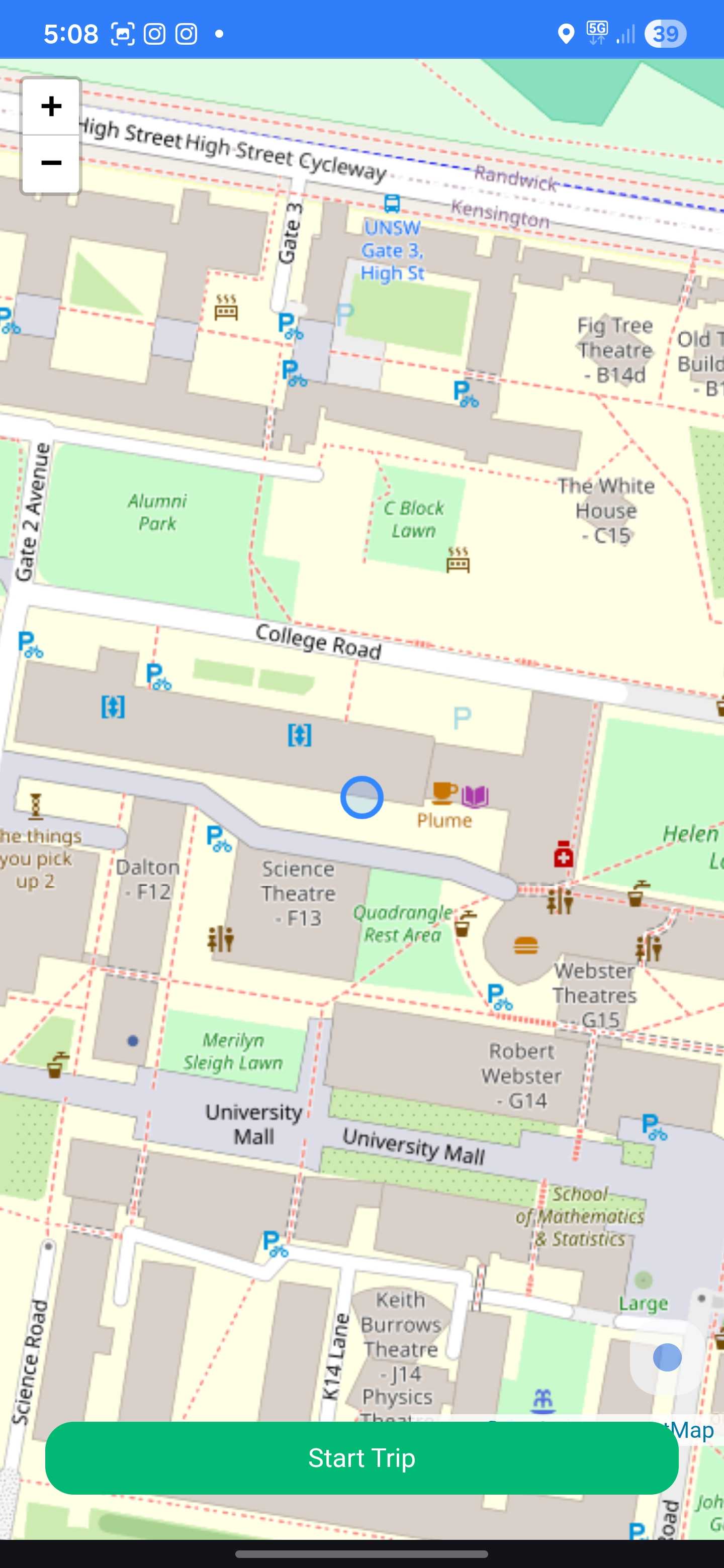
Start Trip Page: Prompts the User to start their drive
-

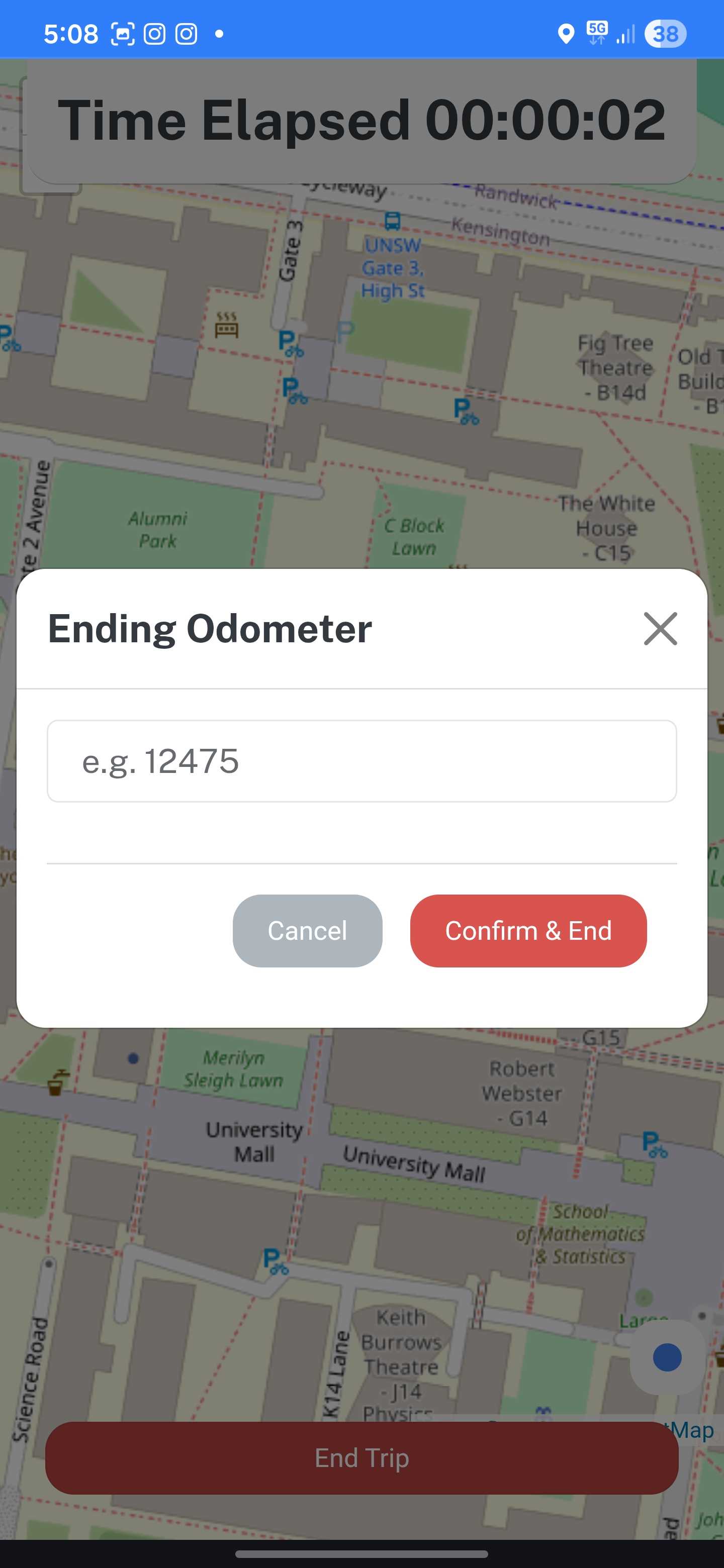
End Trip Page: Prompting User to enter their ending Odometer to finalise trip
-
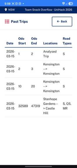
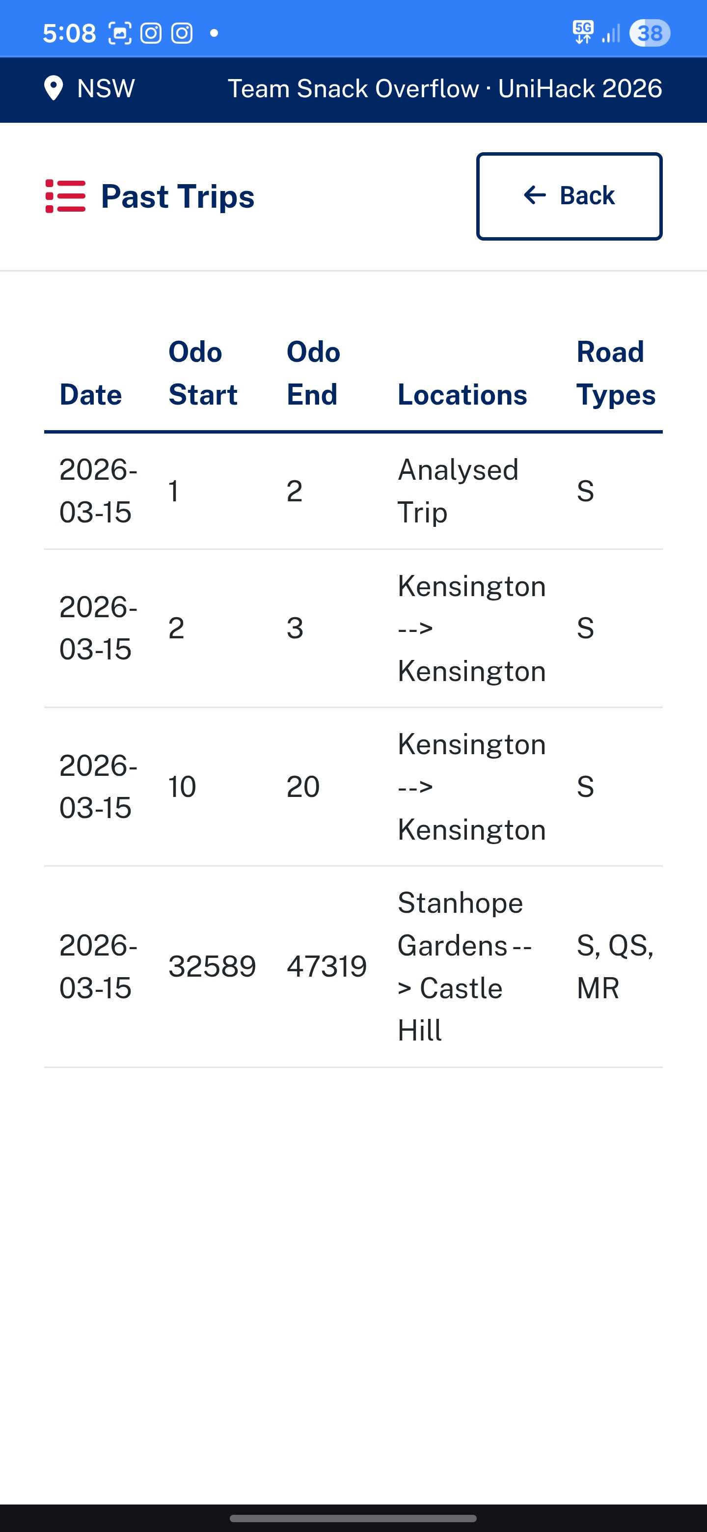
Trip History Page: Displays full range of information in regards to the trip as per the NSW Leaners Logbook

Inspiration
As NSW learner drivers, we kept losing logged hours simply because we forgot to write trips down. The official logbook requires precise details including suburbs, road types, weather conditions, odometer readings, and recalling all of that after a long drive is unrealistic. We wanted to fix that.
What it does
Our product will automatically track your location whenever you start a trip, using the data to gather information about weather, traffic, and even the type of roads you drove on. We aim to prevent the user from having any need of remembering the details about a drive. Just hop behind the wheel, press the "start" button, and don't crash! We return values in a table mirroring the official logbook table and following logbook acronyms, e.g. Sealed Road = S.
How we built it
Flask backend with SQLite, vanilla JS frontend, deployed as a PWA for mobile access without an app store. We integrated Open-Meteo for weather and sunrise/sunset data, OpenStreetMap's Overpass API for road classification, and OpenRouteService for traffic analysis
Challenges we ran into
Our team encountered an innumerable number of challenges during development, such as some team members having upcoming exams and hence having to juggle their time. We also did not have much experience with hackathons (this is our first one), so we lacked the knowledge needed to properly schedule our development.
Accomplishments that we're proud of
We are very happy with how well the map was integrated into the webapp. Additionally, all of our members were on task for the majority of the duration of unihack!
What we learned
We learned the importance of coming in to a hackathon with a solid plan and setting out a development schedule before commencing the chaos.
What's next for Team Snack Overflow
We plan to get lots of sleep and do well in university exams. 90+ WAM!!!


Log in or sign up for Devpost to join the conversation.