



🌍 Inspiration
In the Horn of Africa, the drought forecast is rarely the problem. ICPAC already produces world-class early warnings, and HUSIKA already delivers alerts to the last mile. Yet people and livestock still die in slow-onset droughts that were forecast months in advance.
Why? Because of the missing middle — the step between a forecast and action. Turning "below-average rainfall" into who exactly is at risk, what action to trigger, and why is still done manually, district by district, on spreadsheets. It doesn't scale. ICPAC itself names this the "long-pending operationalization of Impact-Based Forecasting."
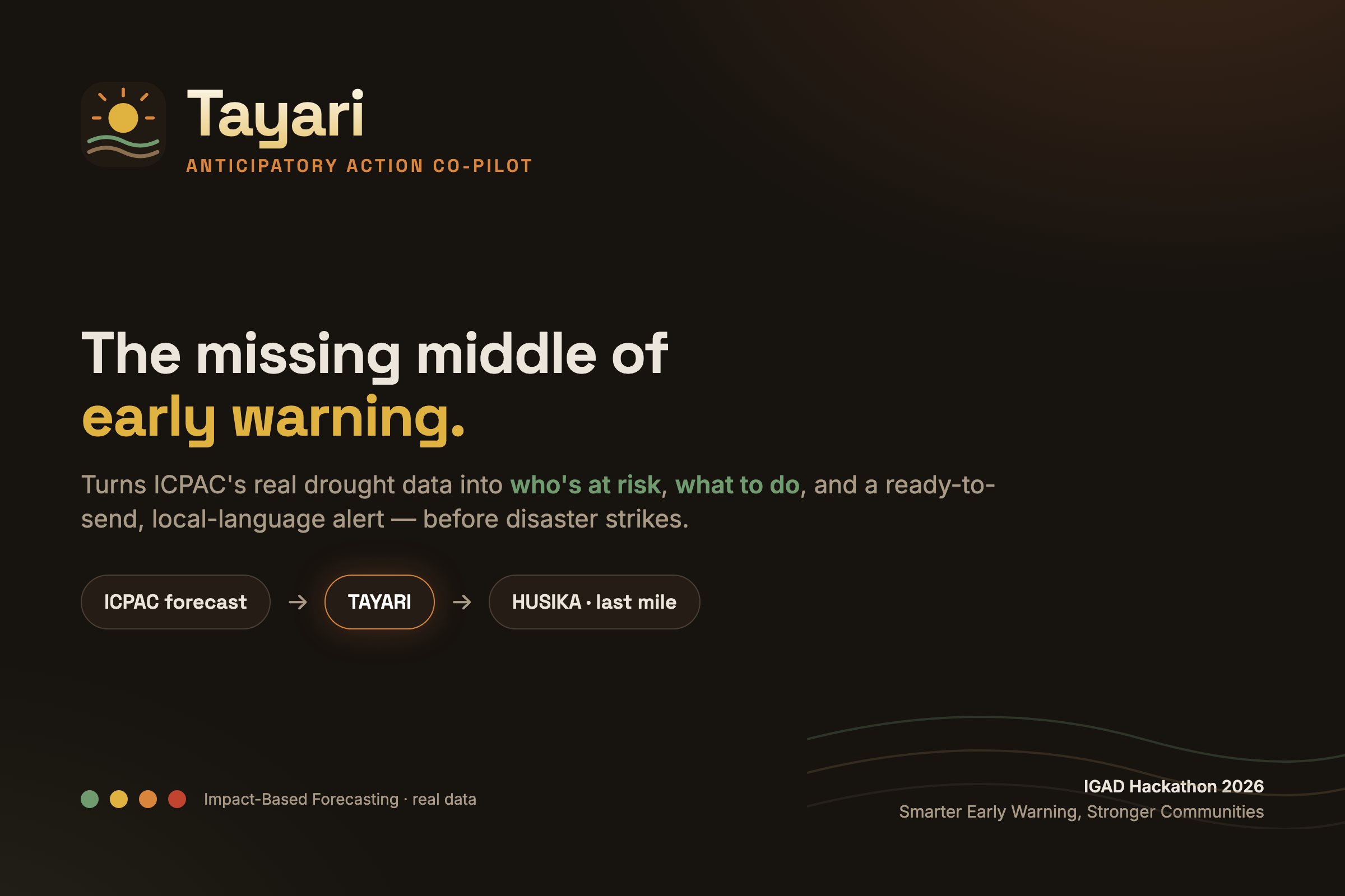
We built Tayari (Swahili for "ready") to be that missing middle.
🚀 What it does
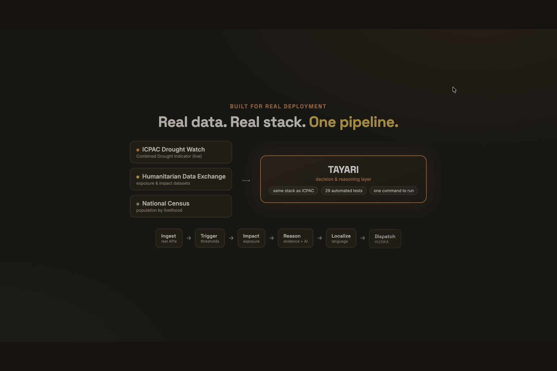
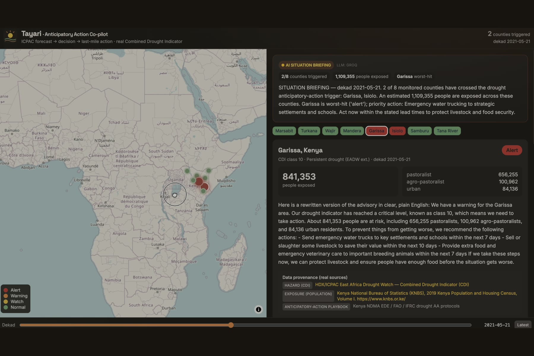
Tayari is the operational decision-and-reasoning layer between the forecast and the delivery pipe. For every district it:
- Reads real hazard data — the ICPAC East Africa Drought Watch Combined Drought Indicator.
- Detects triggers — deterministically flags districts that cross the anticipatory-action threshold.
- Estimates impact — intersects the hazard with real census exposure to count who's affected, by livelihood.
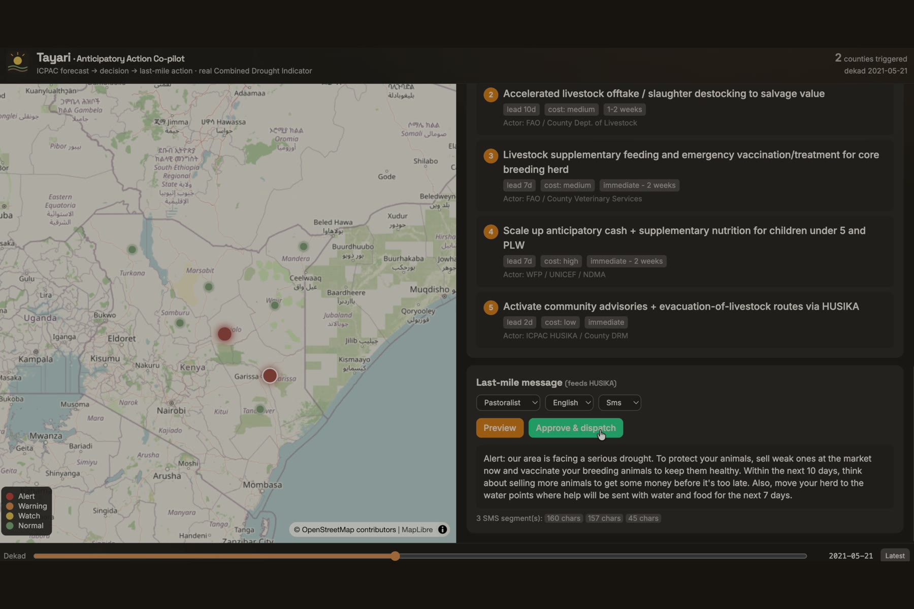
- Recommends action — a ranked anticipatory-action plan (lead time, cost, responsible actor) from Kenya NDMA / FAO / IFRC protocols, each backed by an auditable evidence chain: forecast → threshold → exposure → action.
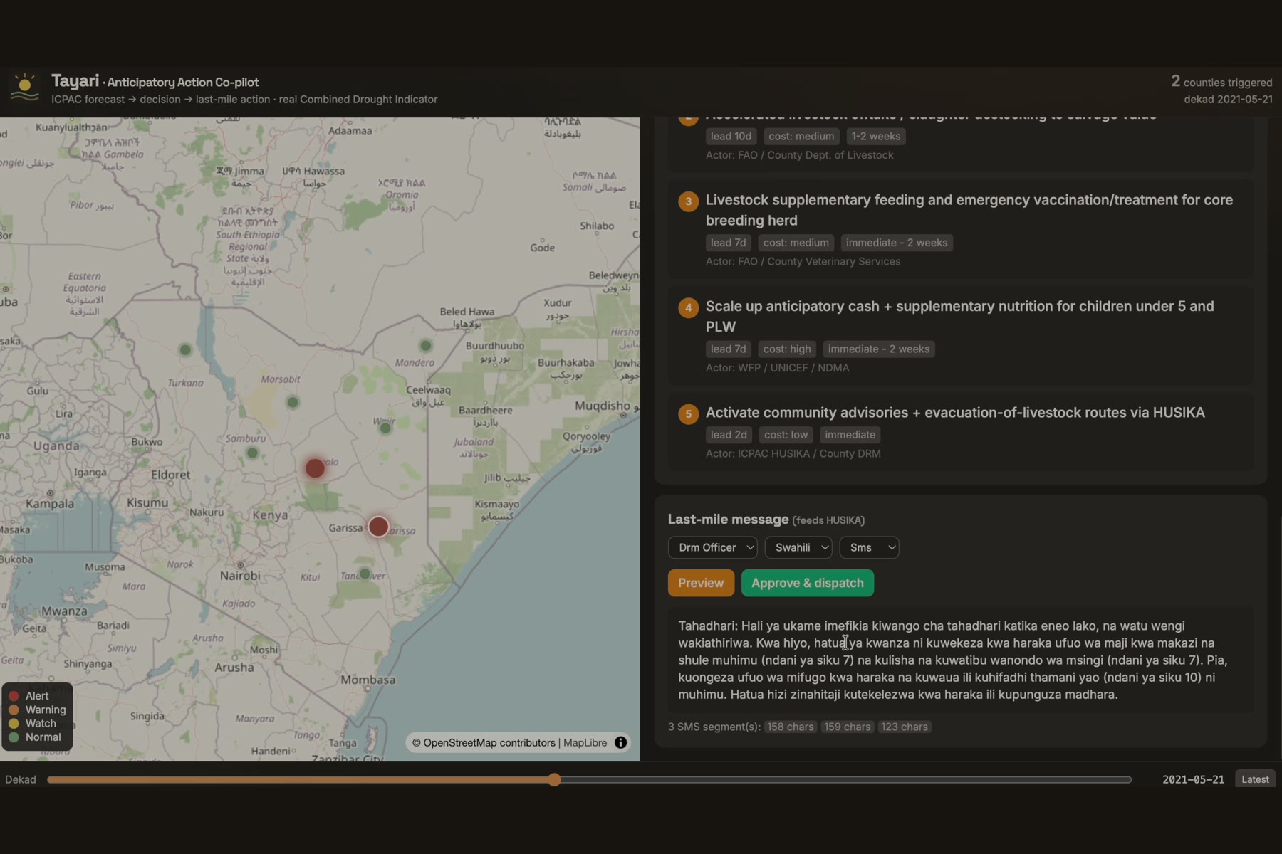
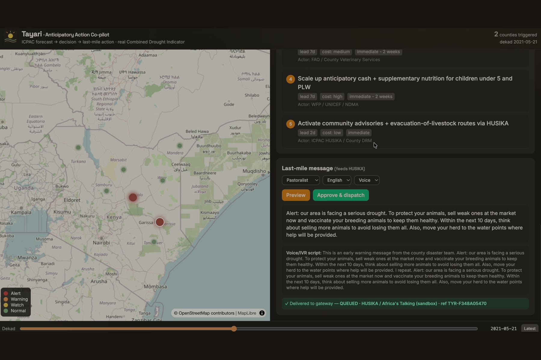
- Writes the last-mile message — one forecast becomes three audiences (pastoralist, farmer, DRM officer), in English or Swahili, as a low-literacy SMS and a voice/IVR script — then hands it to the HUSIKA gateway.
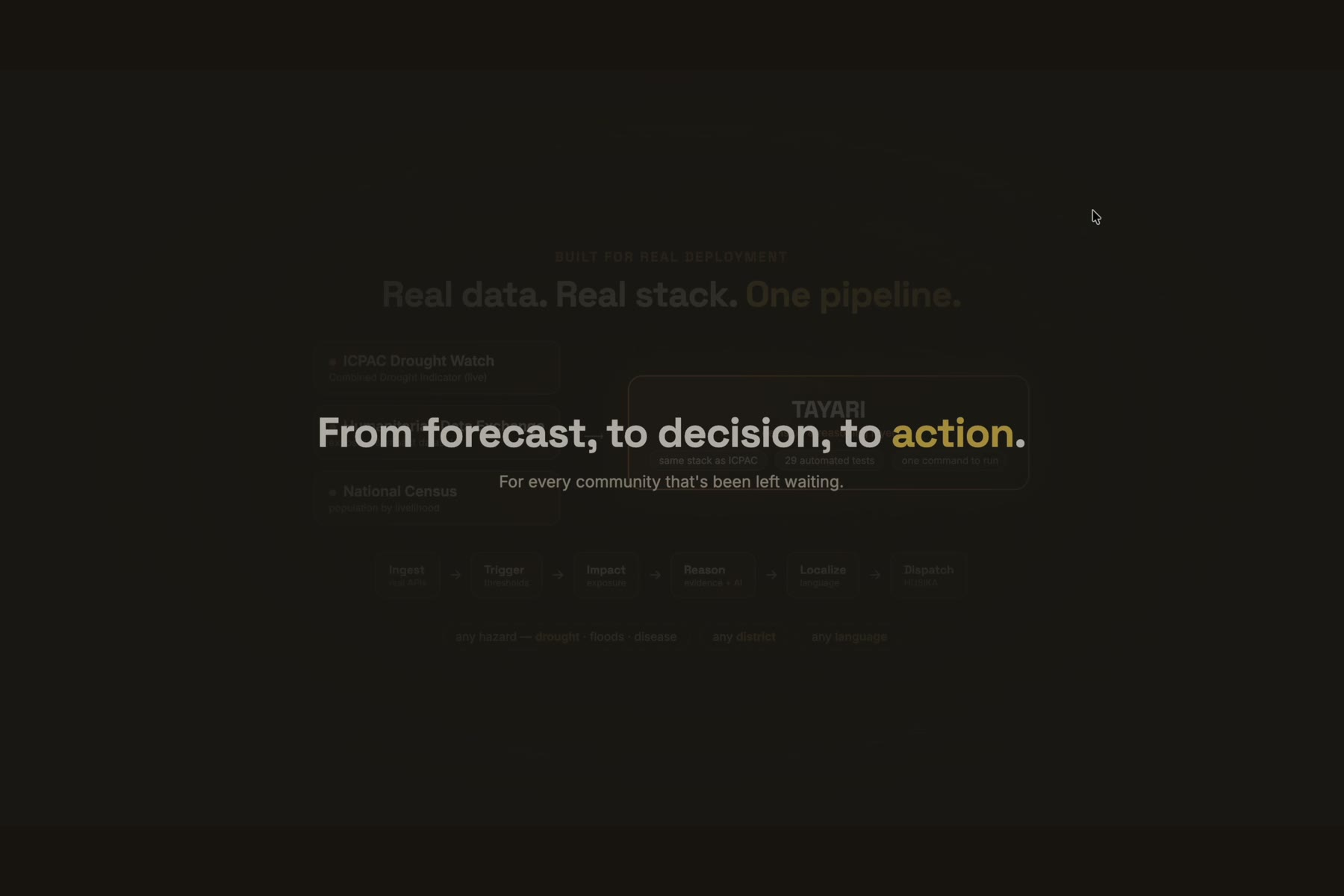
Tayari doesn't replace ICPAC's tools — it completes the stack.
🛠️ How we built it
- Backend: Python + FastAPI, PostGIS,
geopandas/shapely(hazard × exposure intersection),rasterio(sampling the real CDI GeoTIFFs) — mirroring ICPAC's own stack. - Real data connectors: HDX CKAN API (CDI rasters, census/exposure), the ICPAC STAC IBF catalog, and the GeoNode geoportal (1,096 layers). Every figure carries provenance; if a source is down we serve timestamped cache — never fabricated values.
- Reasoning: a deterministic trigger engine + anticipatory-action playbook, plus an LLM (Groq / Llama-3.3) that writes the human narrative and localized messages under a strict grounding contract — a numeric-hallucination guard rejects any number the engine didn't compute, with a deterministic template fallback.
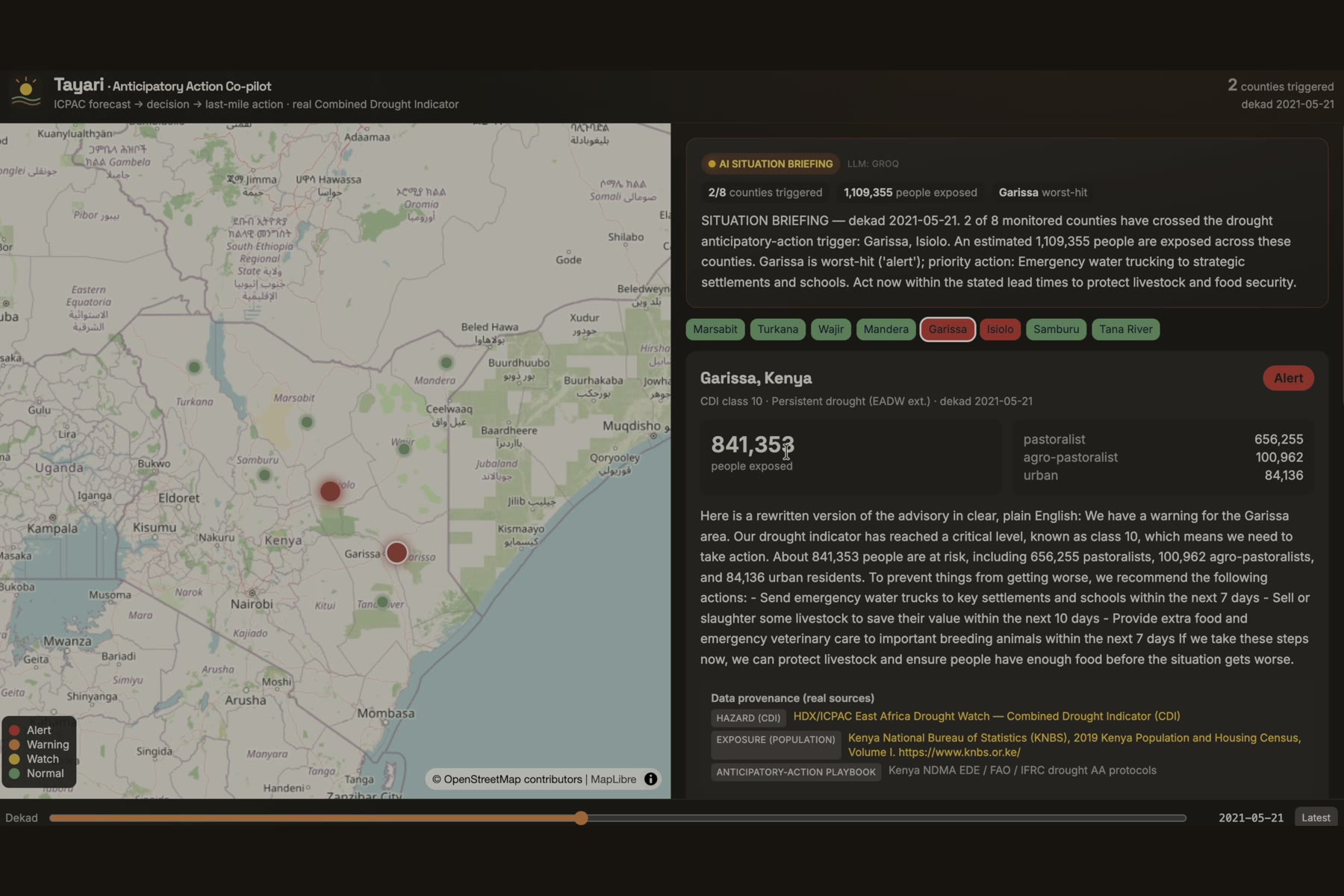
- Frontend: React + TypeScript + MapLibre, with a real-time dekad timeline, a self-writing "AI situation briefing," and a district drill-down.
- Delivery: Africa's Talking (SMS + voice), HUSIKA-compatible payload.
- Ops: one-command Docker Compose; 29 automated tests including live-endpoint integration.
🧗 Challenges we ran into
- Real data, always. We refused mock data, so we verified every ICPAC/HDX/GeoNode endpoint was live and reachable before designing around it.
- Decoding the real CDI. The rasters store discrete classes 0–9; we mapped them to the authoritative Copernicus/EDO drought-severity legend (Watch/Warning/Alert + recovery), documenting every assumption.
- Honest "real-time." The latest dekad showed no active drought — so we made the timeline default to real-time and let users scrub to the real 2021 Horn of Africa drought (4 counties in Alert, 1.88M people exposed).
- Grounding the AI. Getting genuinely useful, multilingual messages out of an LLM without letting it invent numbers required a two-tier guard (strict on population figures, relaxed on natural timeframes).
- Performance. Cold satellite rasters + eager LLM calls made it sluggish; we added caching, per-dekad locks, request debouncing, and moved the LLM off the hot path.
🏆 Accomplishments we're proud of
- A fully operational, real-data system — not a mockup — reproducible with
docker compose up. - Auditable AI: every recommendation is explainable and source-cited; the AI never fabricates a figure.
- Genuine digital inclusion: local-language, low-literacy, voice-ready messages for people on basic phones.
📚 What we learned
The last-mile gap is a reasoning and translation problem, not a forecasting one. And "using AI responsibly" in a humanitarian context means grounding it in verifiable data and keeping a human in the loop — the officer always approves before anything is dispatched.
🔭 What's next
Live HUSIKA integration for real dispatch; extend the same pipeline to floods and disease (the STAC catalog already supports flood IBF); more languages; and probabilistic/ensemble triggers from ICPAC's cGAN forecasts.
Built With
- africas-talking
- ai
- docker
- fastapi
- geonode
- geopandas
- geospatial
- groq
- hdx
- icpac
- llama-3
- maplibre
- postgis
- python
- rasterio
- react
- stac
- tailwindcss
- typescript

Log in or sign up for Devpost to join the conversation.