Inspiration
Cities are complex systems, yet many urban-planning decisions are still made using static maps, fragmented datasets, and limited ways to test the consequences of a plan before construction begins. We wanted to build something that could help planners move from reactive decision-making to predictive, data-driven planning. Our idea was to create an AI-powered system that takes zoning, population, land-use, traffic, and environmental data and turns it into an optimized urban layout that can also be visualized in 3D.
What it does
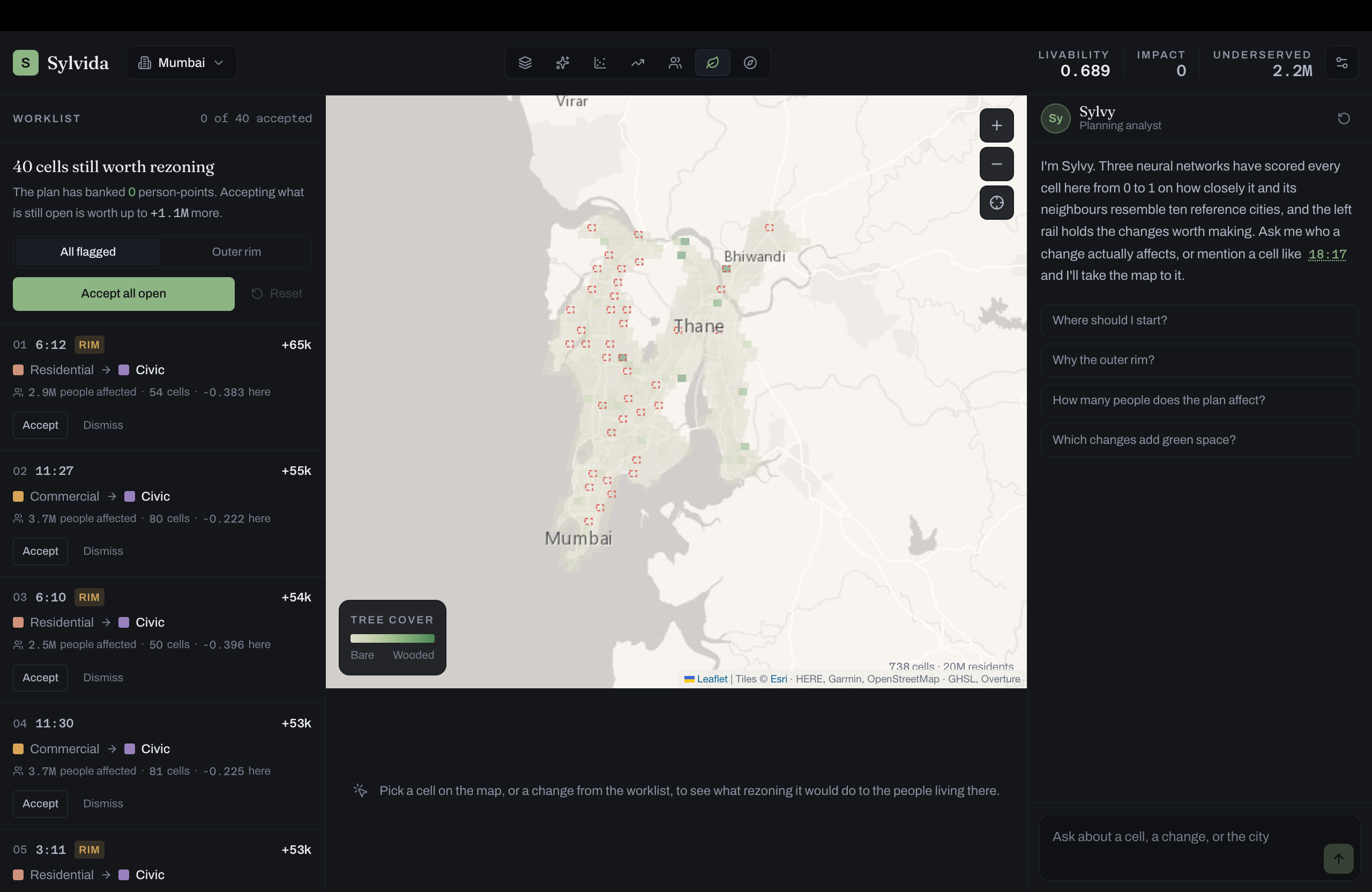
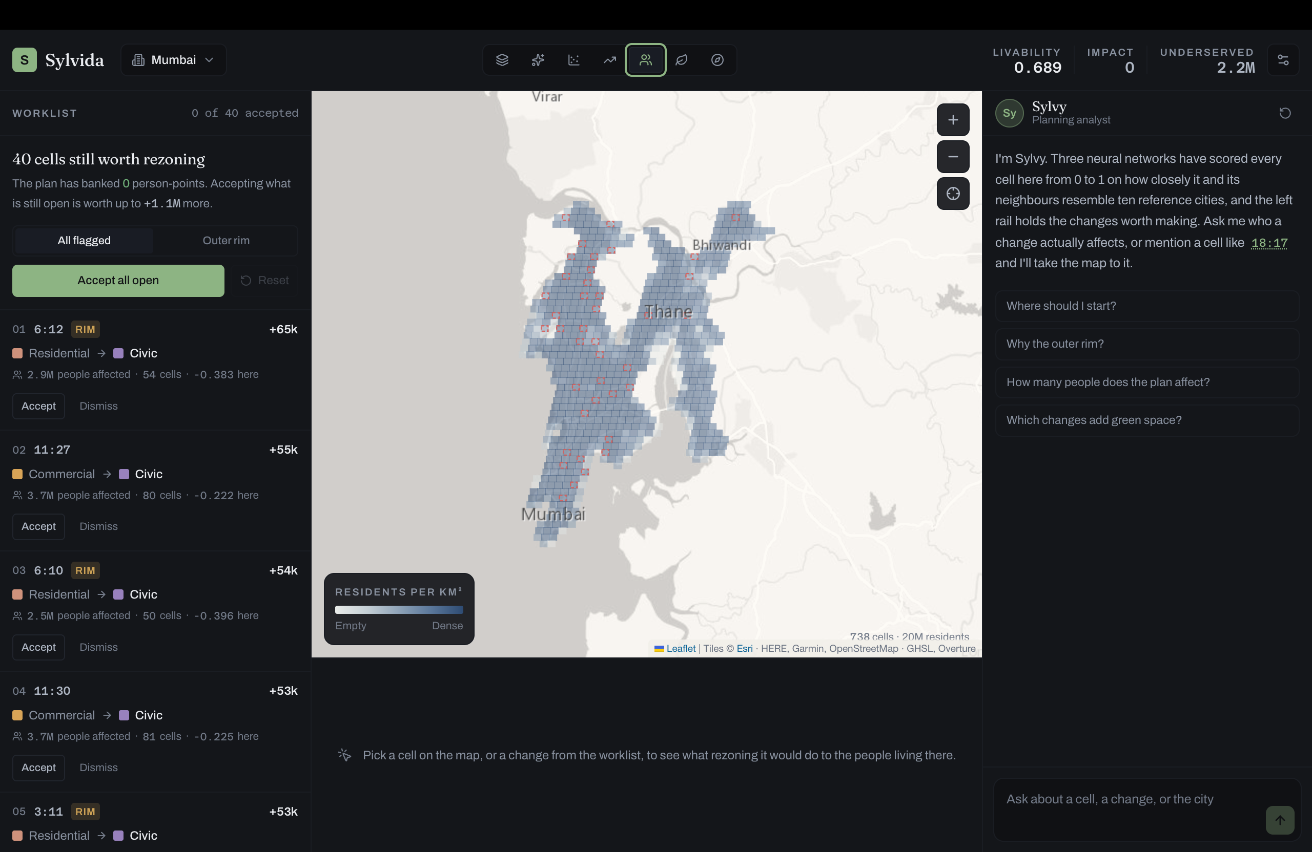
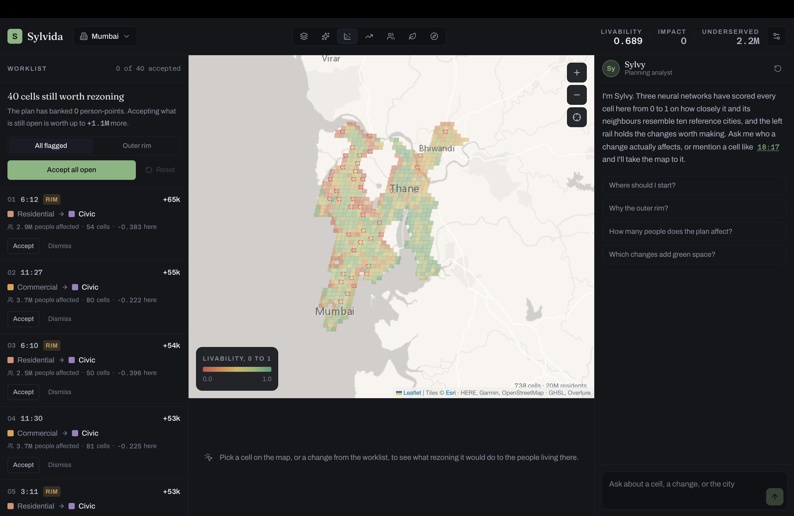
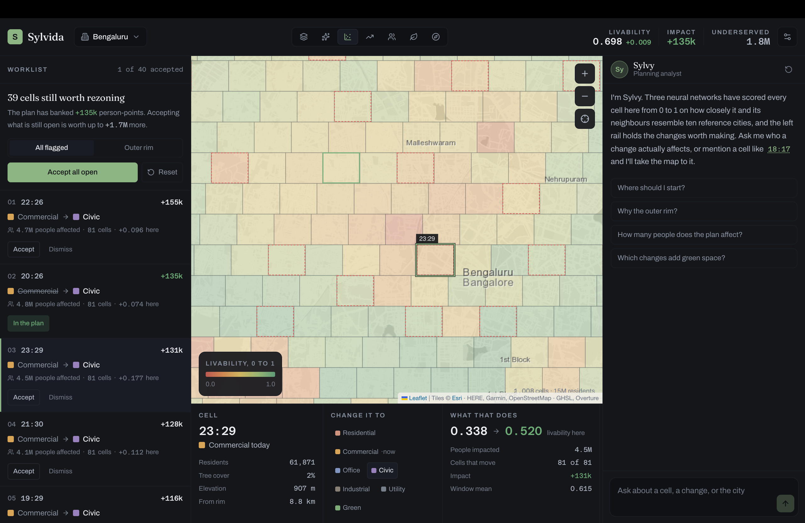
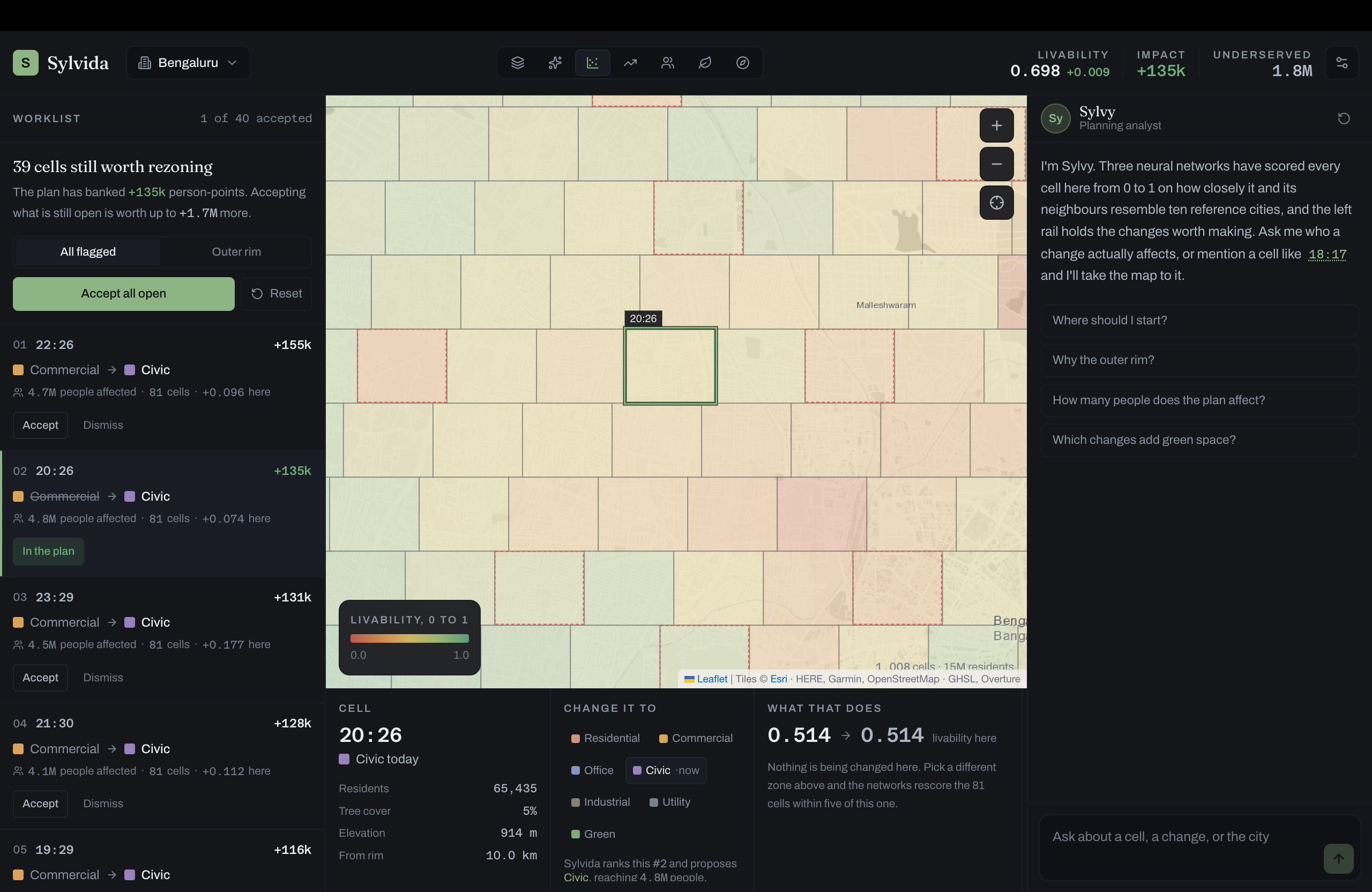
Sylvidia is an AI-assisted urban planning platform that helps planners answer three key questions: what should be built, where should it be built, and how should the city be connected? The system first uses ML-based zoning outputs to understand how different areas of the city should be used. It then performs pathway optimization to design efficient road and mobility networks while considering travel time, congestion, accessibility, construction cost, and environmental constraints. The final plan is represented in GeoJSON, allowing us to visualize roads, zones, parks, and public infrastructure on a 2D map. The same data can then be converted into GLB-based 3D city models, with optional TripoSR-generated 3D assets for selected buildings and landmarks.
How we built it
We designed the project as a modular pipeline. The zoning layer acts as the upstream intelligence, while our pathway module models the city as a graph and uses algorithms such as A* and Dijkstra for routing. We also designed the system around origin-destination demand, congestion-aware costs, accessibility, and multi-objective optimization. Our backend uses Python and represents the city in GeoJSON so that the same data can be reused across visualization, optimization, and 3D generation. For 3D visualization, polygon footprints and height data are deterministically extruded into GLB models. For detailed individual assets, such as hospitals or landmarks, we explored integrating TripoSR for image-to-3D generation. We also built the architecture so the resulting city model can connect to platforms such as Virtual City Systems for future simulation and digital-twin workflows.
Challenges we ran into
One of our biggest challenges was deciding how much of the city should be generated using AI versus deterministic geometry. Fully generative 3D models look impressive, but they can change the dimensions and geometry decided by the urban-planning algorithm. We therefore separated planning geometry from visual geometry. GeoJSON remains the authoritative representation of the city, while generative 3D tools are used only where they add visual detail. Another challenge was balancing multiple objectives at once. The shortest road is not always the best road—it may increase congestion, cross environmentally sensitive land, or reduce accessibility elsewhere. Designing a system that can account for these competing constraints was a major part of our work.
Accomplishments that we're proud of
We are proud that Sylvidia goes beyond being just another AI dashboard or chatbot. We built the foundation for a complete planning pipeline: ML zoning → pathway optimization → GeoJSON city model → 3D visualization → simulation-ready digital twin. We also created the system in a modular way, meaning future optimization methods such as ACO, genetic algorithms, or additional simulation engines can be added without rewriting the entire platform. Most importantly, the same city data can move from algorithmic planning to 2D visualization and then to a 3D environment.
What we learned
We learned that urban planning is fundamentally a multi-objective problem. Optimizing only for shortest distance or traffic flow can easily create poor outcomes elsewhere. We also learned the importance of keeping AI outputs explainable and grounded in structured data. Instead of letting a generative model invent a city, we use AI where it is useful while keeping critical geometry and planning decisions deterministic. On the technical side, we learned how graph optimization, geospatial data, GeoJSON, 3D formats, and AI-generated assets can work together in a single urban-planning pipeline.
What's next for Sylvidia
Our next step is to turn Sylvidia into a closed-loop urban simulation system. We want to connect the generated 3D city to simulation tools that can evaluate factors such as traffic, urban heat, wind, accessibility, and environmental impact. Those simulation results could then be fed back into the optimizer so the system can automatically improve its proposed plan. We also plan to add more advanced optimization methods such as Ant Colony Optimization and Genetic Algorithms, real GIS datasets, stronger demand prediction, and additional 3D-generation providers. The long-term vision is simple: plan, simulate, evaluate, and improve a city before it is built.
Built With
- css
- cypher
- dockerfile
- python
- shell
- typescript

Log in or sign up for Devpost to join the conversation.