Inspiration
I am usually short on time for planning my next hike or trail run. I always leave it until the very end. It is hard to Google "ChatGPT" and get routes from AllTrails or Wikiloc. They are unverified, and more than once I have been on closed hikes or dangerous segments. Also, I think we need to be able to co-create with agents.
Planning a hike is not really a question with a single text answer. It is a shared, spatial decision: where to start, whether a route genuinely closes as a loop, how far it is, what the ascent looks like, and what the current planning context is.
I built Switchback around a simple idea: ask for a loop, then see the ground truth. Rather than having an agent recommend a walk somewhere in a random place, a person and an agent work on the same Collserola–Vallvidrera map and can inspect the same route, evidence, and limitations.
What it does
Switchback is a WebMCP-native trail planner for short, car- or public transport-accessible walks around Collserola in Barcelona, Spain. It is the closest national park to the town.
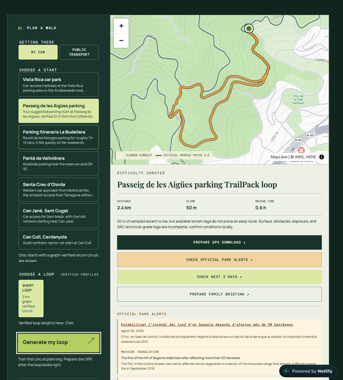
A person can ask for a family loop, a specific distance, or an evening option in natural language. The agent discovers the WebMCP tools, selects from graph-verified circuit options, validates a route before changing the map, and renders the result directly in the shared interface.
The result stays inspectable:
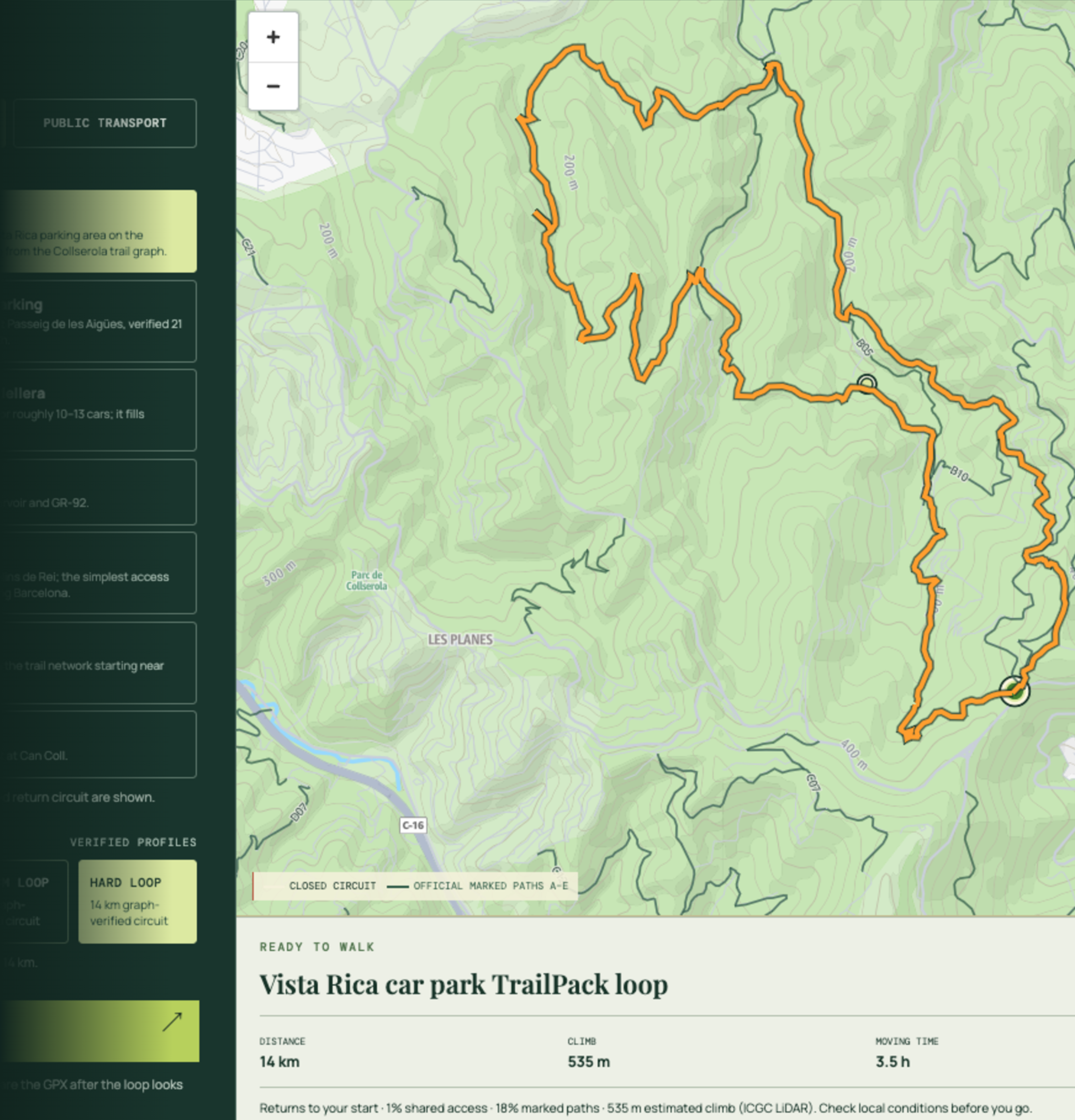
- A closed circuit is drawn on the map.
- The route card shows measured distance and sampled ascent.
- Forecast, daylight, and official Park notices appear as clearly labeled planning context.
- Every agent action is visible in a shared worklog and trail ledger.
- The agent can prepare a briefing or GPX trace, but the person remains in control: they review/copy the briefing and manually click Download GPX.
How I built it
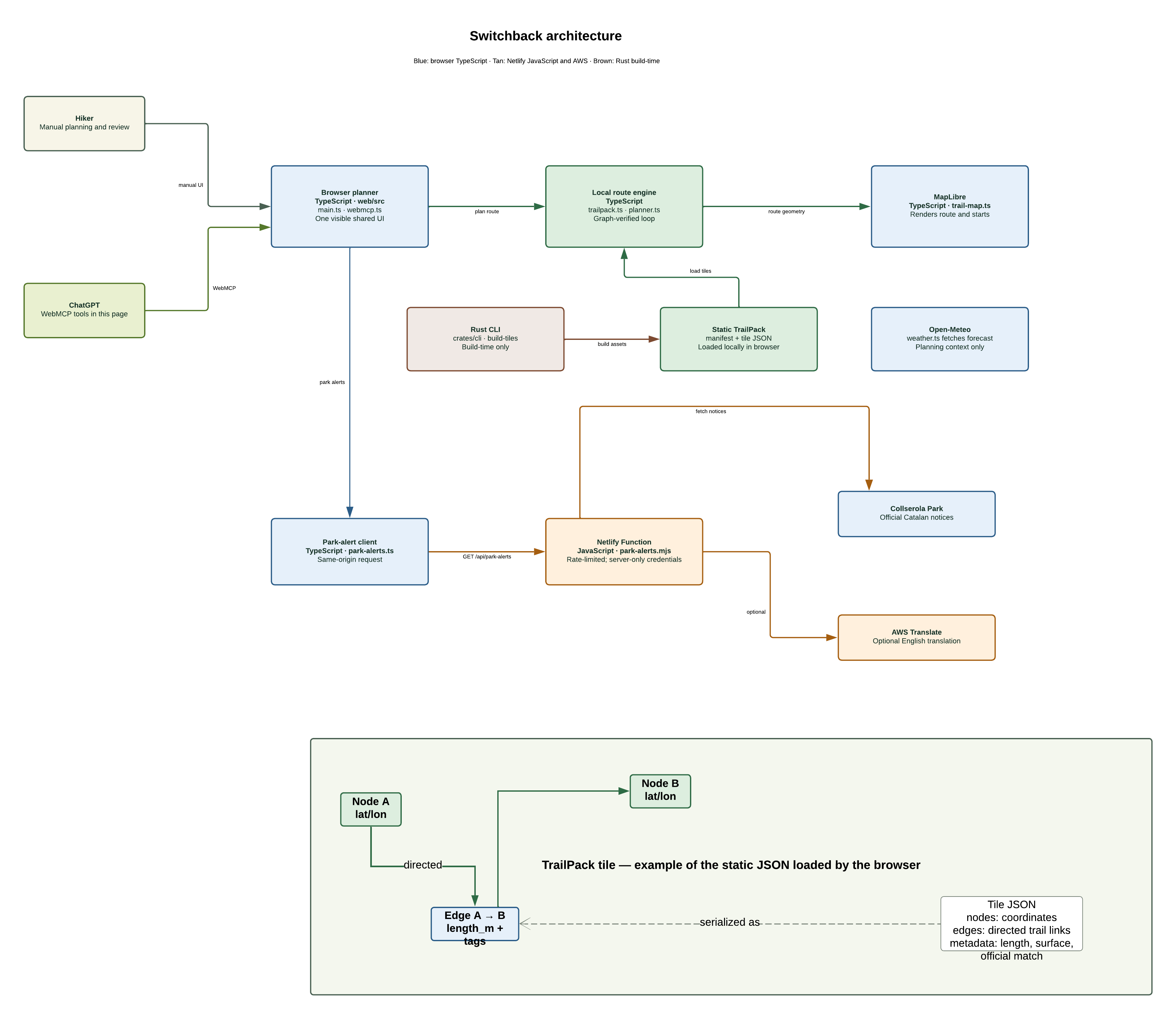
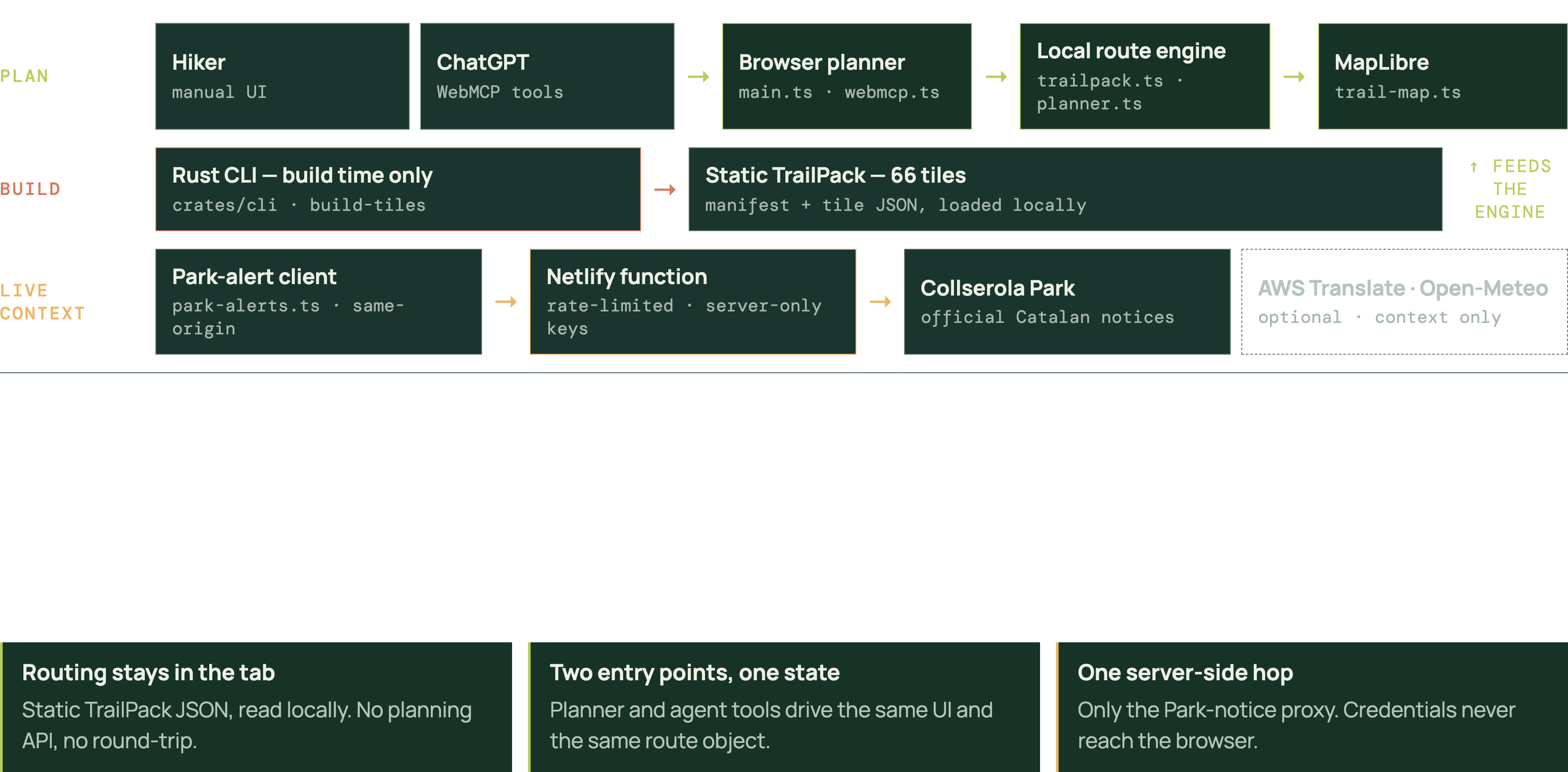
Switchback is a static TypeScript app hosted on Netlify. It registers fourteen page-bound WebMCP tools through the browser’s model context, with strict JSON schemas and the same planner functions used by the manual UI.
Routing happens locally in the browser over a 66-tile directed Collserola TrailPack assembled from OpenStreetMap data and the Park’s published public-use network. The planner only offers routes that the available graph can close without a long retraced leg. I have used the official PDF and the park's website.
I added route-aware forecast/daylight context via Open-Meteo and official Park-alert context through a same-origin adapter. Original Catalan notices remain visible; English is clearly labeled as machine translation. I used the AWS Translate service and Amazon Location services for the translations and maps.
Challenges I ran into
The hardest problem was avoiding an impressive-looking but untrustworthy route suggestion. A distance target alone does not prove that a loop closes, and a forecast does not prove that a hike is safe.
That led to a few important product constraints:
- Routes are graph-validated before they render.
- Short, Medium, and Long are distance profiles, not difficulty labels.
- Difficulty is only described conservatively when the available ascent and terrain data support it.
- Forecasts and Park notices are planning signals, never a safety clearance.
- The agent cannot auto-download GPX files, send messages, or access external accounts.
What I learned
WebMCP is most compelling when the agent is not treated as a chat layer bolted onto an app Sometimes, it was hard for ChatGPT to use the tools because the agent's skill was not working correctly. I even fixed my local installation of ChatGPT with Codex.
Built With
- amazon-web-services
- netlify
- node.js
- typescript
- vite


Log in or sign up for Devpost to join the conversation.