-
-
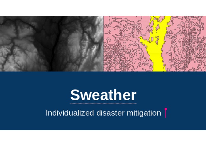
Sweather
-
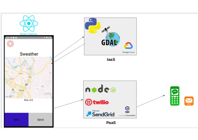
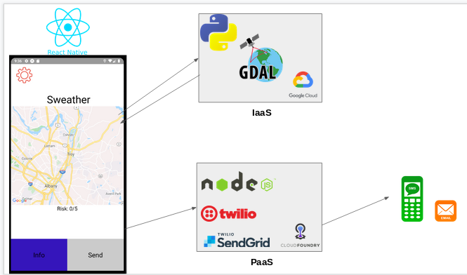
Frontend and Backend Ilustration
-
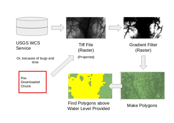
Basic flow of the backend system (run on google cloud)
-

Screenshot of contour line finding (before automation)


Inspiration
At this Hackathon, we were given the task to create an idea that helps first responders and/or civilians tackle the problems around the identification of disasters and mitigating risks to build a sustainable society. Since most extreme storms result in flooding that was our main focus in trying to mitigate the risk around we came up with Sweather to help everyone stay safe while the storm passes. Inspiration also came from the fact that the only system in place like this is the government's flash flood warnings which are loosely based on a persons location and provides minimal information to the recipient.
What it does
It provides users with information to be safe from flooding during extreme storms by telling them where the nearest safe elevations are to escape the storm.
How we built it
Front End: We used React Native to provide the user with a seamless experience.
Back End: IBM Cloudforge - To host the Twilio and Sendgrid Backends GDAL - Geospatial Data Abstraction Library QGIS - Quantum Geographic Information System(not related to physics) Twilio - To send text messages to the User's contacts warning to other's about the flood or storm Sendgrid - To send emails to the User's contacts warning to other's about the flood or storm Google Cloud - To host the GDAL backend
Challenges we ran into
Some challenges we ran into were keeping a running list of contacts with a delete function in React Native. We also were unable to import data from a Web Coverage Service for geospatial data. Instead we focused on making the program work with a smaller pre-downloaded data set, at a lower resolution. We did not have enough time to also implement a weather service check to get water level. Water level is currently manually inputed.
Accomplishments that we're proud of
We are proud that we made a functioning app that can really benefit communities affected by floods by providing the civilians with the information they need to be safe.
What we learned
We developed a deeper understanding of React Native. We learned how to work with each others strengths and weaknesses in order to create a better group.
What's next for Sweather
Next is to make it so that not only the nearest safe elevation is found but rather the nearest safe elevation where there is shelter. Another feature in the future would be to send push notifications when the user may be in danger of flooding. And going that, Sweather can be used for all forms of natural disasters, we chose to primarily focus on flooding because of how regularly catastrophic floods are and yet people are more prepared for a house fire. We also wish to fix WCS data importing, so Sweather can help anywhere there is geospatial data.
Misc.
Entering for the Natural Disaster & Mitigation Category
Built With
- .xyz-domain
- cloud-foundry
- gdal
- github
- google-cloud
- google-maps
- ibmcloud
- javascript
- python
- qgis
- react-native
- redux
- sendgrid
- twilio


Log in or sign up for Devpost to join the conversation.