

In my country, Jamaica human trafficking and kidnapping is a huge problem. Every day we see on the local news different faces reported missing and a majority of these faces are never seen again. This is a problem which deeply concerns us as a country.

We believed that we needed a solution help this issue. We wanted something that could act as a tool to help in the form of education, as the best way to prevent kidnapping and human trafficking is awareness. Personally how we feel is if we can save even one life or prevent one person from being a victim to such a horrible fate then it would all be worth it, and that is how we knew that we had to embody this goal.
What does swaze do? 📱

swaze is a mobile app currently available for Android and iOS.
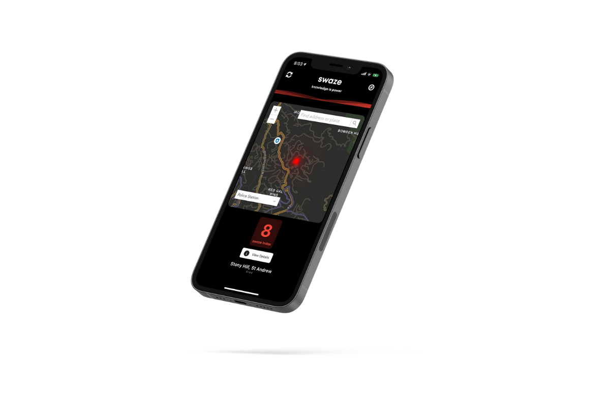
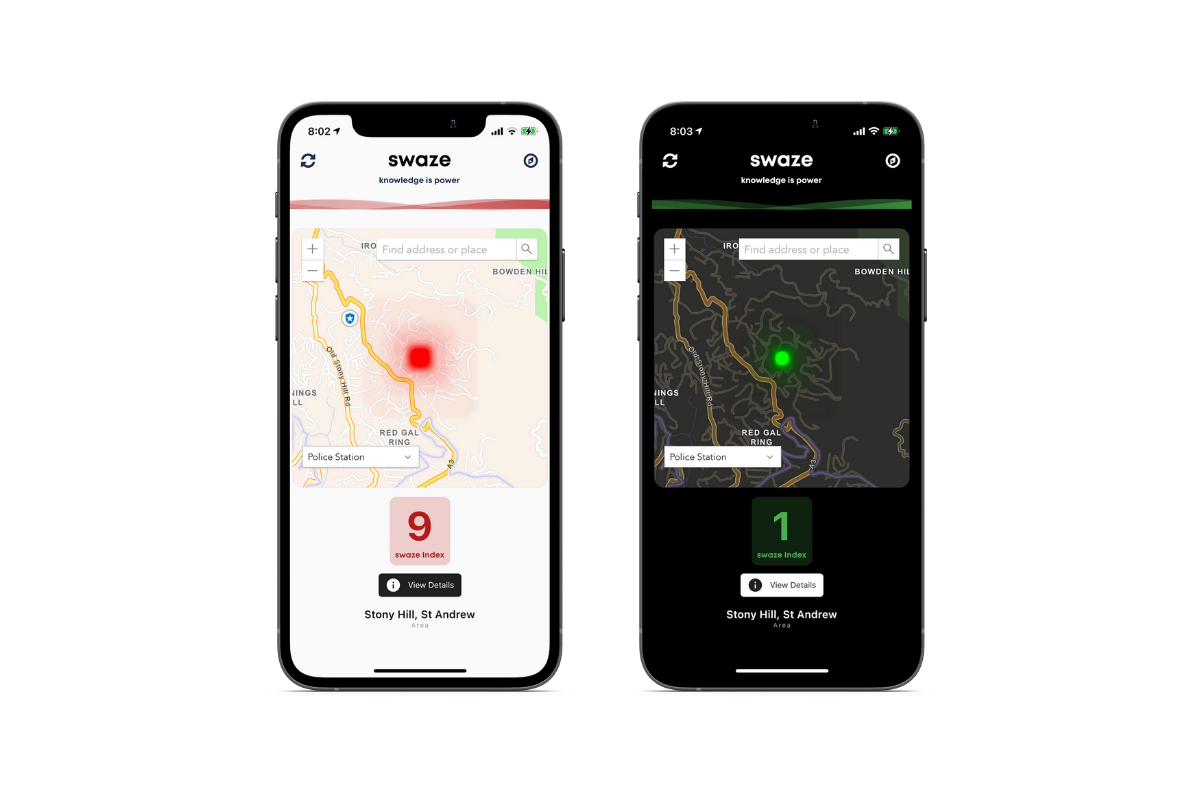
swaze gets your current location and geocodes it using the ArcGIS, that data is then used to do a search using our web scraper to get the current news on a certain location and analyse it using AWS Comprehend which will classify each article scraped as positive or negative news. This news is then used to classify how safe an area is using a rating scale from 1 to 10; with 10 being the highest risk.

Additionally you can conveniently locate the nearest places of safety such as Police Stations , Hospitals and Bus Stations in a situation where you are lost and want to find the closest point of safety to you.
Features
- Risk assessment of a location using artificial intelligence.
- Read recent news articles about a specific location.
- Locate the nearest places of safety.
- Cross platform application.
How we built it 🛠️
- The mobile app was built using the Flutter Framework.
- ArcGIS Javascript API was used for rendering the map as we were not happy with the Flutter's third party API for ArcGIS.
- AWS Lambda was used for the REST functions for ArcGIS for Geocoding and the sentiment analysis was done using AWS Comprehend.
- API Gateway was used with Lambda to allows REST capability on the cloud function.
Challenges we ran into 🤬
- We had some difficulties coming up with ideas under #16 of the SDGS.
- The communicating between the Javascript code and Flutter efficiently as the Flutter's third party ArcGIS API was limiting.
- Finding the fastest and most accurate way to complete the sentiment analysis of the news articles returned from our webscraper.
What we learned ✏️
As a developer personally, I made the mistake of getting caught up of the excitement of the commercial world and building applications for monetary gain. This hackathon taught me that making a change has a nice flavour to it and personally I would love seeing my software make a change and help keep women and children all around the world safe
What's next for swaze? ⭐
What's next is a closed beta testing stage where I would target Jamaica while improving the algorithm and model for generating a more accurate swaze index.


Log in or sign up for Devpost to join the conversation.