Inspiration
GPS jamming and spoofing are growing global threats that disrupt aviation, emergency response, and other critical infrastructure. Despite their impact, these events often go unnoticed until after harm occurs. We were inspired to build a tool that brings transparency and accountability to GNSS interference, leveraging open aircraft data and geospatial visualization to help protect global navigation systems and promote safer, more resilient skies.
What it does
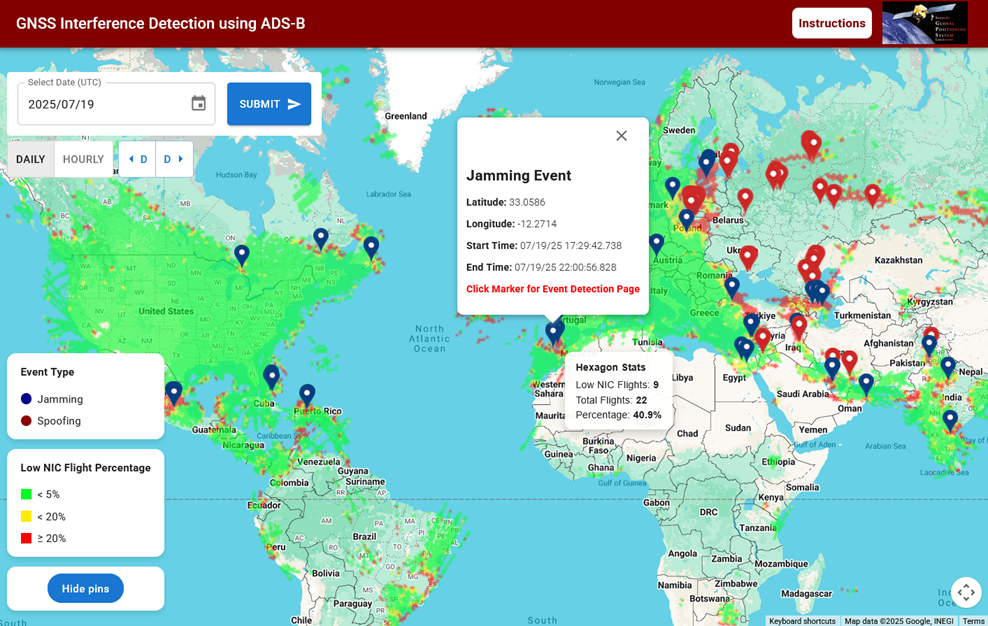
SURFI is an automated global monitoring tool that detects and maps GPS jamming and spoofing using ADS-B aircraft data. It displays daily results on an interactive map powered by Google Maps.
How we built it
We process ADS-B data with MATLAB to detect anomalies, localize events, and generate GeoJSON files. A React frontend uses Google Maps API to visualize results. Hosted on Synology NAS.
Challenges we ran into
Handling noisy data, optimizing map performance for large datasets, and ensuring both technical accuracy and public readability.
Accomplishments that we're proud of
- Built the first interactive and global map of GNSS interference events with detailed event information using real aircraft data.
- Localized real-world jamming events to within a few kilometers of known sources.
- Enabled 24/7 autonomous monitoring of airspace interference patterns using open data and open access tools.
- Promoted aviation safety and system transparency through geospatial visualization.
What we learned
We learned how to extract meaningful insights from noisy ADS-B data, optimize geospatial visualizations for performance, and use Google Maps to design a user-friendly interface that clearly communicates technical results.
What's next for SURFI
Next steps include real-time alerting, a public API for querying events, and expanding to maritime GNSS interference via AIS data.
Log in or sign up for Devpost to join the conversation.