-
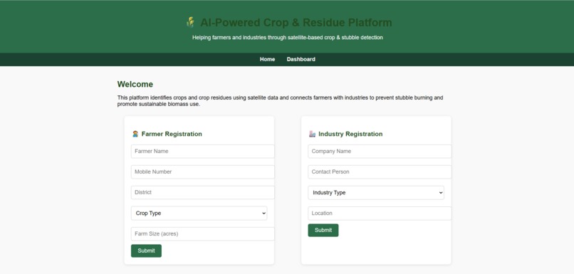
INITIAL INTERFACE
-
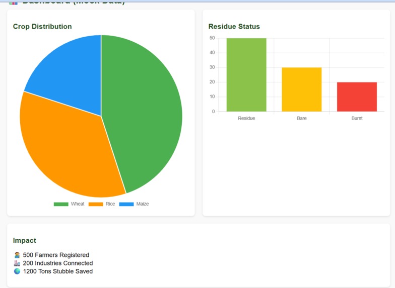
DASHBOARD
-
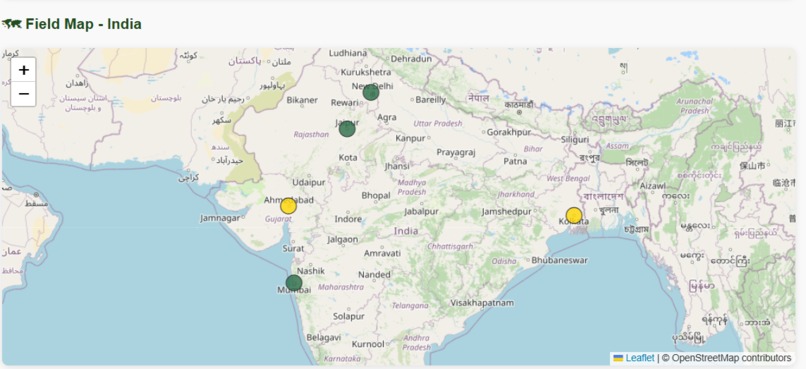
STUBBLE MAP FOR INDIA


Inspiration
Crop identification using satellite observations is an age-old challenge in India. Unlike large, uniform farms in the US or Europe, India’s smallholder farms are highly fragmented and diverse, making it harder for models to generalize.
At the same time, over 35 million tons of crop residue are burnt annually in Northern India, causing up to 40% of Delhi’s winter air pollution.
What if instead of burning stubble, we could connect farmers with industries that need biomass as raw material?
What it does
This project combines crop classification and residue detection into one pipeline, creating value for policymakers, industries, and farmers.
How we built it
Crop Identification: -Used Sentinel-1 SAR, Sentinel-2 optical, and ResourceSAT-2/2A imagery. -Fine-tuned ML models (LightGBM, Random Forest) with the AgriFieldNet India dataset. -Validated results with district-wise cross-validation to ensure generalization across states like UP, Rajasthan, Bihar, and Odisha.
Residue Detection: -Applied vegetation and residue indices (NDVI, NDTI, BSI, NDSVI) and SAR backscatter change to distinguish unburnt residue, bare soil, and burnt areas. -Estimated biomass availability using Residue-to-Product Ratios (RPR).
Integration & Redistribution: -Created district-level crop and residue maps in CSV/GeoJSON. -Designed a mock digital marketplace where farmers can list stubble and industries (biofuels, paper, packaging) can procure it—turning waste into value.
Challenges we ran into
-Handling cloud cover and noisy SAR backscatter. -Differentiating bare soil vs residues vs burnt fields. -Adapting models to India’s fragmented, diverse farming practices. -Building a scalable farmer–industry linkage for biomass redistribution.
Accomplishments that we're proud of
-Built a mock website to demonstrate farmer–industry linkage for stubble redistribution. -Designed the pipeline for crop classification and residue detection using Sentinel-1/2 data. -Ran baseline experiments with ML models (e.g., Random Forest, LightGBM) for crop identification. -Took the first step towards combining crop monitoring and residue management in one framework.
What we learned
-How to process and fuse SAR + multispectral satellite imagery. -Designing indices-based methods (NDVI, NDTI, BSI) for residue vs soil vs burnt detection. -The importance of data generalization for India’s fragmented farms. -That combining a technical pipeline with a digital platform creates a more impactful solution.
What's next for AgriLinkAI
-Extend from baseline ML models to geospatial foundation models fine-tuned for Indian data. -Integrate real district-level crop & residue maps into the website platform. -Partner with industries (biofuel, packaging, paper) to validate the redistribution pipeline. -Scale the framework for multiple Indian states and long-term policy impact.
