-
-
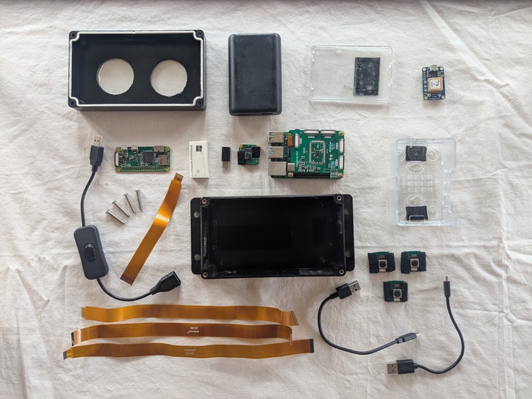
The insides.
-
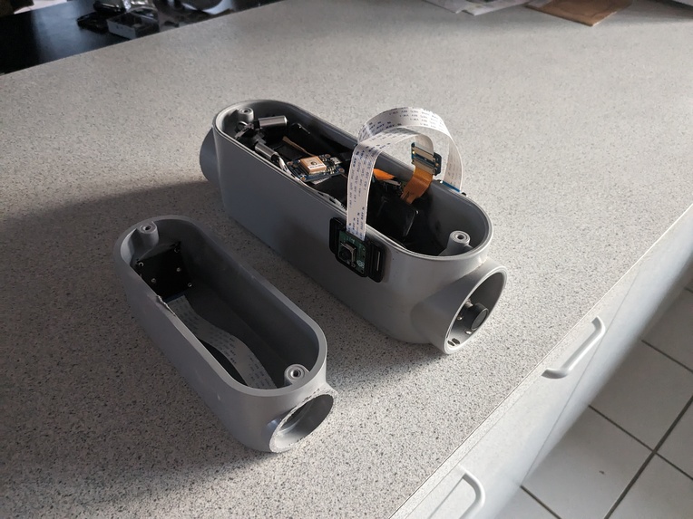
An early version, big and bulky. But it worked!
-
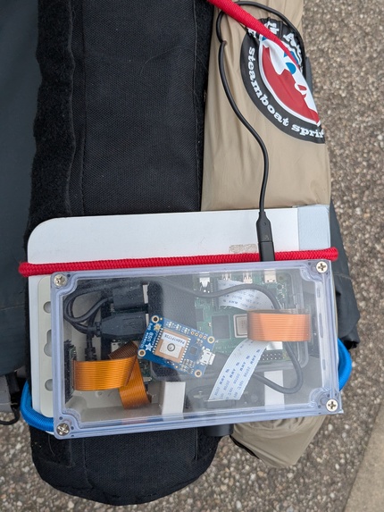
A view from above.
-
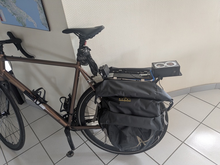
Sits on the rear rack, with a little extension out the back.
-
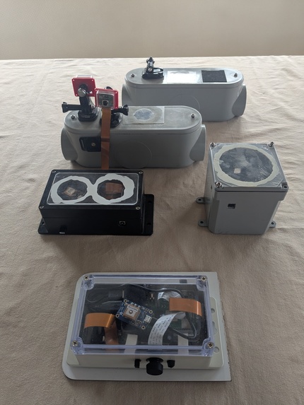
Different versions, becoming smaller and tougher and lighter.
-
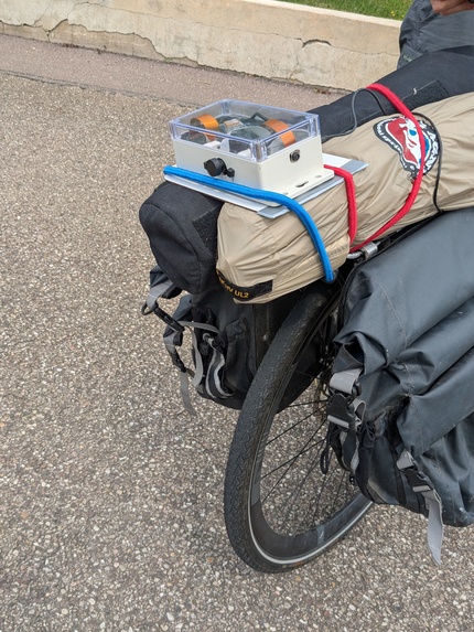
Perched atop camping gear for the next adventure.
-
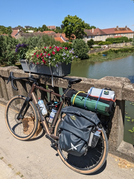
Touring near a river in France.


Inspiration
In 2014 I came across a Ted Talk which described a Norwegian television station that strapped cameras to the front of a train and filmed an entire trip from Oslo to Bergen - almost ten hours of pine forest, hills, rivers… and train track. Then they did the same thing with a ferry boat, pointing cameras toward shore and this time broadcasting live for five days. Millions of people tuned in or came out to see the boat slowly pass, and "Slow TV" hit the masses. I thought to myself… why not put cameras on a bike? I wrote to the broadcaster with my idea and they actually replied: the cameras are too big, they said, and there's no way to transmit the pictures. We can't do it, they said.
I decided to see if I could do it myself, starting with still photos and adding location (GPS) support. Google Maps became the canvas, the viewer, the repository, and the archive. Then Google Street View came along and my idea evolved into a device for documenting bike paths.
What it does
StroogleVélo records a path travelled and takes multiple simultaneous pictures automatically while perched on the back of a bike. In real-time the photos and route are added to a Google Map, or they are uploaded later if a network is not available. The device is small, lightweight, water resistant, and configurable: the number of cameras is only limited by the size of the box. It's also meant to be inexpensive and reproduceable: the components cost less than $100.
How it was built
The original StroogleVélo was crammed inside a bulky PVC conduit. Over time it became smaller and more weather resistant, and now it fits inside a small junction box from the local hardware store. Inside the device are several interconnected Raspberry Pi computers running Perl scripts. There's a main Pi4 providing power to, and orchestrating, the auxiliary Pi Zero 2W's each attached to a wide angle Pi version 3 camera. For fun the main camera has a fisheye lens. The main Perl script also samples a GPS chip every two seconds for location information and shrinks down the photos for transmission.
At regular intervals (say, every 30 seconds) the Pi4 sends a package containing GPS coordinates and a batch of photos to the server running on Google App Engine. Here the Java code stores the photos and adds a marker to the Google Map, along with the updated route, as it's received. The viewer can watch the journey unfold from a web browser, and after the trip the cyclist has an immediate travelogue full of random photos from both sides and behind the bike. A skycam can also be added.
Challenges along the way
The newest Pi5 consumes too much power for a standard cellphone power pack. The device needs to deal with bumpy cobblestone roads, starting and stopping, power consumption, heat and cold, changing light conditions, intermittent (or no) network availability, portability (size and weight are big factors on a bike), and having a clear field of vision for all the cameras. It's not ideal to have the corner of a pannier in every photo.
Accomplishments! Hooray!
It actually works, and reliably. Several times it has come untethered from the bike, bounced across the road, and survived. The photos can be quite interesting, even artistic - despite being taken at random intervals with no human intervention. One of the trickiest parts was getting all the cameras to take the photos at roughly the same time, and building a device with inexpensive components that can be repaired in a tent on a rainy night in the middle of Estonia.
A learning experience
Presentation is important. Even if it works, no one will want to look at blurry lopsided photos. The software needs to be robust and error-tolerant; if something goes wrong, the system dies for the rest of the trip. Strap everything down! You might not realize how much the bike bounces around, and with it everything inside the device. Lastly... Perl is still a relevant language!
What's next for StroogleVélo
Now that the device is sufficiently portable, reliable, and (relatively) easy to use, I'd like to find organizations (and individuals) that could benefit from it. I'd like to achieve what the Norwegian broadcasters accomplished: bring the joy and beauty of travel (and particularly bike travel) to folks at home or far away. And I'd like to help identify, chart, and make known all of the bike paths and waterways of this world that await exploration.

Log in or sign up for Devpost to join the conversation.