-
home
-
board
-
map-request
-
Report Quest
-
report-reward
-
deals
-
council list
-
leaderboard
-
profile
Inspiration
Ask a room of ASU students who has ever reported a pothole or read a city council agenda. Almost nobody raises a hand. The 311 form is hard to find, the agenda is a long PDF full of ordinance numbers, and when you do take part, nothing comes back.
Games have the opposite problem. People will grind for hours for points that mean nothing. We wanted to aim that energy at the street outside.
So we made a game where your neighborhood's score goes up when you fix things around you.
What it does
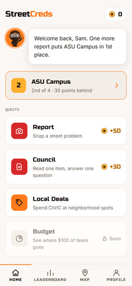
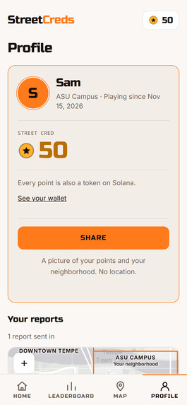
StreetCreds is a phone game for Tempe. Scan a QR code, pick a nickname and a neighborhood, and you're playing. There's nothing to install and you don't need an account.
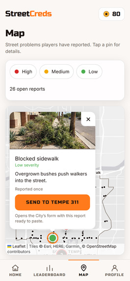
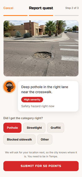
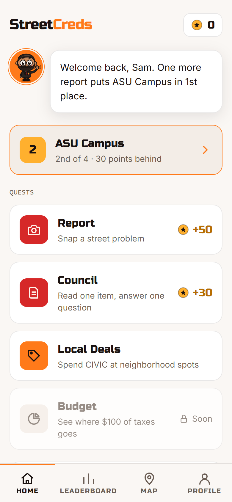
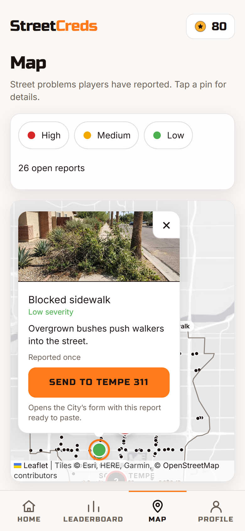
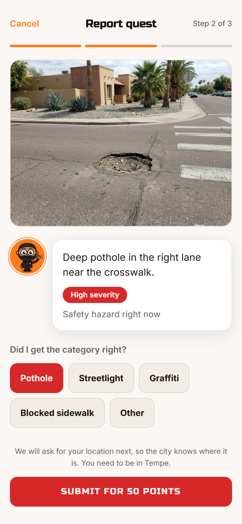
- Report quest. Take a photo of a street problem. Gemini checks whether the photo really shows one, then returns a category (pothole, streetlight, graffiti, blocked sidewalk), a severity and a one-line description. The report goes on a shared map, and one tap opens Tempe's 311 request form, so it reaches the people who fix it.
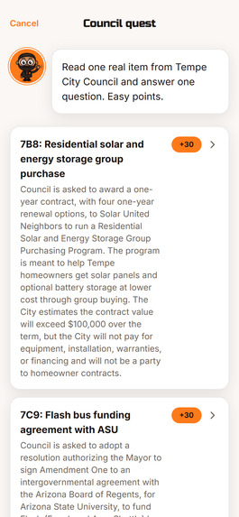
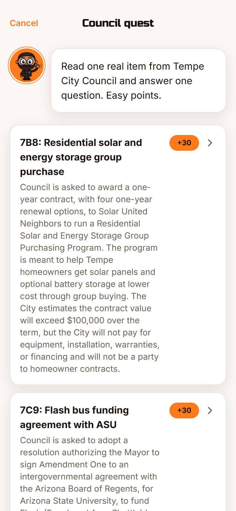
- Council quest. Read a three-sentence summary of a real item from the November 5 Tempe City Council meeting and answer one question about it.
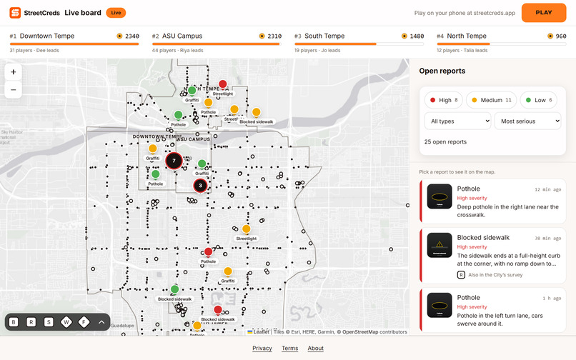
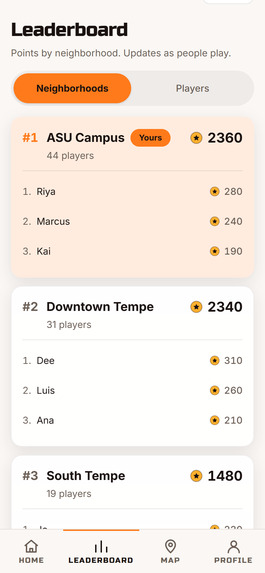
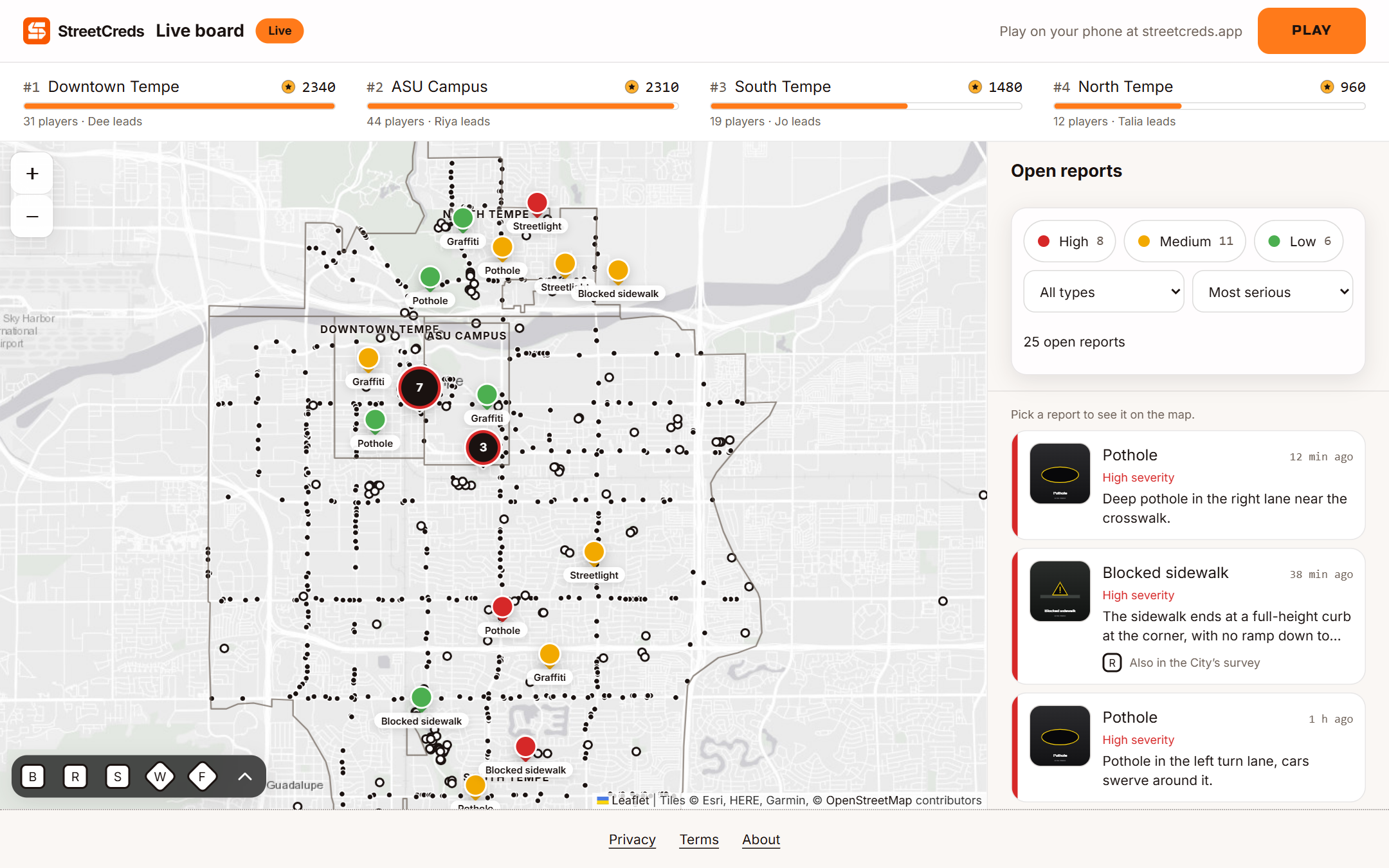
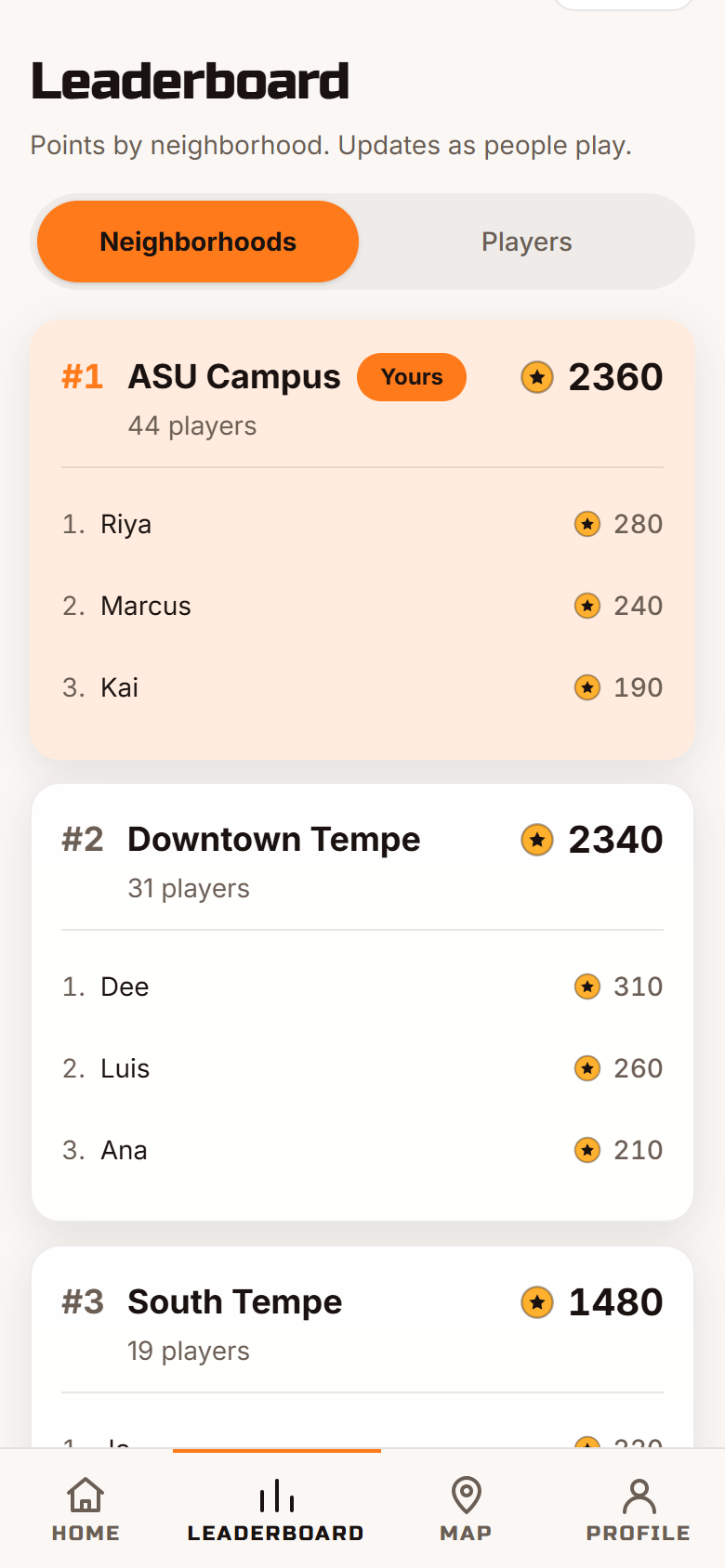
- Neighborhood leaderboard. Downtown Tempe, ASU Campus, North Tempe and South Tempe compete live. The leaderboard also has a big-screen view at
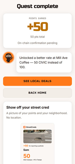
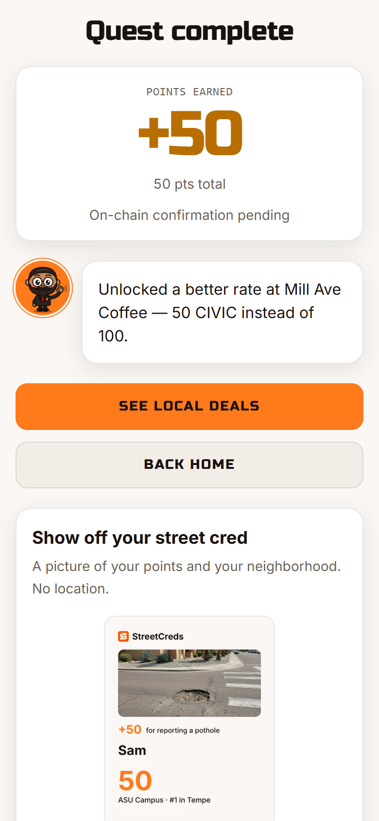
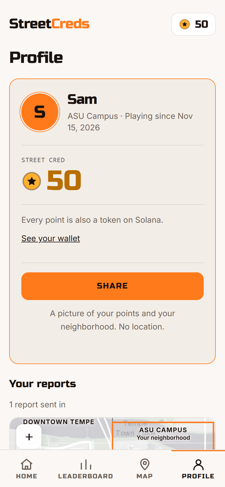
/board. - Points on Solana. Every award is minted as a CIVIC token on devnet to the player's own address. The reward screen links straight to the transaction.
- A map with the city's own data. Player reports sit next to public City of Tempe records: ADA Transition Plan findings, bus stops with no shelter, drinking fountains, park restrooms and community food sites.
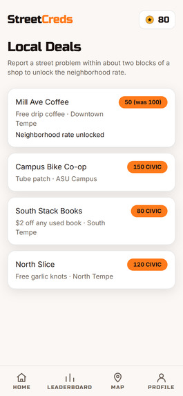
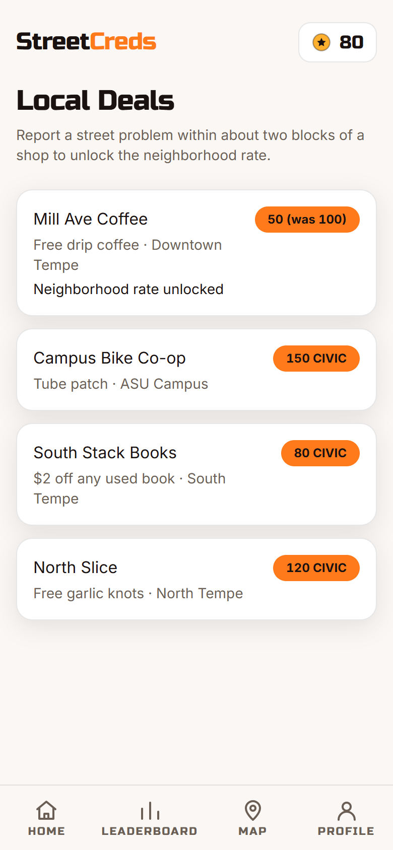
- Local Deals. Spend points at demo partner spots near you.
Joining and reporting check your location against the City of Tempe boundary, and each player can file at most 5 reports an hour, so nobody can farm points from their couch.
How we built it
- Web app: React, Vite and TypeScript, hosted on AWS Amplify at streetcreds.app.
- API: one AWS Lambda running Hono behind API Gateway, all defined in a single SAM template. After every deploy, a script checks that the live API answers on every route.
- Data: DynamoDB for players, reports and awards. Photos go from the phone straight to S3 through a presigned URL, so they never pass through the API on the way up.
- AI: Gemini (gemini-3.8-flash) labels every photo as structured JSON from a fixed list of categories, and turns away selfies and food pics. It also drafted the council summaries and quiz questions from the agenda text, and we checked each one by hand.
- Points: @solana/web3.js and @solana/spl-token. A treasury wallet mints CIVIC to each player's address. The database is the source of truth: if devnet is slow, the points still count and the award shows as pending until the transaction lands.
- Map: Leaflet with Esri dark tiles and the City of Tempe's ArcGIS open data.
Every key (Gemini, the Solana treasury, AWS) lives in Lambda environment variables. None of them reach the phone. We used Claude Code, Cursor and Codex as coding agents, and each piece they wrote is credited in the README.
Challenges we ran into
- Solana from zero. Neither of us had used it before. We gave ourselves 90 minutes to get one token minted, with a backup plan if it failed. It worked, and every player now gets their own address.
- Map tiles. OpenStreetMap's tile servers blocked some browsers. Then CARTO started requiring an API key. We ended up on Esri.
- Phone location is messy. The first reading is often off by hundreds of meters, phone clocks drift, and iPhone users who once tapped "Don't Allow" are stuck. We wait for a precise reading, loosened the limit for joining, and added steps that show iPhone players how to turn location back on.
- Uploads from the phone. A checksum setting on the S3 presigned URL quietly broke photo uploads, and it took a while to find.
- Paying points exactly once. A double tap shouldn't pay twice. Points only change through one function as an atomic add, and every award has an id that can't be written a second time.
Accomplishments that we're proud of
- A stranger goes from scanning the QR code to a token on chain in under two minutes, on their own phone.
- Reports go somewhere real. They don't just end as a game score.
- The map shows real accessibility gaps from the City's own records, not made-up data.
What we learned
- Asking Gemini for JSON from a fixed list of options is far more reliable than parsing free text.
- When the blockchain is the slow part, keep the database as the source of truth and let the chain catch up.
- Location on a phone in the real world behaves nothing like location in a desktop browser.
What's next for StreetCreds
Tempe is the first city, not the only one. Next is the rest of Arizona: Phoenix, Mesa, Scottsdale and Chandler, with neighborhoods competing within each city and cities competing across the state. After that, cities across the country.
Most of the game already works anywhere. What changes from city to city is the city boundary, the 311 form, the council agendas and the open data on the map. We want to make adding a city a matter of plugging in those four things, so StreetCreds can launch in a new city in days instead of weeks.
The long-term goal is a national leaderboard where any city can see how its residents show up for their streets, and where every report lands in the right city's queue.
Built With
- amazon-api-gateway
- amazon-dynamodb
- amazon-web-services
- aws-amplify
- aws-lambda
- aws-sam
- esri
- google-gemini
- hono
- leaflet.js
- node.js
- react
- solana
- spl-token
- typescript
- vite

