-
-
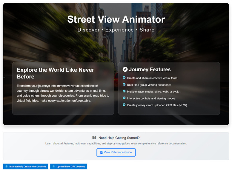
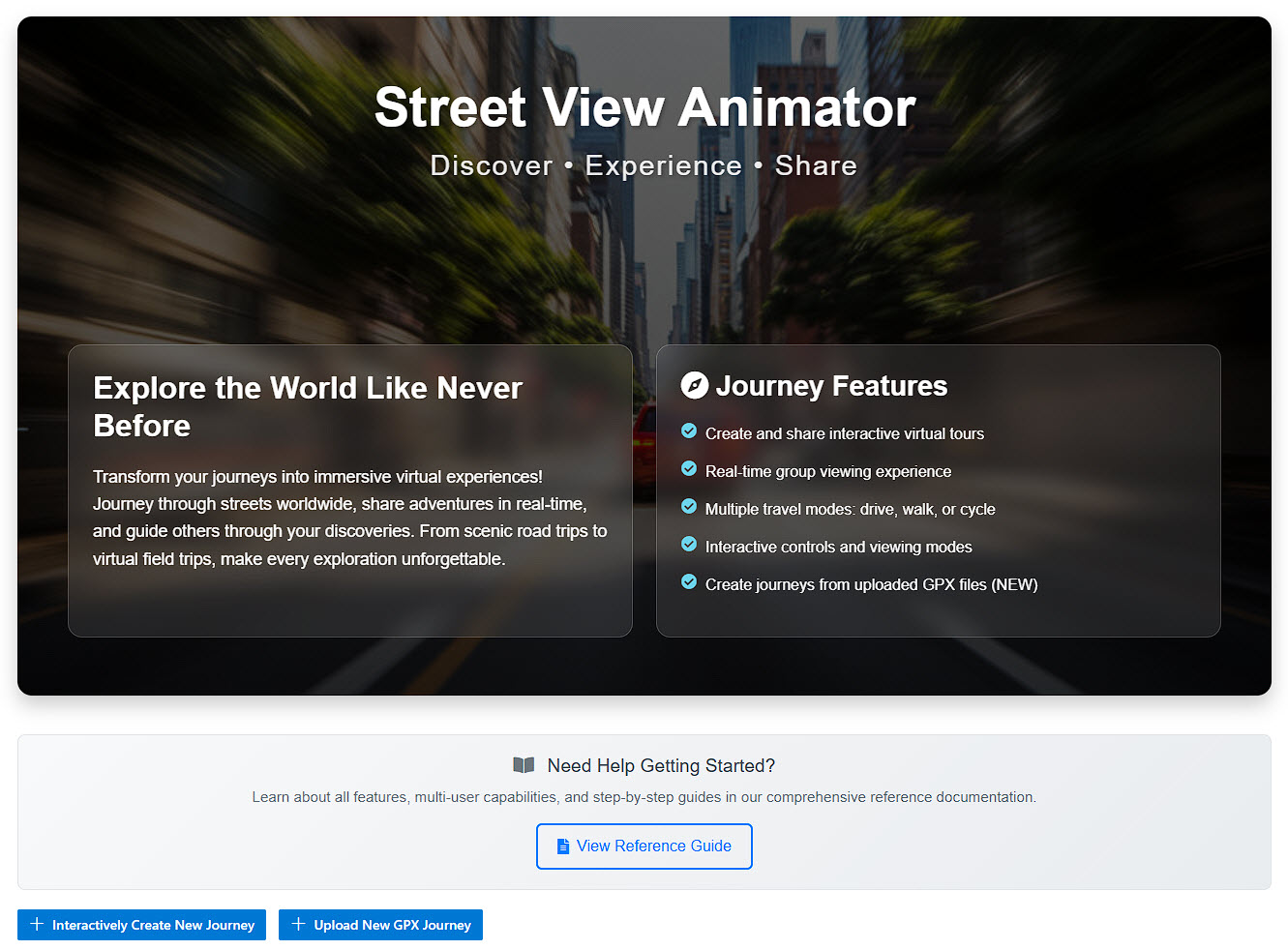
Start page
-
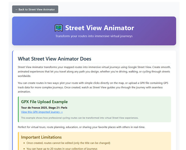
Reference page
-
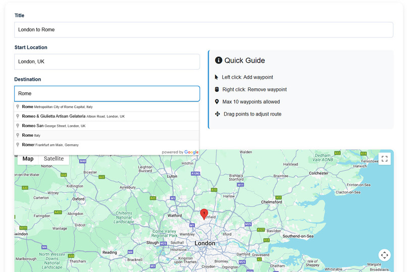
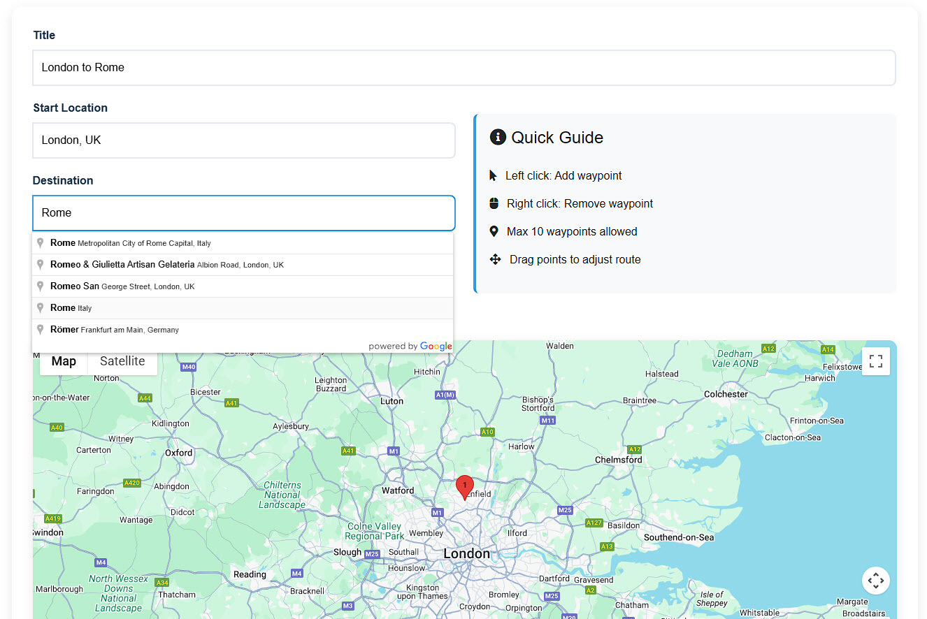
Create your journey
-
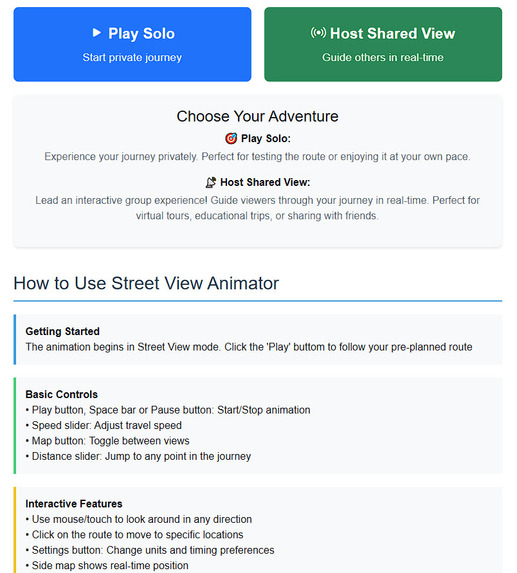
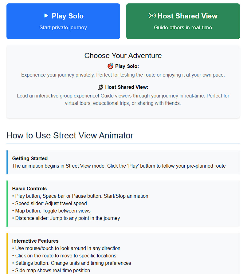
Start viewing of your journey (choose solo or hosted)
-
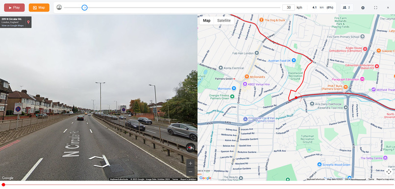
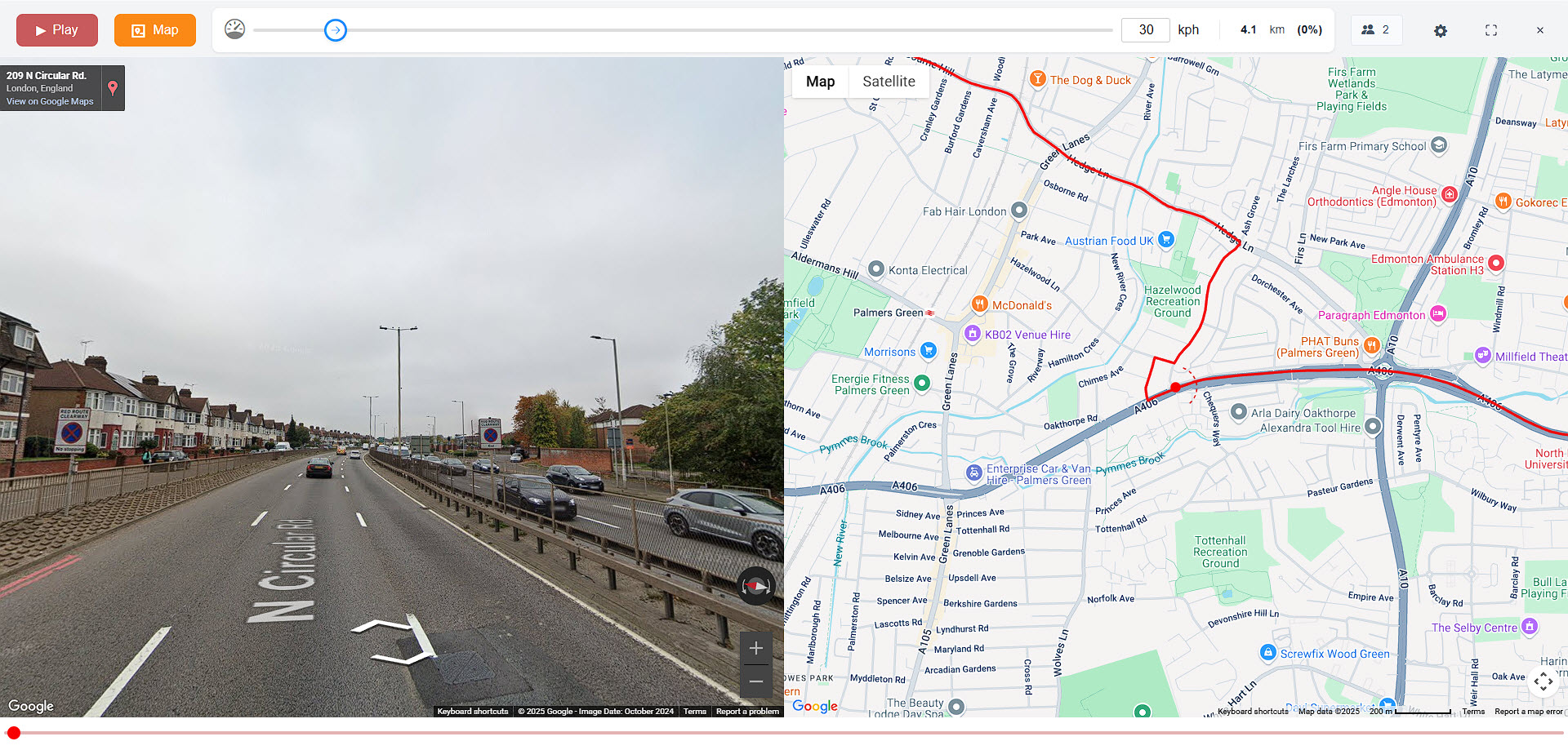
The 'View journey page' with street view, Google map and UI

Inspiration
The inspiration for Street View Animator came from my previous successful mapping projects at Map Channels - Route Maps, Team Maps, and Tour Maps. I wanted to create a next-generation tool that would combine the immersive experience of Google Street View with smooth animation and real-time collaboration capabilities. While existing street view tools worked well for interactive exploration, they weren't optimized for animated journeys. The blur effects that enhance interactive street view can detract from the smooth, cinematic experience needed for virtual tours and shared exploration.
What it does
Street View Animator transforms mapped routes into immersive virtual journeys using Google Street View. Users can create routes in two ways: by plotting points directly on an interactive map or by uploading GPX files containing GPS track data from real-world journeys.
Key Features:
- Smooth Animation: Crystal-clear street view transitions without blur effects, optimized specifically for animated journeys
- Multi-User Capability: Real-time shared viewing experiences where a host can guide multiple viewers through the same journey simultaneously
- Flexible Route Creation: Direct map plotting or GPX file upload support for complex routes Interactive Controls: Adjust speed, change viewing direction, and jump to any point along the route
- Multiple Viewing Modes: View with map overlay, street view only, or immersive full-screen mode
- Privacy-Conscious Sharing: Shows viewer count without revealing personal details
How I built it
Street View Animator was built using Blazor WebAssembly with C# and JavaScript, leveraging modern web technologies for a responsive, interactive experience.
Technical Architecture: Frontend: Blazor WebAssembly for the user interface and component management Real-time Communication: Blazor SignalR for multi-user synchronization and networking Mapping Integration: Google Maps API and Street View for geographical data and imagery File Processing: GPX file parsing and route generation capabilities Double-Buffering: Custom double-buffering approach for Street View to ensure smooth transitions
Key Technical Innovations: Advanced Animation System: Developed a smooth animation pipeline that eliminates the blur effects typically seen in street view transitions Real-time Synchronization: Implemented precise host-client synchronization using SignalR to ensure all viewers see identical imagery at the same time Responsive Design: Mobile-friendly interface that adapts to different screen sizes while maintaining functionality
Challenges I ran into
Synchronization Complexity: The biggest challenge was ensuring perfect synchronization between the host and multiple clients. I needed to coordinate not just the current position along the route, but also viewing angles, speed changes, and interactive jumps to different route segments in real-time. UI/UX Balance: Creating an interface that was simple enough for casual users while still offering advanced functionality for power users required multiple design iterations. I needed to present complex controls in an intuitive way without overwhelming the user experience. Street View Animation: Developing smooth animation without the standard blur effects required creating a custom double-buffering system. Traditional street view transitions include motion blur for interactive use, but this can degrade the viewing experience for animated journeys. Performance Optimization: Managing multiple simultaneous viewers while maintaining smooth animation performance across different devices and network conditions required careful optimization of our SignalR implementation. GPX File Compatibility: Ensuring robust parsing of GPX files from various sources (GPS devices, fitness apps, route planning tools) while handling different data formats and coordinate systems.
Accomplishments that I'm proud of
Seamless Multi-User Experience: Successfully implemented real-time collaboration where multiple users can share the same virtual journey experience, opening up new possibilities for virtual tours, education, and remote exploration. Advanced Animation Technology: Developed a custom Street View animation system that delivers smooth, blur-free transitions specifically optimized for animated journeys rather than interactive exploration. Network Architecture Mastery: Gained significant expertise in Blazor SignalR for real-time web applications, creating a robust foundation for future collaborative mapping tools. User Experience Excellence: Created an intuitive interface that makes complex functionality accessible to users of all technical levels, from casual explorers to professional tour guides. Technical Innovation: The double-buffering approach to Street View represents a novel solution to animation challenges that could benefit the broader mapping and visualization community.
What we learned
Blazor SignalR Networking: Developed expertise in implementing real-time features within Blazor applications, including connection management, message broadcasting, and state synchronization across multiple clients. Street View API Optimization: Learned advanced techniques for working with Google's Street View API, particularly around animation timing, image preloading, and transition management. Real-time Synchronization: Gained valuable experience in coordinating shared experiences across multiple users, including handling network latency, connection drops, and state recovery. User Interface Design: Learned how to balance feature richness with simplicity, creating interfaces that guide users naturally through complex functionality. Performance Optimization: Developed skills in optimizing web applications for real-time performance, particularly around managing multiple simultaneous connections and smooth animation rendering.
What's next for Street View Animator
Team-Based Mapping Tools: I plan to expand the networking capabilities built with Blazor SignalR to create collaborative mapping tools where teams can work together to plan routes, add annotations, and share insights in real-time. Enhanced Collaboration Features: Future versions might include features like voice chat integration, shared bookmarks, and collaborative route editing capabilities. Educational Platform Integration: Developing specialized tools for educational institutions, including classroom management features and curriculum-aligned content creation. Mobile Application: Creating a dedicated mobile app that leverages the existing SignalR infrastructure for on-the-go route creation and viewing. API Development: Building public APIs that will allow other developers to integrate Street View Animator's animation and collaboration features into their own applications. Advanced Analytics: Implementing detailed analytics for route creators to understand viewer engagement and optimize their virtual tours. The networking foundation I built with Blazor SignalR provides the perfect platform for next-generation collaborative mapping tools, positioning Street View Animator as the cornerstone of a comprehensive suite of team-based geographical exploration applications. This approach can be extended to the new 3D Maps API and combine 3D Maps with Street View which I have already tried with other projects such as Travel Cat and Air Tours (see maps.tripgeo.com).
Built With
- blazor
- c#
- javascript


Log in or sign up for Devpost to join the conversation.