-
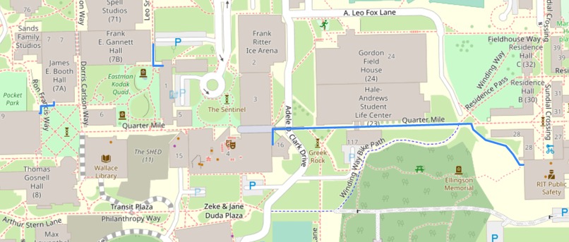
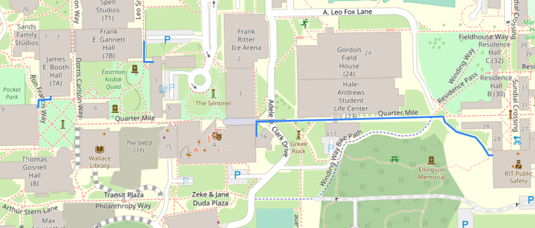
An example route from Gracies to Golisano. The route is only available outdoors. You'll have to figure out the indoors yourself!
Inspiration
I enjoy taking the warmest way to class on cold winter days, so I wanted to make a map that would optimize my trip.
What it does
Given two on-campus buildings, it tells you the warmest way to get between them (least time spent outside). The map takes advantage of RIT's many tunnel systems.
How I built it
I made an XML file containing data about RIT buildings, entrances, and their connections. I parsed this XML file into an OOP structure in Python, then used OpenRouteService API to get information on the distances between building entrances. From there it was just a graph search problem.
Challenges I ran into
I spent a lot of time working on getting all of the XML parsed and structured properly. There were also some issues with the OSR API formatting that I had to work around.
Accomplishments that we're proud of
I managed to not only find the optimal route, but also build and display a map of it for the user.
What I learned
A lot about GIS, formatting data and converting XML to class systems.
What's next for StayWarm
Smarter routing! I'd love to expand this software to routing properly inside buildings too, though this is much easier said than done.
Built With
- folium
- oop
- openrouteservice
- python
- xml


Log in or sign up for Devpost to join the conversation.