-
-
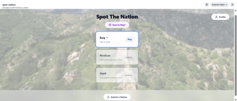
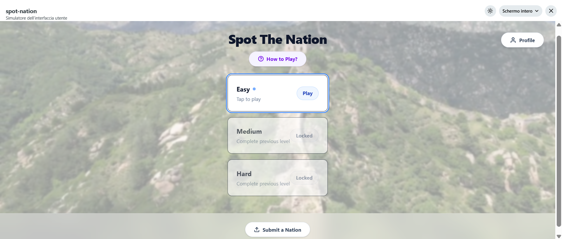
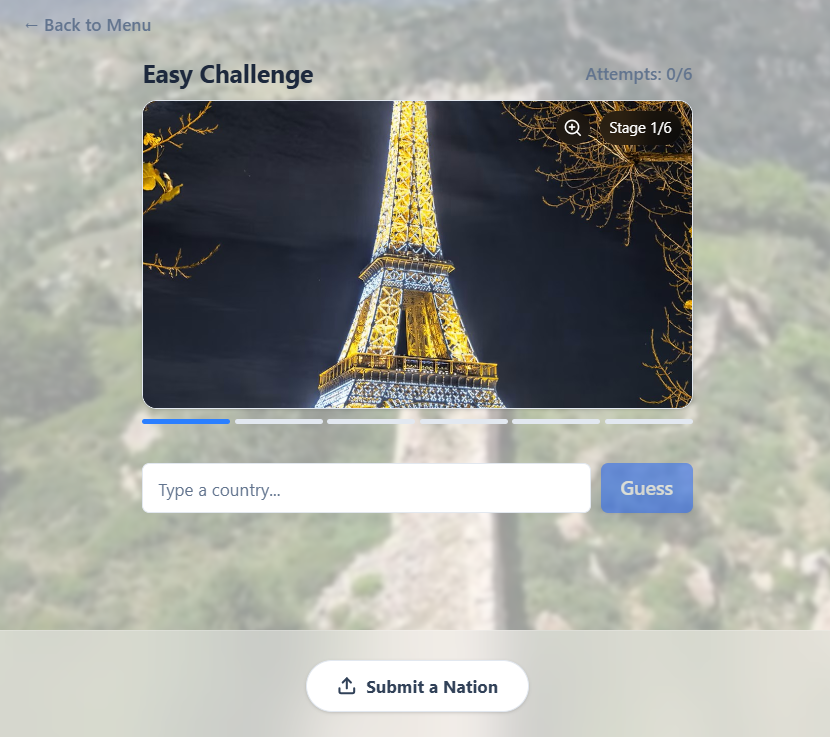
Three mystery nations. Three levels: Easy, Medium, or Hard — each level unlocks sharper clues and tougher deductions.
-
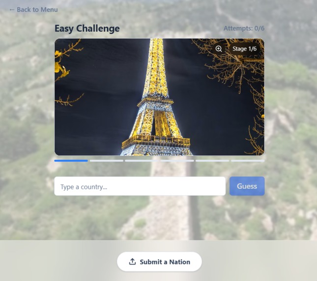
Each level has one photo, six guesses, and a country to spot at a glance.
-
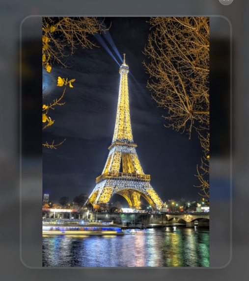
You can zoom out to reveal the full image and catch the details you might have missed.
-

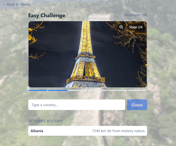
Each wrong guess reveals the distance to the mystery nation, pushing players to rethink and refine their logic.
-
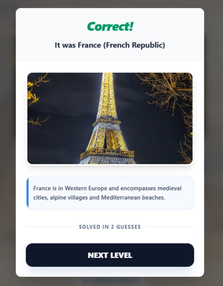
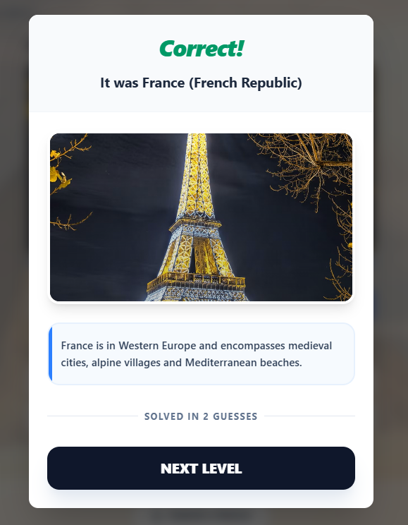
When you find the nation, you get instant feedback, a short cultural insight, and a smooth transition to the next level.
-
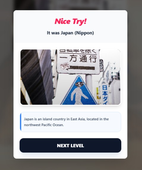
After six wrong attempts, the game reveals the answer and explains the hidden clues.
-
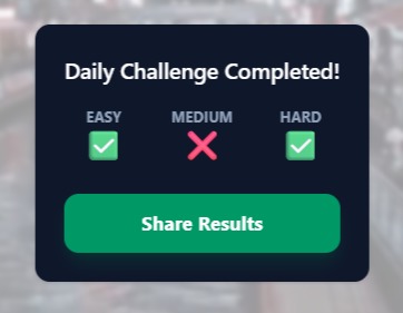
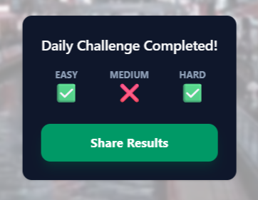
At the end of the game, you can track which challenges you solved today and share your results in the comments section.
-
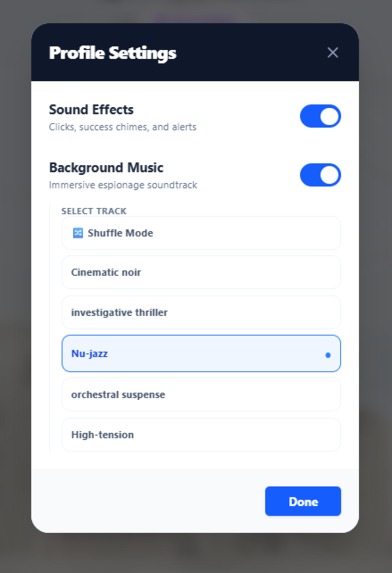
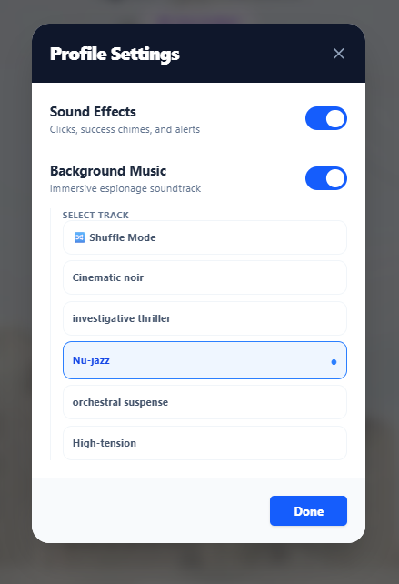
In the Profile section, you can customize sound effects and choose among 5 different background musics.
-

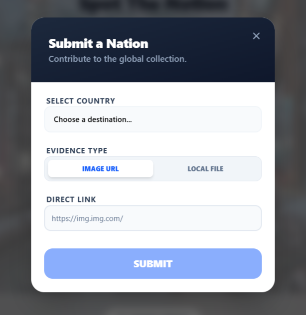
Players can submit country images to grow the shared pool of daily challenges.


Spot the Nation
Inspiration
Spot the Nation was born from a fascination with our world's diverse architecture, flora, and streetscapes. While "Geo-guessing" is a popular genre, traditional versions often lacked a narrative hook.
The goal was to transform geography enthusiasts into "intelligence officers". The game should feel less like a classroom quiz and more like a high-stakes reconnaissance mission, where every minor detail—the curve of a roof, the color of a license plate, or the species of a tree—becomes vital intel.
What it does
Spot the Nation is an immersive daily challenge platform built natively into Reddit.
The Recon Mission
Players face a "Triple Threat" challenge that changes every 24 hours, consisting of three difficulty levels:
Easy • Medium • HardProgressive "Intel" Reveal
The core mechanic: Each level has one photo of a mistery country, that users have to find in no more than 6 guesses.Distance Feedback
Using real-world geospatial data, players receive precise feedback:
"You are X kilometers from the target nation" after every attempt.Community Intelligence
A dedicated submission system lets the community propose new mystery nations → ensuring the game's intelligence database is constantly evolving and user-curated.Atmospheric Immersion
Integrated audio profiles (Cinematic Noir, Nu-jazz, etc.) create a professional "investigative" tone.
How I built it
I used Devvit (Reddit Developer Platform) to create a high-performance, premium WebView experience.
The Stack
- Frontend: React 19 + Vite
- Styling: Tailwind CSS 4 with a high-polish Glassmorphism interface
- Frontend: React 19 + Vite
Type-Safe Communication
tRPC + Hono for seamless, end-to-end type-safe communication between the React client and Devvit server.Global Presence
Redis handles persistence: daily rotations for the entire subreddit + user-submitted locations.Geospatial Logic
Accurate distance feedback is powered by the Haversine formula:
$$ a = \sin^2\left(\frac{\Delta\phi}{2}\right) + \cos\phi_1 \cdot \cos\phi_2 \cdot \sin^2\left(\frac{\Delta\lambda}{2}\right) $$
$$ c = 2 \cdot \operatorname{atan2}(\sqrt{a}, \sqrt{1-a}) $$
$$ d = R \cdot c $$
where $R$ = Earth's radius (6,371 km), $\phi$ = latitude, $\lambda$ = longitude.
Challenges I ran into
The "Intel" Logic
Designing a performant and visually satisfying progressive uncrop was complex — needed to feel like natural information expansion without breaking UI layout across device screen sizes.State Synchronization
Managing three distinct game states (Easy/Medium/Hard) in a single daily session while preventing data loss during page refreshes or Reddit app transitions.Content Policy & Security
Handling user-submitted images while strictly adhering to Reddit's Content Security Policy (CSP) → required building a secure proxy layer to validate and serve assets safely.
Accomplishments that I'm proud of
- Successfully created an immersive narrative — moving away from trivia to a modern reconnaissance experience
- Built a unified visual identity that feels like a native, premium Reddit application (smooth hardware-accelerated transitions)
- Created an infinite loop via the "Submit a Nation" system — community provides the content they want to play
What I learned
Building on the Reddit Developer Platform taught me the importance of "Social-First" design: bridging complex web logic (e.g. coordinate distance calculation) with social features like one-click sharing that posts results as native Reddit comments.
What's next for Spot the Nation
Global Intelligence Briefing
Reddit-wide leaderboard showing which "Intelligence Officers" have the best global reachStreet-Level Intel
Evolving from static images to interactive 360-degree street-view reconnaissanceCompetitive Recon
Real-time multiplayer modes — players race to identify a nation with the fewest "Intel Reveals"
Built With
- css
- css4
- devvit
- eslint
- hono
- lucide-react
- react
- react19
- reddit-developer-platform
- redis
- tailwind
- trpc
- typescript
- vite
- vitest

Log in or sign up for Devpost to join the conversation.