-
-
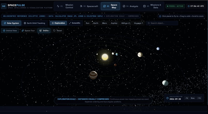
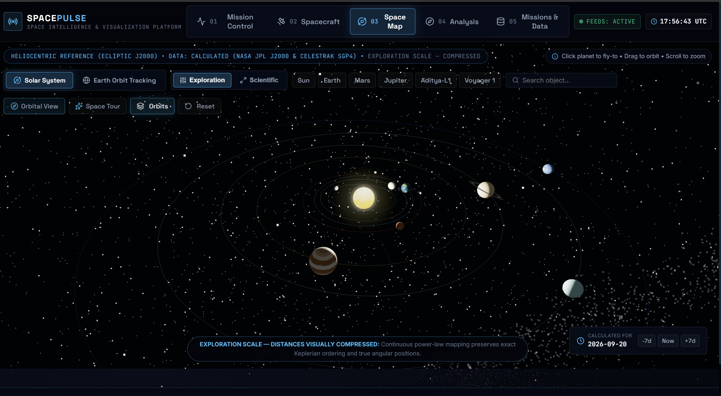
Space Map: An interactive 3D solar system that lets users explore planets, spacecraft, and orbital paths using calculated space data.
-
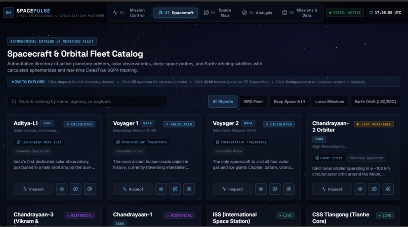
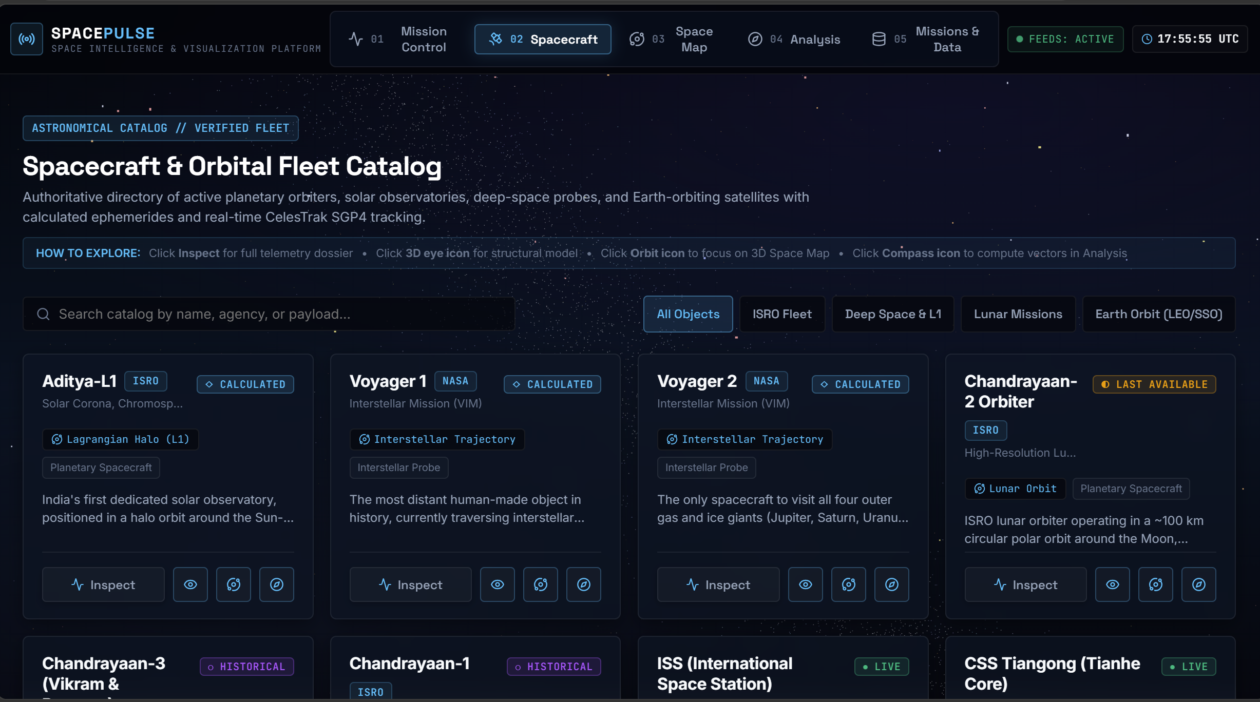
Spacecraft: A verified fleet catalog showing spacecraft, satellites, missions, orbit types, and their current data status.
-
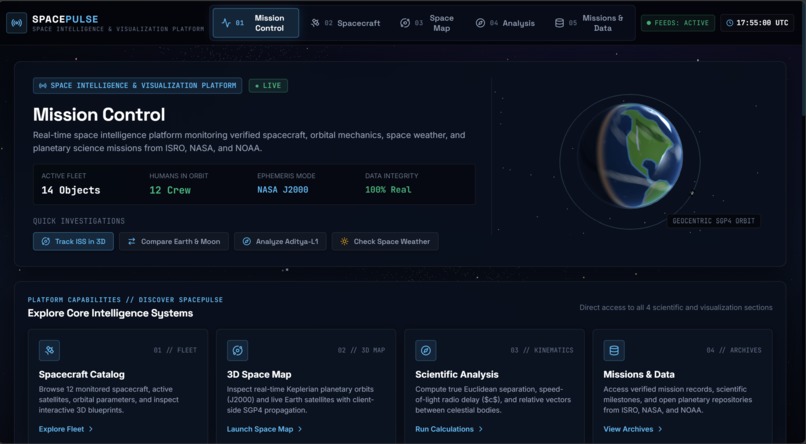
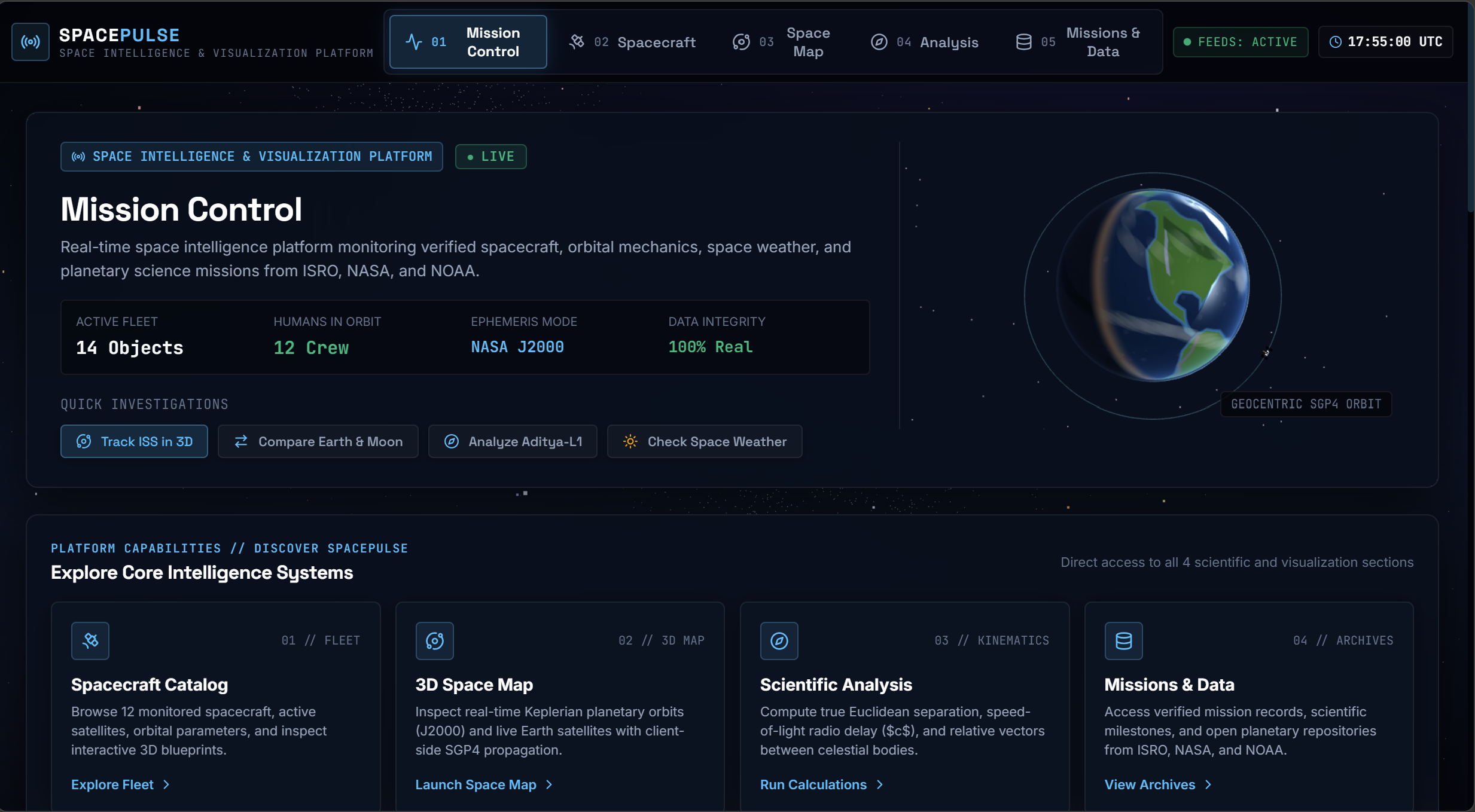
Mission Control: The main dashboard showing spacecraft, orbital data, space weather, and key SpacePulse intelligence systems in one place.
-
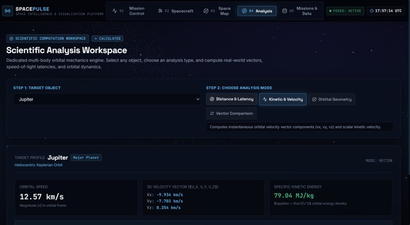
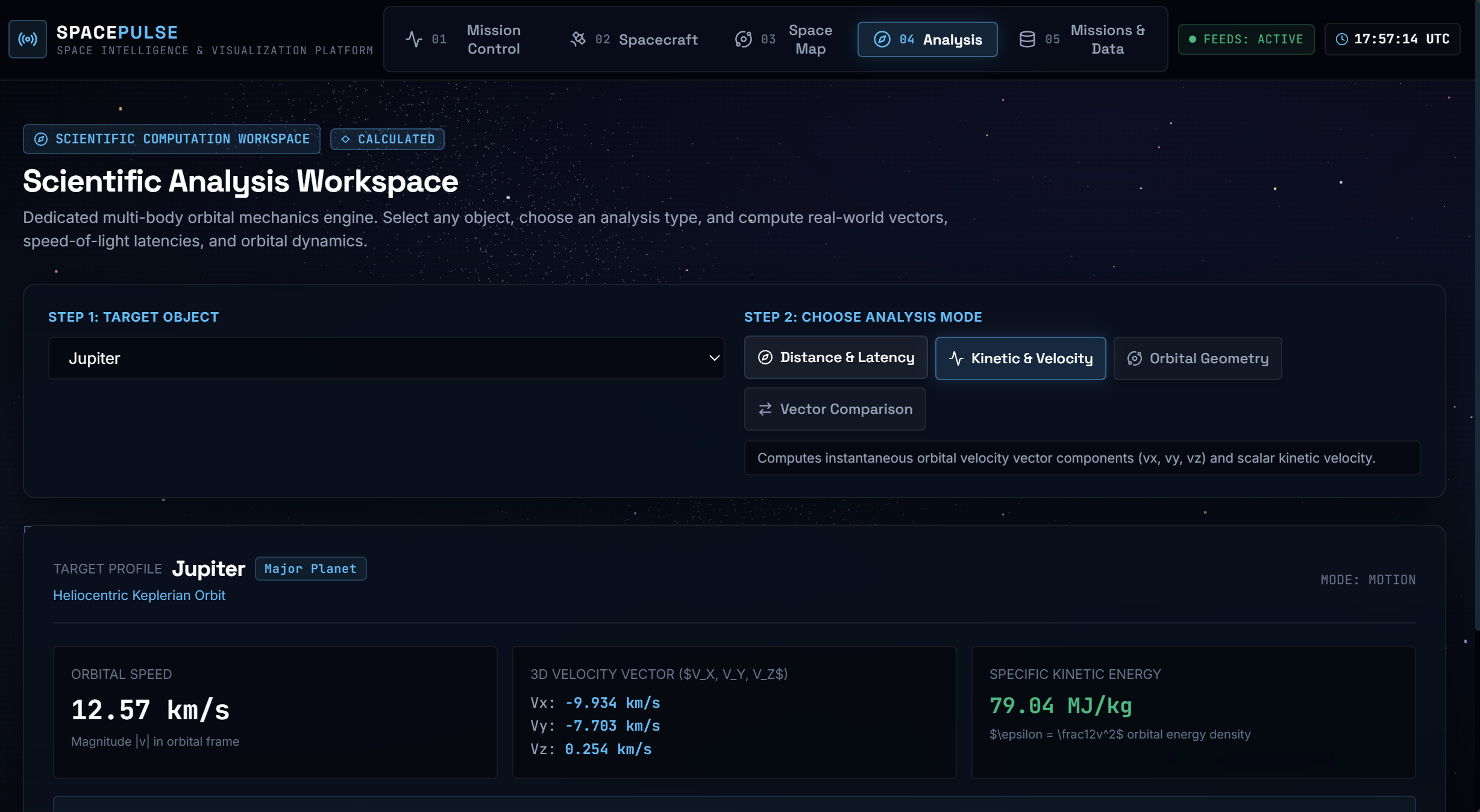
Scientific Analysis: Calculates real-world orbital data such as distance, velocity, latency, and kinetic energy for planets and spacecraft.
-
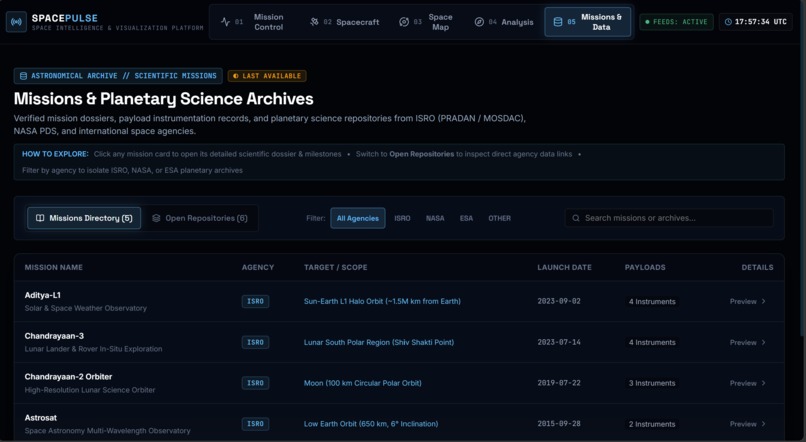
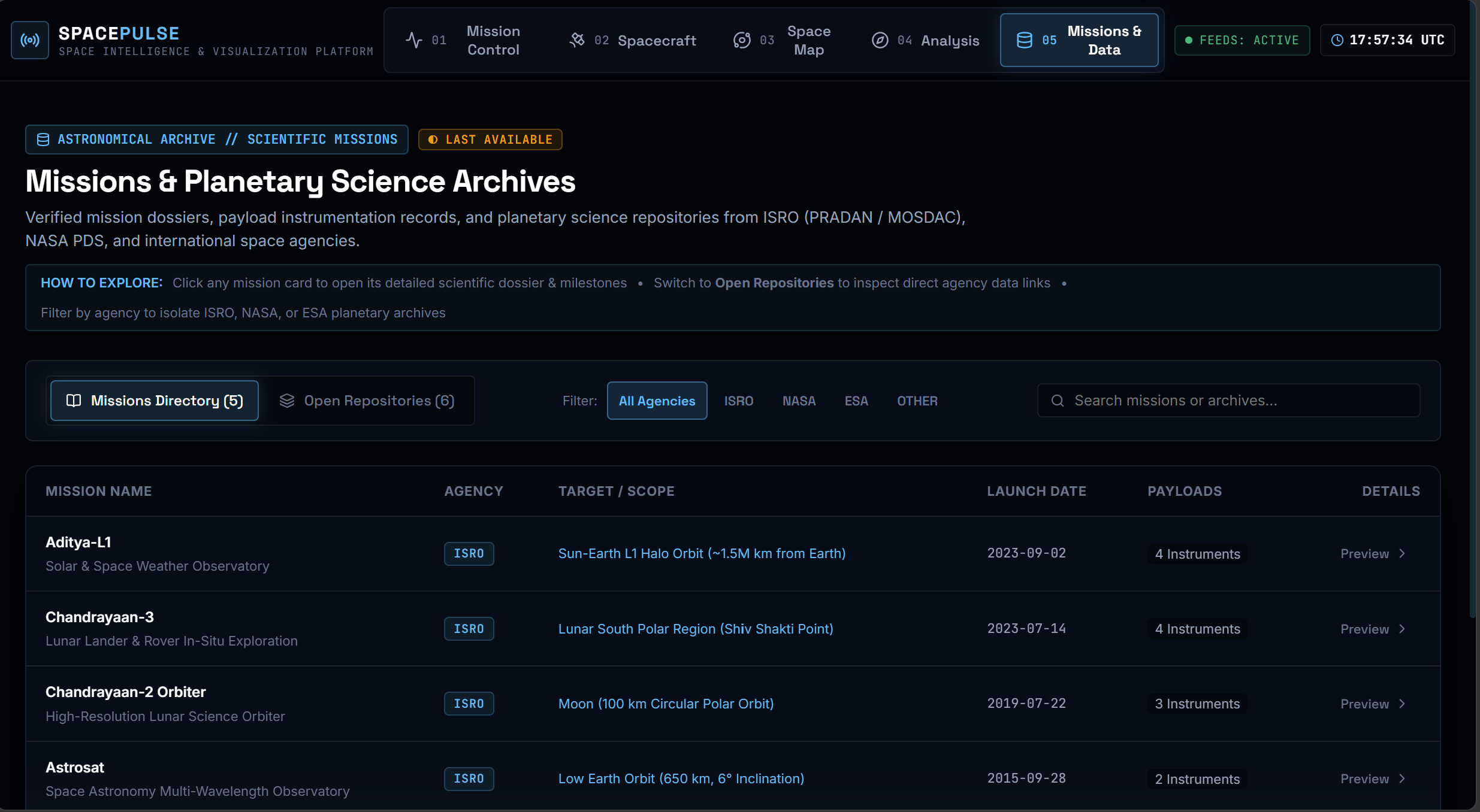
Missions & Data: Provides verified mission records, scientific archives, and planetary data from agencies like ISRO, NASA, and ESA.
Inspiration
SpacePulse was inspired by the idea that satellites and space based data can help us better understand our changing planet. I wanted to turn complex space and Earth data into an interactive, understandable experience that connects space technology with real world climate awareness and sustainable action.
What it does
SpacePulse turns real space and satellite data into a simple interactive 3D platform. It lets users explore Earth, satellites, spacecraft, missions, space weather, and scientific data in one place making complex space information easier to understand.
How we built it
SpacePulse was built as a frontend web platform using React, TypeScript, Vite, Three.js, and React Three Fiber. We connected it to publicly available space data sources and created an interactive 3D environment to visualize satellites, spacecraft, missions, Earth, and space related information.
Challenges we ran into
The biggest challenge was working with real space data while keeping the platform scientifically accurate. We had to handle different data sources, API limitations, complex 3D visualization, performance, and make sure unavailable or outdated data was never presented as real time information.
Accomplishments that we're proud of
We built a complete interactive space intelligence platform that brings real space data, 3D visualization, spacecraft and satellite tracking, missions, and space weather insights into one place. We’re especially proud of making complex scientific information more accessible and engaging.
What we learned
We learned how to work with real world space data, build interactive 3D visualizations, handle API and data limitations, and optimize a complex web application for performance. Most importantly, we learned how to turn complex scientific data into an experience that anyone can understand.
What's next for SpacePulse: Earth Intelligence for Climate Action.
Next, we plan to expand SpacePulse with more Earth observation data, stronger climate focused insights, and better tools for understanding how changes in our planet can be monitored from space. Our goal is to make scientific space data more accessible and useful for climate awareness and action.

Log in or sign up for Devpost to join the conversation.