-
-
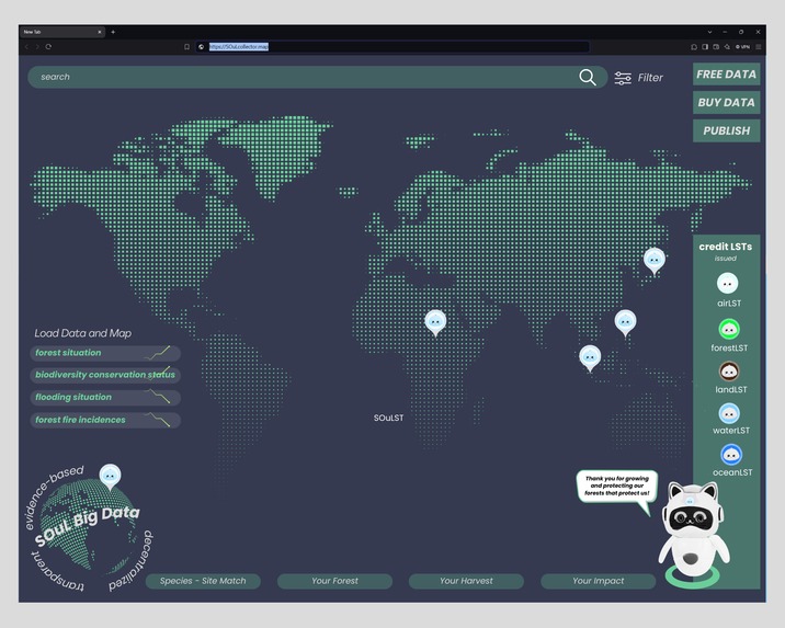
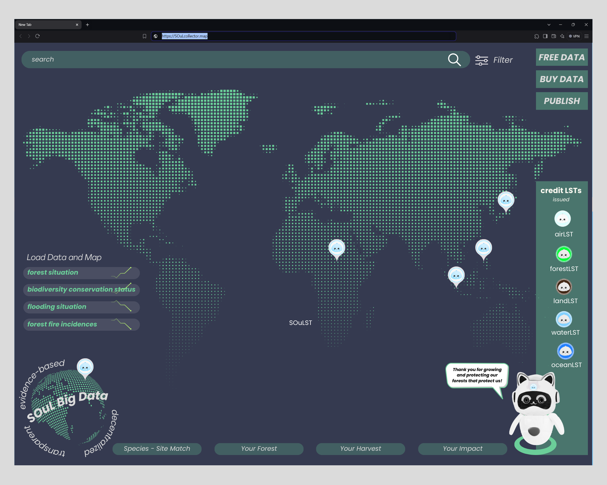
SOuL Map AI
-
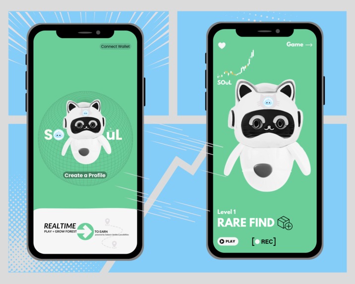
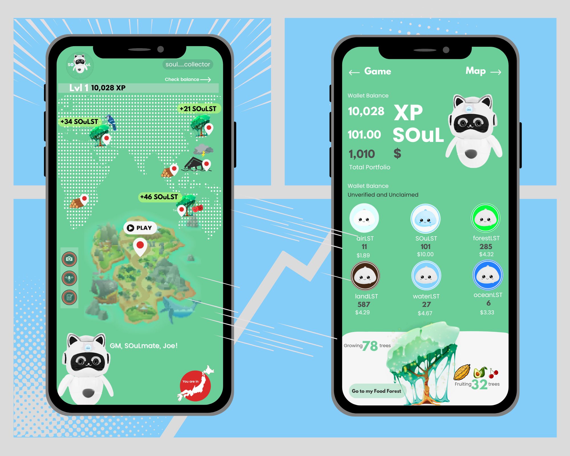
SOuL Collector AI
-

SOuL Collector AI

Inspiration
SOuL is inspired by the goal of preventing an estimated 5,000 human deaths, protecting 1.2 trillion wildlife and animals, and avoiding $2 trillion in damages from calamities annually. The project involves building a DePIN to safeguard remote forests and communities using IoT networks and satellites. Challenges included data availability, computational resources, and real-time processing. Accomplishments include developing SOuL Collector and Map UX, collaborations with iLoop.Finance and other partners, and successful negotiations with investment groups. Lessons learned emphasize the importance of decentralization and transparency for trustworthy data. Future plans include prototyping, expanding partnerships with environmental organizations, and attracting more clean energy investors for innovation.
What it does
SOuL aims to address the critical issue of remote forests and their communities lacking internet and Solana asset access, technical support, engaging tools for transparent forest protection, and an AI to solve the significant problem in satellite imagery. This problem involves accurately detecting the presence or absence of trees, wildlife, rain, flooding, landslides, and forest fires, as well as tracking hydrological changes due to waste waster.
SOuL is building a DePIN (Decentralized Protocol for Infrastructure and Networks) that integrates real-world ecosystems and economies to protect remote forests and communities from these threats. It utilizes a gamified mapping platform, harnessing the Internet of Things network and low-Earth orbit objects in a hybrid smartphone. This system connects forests, empowers local guardians, and creates regenerative local economies in Solana-based cooperatives with a dividend protocol.
How we built it
SOuL Collector AI is building an AI to accurately detect the presence or absence of trees, wildlife, rain, flooding, landslides, and forest fires in this approach:
- Data Acquisition and Preparation: Gather a Large and Diverse Dataset: Collect a massive amount of satellite imagery data from various regions, covering different seasons, weather conditions, and terrain types. This dataset should include labeled images where each pixel is annotated with its corresponding class (e.g., tree, water, fire, etc.).
Labeling: This is a crucial step. You'll need to accurately annotate the images to train your AI. This can be done manually by experts or using semi-automated tools.
Data Augmentation: To prevent overfitting and improve model generalization, apply data augmentation techniques. This could involve rotating, scaling, flipping, or adding noise to the images.
- Model Selection and Architecture: Convolutional Neural Networks (CNNs): CNNs are highly effective for image recognition tasks. Popular architectures include ResNet, VGG, and Inception.
Object Detection Models: Models like YOLO (You Only Look Once) and Faster R-CNN are specifically designed for object detection. These models can locate and classify multiple objects within an image.
Hybrid Approaches: Combine CNNs with other techniques like recurrent neural networks (RNNs) or transformers for better temporal analysis (e.g., detecting changes over time).
- Model Training and Evaluation: Train the Model: Using your labeled dataset, train your chosen model. This involves adjusting the model's parameters (weights) to minimize errors in predicting the correct class for each pixel.
Evaluation Metrics: Use appropriate metrics to assess your model's performance. For example: Accuracy: Overall correct predictions.
Precision: Proportion of true positive predictions.
Recall: Proportion of actual positive cases correctly identified.
F1-Score: A balance between precision and recall.
Hyperparameter Tuning: Experiment with different hyperparameters (e.g., learning rate, batch size) to optimize your model's performance.
- Deployment and Monitoring: Deploy the Model: Integrate your trained model into a system that can process real-time satellite imagery.
Regular Monitoring and Updates: Monitor the model's performance and retrain it with new data as needed to maintain accuracy and adapt to changing conditions.
Additional Considerations: Multi-Temporal Analysis: Use data from multiple time points to detect changes over time, which can be helpful for identifying forest fires, deforestation, and other events.
Data Fusion: Combine data from different sources (e.g., satellite imagery, weather data, ground-based sensors) to improve accuracy and provide a more holistic view.
Explainability: Make the AI's decisions understandable to humans. This will help ensure trust and transparency.
Challenges we ran into
Accomplishments that we're proud of
Ideation began in mid-April and escalated into a deep dive during the Solana Summit APAC in May. This was followed by the finalization of the business model when the project was accepted into the dotHAX Incubation program by Superteam Japan and IslanDAO Startup Village.
Website: https://soulsanctuary.cloud
Whitepaper: https://drive.google.com/file/d/1tHKAVgpj1R5xTXVJm99oQNvtvPVHTQ9m/view
Github: https://github.com/SOuLFST
UI/UX of SOuL Collector and SOuL Map of Transparency and Decentralisation Analytics AI
Partnerships with iLoop.Finance, Proto and Superteam Japan
Under negotiation with Provins-Invest, Kraft Investment, and Lunax Groups
What we learned
Decentralisation opens the space for building huge and diverse data and must be retained in the model. Transparency builds trust and creates reliable data.
What's next for SOuL
Build the prototype, network more with environmental and sustainability groups, and find more cleantech energy and innovation investors.
Built With
- anchor
- rust
Log in or sign up for Devpost to join the conversation.