-
-
soul saver
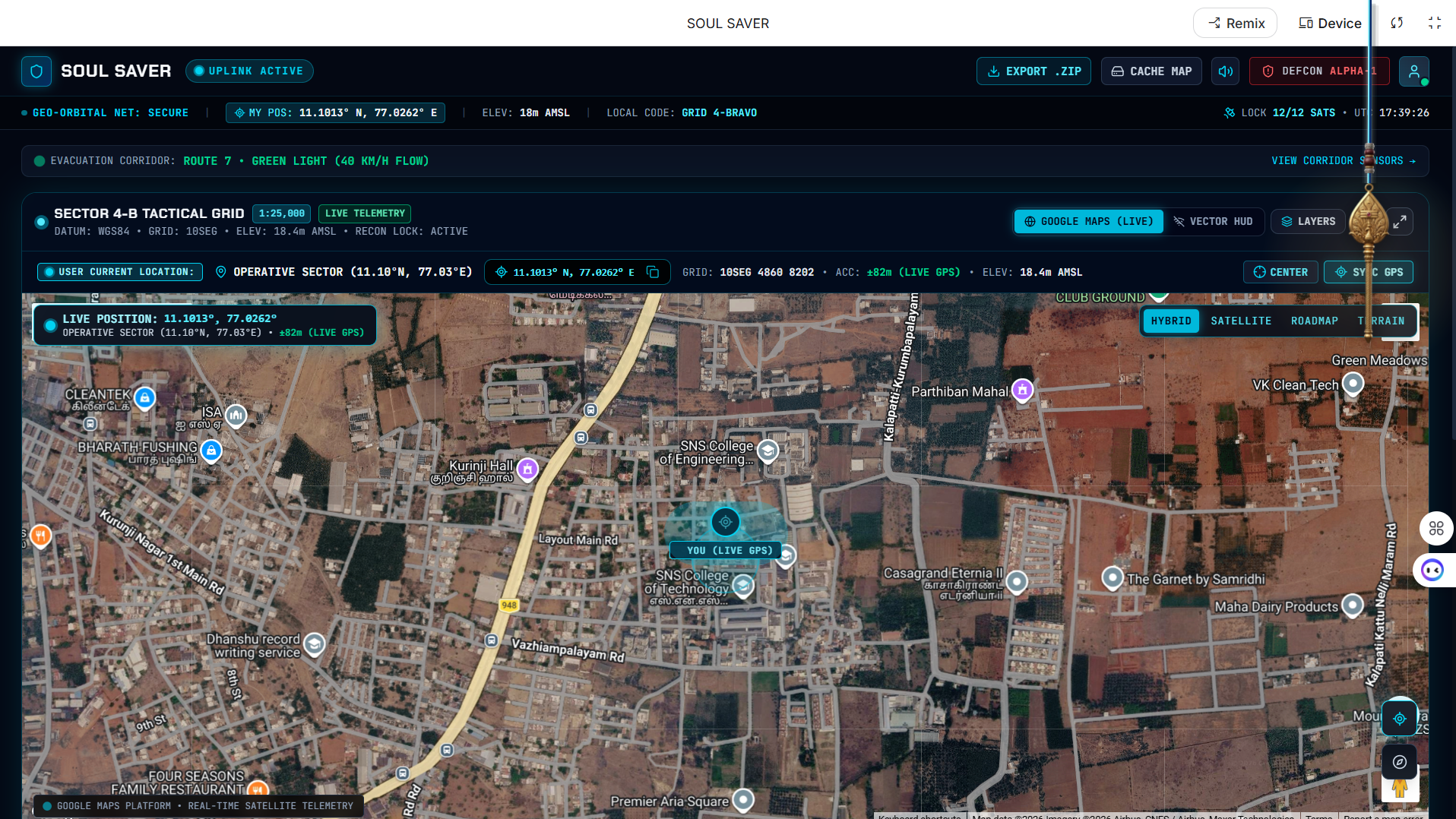
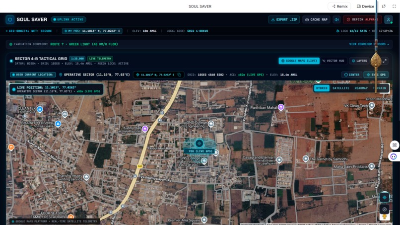
Smart Disaster Management Web is a web-based platform designed to support disaster awareness and emergency response. The system brings together real-time maps, location services, and instant communication tools to keep people informed, safe, and connected during hazardous events. By combining live situational data with fast, one-tap emergency actions, the platform aims to reduce response time and improve coordination between individuals, their trusted contacts, and emergency responders. The platform is built around three core pillars: real-time data (live maps, weather, and sensor feeds), location services (precise positioning and safe routing), and connected community features (alerts, emergency contacts, and nearby help). Together, these pillars turn disaster response into a faster, smarter, and safer process. Smart Map The Smart Map gives users a clear, layered view of their surroundings so they can assess safety at a glance. • Current Location: Shows the user's position in real time for immediate situational awareness. • Layered Insights: Separate toggleable layers for roads, buildings, weather, and danger zones. • Safer Routes: Suggests alternative paths that steer users away from affected or hazardous areas. One-Tap SOS A prominent, always-visible SOS button gives users instant access to help from any screen. • Visible Blue SOS: A clearly marked button for immediate alerts, accessible with a single tap. • Immediate Alerts: Sends an emergency alert directly to the user's primary contact. • Local Broadcast: Notifies nearby users and responders with the user's live location to speed up assistance. Connected Emergency Support This feature keeps a user's trusted network informed and involved during an incident, enabling faster, coordinated help. • Emergency Contacts: Add and prioritize family members, neighbors, and responders. • Live Location Sharing: Continuously shares the user's location with chosen contacts during an event. • Status Tracking: Trusted contacts can monitor the user's movement and status in real time. • In-App Communication: Messaging and call shortcuts allow contacts to coordinate help quickly. Smart Alerts Smart Alerts deliver timely, relevant notifications so users can respond quickly to unfolding situations. • Disaster Notifications: Flood, storm, fire, and other hazard alerts are pushed in real time. • Proximity / Danger-Zone Warnings: Users are warned when entering nearby danger zones or blocked roads. • SOS Broadcast / Relay: Users receive alerts triggered by others nearby, helping the community coordinate its response.
Target Users The platform is designed to serve anyone who may need fast, reliable information and communication during a hazardous event, including: • Residents and the general public: everyday users who need situational awareness and a fast way to call for help. • Families and trusted contacts: people who want to track and support loved ones during an emergency. • Local communities and neighbors: users who can assist one another through nearby SOS broadcasts. • Emergency responders and coordinators: personnel who benefit from live location data and faster incident awareness.
• Faster emergency communication and coordinated response between individuals, contacts, and responders. • Improved situational awareness through live, location-based data. • Quicker access to help via one-tap SOS and continuous live tracking. • Better-informed decisions through layered map data supporting safe routing and action. • Stronger, safer communities enabled by shared, real-time information.
Built With
- aistudio
- googlestitch
- vscode

Log in or sign up for Devpost to join the conversation.