-
-

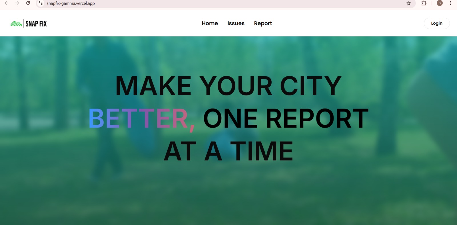
Landing Page
-

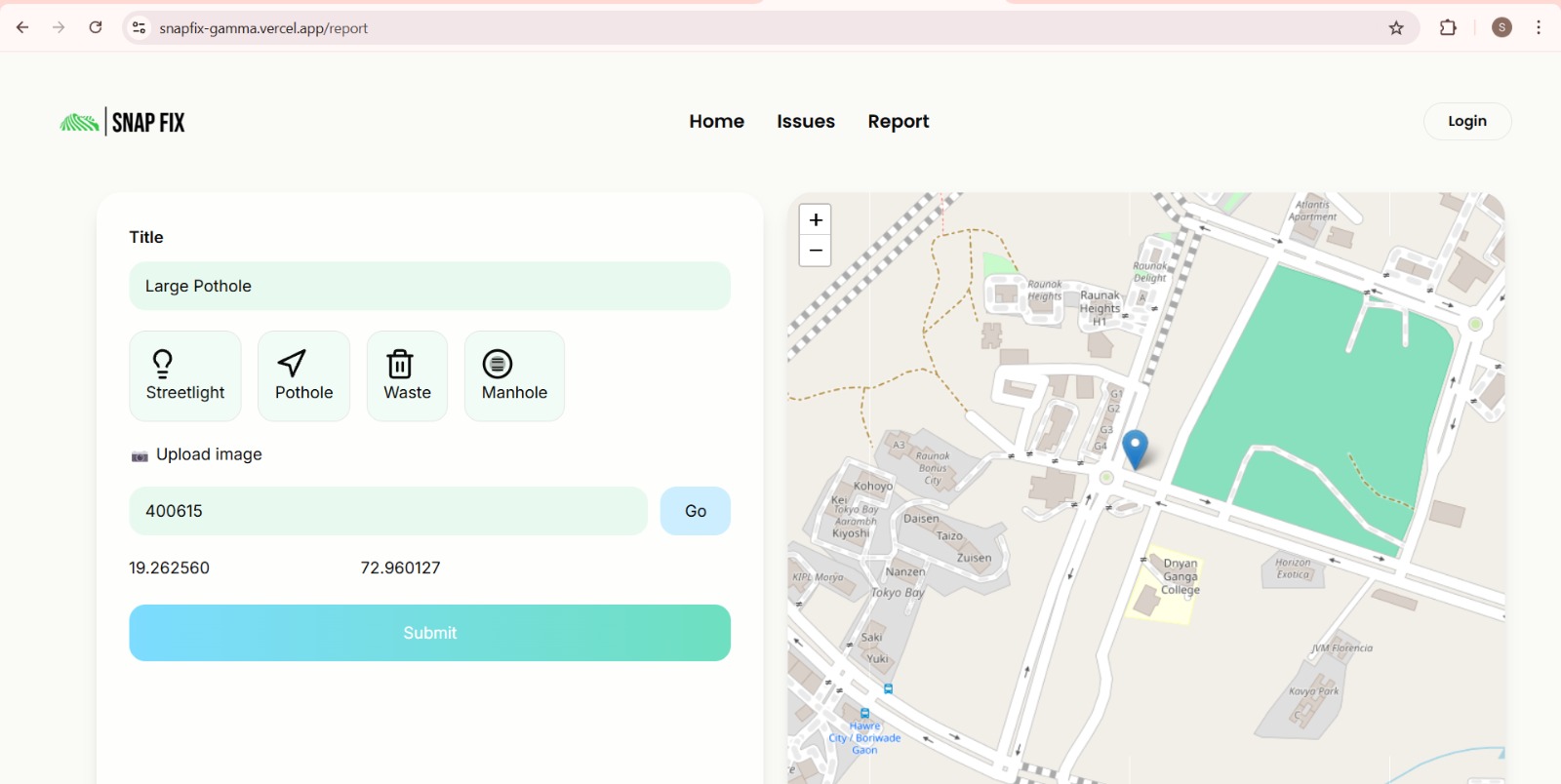
Report Page
-
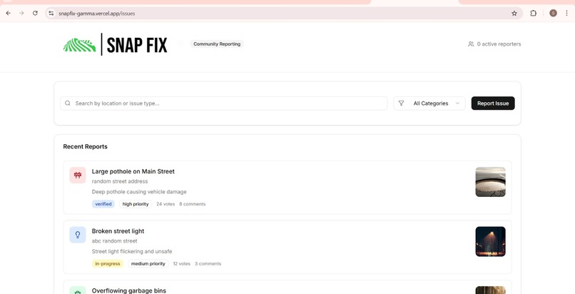
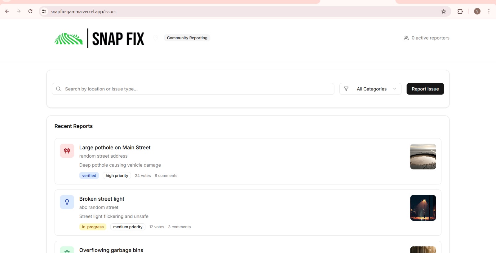
Issues Page
-
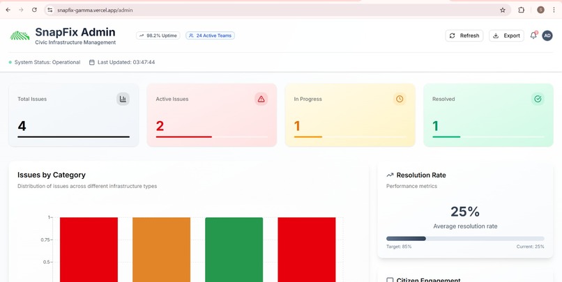
Admin Page
-
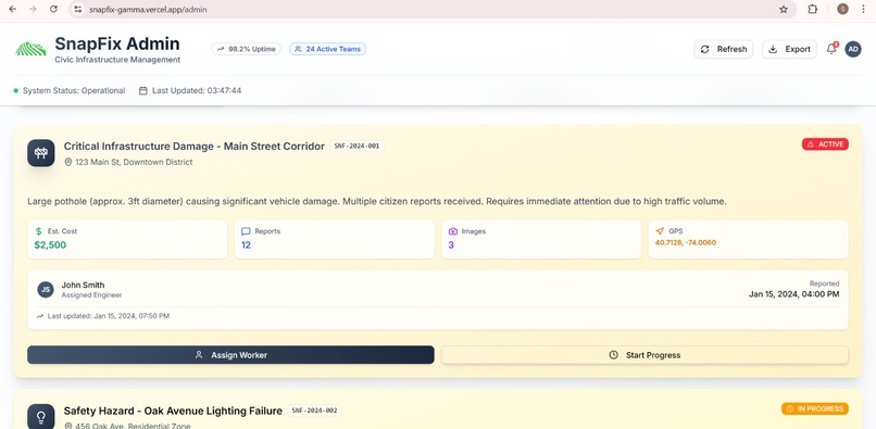
Admin
-

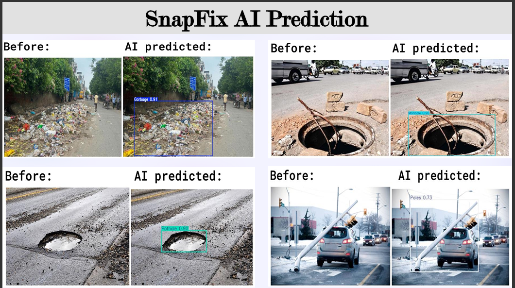
Predictions of the model
-

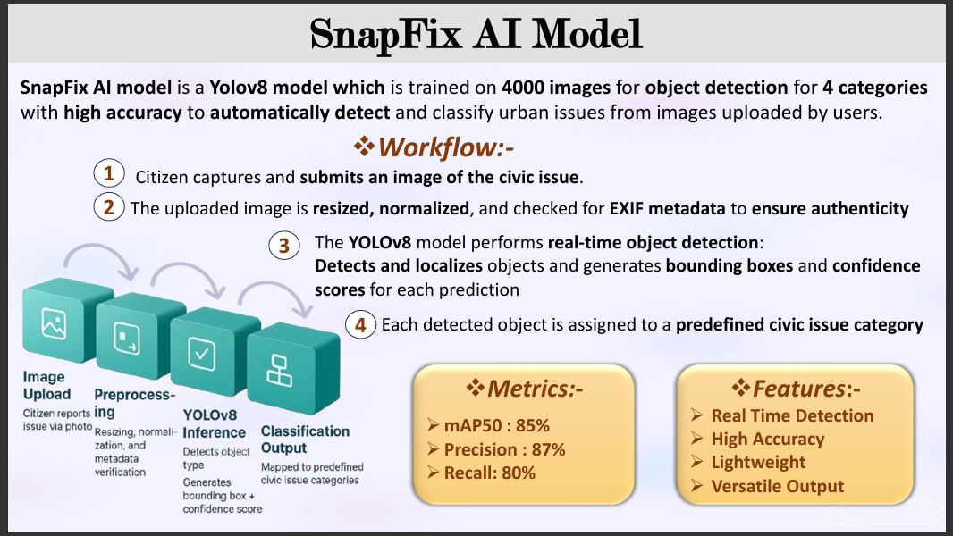
Ai model features and workflow


Inspiration
It started with something small, a pothole on a road we use every day.
Cars slowed down, bikes swerved around it, and pedestrians stepped carefully to avoid it. Everyone noticed it. Everyone complained about it. But days turned into weeks, and nothing changed. The problem wasn’t the lack of issues it was the lack of a simple, effective way to turn everyday observations into real action.
During the hackathon, we realized this wasn’t just one pothole or one street. Broken streetlights, overflowing garbage bins, open unattended manholes, are unsafe public spaces that exist everywhere. Reporting these problems often involves long forms, unclear processes, and little to no feedback.
That’s when a simple idea emerged: what if fixing a city could start with a single photo?
We imagined a system where a photo doesn’t just capture a problem, but understands it. Using AI, the image could be analysed and automatically classified into one of four meaningful urban issue categories transforming a casual photo into structured, actionable data. That idea became SnapFix.
What it does
SnapFix is an AI-powered urban issue reporting platform that enables citizens to report civic problems quickly and efficiently.
Users can:
a. Capture and upload images of urban issues
b. Let AI automatically classify the issue into predefined categories: Pothole , Manhole , faulty streetlights and overflowing garbage
c. Attach location data and view issues on an interactive map using pincode
d. Track reported issues and their current status
SnapFix bridges the gap between citizens and city authorities by converting unstructured visual data into organized, location-aware reports
How we built it
SnapFix is as an end-to-end, AI-driven web platform with a strong focus on real-world usability and scalability.
🔹 AI Model & Dataset
We built a custom image classification model using a large dataset of 4,696 images, curated and managed on Roboflow. Each image was manually annotated and labelled into four distinct urban issue classes, ensuring high-quality training data.
The model learns to analyse uploaded images and automatically classify the type of urban issue, transforming raw visual input into structured, actionable information. This AI-driven classification removes the need for manual categorization and significantly speeds up the reporting process.
🔹 Frontend Development
The frontend was built using React and Next.js, with Tailwind CSS for a responsive and modern user interface. The application consists of three primary user-facing pages:
Landing Page Introduces SnapFix, its purpose, and how users can participate in improving their city.
Report Page Allows users to report issues by: 1.Uploading an image 2.Viewing and interacting with an integrated map using pincodes 3.Attaching location data This page connects the AI classification with the reporting workflow.
Issues Feed Page Displays all reported issues submitted by users across the platform. Users can upvote issues, helping prioritize problems that require immediate attention. Upvotes directly influence the priority level of an issue, enabling community-driven urgency.
🔹 Admin Dashboard
We also built a dedicated admin dashboard for SnapFix, designed to support decision-making and analysis. The admin panel includes:
A centralized view of all reported issues
--->Severity analysis of issues using AI insights
--->Region-specific analytics to identify problem hotspots
--->Priority-based sorting influenced by user upvotes
--->Tools to monitor trends and patterns across the city
This dashboard enables authorities to move from reactive responses to data-driven urban management.
Challenges we ran into
Production build and deployment failures during hosting the frontend.
Continuous overfitting while training the ai model.
Synchronizing map-based issue visualization.
Data cleaning and image segmentation
Each challenge required rapid debugging, iteration, and prioritization.
Accomplishments that we're proud of
`~Successfully built a custom AI image classification model trained on a manually annotated dataset of 4,696 images, accurately categorizing urban issues into four distinct classes
~Achieved strong and reliable model performance with mAP@50 of 88%, precision of 92%, and recall of 84%, demonstrating the model’s effectiveness in real-world conditions
~Seamlessly integrated the AI model into the reporting workflow, enabling automatic issue classification directly from user-uploaded images
~Designed and developed a highly responsive, user-engaging UI/UX, ensuring smooth interaction across devices frontend
~Built an intuitive reporting flow with map integration, real-time issue visualization, and upvoting, making civic participation simple and engaging
We have attached the link to google document which portrays the ai predictions, and also attached a YouTube link of the ai model. Also attached the link to the frontend below.
What we learned
This project taught us far more than just technical skills: =>How to design real-world, scalable system architectures
=>The complexity of production deployments and environment configurations
=>Practical AI integration beyond isolated models
=>Effective teamwork and decision-making under pressure
=>Turning failures into learning opportunities
Most importantly, we learned how technology can create meaningful social impact when designed with users in mind.
What's next for SnapFix – AI-Powered Urban Issue Reporting Platform
SnapFix has strong potential for real-world adoption. Future plans include:
--->Enhancing AI to detect issue severity and priority levels
--->Implementing role-based access control
--->Introducing user notifications and issue resolution tracking
--->Building a mobile application
--->Integrating with municipal and government systems
SnapFix is a step toward smarter, more responsive cities powered by AI and citizen participation.
Built With
- ai
- colab
- git
- github
- javascript
- machine-learning
- next
- python
- react
- roboflow
- vercel

Log in or sign up for Devpost to join the conversation.