-
-
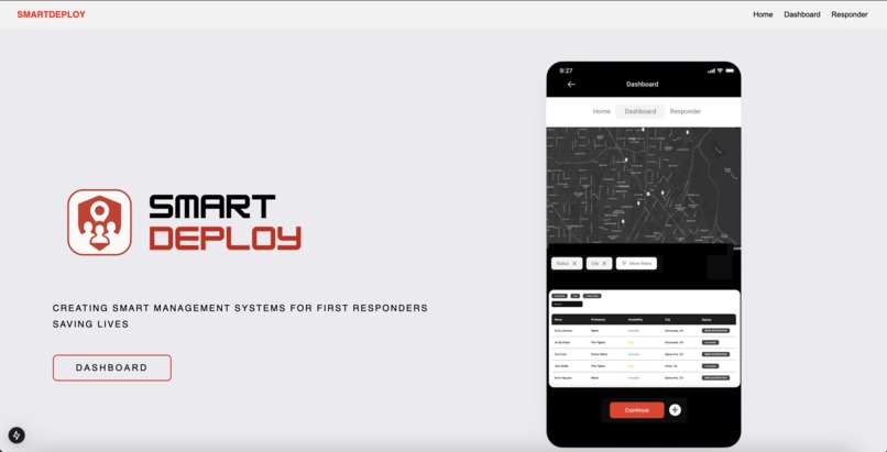
Home Page
-
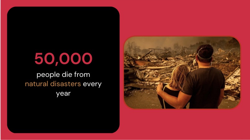
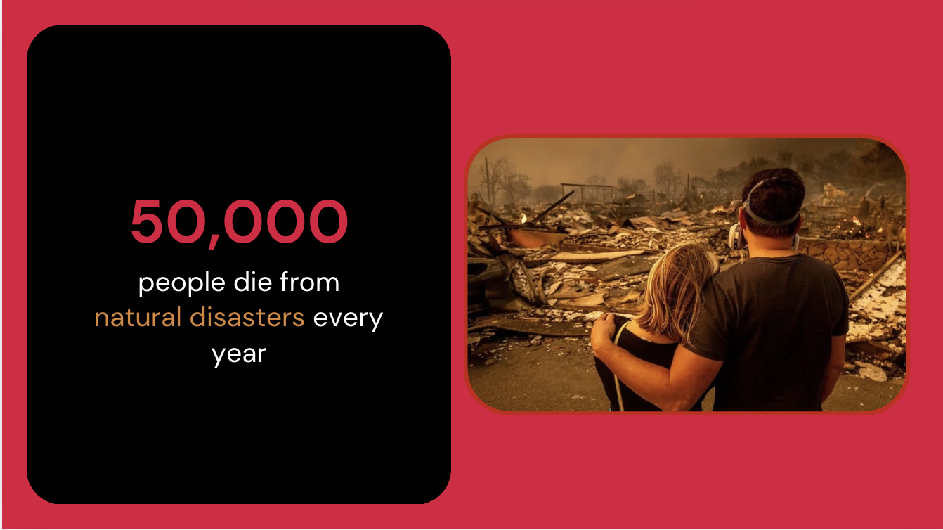
Problem
-
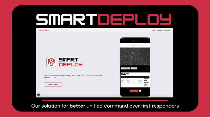
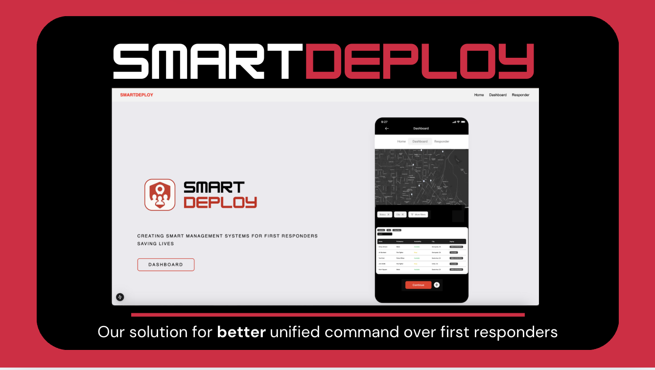
Solution
-
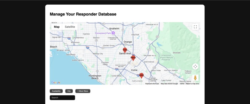
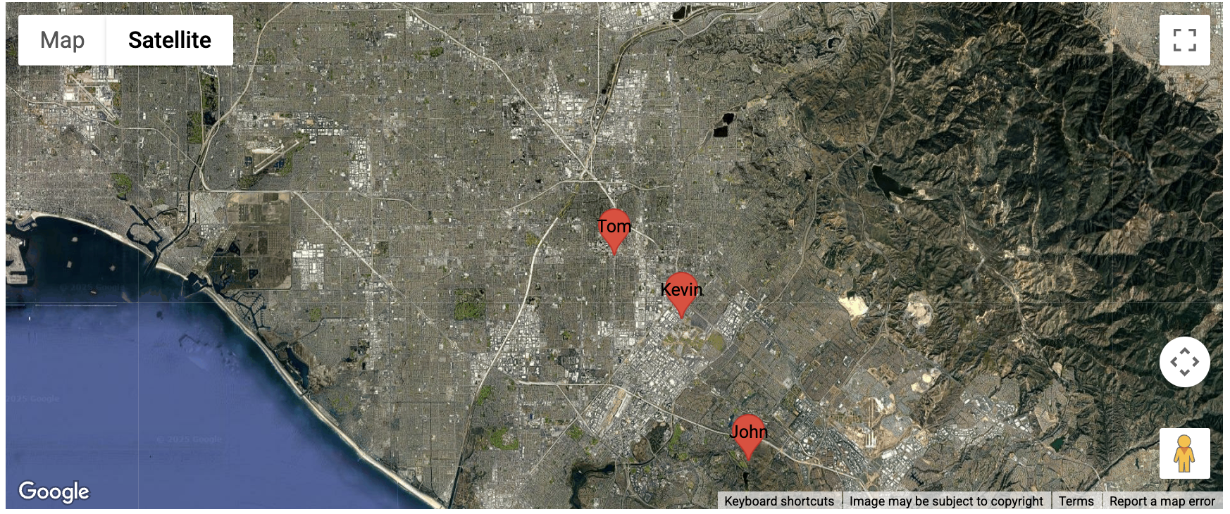
Map API
-
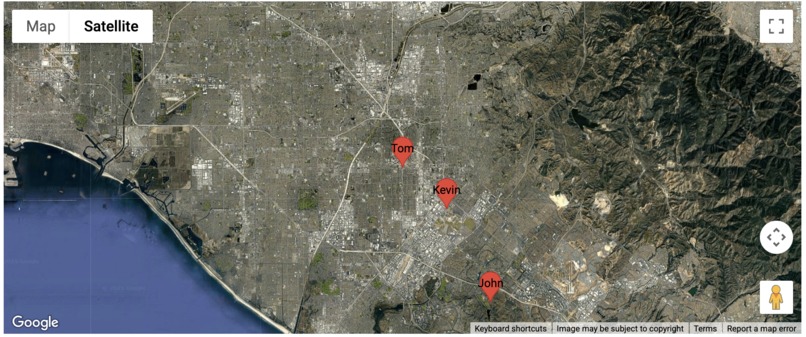
Satelilte View
-

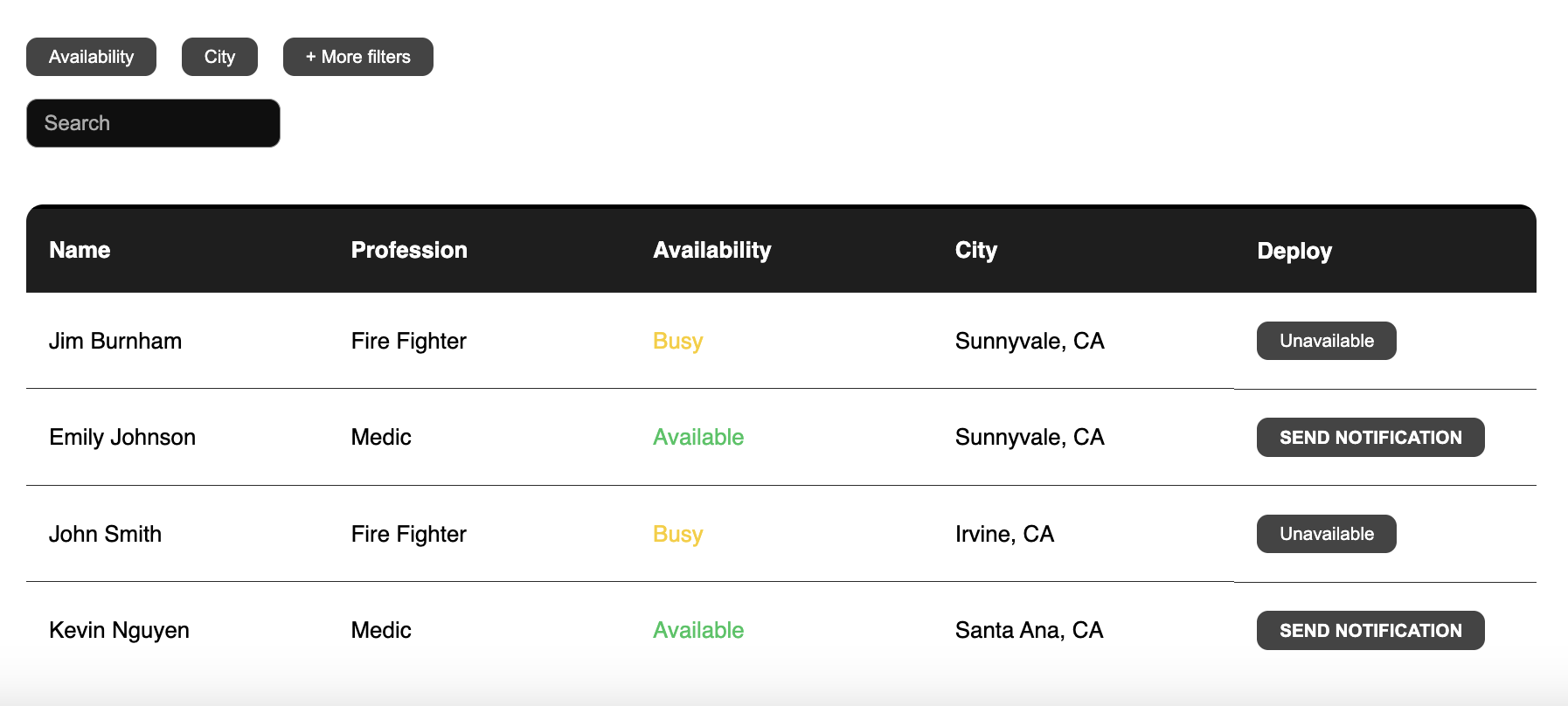
First Responder Deploy Management System
-
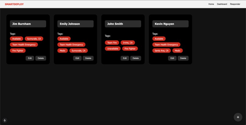
First Responder Data Management System
-
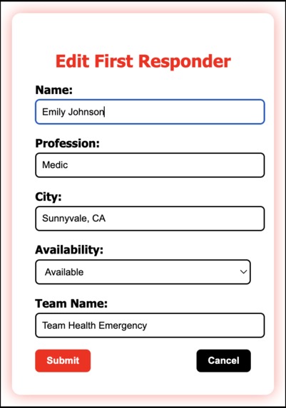
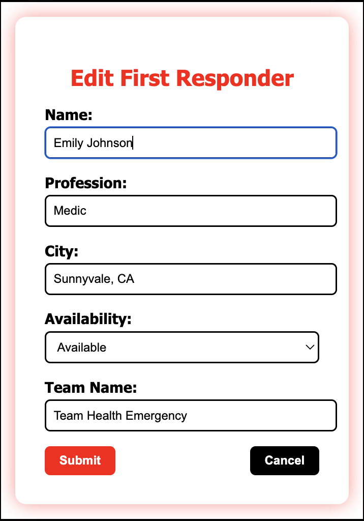
First Responder Data Edit Feature


TRACK 2
Inspiration
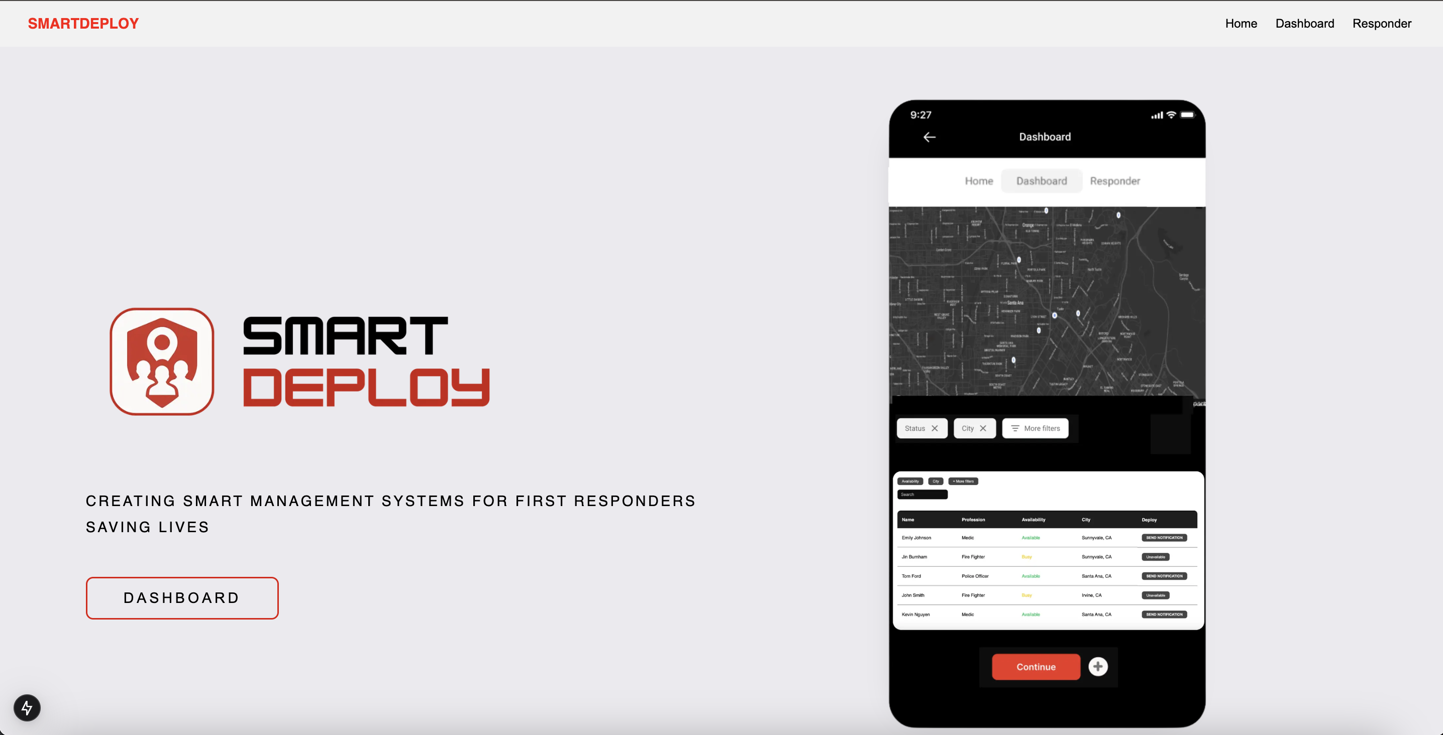
Every year, tens of thousands of lives are lost to natural disasters. Whether it be fires, floods, or earthquakes, first responders jump headfirst into danger in order to save as many as they can. To this end, positioning is crucial. Lives depend on first responders being in the right place at the right time, and we created SmartDeploy as a versatile management system to unify first responders with an intuitive interface.
What it does
SmartDeploy allows the user (a government authority) to register individual first responders into their own database. These people could be firefighters, police officers, and/or paramedics. Each profile takes into account the name, profile, availability, city, and team of the first responder. They can be edited at any time as well.
On the dashboard, the user can see a list of all responders and important statistics like their profession and availability. The search bar can find a specific responder, and there are filters that sort by status and city. On top of the dashboard lies the integrated Google maps, which shows the locations of natural disasters like fires and allows for the placement of nameable markers on points of interest. In addition, we have ‘notify’ buttons for each responder that turn red and display ‘sent’ when pressed. However, the functionality of notifying another device is not yet implemented as of currently. Overall, SmartDeploy contains great functionality for registering first responders, monitoring their availability, viewing the affected area, and marking points of interest.
How we built it
SmartDeploy is built on Next.js, a framework that enabled us to build our frontend using React and backend with Node.js. We used a Google API to integrate Google Maps into our dashboard, and we installed Firebase to store the registry of first responders. Users are able to use the responder page to record first responders to a Firestore database, which is then utilized on the dashboard page to display which responders are currently available in close proximity within the selected area.
Challenges we ran into
We ran into a lot of problems making markers work on our map and coordinating to avoid merge conflicts. Additionally, some of us had problems setting up our programs to allow us to work on the app at first. However, through a lot of communication and assisting each other, we were able to overcome these obstacles. Of course, the biggest obstacle of all was our time limit and energy levels.
Accomplishments that we're proud of
We successfully integrated external services like Google Maps and Firebase to enhance the capabilities and usefulness of our app. In addition, our program serves a greater purpose by facilitating coordination between first responders. We are proud of everything we were able to achieve in just one day.
What we learned
For some of us, this was an opportunity to become familiar with how frontend and backend programming are combined through GitHub and put down some basic code. For others, it was a challenge that taught us how to make user interfaces and integrate external APIs like Google Maps.
What's next for SmartDeploy
SmartDeploy will gain great functionality from a counterpart app for first responders that updates the central map with their real time locations and provides directions to points of interest. In addition, the ability for responders to request backup through the app and receive notifications would help boost the usefulness of the program.
Built With
- css
- figma
- firebase
- firestore
- github
- google-maps
- javascript
- next-dynamic
- nextjs
- react
- virtual-machine
- vs-code

Log in or sign up for Devpost to join the conversation.