-
-

Title
-

Criteria
-
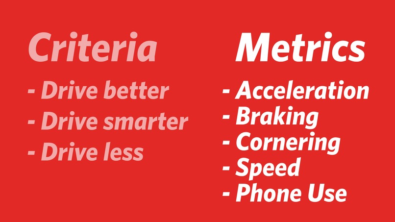
Metrics
-

Team Members


Inspiration
We wanted to create a mobile app that fulfilled State Farm's challenge requirement of getting more people to "Live Life Confidently". We also wanted to create something tangible that solves a problem State Farm customers face and have a working prototype for our presentation.
What it does
Smart Route is a mobile (Android/iOS) app that displays the safest route to any location. Within the app, you enter a "to" and "from" destination and the safest route automatically gets displayed. The bottom portion of the app indicates a 0-5 (5 being the safest) rating system for temperature, wind speed, humidity, visibility, and weather to analyze the route's safety level.
How we built it
Dart
Flutter
Google Maps Direction API
Weather API
Adobe XD
Challenges we ran into
Flutter was very difficult to work with, both because we weren't familiar with it and because the documentation was sparse.
Calculating the geometry involved with polylines was challenging.
Dealing with such a large dataset (1GB) was quite difficult, as Dart cannot natively handle files that large.
Accomplishments that we're proud of
Displaying several alternative routes on Google Maps in Flutter was difficult but rewarding.
We're also proud of creating icons and graphics to visualize road safety.
Helping to make drivers feel a little more safe, so that they can Live Life Confidently.
What we learned
How to use Flutter with Google Maps Directions API.
Using Weather APIs with HTTP requests
Parsing large amounts of CSV data (we explored Python, Javascript, and Java solutions and found that Python was the most effective)
What's next for Smart Route
Integration with State Farm's app
Advanced sorting functionalities
Discount incorporation
Built With
- adobe-xd
- dart
- flutter
- google-maps
- photoshop
- weather-api.net


Log in or sign up for Devpost to join the conversation.