-
-
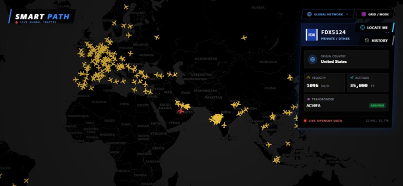
GLOBAL AIR TRAFFIC
-
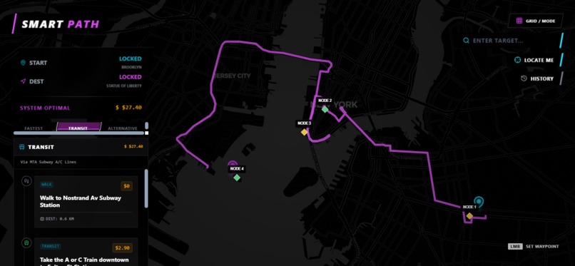
SMART ROUTING
-
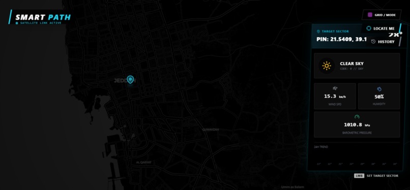
WEATHER MAPS
-
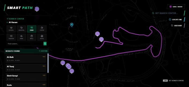
LOCAL EXPLORER
-
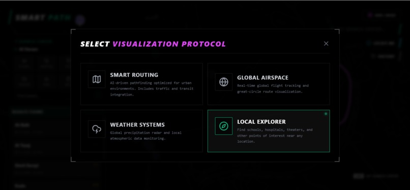
VISUALIZATION PROTOCOL


Inspiration
The inspiration for Smart Path came from the "Information Fragmentation" problem. Modern travelers and explorers have to constantly switch between four or five different applications: one for navigation, one for flight tracking, another for weather, and a different one for local discovery. We wanted to build a unified Geospatial Intelligence Hub where Google Gemini acts as the central reasoning engine, synthesizing live data into a single, intuitive interface.
What it does
Smart Path is an all-in-one mapping platform that features four core AI-driven modules:
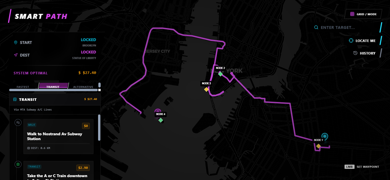
- Smart Routing: Goes beyond simple lines on a map. Gemini analyzes routes to provide the Fastest, Cheapest, and Alternative paths, offering natural language reasoning for each choice.
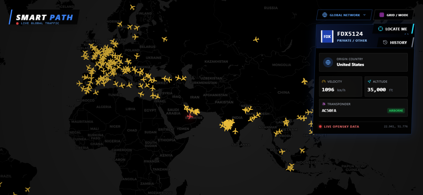
- Global Airspace: Provides a live, bird's-eye view of global aviation. Users can click any aircraft to receive real-time flight details and AI-generated insights about the journey.
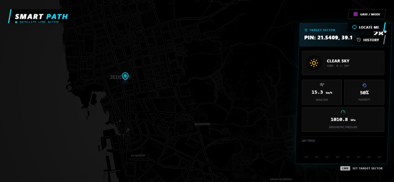
- Weather System: A contextual layer allowing users to click anywhere on the globe to get instant weather reports and AI-summarized safety advisories.
- Local Exploration: An intelligence tool for neighborhood discovery. Powered by Grounding with Google Maps, it helps users find essentials like hospitals, schools, and hotels with AI-curated descriptions.
How we built it
The project is built using a modern full-stack architecture designed for high-performance geospatial rendering:
- Gemini 3 Pro Serves as the brain of the application, processing routing logic and summarizing complex flight and weather data.
- Grounding with CARTO Basemaps: Used to ensure the AI’s local discovery features are factually accurate and based on real-world business listings.
- React & Tailwind CSS: For a responsive, "glassmorphic" UI/UX.
- OpenSky Network API: To fetch live state vectors for global aircraft tracking.
Challenges we ran into
One of the primary challenges was Data Synchronization. Live flight data involves thousands of moving parts; syncing this with a map without causing lag required optimizing the rendering cycle in React. Furthermore, "hallucination" is a risk with LLMs in geography. We solved this by strictly using Gemini Grounding, ensuring the AI only talks about places that actually exist in the Google Maps database.
Accomplishments that we're proud of
We are incredibly proud of the Global Airspace integration. Successfully mapping live aircraft vectors and allowing Gemini to "describe" a flight's status in real-time feels like having a personal air traffic controller. We also succeeded in creating a seamless UI where switching between weather data and routing feels instantaneous.
What we learned
Building Smart Path was a masterclass in Spatial Intelligence. We learned how to:
- Leverage Gemini's reasoning to interpret coordinate-based data.
- Manage high-frequency API calls for live tracking.
- Design "Agentic" UIs where the AI anticipates the user's next need based on the map location they are viewing.
What's next for Smart Path
The next step for Smart Path is Multimodal Exploration. We plan to allow users to upload a photo of a landmark, which Gemini will then identify to provide instant routing to that location, live weather updates for that spot, and historical context—all within the same map view. We also aim to add "Predictive Travel," using historical data to forecast the cheapest travel times weeks in advance.
Built With
- carto-basemaps
- gemini
- opensky-api
- react
- tailwind-css
- typescript
- weather-api


Log in or sign up for Devpost to join the conversation.